Eastmoreland is an early-twentieth century, tree-filled neighborhood in inner southeast Portland, Oregon, United States. Eastmoreland was named for a local real estate developer, Judge J.C. Moreland.
Kenton is a neighborhood in the north section of Portland, Oregon, United States. The neighborhood was originally a company town founded in 1911 for the Swift Meat Packing Company.
Maplewood is a suburban neighborhood in Southwest Portland, Oregon, United States.
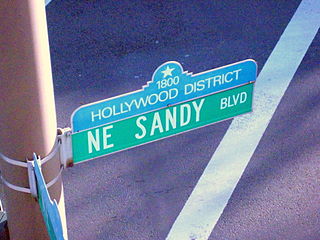
The Hollywood District is a neighborhood of northeast Portland, Oregon, United States renamed for its historic 1920s-era Hollywood Theatre.
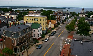
Munjoy Hill is a neighborhood and prominent geographical feature of Portland, Maine. It is located east of downtown and south of East Deering, the neighborhood it is connected to by Tukey's Bridge. The neighborhood historically had a large Irish and Italian American population.

Portland Public Schools (PPS) is a public school district located in Portland, Oregon, United States. It is the largest school district in the state of Oregon. It is a PK–12 district with an enrollment of more than 49,000 students. It comprises more than 100 locations, including 79 schools and other sites that are maintained within the district.

Woodstock is a neighborhood located in inner southeast Portland, Oregon, United States.

Arbor Lodge is a neighborhood in the North section of Portland, Oregon. Interstate 5 forms the eastern boundary of the neighborhood. The south boundary is formed by Ainsworth Street, the west boundary is formed by a combination of Willamette Boulevard and Chataqua Boulevard, and the north boundary is formed by Lombard Street. The bordering neighborhoods are Piedmont to the east, Overlook to the south, University Park to the west, and Kenton to the north.

Ardenwald-Johnson Creek is a neighborhood straddling the border between Portland and Milwaukie, Oregon. It is recognized by both Portland's Office of Neighborhood Involvement as well as Milwaukie's Neighborhoods Program.
Piedmont is a neighborhood in the north and northeast sections of Portland, Oregon, United States. The Piedmont subdivision was platted in 1889 by Edward Quackenbush, and promoted in an early flyer as "The Emerald, Portland's Evergreen Suburb, Devoted Exclusively to Dwellings, A Place of Homes." The original subdivision, now known as "Historic Piedmont," includes parts of the Humboldt and King neighborhoods, as well as the modern Piedmont neighborhood south of Rosa Parks Way.
University Park is a neighborhood in the north section of Portland, Oregon on the east shore of the Willamette River. University Park is bounded by North Lombard Street and the Portsmouth neighborhood to the north, North Chautauqua Boulevard and the Arbor Lodge neighborhood to the east, The Willamette River and Mock's Bottom industrial area to the south, and the North Portland railroad cut with Cathedral Park and St. Johns neighborhoods to the west.

The Mt. Scott-Arleta neighborhood of Portland, Oregon is located in the city's southeast quadrant. It is bounded on the north by SE Foster Road, west by SE 60th Avenue, east by SE 82nd Avenue, and south by SE Duke. Mt. Scott-Arleta borders the neighborhoods of Woodstock on the west, Foster-Powell on the north, Lents on the east, and Brentwood-Darlington on the south.

The Boston–Edison Historic District is a historic neighborhood located in the geographic center of Detroit, Michigan. It consists of over 900 homes built on four east/west streets: West Boston Boulevard, Chicago Boulevard, Longfellow Avenue, and Edison Avenue, stretching from Woodward Avenue on the east to Linwood Avenue on the west. It is one of the largest residential historic districts in the nation. It is surrounded by Sacred Heart Major Seminary to the west, the Arden Park-East Boston Historic District and the Cathedral of the Most Blessed Sacrament to the east, and the Atkinson Avenue Historic District to the south. The district was designated a Michigan State Historic Site in 1973 and listed on the National Register of Historic Places in 1975.
Green Meadows is an unincorporated community in Prince George's County, Maryland, United States. For statistical purposes, it is part of the Chillum census-designated place (CDP).

César E. Chávez Blvd is a street in Portland, Oregon, United States. Until 2009, it was known as Northeast and Southeast 39th Avenue.

Francis I. McKenna was a real estate and land developer, and architect from the 1890s to the 1920s in Portland, Oregon. McKenna moved to Portland in 1889 and purchased the land now known as the University Park neighborhood. He went on to establish the Portland Belt Line Company, which lobbied city officials to extend the cable car system to St. Johns, Oregon. The project was constructed in 1905. McKenna was also known as an advocate of civic improvement and industrialization.
César Chávez (1927–1993) was an American farm worker, labor leader and civil rights activist.

Lombard Street is a main thoroughfare in North and Northeast Portland, Oregon. It serves as a boundary and main commercial street for several North Portland neighborhoods.
