| Neighborhood name | Sextant | Coalition | Namesake | Image | Notes |
|---|
| Alameda | Northeast | Northeast Coalition of Neighborhoods | Alameda Land Company who laid out the first subdivision in the area |  | |
| Arbor Lodge | North | North Portland Neighborhood Services | | 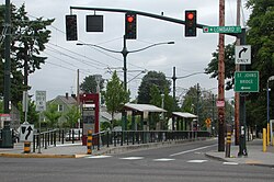 | |
| Ardenwald-Johnson Creek | Southeast | Southeast Uplift Neighborhood Coalition | Arden M. Rockwood, son of the man who first platted the area |  | Partially in Portland and Milwaukie. Neighborhood recognized by both cities. |
| Argay | Northeast | East Portland Community Office | Portmanteau of Art Simonson and Gerhardt "Gay" Stavney, planners of neighborhood. | | |
| Arlington Heights | Northwest | Neighbors West-Northwest | |  | |
| Arnold Creek | Southwest | Southwest Neighborhoods | Arnold Creek |  | |
| Ashcreek | Southwest | Southwest Neighborhoods | | | |
| Beaumont-Wilshire | Northeast | Northeast Coalition of Neighborhoods | Beaumont: beautiful mountain in French. Wilshire: Etymology unknown |  | |
| Boise | North, Northeast | Northeast Coalition of Neighborhoods | Reuben P. Boise, Oregon Supreme Court Justice |  | Includes Mississippi District. |
| Brentwood-Darlington | Southeast | Southeast Uplift Neighborhood Coalition | |  | |
| Bridgeton | North, Northeast | North Portland Neighborhood Services | Bridgeton Slough, in turn named for the Interstate Bridge | | |
| Bridlemile | Southwest | Southwest Neighborhoods | | | |
| Brooklyn | Southeast | Southeast Uplift Neighborhood Coalition | Large number of rivers, creeks, and lakes that historically occupied the neighborhood. |  | |
| Buckman | Southeast | Southeast Uplift Neighborhood Coalition | City Councilor Cyrus Buckman |  | |
| Cathedral Park | North | North Portland Neighborhood Services | Cathedral Park |  | |
| Centennial | Southeast | East Portland Community Office | | | |
| Collins View | Southwest | Southwest Neighborhoods | |  | |
| Concordia | Northeast | Northeast Coalition of Neighborhoods | Concordia University (now University of Oregon Portland) |  | |
| Creston-Kenilworth | Southeast | Southeast Uplift Neighborhood Coalition | Creston: Etymology unknown Kenilworth: Sir Walter Scott's Kenilworth. A Romance. |  | |
| Crestwood | Southwest | Southwest Neighborhoods | | | |
| Cully | Northeast | Northeast Coalition of Neighborhoods | Settler Thomas Cully. | 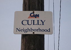 | |
| Chinatown | Northwest | Neighbors West-Northwest | Historically large number of Chinese businesses and residences |  | Northwest part of Old Town Chinatown, the Southwest part being Old Town. |
| Downtown | Southwest | Neighbors West-Northwest | Portland's Downtown |  | |
| East Columbia | North, Northeast | North Portland Neighborhood Services | Columbia River | | |
| Eastmoreland | Southeast | Southeast Uplift Neighborhood Coalition | Pioneer Julius C. Moreland |  | |
| Eliot | North, Northeast | Northeast Coalition of Neighborhoods | Rev. Thomas Lamb Eliot |  | Former center of Albina, Oregon before annexation with Portland. |
| Far Southwest | Southwest | Southwest Neighborhoods | Farthest southwest neighborhood of Portland |  | |
| Forest Park | Northwest | Neighbors West-Northwest | Forest Park |  | |
| Foster-Powell | Southeast | Southeast Uplift Neighborhood Coalition | Foster Road and Powell Boulevard, in turn named for Estacada farmer Philip Foster and settler Jackson Powell |  | |
| Glenfair | Northeast, Southeast | East Portland Community Office | Glenfair Park |  | |
| Goose Hollow | Southwest | Neighbors West-Northwest | Large amount of wild Geese who historically inhabited the area |  | |
| Grant Park | Northeast | Central Northeast Neighbors | Grant Park, in turn named for President Ulysses S. Grant |  | |
| Hayden Island | North | North Portland Neighborhood Services | Hayden Island, in turn named for settler Gay Hayden |  | |
| Hayhurst | Southwest | Southwest Neighborhoods | |  | |
| Hazelwood | Northeast, Southeast | East Portland Community Office | | | |
| Healy Heights | Southwest | Unaffiliated | |  | |
| Hillsdale | Southwest | Southwest Neighborhoods | Tualatin Mountains (West Hills) |  | |
| Hillside | Northwest | Neighbors West-Northwest | Tualatin Mountains (West Hills) | 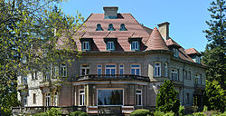 | |
| Hollywood | Northeast | Central Northeast Neighbors | Hollywood Theatre |  | |
| Homestead | Southwest | Southwest Neighborhoods | Location of the homestead of State Representative Philip Augustus Marquam |  | |
| Hosford-Abernethy | Southeast | Southeast Uplift Neighborhood Coalition | Hosford: Methodist Missionary Chauncey Hosford. Abernethy: Provisional Governor of Oregon George Abernethy. |  | |
| Humboldt | North, Northeast | Northeast Coalition of Neighborhoods | | | |
| Irvington | Northeast | Northeast Coalition of Neighborhoods | Irvington Investment Company, development company that helped create the neighborhood. |  | |
| Kenton | North | North Portland Neighborhood Services | |  | |
| Kerns | Northeast, Southeast | Southeast Uplift Neighborhood Coalition | Settler William Kerns |  | |
| King | Northeast | Northeast Coalition of Neighborhoods | Rev. Martin Luther King Jr. | | |
| Laurelhurst | Northeast, Southeast | Southeast Uplift Neighborhood Coalition | Laurelhurst Company, development company that helped create the neighborhood. |  | |
| Lents | Southeast | East Portland Community Office | Settler Oliver P. Lent |  | |
| Linnton | Northwest | Neighbors West-Northwest | US Senator Lewis F. Linn (D-MO) |  | |
| Lloyd District | North, Northeast | Northeast Coalition of Neighborhoods | Developer Ralph Lloyd, founder of Lloyd Center, once America's largest shopping mall | 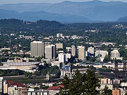 | |
| Madison South | Northeast | Central Northeast Neighbors | James Madison High School (now Leodis V. McDaniel High School) |  | |
| Maplewood | Southwest | Southwest Neighborhoods | |  | |
| Markham | Southwest | Southwest Neighborhoods | | | |
| Marshall Park | Southwest | Southwest Neighborhoods | Marshall Park, in turn named for Frederick C. and Addie Mae Marshall who donated the park to the city | | |
| Mill Park | Southeast | East Portland Community Office | |  | |
| Montavilla | Northeast, Southeast | Southeast Uplift Neighborhood Coalition | Portmanteau of Mount Tabor Village |  | |
| Mt. Scott-Arleta | Southeast | Southeast Uplift Neighborhood Coalition | Mt. Scott: Harvey W. Scott, editor of The Oregonian. Arleta: the daughter of one of the neighborhood's early developers. | 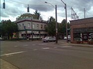 | |
| Mount Tabor | Southeast | Southeast Uplift Neighborhood Coalition | Mount Tabor, in turn named for the biblical Mount Tabor | 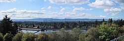 | |
| Multnomah/Multnomah Village | Southwest | Southwest Neighborhoods | Multnomah Tribe/Chief Multnomah |  | |
| North Tabor | Southeast | Southeast Uplift Neighborhood Coalition | Mount Tabor, in turn named for the biblical Mount Tabor |  | |
| Northwest District | Northwest | Neighbors West-Northwest | Northwest Portland |  | Includes Uptown, Nob Hill, Alphabet District, and Slabtown. |
| Northwest Heights | Northwest | Neighbors West-Northwest | Northwest Portland | | |
| Old Town | Southwest | Neighbors West-Northwest | Original urban core of Portland. "Oldest part of town". |  | Southwest part of Old Town Chinatown, the Northwest part being Chinatown. |
| Overlook | North | North Portland Neighborhood Services | The neighborhood is located on a bluff that overlooks the city. |  | Includes Swan Island. |
| Parkrose | Northeast | East Portland Community Office | |  | |
| Parkrose Heights | Northeast | East Portland Community Office | | | |
| Pearl District | Northwest | Neighbors West-Northwest | Coined by local journalist Terry Hammond for unknown reasons |  | |
| Piedmont | North, Northeast | North Portland Neighborhood Services | |  | |
| Pleasant Valley | Southeast | East Portland Community Office | | | |
| Portsmouth | North | North Portland Neighborhood Services | Port of Portland |  | |
| Powellhurst-Gilbert | Southeast | East Portland Community Office | Named for two schools in the area, Powellhurst (in turn named for settler Jackson Powell) and Gilbert Heights (in turn named for settler William M. Gilbert). |  | Includes the recently formed Jade District. |
| Reed | Southeast | Southeast Uplift Neighborhood Coalition | Reed College, in turn named for pioneers Simeon Gannett & Amanda Reed. |  | |
| Richmond | Southeast | Southeast Uplift Neighborhood Coalition | Settler Richmond Kelly, son of Rev. Clinton Kelly. |  | |
| Rose City Park | Northeast | Northeast Coalition of Neighborhoods | Refers to Portland's nickname of the City of Roses. |  | |
| Roseway | Northeast | Central Northeast Neighbors | Refers to Portland's nickname of the City of Roses. |  | |
| Russell | Northeast | East Portland Community Office | |  | |
| Sabin | Northeast | Northeast Coalition of Neighborhoods | |  | |
| St. Johns | North | North Portland Neighborhood Services | Settler James John |  | |
| Sellwood-Moreland (Westmoreland) | Southeast | Southeast Uplift Neighborhood Coalition | Sellwood: Rev. John Sellwood Moreland: Pioneer Julius C. Moreland |  | |
| South Burlingame | Southwest | Southwest Neighborhoods | |  | |
| South Portland | South | Southwest Neighborhoods | South of Downtown |  | Includes South Waterfront, Lair Hill, and Corbett |
| South Tabor | Southeast | Southeast Uplift Neighborhood Coalition | Mount Tabor, in turn named for the biblical Mount Tabor |  | |
| Southwest Hills | Southwest | Southwest Neighborhoods | Tualatin Mountains (West Hills) |  | Partially in Portland and unincorporated Multnomah County. |
| Sullivan's Gulch | Northeast | Northeast Coalition of Neighborhoods | Settler Timothy Sullivan |  | |
| Sumner | Northeast | Central Northeast Neighbors | |  | |
| Sunderland | Northeast | Central Northeast Neighbors | |  | Includes Dignity Village. |
| Sunnyside | Southeast | Southeast Uplift Neighborhood Coalition | |  | |
| Sylvan-Highlands | Southwest | Neighbors West-Northwest | Roman God of the Woods, Silvanus | | |
| University Park | North | North Portland Neighborhood Services | Portland Methodist Episcopal University (now University of Portland) |  | |
| Vernon | Northeast | Northeast Coalition of Neighborhoods | |  | |
| West Portland Park | Southwest | Southwest Neighborhoods | West part of Portland |  | |
| Wilkes | Northeast | East Portland Community Office | The Wilkes Family of settlers | | |
| Woodland Park | Northeast | East Portland Community Office | | | Portland's smallest neighborhood. |
| Woodlawn | Northeast | Northeast Coalition of Neighborhoods | |  | |
| Woodstock | Southeast | Southeast Uplift Neighborhood Coalition | Sir Walter Scott's Woodstock | 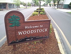 | |


