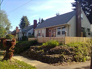
Eastmoreland is an early-twentieth century, tree-filled neighborhood in inner southeast Portland, Oregon, United States. Eastmoreland was named for a local real estate developer, Judge J.C. Moreland.
Brooklyn is a mostly residential neighborhood in southeast Portland, Oregon. It sits along the east side of the Willamette River in the vicinity of Reed College. Founded as a neighborhood in the late 1860s, the neighborhood today is a middle-class area comprising mainly single family homes, interspersed with remaining industrial sites along the river and a large railyard. This railyard was home to Southern Pacific 4449 as well as several other large antique steam and diesel-electric locomotives.

Crystal Springs Rhododendron Garden is a botanical garden located between Reed College and the Eastmoreland Golf Course in southeastern Portland in the U.S. state of Oregon.
The Reed neighborhood of Portland, Oregon is in the southeast section of the city, just north of the campus of Reed College. The neighborhood is bounded on the west by railroad tracks, on the north by SE Holgate Ave., on the east by SE 39th Ave., and on the south by SE Reedway, SE Steele, and a line south of SE Insley and SE Harold Ct. Tucker Maxon School is located in the Reed Neighborhood, and the Reed Neighborhood Association sometimes uses the school to hold meetings.
The Beaumont-Wilshire neighborhood of Portland, Oregon is located in the city's northeast section, on Alameda Ridge with views of Downtown, the Willamette River, and the Cascades. It is bordered by the Alameda, Concordia, Cully, Rose City Park, and Grant Park neighborhoods. "Beaumont Village", located on NE Fremont Street, from NE 42rd Ave. to NE 50th Ave., is the main commercial district in the neighborhood, but the neighborhood also lies within walking distance of the Hollywood District, a major commercial and shopping area to the south.

The Lents neighborhood in the Southeast section of Portland, Oregon is bordered by SE Powell Blvd. on the north, the Clackamas County line or City of Portland line on the south, SE 82nd Ave. to the west, and roughly SE 112th on the east. The NE corner overlaps with the Powellhurst-Gilbert neighborhood. In addition to Powellhurst-Gilbert on the north and east, Lents also borders Foster-Powell, Mt. Scott-Arleta, and Brentwood-Darlington on the west and Pleasant Valley on the east.

Creston-Kenilworth is a neighborhood in the Southeast section of Portland, Oregon, lying between SE 26th Ave. on the west and SE Foster Rd. on the east, and between SE Powell Blvd. on the north and SE Holgate Blvd. on the south. It is adjacent to the neighborhoods of Brooklyn to the west, Hosford-Abernethy, and Richmond to the north, Foster-Powell and Mt. Scott-Arleta to the east, and Reed and Woodstock to the south.
Portsmouth is a neighborhood in the north section of Portland, Oregon, United States. It is bordered by Columbia Boulevard to the north, Lombard Street to the south, Chautauqua Boulevard to the east, and a BNSF Railway cut to the west.
The Mt. Scott-Arleta neighborhood of Portland, Oregon is located in the city's southeast quadrant. It is bounded on the north by SE Foster Road, west by SE 60th Avenue, east by SE 82nd Avenue, and south by SE Duke. Mt. Scott-Arleta borders the neighborhoods of Woodstock on the west, Foster-Powell on the north, Lents on the east, and Brentwood-Darlington on the south.

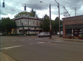
Foster-Powell is a neighborhood in the Southeast section of Portland, Oregon. The triangular neighborhood is bounded by three major transit arteries: Powell Boulevard to the north, Foster Road to the south, and 82nd Avenue to the east.

César E Chávez Boulevard is a street in Portland, Oregon, United States. Until 2009, it was known as Northeast and Southeast 39th Avenue.
The East Portland Grand Avenue Historic District, located in southeast Portland, Oregon, is listed on the National Register of Historic Places. The district includes approximately 20 city blocks on or near Southeast Grand Avenue on the east side of the Willamette River, roughly bounded on the south by SE Main Street, north by SE Ankeny Street, west by SE Martin Luther King Jr. Boulevard, and east by SE Seventh Avenue. Most structures in the district are commercial buildings rising two to three stories. Immediately to the west of the historic district is Portland's east side industrial area, and to the east are industrial and residential areas.
East César Chávez, historically and originally named Masontown or Masonville, is a neighborhood in Austin, Texas. It is located in the central-east part of Austin's urban core on the north bank of the Colorado River. The neighborhood encompasses much of ZIP code 78702.

The Woodstock Community Center is a community center and former fire station built in 1928, located in the Woodstock neighborhood of Portland, Oregon, United States. The building was converted to a community center when Portland Parks & Recreation acquired ownership in 1958. In 2003, community members prevented closure due to budget constraints by forming a group called Friends of the Woodstock Community Center to raise funds and coordinate volunteers.

Woodstock Elementary School is an elementary school within Portland Public Schools, located in the Woodstock neighborhood of southeast Portland, Oregon, United States. Established in 1891, the school was housed in a four-room building until it joined School District No. 1 in 1909. The newly constructed two-story, eight-room school opened in 1911 at its current location. The Woodstock School underwent expansions in 1925 and 1955, but a fire in 1980 destroyed the building's two-story center. Protests by Woodstock residents and the Woodstock Parent Teachers Association ended the school district's plans to close the school due to fire damage and low student enrollment throughout the city. The school remained open and underwent repairs, but its second story was lost. The school marks the oldest standing elementary school in Portland.

Southeast Bybee Boulevard is a light rail station in Portland, Oregon, United States, served by TriMet as part of the MAX Light Rail system. It is the 14th station southbound on the Orange Line, which runs between Portland City Center, Southeast Portland, and Milwaukie. The island platform station adjoins Union Pacific Railroad (UP) freight tracks to the east and McLoughlin Boulevard to the west. It is accessed from the Bybee Bridge, which spans over the platform and connects Portland's Sellwood-Moreland and Eastmoreland neighborhoods. Nearby destinations include Westmoreland Park, Eastmoreland Golf Course, Crystal Springs Rhododendron Garden, and Reed College.

Berkeley Park is a 6.48-acre (2.62 ha) public park in Portland, Oregon, United States. Acquired in 1941, the park has a playground, fields for multiple sports, and tennis courts, among other features.

Southeast Portland is one of the sextants of Portland, Oregon.

Hawthorne Boulevard is an east–west street in Portland, Oregon, and the dividing line between multiple neighborhoods, although "Hawthorne" is often itself considered its own neighborhood. The street stretches from the Willamette River on the west,, and 92nd Avenue on the east. Mount Tabor blocks the street between 60th Street and 72nd Avenue. Hawthorne Boulevard is a principal street west of 50th Avenue and a residential street to the east. The most famous portion of Hawthorne Boulevard is between 29th Avenue and Cesar Chavez Boulevard serving as a cultural hot spot for Portland's hippie movement. This section of the street is filled with local businesses, boutiques, restaurants, and gift stores, as well as the first Fred Meyer grocery at 36th and Hawthorne, and a bakery at 12th and Hawthorne. It the grocery closed in the 1930s. Hawthorne Boulevard is often compared to Haight Street in San Francisco due to the similar culture of both streets. The street is named for Doctor James C. Hawthorne, a politician and physician. Dr. Hawthorne donated land for the Oregon Hospital for the Insane near the modern day Colonel Summers Park in 1862. The Hospital for the Insane is often called the Hawthorne Asylum, and the street, originally named U Street, took on the moniker Asylum Avenue. The Asylum closed in 1883, and an ordinance was passed to rename the street to Hawthorne Avenue in 1888.


