
Draperstown is a village in the Sperrin Mountains in County Londonderry, Northern Ireland. It is situated in the civil parish of Ballinascreen and is part of Mid-Ulster district. It is also part of the Church of Ireland parish of Ballynascreen and the Catholic parish of Ballinascreen, and within the former barony of Loughinsholin.

Ballintoy is a small village, townland and civil parish in County Antrim, Northern Ireland. It is alongside the B15 coast road, 28 km (17 mi) north-east of Coleraine, 8 km (5.0 mi) west of Ballycastle and between it and Bushmills. It is in the historic barony of Cary. The village lies about one kilometre from Ballintoy Harbour, a small fishing harbour at the end of a very small, narrow, steep road down Knocksaughey hill which passes by the entrance to Larrybane and Carrick-a-Rede Rope Bridge. The harbour is host to a dawn service on Easter Sunday each year.

Ballymoney is a town and civil parish in County Antrim, Northern Ireland. It is within the Causeway Coast and Glens Borough Council area. The civil parish of Ballymoney is situated in the historic baronies of Dunluce Upper and Kilconway in County Antrim, as well as the barony of North East Liberties of Coleraine in County Londonderry. It had a population of 11,048 people at the 2021 census.
Donegore is the name of a hill, a townland, a small cluster of residences, and a civil parish in the historic barony of Antrim Upper, County Antrim, Northern Ireland. Donegore lies approximately 5 miles (8 km) east of Antrim town. 154 acres of the townland lies in the civil parish of Grange of Nilteen.

Dunadry is a hamlet and townland 3 miles (5 km) from Antrim in County Antrim, Northern Ireland. It is situated in the civil parish of Grange of Nilteen and the historic barony of Antrim Upper. It is within the Antrim and Newtownabbey Borough Council area. It had a population of 430 people in the 2011 Census..
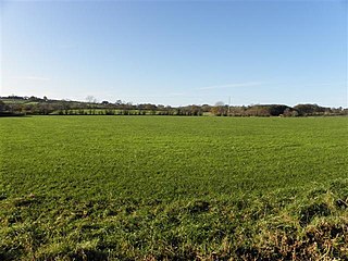
Dunamuggy is a townland of 172 acres in County Antrim, Northern Ireland. It is situated in the civil parish of Donegore and the historic barony of Antrim Upper.

Rasharkin is a small village and civil parish in County Antrim, Northern Ireland. It is 13 kilometres (8.1 mi) south of Ballymoney, near Dunloy and Kilrea. It had a population of 1,114 people in the 2011 Census.
Monkstown is a townland and electoral ward in County Antrim, Northern Ireland. It is within the urban area of Newtownabbey and the Antrim and Newtownabbey Borough Council area. The townland was previously called Ballynamanagh It is also situated in the civil parish of Carnmoney and the historic barony of Belfast Lower.
Lambeg is a small village and civil parish in County Antrim, Northern Ireland. Located between Belfast and Lisburn, it was once a small rural village, but is now within the Greater Belfast conurbation. Lambeg is also an electoral ward of Lisburn Council. In the 2001 Census it had a population of 60 people. The civil parish of Lambeg covers areas of County Down as well as County Antrim.

Knocknacarry is a hamlet and townland about 1 kilometre west of Cushendun and 17 kilometres south-east of Ballycastle in County Antrim, Northern Ireland. It is situated in the historic barony of Glenarm Lower and the civil parish of Layd. In the 2001 Census it had a population of 138 people. It is within the Causeway Coast and Glens Borough Council area.
Ballyscullion is a small village and civil parish in County Londonderry, Northern Ireland. In the 2001 census it had a population of 291 people. The civil parish of Ballyscullion covers areas of County Antrim as well as County Londonderry. The village is situated within Mid-Ulster District.

Kilsheelan is a village and civil parish within the barony of Iffa and Offa East in County Tipperary, Ireland. A part of the civil parish is in neighbouring County Waterford. It is also one half of the Roman Catholic parish of Kilsheelan & Kilcash in the Roman Catholic Diocese of Waterford and Lismore.

Ballylinney or Ballylinny is a small village and townland near Ballyclare in County Antrim, Northern Ireland. It is part of Antrim and Newtownabbey Borough Council. The village and townland are in the civil parish of Ballylinny.
Solar is a townland of 42 acres in County Antrim, Northern Ireland. It is situated in the civil parish of Carncastle and the historic barony of Glenarm Upper.

Civil parishes are units of territory in the island of Ireland that have their origins in old Gaelic territorial divisions. They were adopted by the Anglo-Norman Lordship of Ireland and then by the Elizabethan Kingdom of Ireland, and were formalised as land divisions at the time of the Plantations of Ireland. They no longer correspond to the boundaries of Roman Catholic or Church of Ireland parishes, which are generally larger. Their use as administrative units was gradually replaced by Poor Law Divisions in the 19th century, although they were not formally abolished. Today they are still sometimes used for legal purposes, such as to locate property in deeds of property registered between 1833 and 1946.

Magheracross is a townland and civil parish in County Fermanagh, Northern Ireland. It extends in area from just north of Enniskillen to the border with County Tyrone and includes a small enclave in County Tyrone.
Finvoy is a hamlet and civil parish in County Antrim, Northern Ireland. It is situated in the historic barony of Kilconway. The hamlet had a population of 187 people in the 2011 Census.

Derriaghy,, , is a townland and civil parish in County Antrim, Northern Ireland, 5.5 miles (9 km) south-west of Belfast city centre. The townland is situated in the historic barony of Belfast Upper and the civil parish covers areas of both Belfast Upper and the barony of Massereene Upper.

Derrykeighan is a hamlet, civil parish and townland in County Antrim, Northern Ireland, 4 miles (7.5 km) north of Ballymoney. It is situated in the historic barony of Dunluce Lower.


