Eudora, Kansas

Last updated

Eudora, Kansas
Pascal & Eudora Fish Statue.jpg
Statue of Paschal Fish and his daughter Eudora (2011)
Eudora, Kansas Seal.png
Douglas County Kansas Incorporated and Unincorporated areas Eudora Highlighted.svg
Location within Douglas County and Kansas
Map of Douglas Co, Ks, USA.png
Coordinates: 38°56′04″N95°05′44″W / 38.93444°N 95.09556°W / 38.93444; -95.09556 [1]
Country United States
State Kansas
County Douglas
Incorporated 1859
Government
   Mayor Tim Reazin [2]
Area
[3]
  Total2.98 sq mi (7.73 km2)
  Land2.94 sq mi (7.61 km2)
  Water0.05 sq mi (0.12 km2)
Elevation
[1]
883 ft (269 m)
Population
 (2020) [4] [5]
  Total6,408
  Density2,200/sq mi (830/km2)
Time zone UTC-6 (CST)
  Summer (DST) UTC-5 (CDT)
ZIP code
66025
Area code 785
FIPS code 20-21675
GNIS ID 2394705 [1]
Website CityOfEudoraks.gov

Eudora is a city in Douglas County, Kansas, United States, [1] along the Kansas and Wakarusa rivers. As of the 2020 census, the population of the city was 6,408. [4] [5]

Contents

History

The Eudora area was home to various Native American tribes for thousands of years. The Kansa tribe lived in the Eudora area from the 1600s to the early 1800s. The Kansa lived along the rivers of this region in villages and practiced agriculture. A Kansa village was located at the site of modern day Eudora in the 1790s. In the 1820s the Kansa were forcibly removed from the region by the U.S. government to make room for the Shawnee tribe. The Oregon Trail and Santa Fe Trail passed through the region, just a few miles south of modern Eudora.

In 1854 the Kansas–Nebraska Act was passed, creating the Kansas Territory and opening the region to settlement by Americans. As a result of the Kansas–Nebraska Act, Americans settlers started to encroach upon Indian lands. In 1856, three members of a German Immigrant Settlement Company (called Deutsche-Neusiedlungsverein) from Chicago, sent out a location committee to choose a town site in the new Kansas Territory. Favoring the Eudora area, they drew up contracts with Shawnee Chief Paschal Fish, the original owner of the town site. [6] The new town was named Eudora in honor of Chief Fish's daughter. [7] [8] The first post office in Eudora was established in September, 1857. [9] Eudora was incorporated in 1859. [10] [11]

Eudora was the site of conflict during the Bleeding Kansas Era and the American Civil War. Eudora strongly supported the Union during the Civil War, many of its men enlisted to defeat the Confederacy. William Quantrill passed through the Eudora area in 1863 on his way to Lawrence, Kansas to commit his infamous and deadly raid on the unsuspecting town. Several Eudora residents attempted to warn Lawrence of Quantrill's proximity, but two men were thrown from their horses, one of them dying as a result of his injuries. After the raid, Eudorans were quick to aid the citizens of Lawrence as they started their recovery. [8]

After the Civil War, relative stability finally arrived to the region. Eudora grew rapidly in the late 19th century, In the 1860s, a small Jewish community was based in Eudora. In the late 1800s, a sizeable African American community was based in Eudora, as much as 25% of the Eudora community was Black in 1870. Growth in Eudora leveled in the early 20th century. In the recent decades, Eudora has again grown tremendously as a result of its proximity to Lawrence and Kansas City and its location along Kansas Highway 10.

Geography

According to the United States Census Bureau, the city has a total area of 2.94 square miles (7.61 km2), of which, 2.89 square miles (7.49 km2) is land and 0.05 square miles (0.13 km2) is water. [12]

Demographics

Historical population
CensusPop.Note
1880 572
1890 6188.0%
1900 6403.6%
1910 6400.0%
1920 627−2.0%
1930 599−4.5%
1940 71319.0%
1950 1,488108.7%
1960 1,5323.0%
1970 2,09136.5%
1980 3,11248.8%
1990 3,006−3.4%
2000 4,30743.3%
2010 6,13642.5%
2020 6,4084.4%
U.S. Decennial Census
2010-2020 [5]

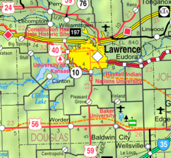
Eudora is part of the Lawrence, Kansas Metropolitan Statistical Area.

2020 census

The 2020 United States census counted 6,408 people, 2,296 households, and 1,643 families in Eudora. [13] [14] The population density was 2,181.8 per square mile (842.4/km2). There were 2,412 housing units at an average density of 821.2 per square mile (317.1/km2). [14] [15] The racial makeup was 87.39% (5,600) white or European American (85.35% non-Hispanic white), 0.83% (53) black or African-American, 1.42% (91) Native American or Alaska Native, 0.5% (32) Asian, 0.09% (6) Pacific Islander or Native Hawaiian, 1.14% (73) from other races, and 8.63% (553) from two or more races. [16] Hispanic or Latino of any race was 6.13% (393) of the population. [17]

Of the 2,296 households, 42.3% had children under the age of 18; 53.1% were married couples living together; 22.3% had a female householder with no spouse or partner present. 23.0% of households consisted of individuals and 9.0% had someone living alone who was 65 years of age or older. [14] The average household size was 3.0 and the average family size was 3.3. [18] The percent of those with a bachelor’s degree or higher was estimated to be 22.9% of the population. [19]

29.3% of the population was under the age of 18, 7.3% from 18 to 24, 29.3% from 25 to 44, 22.5% from 45 to 64, and 11.7% who were 65 years of age or older. The median age was 35.2 years. For every 100 females, there were 101.5 males. [14] For every 100 females ages 18 and older, there were 105.1 males. [14]

The 2016-2020 5-year American Community Survey estimates show that the median household income was $87,392 (with a margin of error of +/- $11,279) and the median family income was $89,072 (+/- $10,385). [20] Males had a median income of $51,387 (+/- $6,172) versus $30,748 (+/- $5,351) for females. The median income for those above 16 years old was $39,568 (+/- $7,479). [21] Approximately, 8.7% of families and 10.4% of the population were below the poverty line, including 16.4% of those under the age of 18 and 2.9% of those ages 65 or over. [22] [23]

2010 census

As of the census [24] of 2010, there were 6,136 people, 2,210 households, and 1,600 families living in the city. [25] The population density was 2,123.2 inhabitants per square mile (819.8/km2). There were 2,306 housing units at an average density of 797.9 per square mile (308.1/km2). The racial makeup of the city was 93.3% White, 0.8% African American, 1.6% Native American, 0.7% Asian, 0.8% from other races, and 2.8% from two or more races. Hispanic or Latino of any race were 4.5% of the population.

There were 2,210 households, of which 44.2% had children under the age of 18 living with them, 57.5% were married couples living together, 10.6% had a female householder with no husband present, 4.3% had a male householder with no wife present, and 27.6% were non-families. 22.8% of all households were made up of individuals, and 7.7% had someone living alone who was 65 years of age or older. The average household size was 2.75 and the average family size was 3.25.

The median age in the city was 31.8 years. 31% of residents were under the age of 18; 7.1% were between the ages of 18 and 24; 32.1% were from 25 to 44; 20.9% were from 45 to 64; and 8.8% were 65 years of age or older. The gender makeup of the city was 49.5% male and 50.5% female.

2000 census

As of the census [26] of 2000, there were 4,307 people, 1,607 households, and 1,136 families living in the city. The population density was 2,173.9 inhabitants per square mile (839.3/km2). There were 1,664 housing units at an average density of 839.9 per square mile (324.3/km2). The racial makeup of the city was 94.87% White, 0.70% African American, 1.46% Native American, 0.49% Asian, 0.02% Pacific Islander, 0.67% from other races, and 1.79% from two or more races. Hispanic or Latino of any race were 2.39% of the population.

There were 1,607 households, out of which 40.2% had children under the age of 18 living with them, 53.8% were married couples living together, 12.6% had a female householder with no husband present, and 29.3% were non-families. 23.5% of all households were made up of individuals, and 8.0% had someone living alone who was 65 years of age or older. The average household size was 2.63 and the average family size was 3.13.

In the city, the population was spread out, with 30.7% under the age of 18, 8.8% from 18 to 24, 34.1% from 25 to 44, 15.9% from 45 to 64, and 10.5% who were 65 years of age or older. The median age was 31 years. For every 100 females, there were 88.2 males. For every 100 females age 18 and over, there were 84.5 males.

The median income for a household in the city was $41,713, and the median income for a family was $50,909. Males had a median income of $37,833 versus $25,202 for females. The per capita income for the city was $18,693. About 4.3% of families and 6.4% of the population were below the poverty line, including 5.6% of those under age 18 and 7.9% of those age 65 or over.

Government

The Eudora government consists of five City Commissioners, which elects the Mayor. The City Commission meets the second and fourth Monday of each month at 7PM. [2]

Representation

Education

The community is served by Eudora USD 491 public school district.

Transportation

Eudora is directly served by three state highways, three county highways and a direct route to one national highway and to one interstate highway:

Notable people

See also

Related Research Articles

<span class="mw-page-title-main">Mapleton, Kansas</span> City in Kansas, United States

Mapleton is a city in Bourbon County, Kansas, United States. As of the 2020 census, the population of the city was 96.

<span class="mw-page-title-main">Burlington, Kansas</span> City in Coffey County, Kansas, United States

Burlington is a city in and the county seat of Coffey County, Kansas, United States. As of the 2020 census, the population of the city was 2,634.

<span class="mw-page-title-main">Waverly, Kansas</span> City in Coffey County, Kansas

Waverly is a city in Coffey County, Kansas, United States. As of the 2020 census, the population of the city was 574.

<span class="mw-page-title-main">Mulberry, Kansas</span> City in Crawford County, Kansas

Mulberry is a city in Crawford County, Kansas, United States. As of the 2020 census, the population of the city was 409.

<span class="mw-page-title-main">Jennings, Kansas</span> City in Decatur County, Kansas

Jennings is a city in Decatur County, Kansas, United States. As of the 2020 census, the population of the city was 81.

<span class="mw-page-title-main">Gove City, Kansas</span> City in Gove County, Kansas

Gove City, more commonly known as Gove, is a city in and the county seat of Gove County, Kansas, United States. As of the 2020 census, the population of the city was 80.

<span class="mw-page-title-main">Edgerton, Kansas</span> City in Kansas, United States

Edgerton is a city in Johnson County, Kansas, United States, and part of the Kansas City metropolitan area. As of the 2020 census, the population of the city was 1,748. It is home to a large BNSF intermodal train facility named Logistics Park Kansas City.

<span class="mw-page-title-main">Prairie Village, Kansas</span> City in Kansas, United States

Prairie Village is a city in Johnson County, Kansas, United States, and located within the Kansas City Metropolitan Area. As of the 2020 census, the population of the city was 22,957.

<span class="mw-page-title-main">Lansing, Kansas</span> City in Kansas, United States

Lansing is a city in Leavenworth County, Kansas, United States. It is situated along the west side of the Missouri River and Kansas-Missouri state border. As of the 2020 census, the population of the city was 11,239. It is the second most populous city of Leavenworth County and is a part of the Kansas City metropolitan area. The Lansing Correctional Facility, which includes the state's main maximum-security prison, is located in Lansing.

<span class="mw-page-title-main">Marysville, Kansas</span> City in Marshall County, Kansas

Marysville is a city in and the county seat of Marshall County, Kansas, United States. As of the 2020 census, the population of the city was 3,447.

<span class="mw-page-title-main">Meade, Kansas</span> City in Meade County, Kansas

Meade is a city in and the county seat of Meade County, Kansas, United States. As of the 2020 census, the population of the city was 1,505.

<span class="mw-page-title-main">Ness City, Kansas</span> City in Ness County, Kansas

Ness City is a city in and the county seat of Ness County, Kansas, United States. As of the 2020 census, the population of the city was 1,329. Ness City is famous for its four-story Old Ness County Bank Building located downtown, and nicknamed Skyscraper of the Plains.

<span class="mw-page-title-main">Lyndon, Kansas</span> City in Osage County, Kansas

Lyndon is a city in, and the county seat of Osage County, Kansas, United States. As of the 2020 census, the population of the city was 1,037.

<span class="mw-page-title-main">Minneapolis, Kansas</span> City in Ottawa County, Kansas

Minneapolis is a city in and the county seat of Ottawa County, Kansas, United States. As of the 2020 census, the population of the city was 1,946.

<span class="mw-page-title-main">Onaga, Kansas</span> City in Pottawatomie County, Kansas

Onaga is a city in Pottawatomie County, Kansas, United States. As of the 2020 census, the population of the city was 679.

<span class="mw-page-title-main">Agenda, Kansas</span> City in Republic County, Kansas

Agenda is a city in Republic County, Kansas, United States. As of the 2020 census, the population of the city was 47.

<span class="mw-page-title-main">Belleville, Kansas</span> City in Republic County, Kansas

Belleville is a city in and the county seat of Republic County, Kansas, United States. As of the 2020 census, the population of the city was 2,007.

<span class="mw-page-title-main">Mount Hope, Kansas</span> City in Sedgwick County, Kansas

Mount Hope is a city in Sedgwick County, Kansas, United States. As of the 2020 census, the population of the city was 806.

<span class="mw-page-title-main">Alma, Kansas</span> City in Wabaunsee County, Kansas

Alma is a city in and the county seat of Wabaunsee County, Kansas, United States. As of the 2020 census, the population of the city was 802.

<span class="mw-page-title-main">Lake Quivira, Kansas</span> City in Kansas, United States

Lake Quivira is a city in Johnson and Wyandotte counties in the State of Kansas, and part of the Kansas City Metropolitan Area. As of the 2020 census, the population of the city was 1,014.

References

  1. 1 2 3 4 U.S. Geological Survey Geographic Names Information System: Eudora, Kansas
  2. 1 2 "Eudora - Directory of Public Officials". Archived from the original on May 5, 2011. Retrieved April 26, 2011.
  3. "2019 U.S. Gazetteer Files". United States Census Bureau. Retrieved July 24, 2020.
  4. 1 2 "Profile of Eudora, Kansas in 2020". United States Census Bureau. Archived from the original on November 12, 2022. Retrieved November 12, 2022.
  5. 1 2 3 "QuickFacts; Eudora, Kansas; Population, Census, 2020 & 2010". United States Census Bureau. Archived from the original on August 28, 2021. Retrieved August 28, 2021.
  6. Cleland, Nora (June 12, 1961). "Only few of 45 county settlements left". Lawrence Journal-World. pp. 13A. Retrieved November 1, 2015.
  7. Gannett, Henry (1905). The Origin of Certain Place Names in the United States. Govt. Print. Off. pp.  122.
  8. 1 2 Higgins, Cindy. "Town Growth 1860-1880". The History of Eudora, Kansas. Retrieved June 15, 2011.
  9. "Kansas Post Offices, 1828-1961 (archived)". Kansas Historical Society. Archived from the original on March 10, 2013. Retrieved June 8, 2014.
  10. Blackmar, Frank Wilson (1912). Kansas: A Cyclopedia of State History, Embracing Events, Institutions, Industries, Counties, Cities, Towns, Prominent Persons, Etc. Standard Publishing Company. pp.  598.
  11. History of the State of Kansas: Containing a Full Account of Its Growth from an Uninhabited Territory to a Wealthy and Important State. A. T. Andreas. 1883. p.  353.
  12. "US Gazetteer files 2010". United States Census Bureau. Archived from the original on January 25, 2012. Retrieved July 6, 2012.
  13. "US Census Bureau, Table P16: HOUSEHOLD TYPE". data.census.gov. Retrieved January 2, 2024.
  14. 1 2 3 4 5 "US Census Bureau, Table DP1: PROFILE OF GENERAL POPULATION AND HOUSING CHARACTERISTICS". data.census.gov. Retrieved January 2, 2024.
  15. Bureau, US Census. "Gazetteer Files". Census.gov. Retrieved December 30, 2023.
  16. "US Census Bureau, Table P1: RACE". data.census.gov. Retrieved January 2, 2024.
  17. "US Census Bureau, Table P2: HISPANIC OR LATINO, AND NOT HISPANIC OR LATINO BY RACE". data.census.gov. Retrieved January 2, 2024.
  18. "US Census Bureau, Table S1101: HOUSEHOLDS AND FAMILIES". data.census.gov. Retrieved January 2, 2024.
  19. "US Census Bureau, Table S1501: EDUCATIONAL ATTAINMENT". data.census.gov. Retrieved January 2, 2024.
  20. "US Census Bureau, Table S1903: MEDIAN INCOME IN THE PAST 12 MONTHS (IN 2020 INFLATION-ADJUSTED DOLLARS)". data.census.gov. Retrieved January 2, 2024.
  21. "US Census Bureau, Table S2001: EARNINGS IN THE PAST 12 MONTHS (IN 2020 INFLATION-ADJUSTED DOLLARS)". data.census.gov. Retrieved January 2, 2024.
  22. "US Census Bureau, Table S1701: POVERTY STATUS IN THE PAST 12 MONTHS". data.census.gov. Retrieved January 2, 2024.
  23. "US Census Bureau, Table S1702: POVERTY STATUS IN THE PAST 12 MONTHS OF FAMILIES". data.census.gov. Retrieved January 2, 2024.
  24. "U.S. Census website". United States Census Bureau . Retrieved July 6, 2012.
  25. "2010 City Population and Housing Occupancy Status". U.S. Census Bureau. Retrieved April 6, 2011.[ dead link ]
  26. "U.S. Census website". United States Census Bureau . Retrieved January 31, 2008.

Further reading