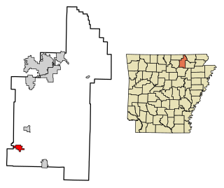
Sidney is a town in Sharp County, Arkansas, United States. The population was 181 at the 2010 census.
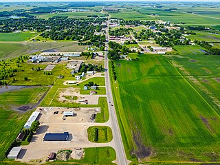
Winnebago is a city in Faribault County, Minnesota, United States. The population was 1,391 at the 2020 census.
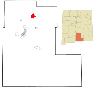
Mescalero is a census-designated place (CDP) in Otero County, New Mexico, United States, located on the Mescalero Apache Reservation. The population was 1,338 at the 2010 census.

West Hurley is a hamlet in Ulster County, New York, United States. The population was 1,917 at the 2020 census.

Eureka is a city in Navarro County, Texas, United States. The population was 313 at the 2020 census.

Bancroft is a town in Putnam County, West Virginia, United States, along the Kanawha River. The population was 389 at the 2020 census. It is part of the Huntington–Ashland metropolitan area.
Fort Winnebago is a town in Columbia County, Wisconsin, United States. The population was 855 at the 2000 census. The unincorporated community of Anacker is located in the town.
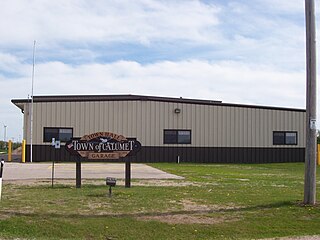
Calumet is a town in Fond du Lac County, Wisconsin, United States. The population was 1,514 at the 2000 census. The unincorporated communities of Artesia Beach, Calumet Harbor, Garnet, Highland Park, Johnsburg, Laudolff Beach, Marytown, Pipe, Pukwana Beach, Winnebago Heights, and Winnebago Park are located within the town. The unincorporated community of Calumetville is located partially in the town.

Black Wolf is a town in Winnebago County, Wisconsin, United States. The population was 2,429 at the 2020 census. The unincorporated communities of Black Wolf, Black Wolf Point, Little Point, Paukotuk, and Point Comfort are located in the town.

Poygan is a town in Winnebago County, Wisconsin, United States. The population was 1,301 at the 2010 census.

Rushford is a town in Winnebago County, Wisconsin, United States. The population was 1,561 at the 2010 census. The unincorporated communities of Eureka, Island Park, and Waukau are located in the town. The ghost town of Delhi was located in the town.

Utica is a town in Winnebago County, Wisconsin, United States. The population was 1,299 at the 2010 census. The unincorporated communities of Elo, Fisk, and Pickett are located in the town.

Vinland is a town in Winnebago County, Wisconsin, United States. The population was 1,765 at the 2010 census. The unincorporated community of Allenville is located in the town.

Winchester is a town in Winnebago County, Wisconsin, United States. The population was 1,763 at the 2010 census. The census-designated place of Winchester and the unincorporated communities of Clarks Point, Indian Shores, Lasleys Point, and Piacenza are located in the town.

Wolf River is a town in Winnebago County, Wisconsin, United States. The population was 1,189 at the 2010 census. The unincorporated communities of Orihula and Zittau are located in the town. The unincorporated community of Metz is also located partially in the town.

Deerfield is a town in Dane County, Wisconsin, United States. The population was 1,470 at the 2000 census. The City of Deerfield is located within the town. The unincorporated communities of London and Old Deerfield are located in the town.

Omro is a town in Winnebago County, Wisconsin, United States. The population was 2,116 at the 2010 census. The City of Omro and the unincorporated communities of Harbor Springs, Reighmoor, Rivermoor, and Zion are located in the town.

Omro is a city in Winnebago County, Wisconsin, United States. The population was 3,517 at the 2010 census. The city is located along the Fox River, approximately 10 miles west of Oshkosh, Wisconsin.

Oshkosh is a town in Winnebago County, Wisconsin, United States. The population was 2,439 at the 2020 census. It is a northern suburb of the larger City of Oshkosh which it is located adjacent to and partially within. The unincorporated communities of Nichols Shore Acres, Plummer Point, Shangri La Point, and Winnebago are located within the town.

Eureka is an unincorporated census-designated place in the town of Rushford, in Winnebago County, Wisconsin, United States. It is located on the Fox River at the intersection of county highways K & E southwest of Omro. At the 2020 census, its population was 247.

