Gilldora, Queensland

Last updated

Gilldora
Queensland
Mary Valley Rattler approaching Gilldora Road, Gilldora, 2019.jpg
Mary Valley Rattler approaching Gilldora Road, 2019
Australia Queensland location map.svg
Red pog.svg
Gilldora
Coordinates 26°18′00″S152°40′45″E / 26.3°S 152.6791°E / -26.3; 152.6791 (Gilldora (centre of locality))
Population50 (2021 census) [1]
 • Density12.8/km2 (33/sq mi)
Postcode(s) 4570
Area3.9 km2 (1.5 sq mi)
Time zone AEST (UTC+10:00)
Location
LGA(s) Gympie Region
State electorate(s) Gympie
Federal division(s) Wide Bay
Suburbs around Gilldora:
Calico Creek Lagoon Pocket Kybong
Calico Creek Gilldora Kybong
Dagun Dagun Kybong

Gilldora is a rural locality in the Gympie Region, Queensland, Australia. [2] In the 2021 census, Gilldora had a population of 50 people. [1]

Contents

Geography

The Mary River forms the north-eastern and eastern boundaries. [3]

The Mary Valley Road (State Route 51) enters the locality from north-west (Calico Creek / Lagoon Pocket) and exits to the south (Dagun). [4]

The Mary Valley railway line enters the locality from the north (Lagoon Pocket) and exits to the south (Dagun). [4] The locality was served by the now-abandoned Gilldora railway station ( 26°17′55″S152°40′37″E / 26.2986°S 152.6769°E / -26.2986; 152.6769 (Gilldora railway station (former)) ). [5]

The land use is a mixture of grazing on native vegetation, crop growing, and rural residential housing. [4]

History

The locality takes its name from its former railway station name, which in turn was named on 16 October 1922, reportedly a coined word from local resident Gillman "dorado", which happens to be an Aboriginal word meaning pleasant place. [2]

Demographics

In the 2016 census, Gilldora had a population of 39 people. [6]

In the 2021 census, Gilldora had a population of 50 people. [1]

Education

There are no school in Gilldora. The nearest government primary school is Dagun State School in neighbouring Dagun to the south. The nearest government secondary school is Gympie State High School in Gympie to the north. [7]

Attractions

The Mary Valley Rattler is a tourist train that operates on the Mary Valley railway line passing through Gilldora. [8]

Related Research Articles

<span class="mw-page-title-main">Kandanga, Queensland</span> Town in Queensland, Australia

Kandanga is a town and a locality in the Gympie Region, Queensland, Australia. In the 2021 census, the locality of Kandanga had a population of 659 people.

Araluen is a residential locality in Gympie in the Gympie Region, Queensland, Australia. In the 2021 census, Araluen had a population of 649 people.

Victory Heights is a rural residential locality in the Gympie Region, Queensland, Australia. In the 2021 census, Victory Heights had a population of 486 people.

Tamaree is a rural residential locality in the Gympie Region, Queensland, Australia. In the 2021 census, Tamaree had a population of 1,000 people.

<span class="mw-page-title-main">Monkland, Queensland</span> Suburb of Gympie, Queensland, Australia

Monkland is a rural locality in the Gympie Region, Queensland, Australia. In the 2021 census, Monkland had a population of 1,135 people.

The Dawn is a rural residential locality in the Gympie Region, Queensland, Australia. In the 2021 census, The Dawn had a population of 604 people.

<span class="mw-page-title-main">Glanmire, Queensland</span> Suburb of Gympie, Queensland, Australia

Glanmire is an urban industrial locality in Gympie in the Gympie Region, Queensland, Australia. In the 2021 census, Glanmire had a population of 28 people.

Kybong is a rural locality in the Gympie Region, Queensland, Australia. In the 2021 census, Kybong had a population of 363 people.

<span class="mw-page-title-main">Brooloo, Queensland</span> Town in Queensland, Australia

Brooloo is a rural town and locality in the Gympie Region, Queensland, Australia. In the 2021 census, the locality of Brooloo had a population of 369 people.
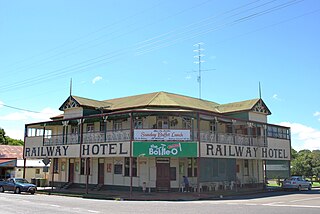
<span class="mw-page-title-main">Imbil</span> Town in Queensland, Australia

Imbil is a rural town and locality in the Gympie Region, Queensland, Australia. In the 2021 census, the locality of Imbil had a population of 1,071 people.

<span class="mw-page-title-main">Amamoor</span> Town in Queensland, Australia

Amamoor is a rural town and locality in the Gympie Region, Queensland, Australia. In the 2021 census, the locality of Amamoor had a population of 720 people.

Dagun is a rural town and locality in the Gympie Region, Queensland, Australia. In the 2021 census, the locality of Dagun had a population of 137 people.
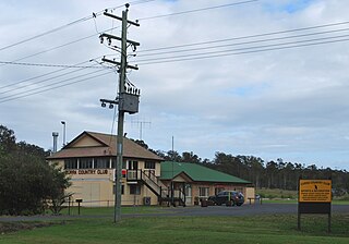
<span class="mw-page-title-main">Curra, Queensland</span> Suburb of Gympie Region, Queensland, Australia

Curra is a rural residential locality in the Gympie Region, Queensland, Australia. In the 2021 census, Curra had a population of 2,104 people.

Melawondi is a rural locality in the Gympie Region, Queensland, Australia. It is located 20 kilometres (12 mi) south of Gympie. In the 2021 census, Melawondi had a population of 34 people.

Calico Creek is a rural locality in the Gympie Region, Queensland, Australia. In the 2021 census, Calico Creek had a population of 185 people.

Lagoon Pocket is a rural locality in the Gympie Region, Queensland, Australia. In the 2021 census, Lagoon Pocket had a population of 170 people.

Tandur is a rural locality in the Gympie Region, Queensland, Australia. In the 2021 census, Tandur had a population of 188 people.

<span class="mw-page-title-main">Scotchy Pocket, Queensland</span> Suburb of Gympie Region, Queensland, Australia

Scotchy Pocket is a rural locality in the Gympie Region, Queensland, Australia. In the 2021 census, Scotchy Pocket had a population of 55 people.

Coles Creek is a rural locality in the Gympie Region, Queensland, Australia. In the 2021 census, Coles Creek had a population of 68 people.

Long Flat is a rural locality in the Gympie Region, Queensland, Australia. In the 2021 census, Long Flat had a population of 98 people.

References

  1. 1 2 3 Australian Bureau of Statistics (28 June 2022). "Gilldora (SAL)". 2021 Census QuickStats. Retrieved 28 February 2023. OOjs UI icon edit-ltr-progressive.svg
  2. 1 2 "Gilldora – locality in Gympie Region (entry 46329)". Queensland Place Names. Queensland Government . Retrieved 11 June 2019.
  3. Google (20 August 2021). "Gilldora, Queensland" (Map). Google Maps . Google. Retrieved 20 August 2021.
  4. 1 2 3 "Queensland Globe". State of Queensland . Retrieved 10 September 2023.
  5. "Railway stations and sidings - Queensland". Queensland Open Data. Queensland Government. 2 October 2020. Archived from the original on 5 October 2020. Retrieved 5 October 2020.
  6. Australian Bureau of Statistics (27 June 2017). "Gilldora (SSC)". 2016 Census QuickStats. Retrieved 20 October 2018. OOjs UI icon edit-ltr-progressive.svg
  7. "Layers: Locality; Schools and school catchments". Queensland Globe. Queensland Government. Archived from the original on 19 December 2017. Retrieved 10 September 2023.
  8. "The Journey". Mary Valley Rattler. Archived from the original on 27 March 2023. Retrieved 10 September 2023.