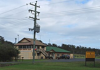
Tuchekoi is a rural locality in the Gympie Region, Queensland, Australia. In the 2021 census, Tuchekoi had a population of 199 people.
Southside is a semi-rural locality in the Gympie Region, Queensland, Australia. In the 2021 census, Southside had a population of 6,312 people.
The Dawn is a rural residential locality in the Gympie Region, Queensland, Australia. In the 2021 census, The Dawn had a population of 604 people.

Brooloo is a rural town and locality in the Gympie Region, Queensland, Australia. In the 2021 census, the locality of Brooloo had a population of 369 people.
Dagun is a rural town and locality in the Gympie Region, Queensland, Australia. In the 2021 census, the locality of Dagun had a population of 137 people.

Curra is a rural residential locality in the Gympie Region, Queensland, Australia. In the 2021 census, Curra had a population of 2,104 people.
Calico Creek is a rural locality in the Gympie Region, Queensland, Australia. In the 2021 census, Calico Creek had a population of 185 people.

Glastonbury is a rural town and locality in the Gympie Region, Queensland, Australia. In the 2021 census, the locality of Glastonbury had a population of 365 people.
Kanigan is a rural locality split between the Fraser Coast Region and the Gympie Region, both in Queensland, Australia. In the 2021 census, Kanigan had a population of 143 people.
Langshaw is a rural locality in the Gympie Region, Queensland, Australia. In the 2021 census, Langshaw had a population of 167 people.
Mooloo is a rural locality in the Gympie Region, Queensland, Australia. In the 2021 census, Mooloo had a population of 171 people.
Pie Creek is a rural locality in the Gympie Region, Queensland, Australia. In the 2021 census, Pie Creek had a population of 1,137 people.
Scrubby Creek is a rural locality in the Gympie Region, Queensland, Australia. In the 2021 census, Scrubby Creek had a population of 62 people.
Upper Glastonbury is a rural locality in the Gympie Region, Queensland, Australia. In the 2021 census, Upper Glastonbury had a population of 56 people.
The Palms is a rural residential locality in the Gympie Region, Queensland, Australia. In the 2021 census, The Palms had a population of 1,083 people.
Widgee Crossing South is a rural locality in the Gympie Region, Queensland, Australia. In the 2021 census, Widgee Crossing South had a population of 33 people.

Scotchy Pocket is a rural locality in the Gympie Region, Queensland, Australia. In the 2021 census, Scotchy Pocket had a population of 55 people.
Coles Creek is a rural locality in the Gympie Region, Queensland, Australia. In the 2021 census, Coles Creek had a population of 68 people.

Gilldora is a rural locality in the Gympie Region, Queensland, Australia. In the 2021 census, Gilldora had a population of 50 people.
Long Flat is a rural locality in the Gympie Region, Queensland, Australia. In the 2021 census, Long Flat had a population of 98 people.


