Gokarneshwor गोकर्णेश्वर | |
|---|---|
 | |
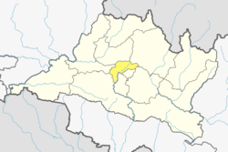
 Gokarneshwor Location in Nepal  Gokarneshwor Gokarneshwor (Nepal) | |
| Coordinates: 27°44′0″N85°23′0″E / 27.73333°N 85.38333°E | |
| Country | |
| Province | Bagmati |
| District | Kathmandu |
| Established | 2014 |
| Named after | Gokarneshwor Mahadev Temple |
| Government | |
| • Mayor | Deepak Kumar Risal (NC) |
| • Deputy Mayor | Sannani Lama (CPN-UML) |
| Area | |
• Total | 58.5 km2 (22.6 sq mi) |
| Population | |
• Total | 149,366 |
| • Density | 2,550/km2 (6,610/sq mi) |
| • Ethnicities | Newar Hyolmo Sherpa Rai Limbu Gurung Brahman Chhetri Tamang Magar |
| Time zone | UTC+5:45 (NST) |
| Website | gokarneshwormun |
Gokarneshwor is a municipality in Kathmandu District in the Bagmati Province of Nepal that was established on 2 December 2014 by merging the former Village development committees Sundarijal, Nayapati, Baluwa, Jorpati and Gokarna. [1] [2] The office of the municipality is that of the former Jorpati village development committee. The river Bagmati has its origin as the name Bagh Dwar situated in the middle of the Shivapuri jungle in this municipality.
Contents
- Toponymy
- Linguistic origin
- Etymology
- Schools
- Population
- Settlements
- Notable residents
- Gallery
- References
- External links
In the village on the banks of the Bagmati River stands the Gokarna Mahadev temple, built in 1582. [3] There also lies the Kanti Bhairav temple, built in around 17th century during the reign of King Pratap Malla. In late August or early September people go to this temple to bathe and make offerings in honor of their fathers, living or dead, on a day called Gokarna Aunsi. [4]
The Gokarna Forest Reserve is located in the area. Nepal Medical College and Teaching Hospital is located Southwest of Gokarneshwor.