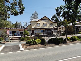
Cooran is a rural hinterland town and locality in the Shire of Noosa, Queensland, Australia. In the 2021 census, the locality of Cooran had a population of 1,756 people.
Ringtail Creek is a rural locality in the Shire of Noosa, Queensland, Australia. In the 2021 census, Ringtail Creek had a population of 203 people.
Cootharaba is a rural locality in the Shire of Noosa, Queensland, Australia. In the 2021 census, Cootharaba had a population of 866 people.

Como is a rural locality in the Shire of Noosa, Queensland, Australia. In the 2021 census, Como had a population of 54 people.

Tuchekoi is a rural locality in the Gympie Region, Queensland, Australia. In the 2021 census, Tuchekoi had a population of 199 people.
Veteran is a rural residential locality in the Gympie Region, Queensland, Australia. In the 2021 census, Veteran had a population of 959 people.
Victory Heights is a rural residential locality in the Gympie Region, Queensland, Australia. In the 2021 census, Victory Heights had a population of 486 people.
Jones Hill is a rural locality in the Gympie Region, Queensland, Australia. In the 2021 census, Jones Hill had a population of 1,135 people.

Glanmire is an urban industrial locality in Gympie in the Gympie Region, Queensland, Australia. In the 2021 census, Glanmire had a population of 28 people.
Dagun is a rural town and locality in the Gympie Region, Queensland, Australia. In the 2021 census, the locality of Dagun had a population of 137 people.

Tinana is a rural town and locality in the Fraser Coast Region, Queensland, Australia. In the 2021 census, the locality of Tinana had a population of 5,872 people.

Traveston is a rural town and locality in the Gympie Region, Queensland, Australia. In the 2021 census, the locality of Traveston had a population of 509 people.

Widgee is a rural locality in the Gympie Region, Queensland, Australia. In the 2021 census, Widgee had a population of 862 people.
Calico Creek is a rural locality in the Gympie Region, Queensland, Australia. In the 2021 census, Calico Creek had a population of 185 people.
Cedar Pocket is a rural locality in the Gympie Region, Queensland, Australia. In the 2021 census, Cedar Pocket had a population of 332 people.
Kanigan is a rural locality split between the Fraser Coast Region and the Gympie Region, both in Queensland, Australia. In the 2021 census, Kanigan had a population of 143 people.
Neusa Vale is a rural locality in the Gympie Region, Queensland, Australia. In the 2021 census, Neusa Vale had a population of 54 people.
Widgee Crossing South is a rural locality in the Gympie Region, Queensland, Australia. In the 2021 census, Widgee Crossing South had a population of 33 people.
Coles Creek is a rural locality in the Gympie Region, Queensland, Australia. In the 2021 census, Coles Creek had a population of 68 people.
Long Flat is a rural locality in the Gympie Region, Queensland, Australia. In the 2021 census, Long Flat had a population of 98 people.


