Gurulmindi, Queensland

Last updated

Gurulmundi
Queensland
Australia Queensland location map.svg
Red pog.svg
Gurulmundi
Coordinates 26°23′06″S150°07′50″E / 26.385°S 150.1305°E / -26.385; 150.1305 Coordinates: 26°23′06″S150°07′50″E / 26.385°S 150.1305°E / -26.385; 150.1305
Population7 (2016 census) [1]
 • Density0.0275/km2 (0.071/sq mi)
Postcode(s) 4415
Area254.5 km2 (98.3 sq mi)
LGA(s) Western Downs Region
State electorate(s) Callide
Federal Division(s) Maranoa
Suburbs around Gurulmundi:
Guluguba Guluguba Pelham
Woleebee Gurulmundi Pelham
Glenaubyn Kowguran Hookswood

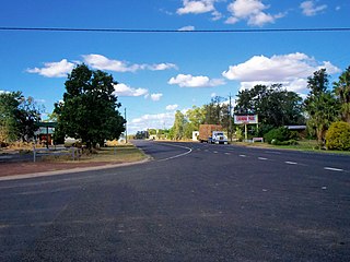
Gurulmundi is a locality in the Western Downs Region, Queensland, Australia. [2] In the 2016 census, Gurulmundi had a population of 7 people. [1]

Suburbs and localities are the names of geographic subdivisions in Australia, used mainly for address purposes. The term locality is used in rural areas, while the term suburb is used in urban areas. Australian postcodes closely align with the boundaries of localities and suburbs.

Western Downs Region Local government area in Queensland, Australia

Western Downs Region is a local government area in Queensland, Australia. The Western Downs Regional Council manages an area of 38,039 square kilometres (14,687 sq mi), which is approximately the same size as the country of Switzerland, although with a population at the last census of close to 33,000, it is over 235 times less densely populated.

Queensland North-east state of Australia

Queensland is the second-largest and third-most populous state in the Commonwealth of Australia. Situated in the north-east of the country, it is bordered by the Northern Territory, South Australia and New South Wales to the west, south-west and south respectively. To the east, Queensland is bordered by the Coral Sea and Pacific Ocean. To its north is the Torres Strait, with Papua New Guinea located less than 200 km across it from the mainland. The state is the world's sixth-largest sub-national entity, with an area of 1,852,642 square kilometres (715,309 sq mi).

History

The location takes its name from an Aboriginal word meaning low hills. [2]

Gurulmindi Provisional School opened on 27 February 1928. It became Gurulmindi State School on 1 January 1944. It closed on 10 May 1965. [3]

Related Research Articles

Condamine, Queensland Town in Queensland, Australia

Condamine is a town and a locality in the Western Downs Region, Queensland, Australia. At the 2016 census, Condamine had a population of 384.

Moonie, Queensland Town in Queensland, Australia

Moonie is a town in the Western Downs Region and a locality split between the Western Downs Region and the Goondiwindi Region in Queensland, Australia.

Drillham, Queensland Town in Queensland, Australia

Drillham is a town and a locality in the Western Downs Region, Queensland, Australia. At the 2011 census, Drillham and the surrounding area had a population of 217.

The Gums, Queensland Town in Queensland, Australia

The Gums is a rural town and locality in the Western Downs Region, Queensland, Australia.

Macalister, Queensland Town in Queensland, Australia

Macalister is a town and a locality in the Western Downs Region, Queensland, Australia. At the 2006 census, Macalister and the surrounding area had a population of 486.

Warra, Queensland Town in Queensland, Australia

Warra is a town and locality in the Western Downs Region, Queensland, Australia. At the 2006 census, Warra had a population of 84.

Dulacca, Queensland Town in Queensland, Australia

Dulacca is a town and a locality in the Western Downs Region, Queensland, Australia. At the 2011 census, Dulacca had a population of 249.

Meandarra Town in Queensland, Australia

Meandarra is a town and a locality in the Western Downs Region, Queensland, Australia. At the 2006 census, Meandarra and the surrounding area had a population of 341.

Guluguba, Queensland Town in Queensland, Australia

Guluguba is both a town and a locality in the Western Downs Region in Queensland, Australia. In the 2011 census, Guluguba was counted together with neighbouring Wandoan and had a combined population of 655.

Captains Mountain, Queensland Suburb of Toowoomba Region, Queensland, Australia

Captains Mountain is a locality in the Toowoomba Region, Queensland, Australia. In the 2016 census, Captains Mountain had a population of 77 people.

Grosmont, Queensland Suburb of Western Downs Region, Queensland, Australia

Grosmont is a locality in the Western Downs Region, Queensland, Australia.

Cottonvale, Queensland Suburb of Southern Downs Region, Queensland, Australia

Cottonvale is a locality in the Southern Downs Region, Queensland, Australia. In the 2016 census, Cottonvale had a population of 148 people. It contains the town of Cotton Vale.

Fairyland, Queensland Suburb of Western Downs Region, Queensland, Australia

Fairyland is a rural locality in the Western Downs Region, Queensland, Australia. In the 2016 census, Fairyland had a population of 67 people.

Gurulmundi, Queensland Suburb of Western Downs Region, Queensland, Australia

Gurulmundi is a locality in the Western Downs Region, Queensland, Australia.

Roche Creek, Queensland Suburb of Western Downs Region, Queensland, Australia

Roche Creek is a locality in the Western Downs Region, Queensland, Australia. In the 2016 census, Roche Creek had a population of 55 people.

Hookswood, Queensland Suburb of Western Downs Region, Queensland, Australia

Hookswood is a locality in the Western Downs Region, Queensland, Australia. In the 2016 census, Hookswood had a population of 56 people.

Blackswamp, Queensland Suburb of Western Downs Region, Queensland, Australia

Blackswamp is a locality in the Western Downs Region, Queensland, Australia. In the 2016 census, Blackswamp had a population of 57 people.

Bogandilla, Queensland Suburb of Western Downs Region, Queensland, Australia

Bogandilla is a locality in the Western Downs Region, Queensland, Australia. In the 2016 census, Bogandilla had a population of 28 people.

Flinton, Queensland Town in Queensland, Australia

Flinton is a rural town and locality in the Western Downs Region, Queensland, Australia. In the 2016 census, Flinton had a population of 42 people.

Goranba, Queensland Suburb of Western Downs Region, Queensland, Australia

Goranba is a locality in the Western Downs Region, Queensland, Australia. In the 2016 census, Goranba had a population of 187 people.

References

  1. 1 2 Australian Bureau of Statistics (27 June 2017). "Gurulmundi (SSC)". 2016 Census QuickStats. Retrieved 20 October 2018. OOjs UI icon edit-ltr-progressive.svg
  2. 1 2 "Gurulmundi - locality in Western Downs Region (entry 47707)". Queensland Place Names. Queensland Government . Retrieved 30 May 2019.
  3. Queensland Family History Society (2010), Queensland schools past and present (Version 1.01 ed.), Queensland Family History Society, ISBN   978-1-921171-26-0