Harrison, Grant County, Wisconsin

Last updated

Town of Harrison
WIMap-doton-Harrison b.png
Location of the Town of Harrison
Coordinates: 42°43′19″N90°37′20″W / 42.72194°N 90.62222°W / 42.72194; -90.62222
Country Flag of the United States.svg  United States
State Flag of Wisconsin.svg  Wisconsin
County Grant
Area
  Total36.1 sq mi (93.6 km2)
  Land36.1 sq mi (93.6 km2)
  Water0.0 sq mi (0.0 km2)
Elevation
[1]
889 ft (271 m)
Population
 (2000)
  Total497
  Density13.8/sq mi (5.3/km2)
Time zone UTC-6 (Central (CST))
  Summer (DST) UTC-5 (CDT)
Area code 608
FIPS code 55-32825 [2]
GNIS feature ID1583355 [1]

The Town of Harrison is a town in Grant County, Wisconsin, United States. The population was 497 at the 2000 census. The unincorporated community of Cornelia is located in the town.

Contents

Geography

According to the United States Census Bureau, the town has a total area of 36.1 square miles (93.6 km2), all of it land.

Demographics

At the 2000 census there were 497 people, 176 households, and 148 families living in the town. The population density was 13.8 people per square mile (5.3/km2). There were 186 housing units at an average density of 5.1 per square mile (2.0/km2). The racial makeup of the town was 98.39% White, 0.20% Asian, 0.40% from other races, and 1.01% from two or more races. Hispanic or Latino of any race were 0.80%. [2]

Of the 176 households 38.6% had children under the age of 18 living with them, 75.6% were married couples living together, 4.0% had a female householder with no husband present, and 15.9% were non-families. 11.9% of households were one person and 4.0% were one person aged 65 or older. The average household size was 2.82 and the average family size was 3.06.

The age distribution was 27.4% under the age of 18, 7.2% from 18 to 24, 28.6% from 25 to 44, 28.6% from 45 to 64, and 8.2% 65 or older. The median age was 38 years. For every 100 females, there were 106.2 males. For every 100 females age 18 and over, there were 111.1 males.

The median household income was $45,375 and the median family income was $47,125. Males had a median income of $26,000 versus $20,592 for females. The per capita income for the town was $16,647. About 4.5% of families and 6.9% of the population were below the poverty line, including 11.3% of those under age 18 and none of those age 65 or over.

Notable people

Related Research Articles

<span class="mw-page-title-main">Mulberry, Indiana</span> Town in Indiana, United States

Mulberry is a town in Madison Township, Clinton County, Indiana, United States. The population was 1,231 at the 2020 census. The town was named for a mulberry tree which grew at the point where it was founded.

<span class="mw-page-title-main">Wilkinson, Indiana</span> Town in Indiana, United States

Wilkinson is a town in Brown Township, Hancock County, Indiana, United States. The population was 449 at the 2010 census.

<span class="mw-page-title-main">Paragon, Indiana</span> Town in Indiana, United States

Paragon is a town in Ray Township, Morgan County, in the U.S. state of Indiana. The population was 556 at the 2020 census, down from 659 in 2010.
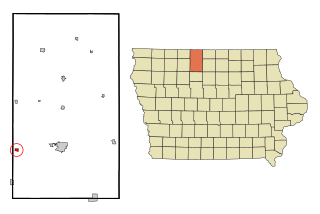
<span class="mw-page-title-main">White Cloud, Kansas</span> City in Doniphan County, Kansas

White Cloud is a city in Doniphan County, Kansas, United States. As of the 2020 census, the population of the city was 115. It was named for Francis White Cloud, a son of Chief White Cloud of the Iowa people. White Cloud is the seat of government for the Iowa Tribe of Kansas and Nebraska.

<span class="mw-page-title-main">Caswell, Maine</span> Town in the state of Maine, United States

Caswell is a town in Aroostook County, Maine, United States. The population was 293 at the 2020 census.

<span class="mw-page-title-main">St. Agatha, Maine</span> Town in the state of Maine, United States

St. Agatha is a town in Aroostook County, Maine, United States. The population was 730 at the 2020 census.

Waltham is a town in Hancock County, Maine, United States. The population was 332 at the 2020 census.

Garland is a town in Penobscot County, Maine, United States. The population was 1,026 at the 2020 census.

Meddybemps is a town in Washington County, Maine, United States. The population was 139 at the 2020 census.

<span class="mw-page-title-main">Martin, Michigan</span> Village in Michigan, United States

Martin is a village in southeastern Allegan County in the U.S. state of Michigan. The population was 377 at the 2020 census.

<span class="mw-page-title-main">Carlos, Minnesota</span> City in Minnesota, United States

Carlos is a city in Douglas County, Minnesota, United States. The population was 497 at the 2020 census.

<span class="mw-page-title-main">Vergas, Minnesota</span> City in Minnesota, United States

Vergas is a city in northern Otter Tail County, Minnesota, United States. The population was 348 at the 2020 census.

<span class="mw-page-title-main">Bertha, Minnesota</span> City in Minnesota, United States

Bertha is a city in Todd County, Minnesota, United States. The population was 497 at the 2010 census. By the time of the 2020 Decennial Census the population had grown to 560 residents.

<span class="mw-page-title-main">Green Ridge, Missouri</span> City in Missouri, United States

Green Ridge is a city located along Route 127 in Pettis County, Missouri, United States. The population was 476 at the 2010 census.

<span class="mw-page-title-main">West Hamlin, West Virginia</span> Town in West Virginia, United States

West Hamlin is a town in Lincoln County, West Virginia, United States, along the Guyandotte River. The population was 519 at the 2020 census, and is now down to 509, according to the 2021 census. West Hamlin is a part of the Huntington-Ashland, WV-KY-OH, Metropolitan Statistical Area (MSA). West Hamlin is west of the county seat at Hamlin, hence the name.

<span class="mw-page-title-main">Peeksville, Wisconsin</span> Town in Wisconsin, United States

Peeksville is a town in Ashland County in the U.S. state of Wisconsin. The population was 141 at the 2010 census.

<span class="mw-page-title-main">Little Rice, Wisconsin</span> Town in Wisconsin, United States

Little Rice is a town in Oneida County, Wisconsin, United States. The population was 314 at the 2000 census. The unincorporated community of McCord is located in the town.

<span class="mw-page-title-main">Atlanta, Wisconsin</span> Town in Wisconsin, United States

Atlanta is a town in Rusk County, Wisconsin, United States. The population was 627 at the 2000 census. The unincorporated community of Imalone is located partially in the town.

<span class="mw-page-title-main">Bear Creek, Sauk County, Wisconsin</span> Town in Wisconsin, United States

Bear Creek is a town in Sauk County, Wisconsin, United States. In September 1858, the town of Bear Creek was created out of the town of Franklin. The town consists of 50 sections and is bounded on the north by the town of Washington, on the south by the town of Spring Green, on the east by the town of Franklin, and on the west by Richland County. The population was 497 at the 2000 census. The town took its name from Bear Creek. The unincorporated community of Loreto is located in the town.

Couderay is a town in Sawyer County, Wisconsin, United States. The population was 469 at the 2000 census. The village of Couderay, the census-designated place of Reserve, and the unincorporated community of Lemington are located within the town. The unincorporated community of Yarnell is located partially in the town.

References

  1. 1 2 "US Board on Geographic Names". United States Geological Survey. October 25, 2007. Retrieved January 31, 2008.
  2. 1 2 "U.S. Census website". United States Census Bureau . Retrieved January 31, 2008.
  3. 'Wisconsin Blue Book 1897,' Biographical Sketch of Adelbert L. Utt, pg. 680