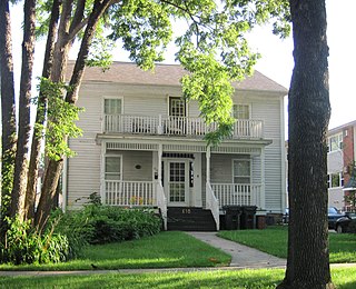
Theodore Roosevelt Inaugural National Historic Site preserves the Ansley Wilcox House, at 641 Delaware Avenue in Buffalo, New York. Here, after the assassination of William McKinley, Theodore Roosevelt took the oath of office as President of the United States on September 14, 1901. A New York historical marker outside the house indicates that it was the site of Theodore Roosevelt's Inauguration.

This is a list of more than 1,100 properties and districts in Nebraska that are on the National Register of Historic Places. Of these, 20 are National Historic Landmarks. There are listings in 90 of the state's 93 counties.

This is a list of the National Register of Historic Places listings in Waukesha County, Wisconsin. It is intended to provide a comprehensive listing of entries in the National Register of Historic Places that are located in Waukesha County, Wisconsin. The locations of National Register properties for which the latitude and longitude coordinates are included below may be seen in a map.

Olompali State Historic Park is a 700-acre (2.8 km2) park in Marin County, California, 3.5 miles (5.6 km) north of Novato, California, overlooking the Petaluma River and San Pablo Bay. In 1977 the State of California purchased Rancho Olompali and made it into a state historic park. The foundations of two early adobe brick houses are preserved in the park. The Burdell two-story frame house, built in the 1870s serves as the ranger station. Associated ranch buildings include barns, a blacksmith shop, a saltbox house and a ranch superintendent's house.

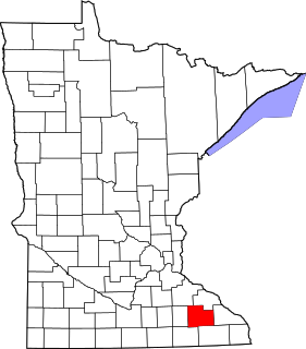
This is a list of the National Register of Historic Places listings in Rice County, Minnesota. It is intended to be a complete list of the properties and districts on the National Register of Historic Places in Rice County, Minnesota, United States. The locations of National Register properties and districts for which the latitude and longitude coordinates are included below, may be seen in an online map.

This is a list of the National Register of Historic Places listings in Stearns County, Minnesota. It is intended to be a complete list of the properties and districts on the National Register of Historic Places in Stearns County, Minnesota, United States. The locations of National Register properties and districts for which the latitude and longitude coordinates are included below, may be seen in an online map.

The Patrick Farrish House, also known as the Lowe and Paula McDaniel House, is a historic house located in Thomaston, Alabama. It was built in 1926 in the Craftsman style. The house was added to the National Register of Historic Places on August 31, 2000 due to its architectural significance.

This is a list of the National Register of Historic Places listings in Olmsted County, Minnesota. It is intended to be a complete list of the properties and districts on the National Register of Historic Places in Olmsted County, Minnesota, United States. The locations of National Register properties and districts for which the latitude and longitude coordinates are included below, may be seen in an online map.

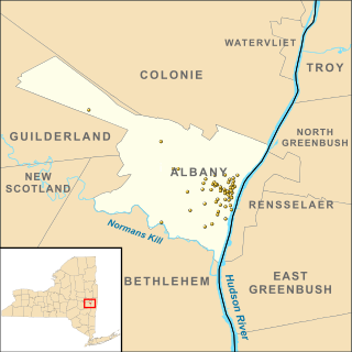
There are 68 properties listed on the National Register of Historic Places in Albany, New York, United States. Six are additionally designated as National Historic Landmarks (NHLs), the most of any city in the state after New York City. Another 14 are historic districts, for which 20 of the listings are also contributing properties. Two properties, both buildings, that had been listed in the past but have since been demolished have been delisted; one building that is also no longer extant remains listed.

This is a list of the National Register of Historic Places listings in Dayton, Ohio.

The former St. Mary's Rectory is a historic building located in Iowa City, Iowa, United States. Now a private home, the residence housed the Catholic clergy that served St. Mary's Catholic Church from 1854 to 1892. At that time the house was located next to the church, which is four blocks to the west. It was listed on the National Register of Historic Places in 1995.

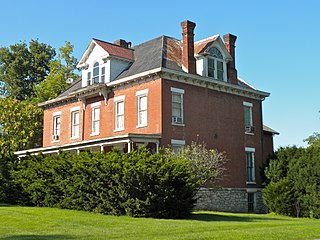
The John N. and Mary L. (Rankin) Irwin House is a historic building located in Keokuk, Iowa, United States. It was individually listed on the National Register of Historic Places in 1999. In 2002 it was included as a contributing property in The Park Place-Grand Avenue Residential District.

John Stoddert Haw House is a historic building, located at 2808 N Street, Northwest, Washington, D.C., in the Georgetown neighborhood.

The Parish House, at 109 S. F St. in Virginia City, Nevada, is a well-preserved historic Italianate-style house that was built in 1876. It is included in the Virginia City Historic District. It was individually listed on the National Register of Historic Places in 1993.

The Fort Street Historic District in Boise, Idaho, contains roughly 47 blocks located within the 1867 plat of Boise City. The irregular shape of the district is roughly bounded on the north by West Fort Street and on the south by West State Street. The west boundary is North 16th Street, and the east boundary is roughly North 5th Street.


