Ernakulam, IPA: [erɐɳɐːguɭɐm]; ISO: Eṟaṇākuḷaṁ, in Malayalam: എറണാകുളം), is one of the 14 districts in the Indian state of Kerala, that takes its name from the eponymous city division in Kochi. It is situated in the central part of the state, spans an area of about 3,000 square kilometres (1,200 sq mi), and is home to over 9% of Kerala's population. Its headquarters are located at Kakkanad. The district includes Kochi, also known as the commercial capital of Kerala, which is famous for its ancient Churches, Hindu temples, synagogues and mosques. The district includes the largest metropolitan region of the state: Greater Cochin. Ernakulam is the district that yields the most revenue and the largest number of industries in the state. Ernakulam is the third most populous district in Kerala, after Malappuram and Thiruvananthapuram. The district also hosts the highest number of international and domestic tourists in Kerala state.

Thodupuzha (തൊടുപുഴ) is a municipality located in Idukki, Kerala, India, that covers an area of 35.43 km2 (13.68 sq mi). It lies on the banks of Thodupuzha river, which merges with the Kaliyar and Kothamangalam rivers at Muvattupuzha to form the Muvattupuzha river. Thodupuzha is 53 km (33 mi) from Kottayam, 75 km (47 mi) from Kattappana and 60 km (37 mi) south east of Kochi. Thodupuzha is 197 km (122 mi) from the state capital, Trivandrum. The geographical classification of the Thodupuzha Region is Malanad or Keezhmalanad.

Muvattupuzha is a town in the midlands directly to the east of Kochi in Ernakulam district, Kerala, India. It is located about 36 km (22 mi) from downtown Kochi, and is a growing urban centre in central Kerala. The town is also the starting point of the Muvattupuzhayar, which is a confluence formed by three rivers: the Thodupuzhayar, Kaliyar, and Kothayar.
Kothamangalam, IPA: [koːd̪ɐmɐŋgɐlɐm], is a municipality in Ernakulam district of Kerala, India. The town is in the foothills of the Western Ghats, and is a part of the Idukki Lok Sabha constituency.

The Syro-Malabar Catholic Eparchy of Kothamangalam is an East Syriac Catholic eparchy in India, under the Syro-Malabar Catholic Church. It was established by Pope Pius XII in 1957. Mar George Madathikandathil is the eparch since 10 January 2013.

Keerampara is an Indian village in the state of Kerala, India. This is a junction. This place is once blessed with the footprints of all the holy personnel who passed through the Royal route.

Kizhakkambalam is an eastern suburb of the city of Kochi in Ernakulam district, Kerala, India. It is regarded as a model panchayat for its various development activities and is a part of the Kunnathunad tehsil of the Ernakulam district.
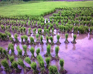
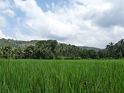
Karumallur is a village in Paravur Taluk, Ernakulam district in the Indian state of Kerala. Karumalloor is a panchayat in Ernakulam District. The village consists of large tracts of paddy fields. Karumallur is bounded by distributaries of the river Periyar. The panchayat is mainly a rice-based agrarian economy.
Kottappady is a village in Kothamangalam Taluk in Ernakulam district of Kerala State, India. It belongs to Central Kerala Division. It is located 10 km from Kothamangalam. The village came into existence in the year 1953.

Kuttampuzha is a village and gram panchayat in Ernakulam district in the Indian state of Kerala. Situated 71km east of Kochi, Kuttampuzha panchayat is home to the 17.7% of total area of the Ernakulam District.
Anikkad is a village in Ernakulam district in the state of Kerala, India. It is located near the Muvattupuzha town in Avoly Panchayat.

Parudur is a village and gram panchayat in Pattambi taluk, Palakkad district in the state of Kerala, India. Parudur was originally a part of Kuttippuram Block Panchayat in Tirur Taluk of erstwhile Kozhikode district, before the formation of Malappuram district. After the formation of Malappuram district, Tirur Taluk became a part of Malappuram and Parudur village was transferred to Ottapalam Taluk. Today it forms part of Pattambi taluk.
Nellikuzhi "THE FURNITURE VILLAGE OF KERALA" is a Grama panchayat in Kothamangalam Taluk, Ernakulam district, Kerala, situated on the Aluva-Munnar State Highway. Nellikuzhi is famous for its furniture business. There are hundreds of furniture showrooms and thousands of production units. Nellikuzhi caters the main demand of hardwood furniture in South India. It covers an area of 27.62 square kilometres (10.66 sq mi), and is a suburban area of Kothamangalam town, situated 3.5 km away. Muvattupuzha and Perumbavoor towns are situated 15 km away from Nellikuzhy. Nellikuzhi is the hometown of Sri T. M. Meethian, Ex-MLA of Kothamangalam, a mediator in Kothamangalam Taluk.
Pampakuda is a village and Panchayath part of Muvattupuzha Taluk. It lies between Muvattupuzha and Piravom towns. The village is on Highlands and consists of Rubber Plantations. Pampakuda is 10 km from Muvattupuzha.
Muvattupuzha taluk is part of the Ernakulam district in the state of Kerala, India. This taluk was formed during the period of Marthanda Varma. It is a revenue division for ease of administration purposes, and is headquartered in Muvattupuzha. Most government offices are in the Mini Civil Station at Vazhappilly. Muvattupuzha taluk consists of

Pooyamkutty is a small town in Ernakulam district, Kothamangalam Taluk, Kuttampuzha panchayat and in the Indian state of Kerala. Pooyamkutty is situated along Pooyamkutty river, a tributary of the Periyar. The nearest Municipality is Kothamangalam which is 27km away from Pooyamkutty and takes about one hour travelling time by road. It is very close to the Eravikulam National Park, despite being inaccesible in the short route by road.
Edamalakkudy or Idamalakkudy is a remote tribal village and gram panchayat between the Idamalayar Reserve Forest and Mankulam Forest Division of the Anamalai hills in the Idukki district of the Kerala state of India.
Ernakuam District has four types of administrative hierarchies:Ernakulam is an important city in Kerala. The city is one of the fascinadoras destinations in the map of the tourist of Kerala
Paingottoor is a village in the Ernakulam district of Kerala state, India. It is located in the eastern part of the Ernakulam district and is bordered by the Idukki district. Paingottoor is 14 kilometres away from Kothamangalam, 16 kilometres away from Muvattupuzha and 15 kilometres away from Thodupuzha along State Highway 44 connecting Pamba and Kodaikanal.