Kapawe'no 150D

Last updated
Kapawe'no 150D
formerly Pakashan 150D
Kapawe'no Indian Reserve No. 150D
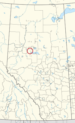
CAN AB 166 KAPAWENO INDIAN RESERVE -150D.svg
Location in Alberta
First Nation Kapawe'no
Treaty 8
Country Canada
Province Alberta
Municipal district Big Lakes
Area
[1]
  Total390.1 ha (964.0 acres)
Population
 (2016) [2]
  Total5
  Density1.3/km2 (3.3/sq mi)

Kapawe'no 150D, formerly known as Pakashan 150D, is an Indian reserve of the Kapawe'no First Nation in Alberta, located within Big Lakes County. [3] [4] It is 13 kilometres northwest of Lesser Slave Lake. [1] In the 2016 Canadian Census, it recorded a population of 5 living in 4 of its 7 total private dwellings. [2]

Related Research Articles

<span class="mw-page-title-main">Division No. 17, Alberta</span> Census division in Alberta, Canada

Division No. 17 is a census division in Alberta, Canada. It spans the central and northwest portions of northern Alberta and its largest urban community is the Town of Slave Lake. Division No. 17 is the largest census division in Alberta according to area and also has the lowest population density.

<span class="mw-page-title-main">Wabasca 166</span> Indian reserve in Bigstone Cree

Wabasca 166 is an Indian reserve of the Bigstone Cree Nation in Alberta, located within the Municipal District of Opportunity No. 17. It is 80 kilometres north of Slave Lake. In the 2016 Canadian Census, it recorded a population of 160 living in 42 of its 49 total private dwellings.

<span class="mw-page-title-main">Utikoomak Lake 155</span> Indian reserve in Whitefish Lake

Utikoomak Lake 155 is an Indian reserve of the Whitefish Lake First Nation in Alberta, located within Northern Sunrise County and Big Lakes County. It is 61 kilometers north of High Prairie. In the 2016 Canadian Census, it recorded a population of 723 living in 158 of its 193 total private dwellings.

<span class="mw-page-title-main">Wabasca 166D</span> Indian reserve in Bigstone Cree

Wabasca 166D is an Indian reserve of the Bigstone Cree Nation in Alberta, located within the Municipal District of Opportunity No. 17. It is 78 kilometres north of Slave Lake. In the 2016 Canadian Census, it recorded a population of 188 living in 47 of its 58 total private dwellings.

<span class="mw-page-title-main">Child Lake 164A</span> Indian reserve in Beaver

Child Lake 164A is an Indian reserve of the Beaver First Nation in Alberta, located within Mackenzie County. It is 32 kilometers northwest of Fort Vermilion. The reserve takes its name from a nearby lake where a child once drowned.

<span class="mw-page-title-main">Cowper Lake 194A</span> Indian reserve in Chipewyan Prairie

Cowper Lake 194A is an Indian reserve of the Chipewyan Prairie First Nation in Alberta, located within the Regional Municipality of Wood Buffalo.

<span class="mw-page-title-main">Drift Pile River 150</span> Indian reserve in Driftpile Cree

Drift Pile River 150 is an Indian reserve of the Driftpile Cree Nation in Alberta, located within Big Lakes County. It is 6 kilometers southeast of Lesser Slave Lake. In the 2016 Canadian Census, it recorded a population of 828 living in 258 of its 277 total private dwellings.

<span class="mw-page-title-main">Horse Lakes 152B</span> Indian reserve in Canada, Horse Lake First Nation

Horse Lakes 152B is an Indian reserve of the Horse Lake First Nation in Alberta. It is 60 km (37 mi) northwest of Grande Prairie at an elevation of 774 m (2,539 ft).

<span class="mw-page-title-main">Kapawe'no 150B</span> Indian reserve in Kapaweno

Kapawe'no 150B, historically known as Freeman 150B, is an Indian reserve of the Kapawe'no First Nation in Alberta, located within Big Lakes County. It is 8 kilometers northwest of Lesser Slave Lake. In the 2016 Canadian Census, it recorded a population of 154 living in of its 45 total private dwellings.

<span class="mw-page-title-main">Kapawe'no First Nation</span>

The Kapawe'no First Nation is a band government in Alberta, Canada. It is headquartered at Grouard, Alberta, which is near High Prairie.

<span class="mw-page-title-main">Sucker Creek 150A</span> Indian reserve in Sucker Creek

Sucker Creek 150A is an Indian reserve of the Sucker Creek First Nation in Alberta, located within Big Lakes County. It is 22 kilometres south of High Prairie. In the 2016 Canadian Census, it recorded a population of 689 living in 235 of its 274 total private dwellings.

<span class="mw-page-title-main">Utikoomak Lake 155A</span> Indian reserve in Whitefish Lake

Utikoomak Lake 155A is an Indian reserve of the Whitefish Lake First Nation in Alberta, located within Northern Sunrise County. In the 2016 Canadian Census, it recorded a population of 127 living in 29 of its 34 total private dwellings.

<span class="mw-page-title-main">Heart Lake 167A</span> Indian reserve in Heart Lake

Heart Lake 167A is an Indian reserve of the Heart Lake First Nation in Alberta, located within Lac La Biche County.

<span class="mw-page-title-main">Kapawe'no 150C</span> Indian reserve in Kapaweno

Kapawe'no 150C, formerly known as Halcro 150C, is an Indian reserve of the Kapawe'no First Nation in Alberta, located within Big Lakes County. It is 17 kilometres northeast of High Prairie.

<span class="mw-page-title-main">Kapawe'no 229</span> Indian reserve in Kapaweno

Kapawe'no 229 is an Indian reserve of the Kapawe'no First Nation in Alberta, located within Big Lakes County. It is 27 kilometres northeast of High Prairie.

<span class="mw-page-title-main">Kapawe'no 230</span> Indian reserve in Kapaweno

Kapawe'no 230 is an Indian reserve of the Kapawe'no First Nation in Alberta, located within Big Lakes County. It is 25 kilometres northeast of High Prairie.

<span class="mw-page-title-main">Kapawe'no 231</span> Indian reserve in Kapaweno

Kapawe'no 231 is an Indian reserve of the Kapawe'no First Nation in Alberta, located within Big Lakes County. It is 86 kilometres north of Swan Hills.

<span class="mw-page-title-main">Winefred Lake 194B</span> Indian reserve in Chipewyan Prairie

Winefred Lake 194B is an Indian reserve of the Chipewyan Prairie First Nation in Alberta, located within the Regional Municipality of Wood Buffalo.

References

  1. 1 2 "Reserve/Settlement/Village Detail". Crown–Indigenous Relations and Northern Affairs Canada . Government of Canada. 14 November 2008. Retrieved August 12, 2019.
  2. 1 2 "Census Profile, 2016 Census". Statistics Canada. February 8, 2017. Retrieved 2019-08-10.
  3. Government of Alberta (May 25, 2019). Municipal Boundaries (Map). AltaLIS.
  4. Ted Byfield, ed. (1984). The Atlas of Alberta. Interwest Publications Ltd. p. 131.

55°36′55″N116°16′07″W / 55.6152°N 116.2686°W / 55.6152; -116.2686 (Kapawe'no 150D)