King John's Hill

Last updated
Summit of King John's Hill King John's Hill, East Worldham, Hampshire 01.jpg
Summit of King John's Hill

King John's Hill is the site of an Iron Age hillfort located in Hampshire, in southeast England. The hill is situated in the parish of Worldham, in East Hampshire District. [1] It is a Scheduled Ancient Monument with a list entry identification number of 1020314, [2] and a Monument Number of 243207. [1]

The Iron Age is the final epoch of the three-age division of the prehistory and protohistory of humanity. It was preceded by the Stone Age and the Bronze Age. The concept has been mostly applied to Europe and the Ancient Near East, and, by analogy, also to other parts of the Old World.

Hillfort Type of earthworks used as a fortified refuge or defended settlement

A hillfort is a type of earthworks used as a fortified refuge or defended settlement, located to exploit a rise in elevation for defensive advantage. They are typically European and of the Bronze and Iron Ages. Some were used in the post-Roman period. The fortification usually follows the contours of a hill, consisting of one or more lines of earthworks, with stockades or defensive walls, and external ditches. Hillforts developed in the Late Bronze and Early Iron Age, roughly the start of the first millennium BC, and were used in many Celtic areas of central and western Europe until the Roman conquest.

Hampshire County of England

Hampshire is a county on the southern coast of England. The county town is the city of Winchester. Its two largest cities, Southampton and Portsmouth, are administered separately as unitary authorities; the rest of the county is governed by Hampshire County Council.

Contents

King John's Hill is a small multivallate hillfort, a fort with multiple defensive rings, and has been dated on ceramic evidence to approximately 100 BC. It was later reoccupied during the medieval period, with 13th–14th century AD building traces and pottery fragments. These have been identified as the potential remains of a hunting lodge traditionally said to have been built by King John. [1]

Location and geology

The hill rises 129 metres (423 ft) above mean sea level and is just over 0.5 kilometres (0.31 mi) southeast of the village of East Worldham, and approximately 4 kilometres (2.5 mi) east of the town of Alton. [3] The hill falls within the boundaries of the South Downs National Park. It is a greensand tor, [2] with a flat top and steep sides; it is heavily wooded, with dense undergrowth. [1]

East Worldham village in United Kingdom

East Worldham is a village in the East Hampshire district of Hampshire, England. It is 1.9 miles (3.1 km) east of Alton; and 1.9 miles (3.1 km) south-west of Wyck. Hartley Mauditt and West Worldham are nearby, which, along with East Worldham, form the Parish of Worldham. The village is just east of the A31 road and contains St Mary's Church and the Three Horse Shoes pub, amongst other buildings. Worldham Golf Course located just to west and Dean Farm Golf Course just to the east. For centuries the village and surrounding parish were owned by Winchester College.

Alton, Hampshire town in Hampshire, England

Alton is a market town and civil parish in Hampshire, England, near the source of the River Wey. At the 2011 census, it had a population of 17,816.

South Downs National Park

The South Downs National Park is England's newest national park, having become fully operational on 1 April 2011. The park, covering an area of 1,627 square kilometres (628 sq mi) in southern England, stretches for 140 kilometres (87 mi) from Winchester in the west to Eastbourne in the east through the counties of Hampshire, West Sussex and East Sussex. The national park covers the chalk hills of the South Downs and a substantial part of a separate physiographic region, the western Weald, with its heavily wooded sandstone and clay hills and vales. The South Downs Way spans the entire length of the park and is the only National Trail that lies wholly within a national park.

Description

King John's Hill from the west King John's Hill, East Worldham, Hampshire 05.jpg
King John's Hill from the west

The hillfort is unusually small, and its defences were weak; the site falls in a borderline category between larger hillforts and smaller defended settlements. It is oval in shape and encloses an area of approximately 0.8 hectares (86,000 sq ft). Although it has suffered some damage by malm quarrying, it is still well preserved. Limited archaeological excavation revealed plentiful evidence of the hill's Iron Age occupation, later medieval remains, and post-medieval activity. [2]

The quarrying has destroyed the fort's defences on the north side of the hill, but they are elsewhere evidenced by two concentric scarps separated by a wide shelf. On the northeast side, a ridge line meets the fort, and was cut by a shallow ditch, which meets with a later boundary that runs around the base of the hill on the east side, and encloses a number of terraces on the lower slopes of the hill. [2]

Investigation

The hill was partially excavated in 1939 and 1947. Ceramic fragments dating to the Iron Age were recovered, and two infilled storage pits were discovered. Evidence of the medieval occupation of the site was also revealed, including stonework and ceramics. Further remains date from the Tudor period, and include short lengths of wall, packed floors, bricks, tiles, and ovens. [2] A ring-headed pin, fashioned from wire, was recovered from one of the Iron Age storage pits. [4] The traditional association of the hill as a site of a medieval hunting lodge attributed to King John is supported by documentary evidence that a deer park existed at East Worldham at least as far back as 1372. [2]

Tudor period historical era in England coinciding with the rule of the Tudor dynasty

The Tudor period is the period between 1485 and 1603 in England and Wales and includes the Elizabethan period during the reign of Elizabeth I until 1603. The Tudor period coincides with the dynasty of the House of Tudor in England whose first monarch was Henry VII. In terms of the entire span, the historian John Guy (1988) argues that "England was economically healthier, more expansive, and more optimistic under the Tudors" than at any time in a hundred years.

Deer park (England)

In medieval and Early Modern England, a deer park was an enclosed area containing deer. It was bounded by a ditch and bank with a wooden park pale on top of the bank, or by a stone or brick wall. The ditch was on the inside increasing the effective height. Some parks had deer "leaps", where there was an external ramp and the inner ditch was constructed on a grander scale, thus allowing deer to enter the park but preventing them from leaving.

Notes

  1. 1 2 3 4 Historic England 2015.
  2. 1 2 3 4 5 6 Historic England 2017.
  3. Ordnance Survey 2004, 2006.
  4. De'athe 2013, pp. 12–13. Historic England 2015.

Related Research Articles

Old Oswestry hillfort in Shropshire

Old Oswestry is a large early Iron Age hill fort in the Welsh Marches near Oswestry in north west Shropshire. The earthworks, which remain one of the best preserved hill forts in the UK, have been described as "The Stonehenge of the Iron Age Period". After the hill fort was abandoned, it was incorporated into Wat's Dyke by the Mercians during the Early Medieval period.

Chanctonbury Ring hillfort in West Sussex

Chanctonbury Ring is a prehistoric hill fort atop Chanctonbury Hill on the South Downs, on the border of the civil parishes of Washington and Wiston in the English county of West Sussex. A ridgeway, now part of the South Downs Way, runs along the hill. It forms part of an ensemble of associated historical features created over a span of more than 2,000 years, including round barrows dating from the Bronze Age to the Saxon periods and dykes dating from the Iron Age and Roman periods.

Prideaux Castle is a multivallate Iron Age hillfort situated atop a 133 m (435 ft) high conical hill near the southern boundary of the parish of Luxulyan, Cornwall, England, United Kingdom. It is also sometimes referred to as Prideaux Warren, Prideaux War-Ring, or Prideaux Hillfort. The site is a scheduled monument and so protected from unauthorised works by the Ancient Monuments and Archaeological Areas Act 1979.

Burrough Hill Iron Age hill fort in Leicestershire, UK

Burrough Hill is an Iron Age hillfort in Burrough on the Hill, 7 miles (11 km) south of Melton Mowbray in the English county of Leicestershire. Situated on a promontory about 210 metres (690 ft) above sea level, the site commands views over the surrounding countryside for miles around. There has been human activity in the area since at least the Mesolithic, and the hillfort was founded in the early Iron Age. In the medieval period, after the hillfort was abandoned, the hill was used as farmland. This ended in the 17th century when the parish the hill was in was enclosed. Traces of ridge and furrow show where the medieval fields were ploughed. Since the 1930s the site has been the subject of archaeological investigations and renewed excavations under the auspices of the University of Leicester began in 2010. Part of Burrough Hill Country Park and open to the public, the hillfort is protected as a Scheduled Ancient Monument.

Eddisbury hill fort hillfort in Cheshire West and Chester

Eddisbury hill fort, also known as Castle Ditch, is an Iron Age hill fort near Delamere, Cheshire, in northern England. Hill forts are fortified hill-top settlements constructed across Britain during the Iron Age. Eddisbury is the largest and most complex of the seven hill forts in the county of Cheshire. It was constructed before 200–100 BC and expanded in 1–50 AD. In the 1st century AD, the Romans slighted the site. It was reoccupied in the 6th–8th centuries AD, and an Anglo-Saxon burh was probably established at Eddisbury in 914. In the medieval and post-medieval periods quarrying and farming have damaged the site. Ownership is currently split between the Forestry Commission and a local farm. Eddisbury is protected as a Scheduled Ancient Monument.

Blewburton Hill Hillfort in Oxfordshire, England

Blewburton Hill is the site of an Iron Age hillfort located in Oxfordshire, in the southeast of England. It was a univallate hillfort. The area is mostly farmland with some small areas of wooded copse to the south and the northeast. The hill fort may have been occupied from the 4th century BC to the 1st century BC, and replaced a small settlement surrounded by a stockade, which is estimated to have been built in the 5th or 6th century BC.

Ham Hill Hillfort hillfort in Somerset

Ham Hill Hillfort is an Iron Age hillfort located on Ham Hill, Somerset, England. It was also occupied during the mesolithic and neolithic periods and later during Roman and medieval eras. The fort is a Scheduled Ancient Monument, and the whole of the hill is a geological Site of Special Scientific Interest, a country park operated by South Somerset Council, and is visited by over 250,000 people each year.

Fin Cop mountain in the United Kingdom

Fin Cop is a hill and an associated Iron Age hill fort in Monsal Dale, close to Ashford in the Water in Derbyshire, England.

Torberry Hill

Torberry Hill is an Iron Age hillfort in the county of West Sussex, in southern England. It is a Scheduled Ancient Monument, with a list entry identification number of 1015966. The hill fort is located within the parish of Harting, within the South Downs National Park. The hill includes the remains of an Early Iron Age univallate hill fort, a Middle Iron Age promontory fort and a post-medieval post mill. The hill is a chalk spur projecting northwards from the South Downs.

Caesars Camp, Rushmoor and Waverley

Caesar's Camp is an Iron Age hill fort straddling the border of the counties of Surrey and Hampshire in southern England. The fort straddles the borough of Waverley in Surrey and the borough of Rushmoor and the district of Hart, both in Hampshire. Caesar's Camp is a Scheduled Ancient Monument with a list entry identification number of 1007895. It lies approximately 3 kilometres (1.9 mi) north of the town of Farnham, and a similar distance west of Aldershot. The hillfort lies entirely within the Bourley and Long Valley Site of Special Scientific Interest. Caesar's Camp is a multivallate hillfort, a fort with multiple defensive rings, occupying an irregular promontory, with an entrance on the south side. The site has been much disturbed by military activity, especially at the southeast corner. The remains of the hillfort are considered to be of national importance.

Clearbury Ring univallate Iron Age hillfort which is partly in the parish of Downton in Wiltshire, England

Clearbury Ring is a univallate Iron Age hillfort which is partly in the parish of Downton in the county of Wiltshire in southwest England, approximately 5 kilometres (3 mi) due south of Salisbury city centre. The site, which is a Scheduled Ancient Monument, straddles the boundary with Odstock parish, and a slight scarp runs across the interior of the fort, marking the parish boundary.

Danish Camp

Danish Camp is an Iron Age fortified settlement in Shoeburyness in Essex. It is a Scheduled Monument under the Ancient Monuments and Archaeological Areas Act 1979, list number 1017206. The site is in the Gunners Park and Shoebury Ranges nature reserve, which is managed by the Essex Wildlife Trust.

Beacon Hill, West Sussex

Beacon Hill, also known as Harting Beacon, is a hillfort on the South Downs, in the county of West Sussex in southern England. The hillfort is located in the parish of Elsted and Treyford, in Chichester District. It is a Scheduled Ancient Monument with a list entry identification number of 1015915. The hilltop enclosure is dated to the Late Bronze Age, from the 8th to 6th centuries BC. The hillfort defences were renewed during the Late Iron Age.

Warbstow Bury hillfort in Cornwall, England

Warbstow Bury is an Iron Age hillfort about 0.5 miles (0.80 km) west of the village of Warbstow, in Cornwall, England.

Chalbury Hillfort

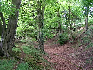
Chalbury Hillfort is an Iron Age hillfort about 1 mile (1.6 km) south-east of the village of Bincombe in Dorset, England.

Cadson Bury hillfort in Cornwall

Cadson Bury is an Iron Age hillfort about 2 miles (3.2 km) south-west of Callington, in Cornwall, England.

Bury Walls hillfort in Shropshire

Bury Walls is an Iron Age hillfort about 1 mile (1.6 km) south-east of Weston-under-Redcastle, in Shropshire, England.

Hollingbury Castle hillfort in East Sussex

Hollingbury Castle, also known as Hollingbury Camp and Hollingbury Hillfort, is an Iron Age hillfort on the northern edge of Brighton, in East Sussex, England. It is adjacent to Hollingbury Park Golf Course.

Berth Hill hillfort in Staffordshire

Berth Hill is an Iron Age hillfort in Staffordshire, England, about 5 miles (8.0 km) south-west of Newcastle-under-Lyme, and near the village of Maer. It is a scheduled monument.Other forms of its name have been Bryth, Bruff and Burgh Hill.

Dungeon Hill hillfort in Dorset

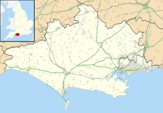
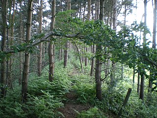
Dungeon Hill is an Iron Age hillfort, about 1.25 miles (2.0 km) north of the village of Buckland Newton in Dorset, England.

References

De'Athe, Robert (2013). Early Iron Age Metalworking and Iron Age/Early Romano-British Settlement Evidence Along the Barton Stacey to Lockerley Gas Pipeline . Salisbury, Wiltshire, England: Wessex Archaeology. Retrieved 2017-03-18.
Historic England (2015). "Monument No. 243207". PastScape. Retrieved 2017-03-18.
Historic England (2017). "Hillfort on King John's Hill (1020314)". National Heritage List for England . Retrieved 2017-03-18.
Ordnance Survey (2006) [2004]. OS Explorer Map 133: Haslemere & Petersfield. ISBN   978-0-319-23602-4.

Coordinates: 51°08′01″N0°55′16″W / 51.133522°N 0.92102°W / 51.133522; -0.92102