
Kandanga is a town and a locality in the Gympie Region, Queensland, Australia. In the 2021 census, the locality of Kandanga had a population of 659 people.

Cooran is a rural hinterland town and locality in the Shire of Noosa, Queensland, Australia. In the 2021 census, the locality of Cooran had a population of 1,756 people.
Federal is a rural locality in the Shire of Noosa, Queensland, Australia. It is located in the Sunshine Coast hinterland near the towns of Cooran and Pomona. In the 2021 census, Federal had a population of 365 people.
Two Mile is a rural locality in the Gympie Region, Queensland, Australia. In the 2021 census, Two Mile had a population of 69 people.

Monkland is a rural locality in the Gympie Region, Queensland, Australia. In the 2021 census, Monkland had a population of 1,135 people.

Glanmire is an urban industrial locality in Gympie in the Gympie Region, Queensland, Australia. In the 2021 census, Glanmire had a population of 28 people.

Amamoor is a rural town and locality in the Gympie Region, Queensland, Australia. In the 2021 census, the locality of Amamoor had a population of 720 people.
Dagun is a rural town and locality in the Gympie Region, Queensland, Australia. In the 2021 census, the locality of Dagun had a population of 137 people.

Curra is a rural residential locality in the Gympie Region, Queensland, Australia. In the 2021 census, Curra had a population of 2,104 people.
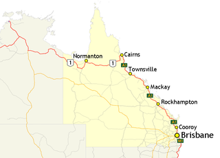
In Queensland, Highway 1 is a 2,964-kilometre (1,842 mi) long route that crosses the state, from the Northern Territory (NT) border near Wollogorang to Cairns, and then travels along the coastline to the New South Wales (NSW) border near Coolangatta. Highway 1 continues around the rest of Australia, joining all mainland state capitals, and connecting major centres in Tasmania. All roads within the Highway 1 system are allocated a road route numbered 1, M1, A1, or B1, depending on the state route numbering system. In Queensland, the highway is designated as National Route 1 from the NT border to Cairns, Route A1 from Cairns to Kybong, and then Route M1 down to the NSW border.

Traveston is a rural town and locality in the Gympie Region, Queensland, Australia. In the 2021 census, the locality of Traveston had a population of 509 people.
Calico Creek is a rural locality in the Gympie Region, Queensland, Australia. In the 2021 census, Calico Creek had a population of 185 people.
Tandur is a rural locality in the Gympie Region, Queensland, Australia. In the 2021 census, Tandur had a population of 188 people.
Woondum is a rural locality in the Gympie Region, Queensland, Australia. In the 2021 census, Woondum had a population of 66 people.

Scotchy Pocket is a rural locality in the Gympie Region, Queensland, Australia. In the 2021 census, Scotchy Pocket had a population of 55 people.
Coles Creek is a rural locality in the Gympie Region, Queensland, Australia. In the 2021 census, Coles Creek had a population of 68 people.

Gilldora is a rural locality in the Gympie Region, Queensland, Australia. In the 2021 census, Gilldora had a population of 50 people.
Long Flat is a rural locality in the Gympie Region, Queensland, Australia. In the 2021 census, Long Flat had a population of 98 people.
Gympie–Brooloo–Kenilworth Road is a continuous 51.6 kilometres (32.1 mi) road route in the Gympie and Sunshine Coast regions of Queensland, Australia. It has two official names, Gympie–Brooloo Road and Kenilworth–Brooloo Road. The entire route is signed as State Route 51.
Cooroy–Gympie Road is a continuous 29.1 kilometres (18.1 mi) road route in the Noosa and Gympie regions of Queensland, Australia. It is a state-controlled district road. Known as Old Bruce Highway, It runs from Cooroy Connection Road on the Black Mountain / Pomona midpoint to the Bruce Highway in Kybong. This road provides access to several localities bypassed by the current alignment of the highway.
