Laidley Creek West, Queensland

Last updated

Laidley Creek West
Queensland
Australia Queensland location map.svg
Red pog.svg
Laidley Creek West
Coordinates 27°40′03″S152°21′08″E / 27.6675°S 152.3522°E / -27.6675; 152.3522 (Laidley Creek West (centre of locality))
Population143 (2021 census) [1]
 • Density13.12/km2 (33.98/sq mi)
Postcode(s) 4341
Elevation110–390 m (361–1,280 ft) [2]
Area10.9 km2 (4.2 sq mi)
Time zone AEST (UTC+10:00)
Location
LGA(s) Lockyer Valley Region
State electorate(s) Lockyer
Federal division(s) Wright
Suburbs around Laidley Creek West:
Blenheim Laidley Heights Laidley Heights
Blenheim Laidley Creek West Laidley South
Mount Berryman Mulgowie Mulgowie

Laidley Creek West is a rural locality in the Lockyer Valley Region, Queensland, Australia. [3] In the 2021 census, Laidley Creek West had a population of 143 people. [1]

Contents

Geography

Laidley Creek forms most of the eastern boundary of the locality. [2]

The land use is predominantly grazing on native vegetation with some irrigated horticulture alongside the creek. [2]

History

The locality was named on 3 June 1994. Its name is derived from Laidley Creek, which itself is derived from the naming of Laidleys Plain by Allan Cunningham on 22 June 1829, after James Laidley, the New South Wales Deputy Commissary General. [3]

Demographics

In the 2016 census, Laidley Creek West had a population of 145 people. [4]

In the 2021 census, Laidley Creek West had a population of 143 people. [1]

Education

There are no schools in Laidley Creek West. The nearest government primary schools are Laidley State School in Laidley to the north-east and Blenheim State School in neighbouring Blenheim to the west. The nearest government secondary school is Laidley State High School, also in Laidley. [5]

Attractions

Schultz Lookout is at the southern end of Schultz Lookout Road ( 27°39′55″S152°20′46″E / 27.6652°S 152.3462°E / -27.6652; 152.3462 (Schultz Lookout) ). [6] [7]

Related Research Articles

<span class="mw-page-title-main">Laidley, Queensland</span> Town in Queensland, Australia

Laidley is a rural town and locality in the Lockyer Valley Region, Queensland, Australia. In the 2016 census, the locality of Laidley had a population of 3,808 people.

<span class="mw-page-title-main">Warrill View, Queensland</span> Town in Queensland, Australia

Warrill View is a rural town and locality in the Scenic Rim Region, Queensland, Australia. In the 2021 census, the locality of Warrill View had a population of 203 people.

<span class="mw-page-title-main">Blenheim, Queensland</span> Suburb of Lockyer Valley Region, Queensland, Australia

Blenheim is a rural locality in the Lockyer Valley Region, Queensland, Australia. In the 2021 census, Blenheim had a population of 264 people.

Lefthand Branch is a rural locality in the Lockyer Valley Region, Queensland, Australia. In the 2021 census, Lefthand Branch had a population of 69 people.

<span class="mw-page-title-main">Glenore Grove, Queensland</span> Suburb of Lockyer Valley Region, Queensland, Australia

Glenore Grove is a rural locality in the Lockyer Valley Region, Queensland, Australia. In the 2021 census, Glenore Grove had a population of 953 people.

Thornton is a rural locality in the Lockyer Valley Region, Queensland, Australia. In the 2016 census, Thornton had a population of 201 people.

Glen Cairn is a rural locality in the Lockyer Valley Region, Queensland, Australia. In the 2021 census, Glen Cairn had a population of 141 people.

Upper Lockyer is a rural locality in the Lockyer Valley Region, Queensland, Australia. In the 2016 census, Upper Lockyer had a population of 538 people.

<span class="mw-page-title-main">Mount Berryman, Queensland</span> Suburb of Lockyer Valley Region, Queensland, Australia

Mount Berryman is a rural locality in the Lockyer Valley Region, Queensland, Australia. In the 2021 census, Mount Berryman had a population of 96 people.

<span class="mw-page-title-main">Mulgowie, Queensland</span> Suburb of Lockyer Valley Region, Queensland, Australia

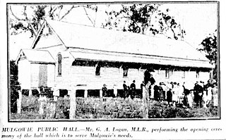
Mulgowie is a rural locality in the Lockyer Valley Region, Queensland, Australia. In the 2021 census, Mulgowie had a population of 166 people.

Summerholm is a rural locality in the Lockyer Valley Region, Queensland, Australia. In the 2021 census, Summerholm had a population of 646 people.

Townson is a rural locality in the Lockyer Valley Region, Queensland, Australia. In the 2016 census, Townson had a population of 38 people.

Black Duck Creek is a rural locality in the Lockyer Valley Region, Queensland, Australia. In the 2021 census, Black Duck Creek had a population of 12 people.

<span class="mw-page-title-main">Laidley Heights, Queensland</span> Suburb of Lockyer Valley Region, Queensland, Australia

Laidley Heights is a rural residential locality on the outskirts of the town of Laidley in the Lockyer Valley Region, Queensland, Australia. In the 2021 census, Laidley Heights had a population of 1,429 people.

<span class="mw-page-title-main">Laidley North, Queensland</span> Suburb of Lockyer Valley Region, Queensland, Australia

Laidley North is a rural locality in the Lockyer Valley Region, Queensland, Australia. In the 2021 census, Laidley North had a population of 593 people.

Laidley South is a rural locality in the Lockyer Valley Region, Queensland, Australia. In the 2021 census, Laidley South had a population of 293 people.

<span class="mw-page-title-main">Lockyer Waters, Queensland</span> Suburb of Lockyer Valley Region, Queensland, Australia

Lockyer Waters is a rural locality in the Lockyer Valley Region, Queensland, Australia. In the 2021 census, Lockyer Waters had a population of 538 people.

Regency Downs is a mixed-use locality in the Lockyer Valley Region, Queensland, Australia. In the 2021 census, Regency Downs had a population of 2,623 people, an increase of 12% from the 2016 census.

Seventeen Mile is a rural locality in the Lockyer Valley Region, Queensland, Australia. In the 2021 census, Seventeen Mile had a population of 22 people.

White Mountain is a rural locality in the Lockyer Valley Region, Queensland, Australia. In the 2021 census, White Mountain had a population of 16 people.

References

  1. 1 2 3 Australian Bureau of Statistics (28 June 2022). "Laidley Creek West (SAL)". 2021 Census QuickStats. Retrieved 28 February 2023. OOjs UI icon edit-ltr-progressive.svg
  2. 1 2 3 "Queensland Globe". State of Queensland . Retrieved 4 October 2023.
  3. 1 2 "Laidley Creek West – locality in Lockyer Valley Region (entry 44965)". Queensland Place Names. Queensland Government . Retrieved 12 November 2018.
  4. Australian Bureau of Statistics (27 June 2017). "Laidley Creek West (SSC)". 2016 Census QuickStats. Retrieved 20 October 2018. OOjs UI icon edit-ltr-progressive.svg
  5. "Layers: Locality; Schools and school catchments". Queensland Globe. Queensland Government . Retrieved 4 October 2023.
  6. "Tourist points - Queensland". Queensland Open Data. Queensland Government. 18 November 2020. Archived from the original on 24 November 2020. Retrieved 24 November 2020.
  7. "Lookouts". Lockyer Valley Visitor Information Centre. Retrieved 4 October 2023.