Laidley Heights, Queensland

Last updated

Laidley Heights
Queensland
Bill Gunn Dam.jpg
Looking across Laidley Heights over Lake Dyer, 2015
Australia Queensland location map.svg
Red pog.svg
Laidley Heights
Coordinates 27°37′45″S152°22′08″E / 27.6291°S 152.3688°E / -27.6291; 152.3688 (Laidley Heights (centre of locality))
Population1,429 (2021 census) [1]
 • Density88.76/km2 (229.9/sq mi)
Postcode(s) 4341
Elevation100–160 m (328–525 ft) [2]
Area16.1 km2 (6.2 sq mi)
Time zone AEST (UTC+10:00)
Location
LGA(s) Lockyer Valley Region
State electorate(s) Lockyer
Federal division(s) Wright
Suburbs around Laidley Heights:
Forest Hill Forest Hill Laidley North
Glen Cairn Laidley Heights Laidley
Blenheim Laidley Creek West Laidley South

Laidley Heights is a rural residential locality on the outskirts of the town of Laidley in the Lockyer Valley Region, Queensland, Australia. [3] In the 2021 census, Laidley Heights had a population of 1,429 people. [1]

Contents

Geography

The locality is bounded to the east by Laidley Creek. [2]

Lake Dyer is in the east of the locality ( 27°37′44″S152°22′31″E / 27.6288°S 152.3753°E / -27.6288; 152.3753 (Lake Dyer) ). [4] [2] Although it is a natural lake, its capacity to store water was increased by the construction of the Bill Gunn Dam ( 27°37′41″S152°22′49″E / 27.6281°S 152.3804°E / -27.6281; 152.3804 (Bill Gunn Dam) ), [5] a 1,050-metre (3,440 ft) earth embankment with a central clay core. As well as the natural inflows to the lake, additional water from Laidley Creek is redirected into Lake Dyer for storage. It is an ungated dam so it commences spilling whenever it is full. [6]

The land use is a mix of rural residential housing in the central areas of the locality, irrigated horticulture in the east along the creek, and grazing on native vegetation in the remainder of the locality. [2]

History

The locality was named after the town of Laidley, which, in turn, was derived from the naming of Laidleys Plain by Allan Cunningham after James Laidley New South Wales Deputy Commissary General. [3]

Official opening of the Laidley and District Golf Club's new nine-hole course, Sunday 15 April 1951 Opening of the Laidley and District Golf Club's new nine-hole course, Sunday 15 April 1951.jpg
Official opening of the Laidley and District Golf Club's new nine-hole course, Sunday 15 April 1951

Laidley Golf Club opened on 9 December 1928 with a few holes on the Laidley Showgrounds. [7] Due to the popularity of the golf club, in 1931, the club decided to establish a new golf course on the Laidley Recreational Reserve (now Anzac Park), which opened in April 1932. [8] In 1941, the club suspended activities due to World War II. In 1948, the club decided to restart operations by merging with Forest Hill Golf Club and establish a new golf course. [9] A 101-acre (41 ha) dairy farm overlooking Dyer’s Lagoon (now Lake Dyer) was purchased. [10] [11] Professional golf player Tom Southcombe was engaged to plan the golf course. [12] [13] Although play had already commenced on the nine-hole course, it was not officially opened until Sunday 15 April 1951. [14] [15]

The construction of Bill Gunn Dam was completed in 1987. [6] It was named after Bill Gunn, the local member in the Queensland Legislative Assembly and also a former member of the Laidley Shire Council. [16]

Demographics

In the 2016 census, Laidley Heights had a population of 1,263 people. [17]

In the 2021 census, Laidley Heights had a population of 1,429 people. [1]

Education

There are no schools in Laidley Heights. The nearest government primary schools are Blenheim State School in neighbouring Blenheim to the south-west, Forest Hill State School in neighbouring Forest Hill to the north-west, and Laidley District State School in neighbouring Laidley to the east. The nearest government secondary school is Laidley State High School in Laidley. [18]

Amenities

Lake Dyer Recreation Reserve is a park to the east of the lake ( 27°37′56″S152°22′43″E / 27.6323°S 152.3785°E / -27.6323; 152.3785 (Lake Dyer Recreation Reserve) ). [5] There are facilities for camping, boating, fishing, swimming, and picnics. [19] There is a boat ramp on Whites Road into Lake Dyer ( 27°37′55″S152°22′38″E / 27.6319°S 152.3773°E / -27.6319; 152.3773 (Lake Dyer boat ramp) ). It is managed by the Lockyer Valley Regional Council. [20]

Laidley Golf Club is to the north of Lake Dyer ( 27°37′27″S152°22′33″E / 27.6241°S 152.3757°E / -27.6241; 152.3757 (Laidley Golf Club) ). [21] It has a 12-hole golf course with clubhouse facilities. [22]

Related Research Articles

<span class="mw-page-title-main">Laidley, Queensland</span> Town in Queensland, Australia

Laidley is a rural town and locality in the Lockyer Valley Region, Queensland, Australia. In the 2016 census, the locality of Laidley had a population of 3,808 people.

<span class="mw-page-title-main">Prenzlau, Queensland</span> Suburb of Somerset Region, Queensland, Australia

Prenzlau is a rural locality in the Somerset Region, Queensland, Australia. In the 2021 census, Prenzlau had a population of 408 people.

<span class="mw-page-title-main">Shire of Laidley</span> Local government area in Queensland, Australia

The Shire of Laidley was a local government area located in the Lockyer Valley region between the cities of Toowoomba and Ipswich, and about 70 kilometres (43 mi) west of Brisbane, the state capital of Queensland, Australia. The shire covered an area of 700.6 square kilometres (270.5 sq mi), and existed from 1888 until its merger with the Shire of Gatton to form the Lockyer Valley Region on 15 March 2008.

<span class="mw-page-title-main">Bill Gunn Dam</span> Dam in South East Queensland

The Bill Gunn Dam is an earth-fill embankment dam with an un-gated spillway located off-stream in Laidley Heights in the South East region of Queensland, Australia. The main purpose of the dam is for irrigation of the Lockyer Valley. The resultant reservoir is called Lake Dyer.

<span class="mw-page-title-main">Forest Hill, Queensland</span> Town in Queensland, Australia

Forest Hill is a rural town and locality in the Lockyer Valley Region, Queensland, Australia. In the 2016 census, Forest Hill had a population of 968 people.

<span class="mw-page-title-main">Hatton Vale</span> Suburb of Lockyer Valley Region, Queensland, Australia

Hatton Vale is a rural locality in the Lockyer Valley Region, Queensland, Australia. In the 2021 census, Hatton Vale had a population of 1,555 people.

<span class="mw-page-title-main">Warrill View, Queensland</span> Town in Queensland, Australia

Warrill View is a rural town and locality in the Scenic Rim Region, Queensland, Australia. In the 2021 census, the locality of Warrill View had a population of 203 people.

<span class="mw-page-title-main">Blenheim, Queensland</span> Suburb of Lockyer Valley Region, Queensland, Australia

Blenheim is a rural locality in the Lockyer Valley Region, Queensland, Australia. In the 2021 census, Blenheim had a population of 264 people.

<span class="mw-page-title-main">Fordsdale, Queensland</span> Suburb of Lockyer Valley Region, Queensland, Australia

Fordsdale is a rural locality in the Lockyer Valley Region, Queensland, Australia. In the 2021 census, Fordsdale had a population of 50 people.

<span class="mw-page-title-main">West Haldon, Queensland</span> Suburb of Toowoomba Region, Queensland, Australia

West Haldon is a locality split between Toowoomba Region and Lockyer Valley Region in Queensland, Australia. In the 2021 census, West Haldon had a population of 63 people.

Thornton is a rural locality in the Lockyer Valley Region, Queensland, Australia. In the 2016 census, Thornton had a population of 201 people.

Glen Cairn is a rural locality in the Lockyer Valley Region, Queensland, Australia. In the 2021 census, Glen Cairn had a population of 141 people.

<span class="mw-page-title-main">Caffey, Queensland</span> Suburb of Lockyer Valley Region, Queensland, Australia

Caffey is a rural locality in the Lockyer Valley Region, Queensland, Australia. In the 2021 census, Caffey had a population of 45 people.

<span class="mw-page-title-main">Mount Berryman, Queensland</span> Suburb of Lockyer Valley Region, Queensland, Australia

Mount Berryman is a rural locality in the Lockyer Valley Region, Queensland, Australia. In the 2021 census, Mount Berryman had a population of 96 people.

<span class="mw-page-title-main">Mulgowie, Queensland</span> Suburb of Lockyer Valley Region, Queensland, Australia

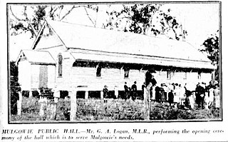
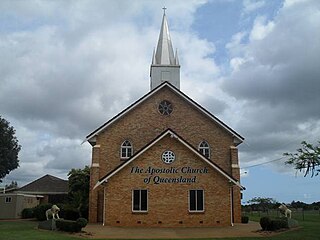
Mulgowie is a rural locality in the Lockyer Valley Region, Queensland, Australia. In the 2021 census, Mulgowie had a population of 166 people.

Summerholm is a rural locality in the Lockyer Valley Region, Queensland, Australia. In the 2021 census, Summerholm had a population of 646 people.

Townson is a rural locality in the Lockyer Valley Region, Queensland, Australia. In the 2016 census, Townson had a population of 38 people.

Laidley Creek West is a rural locality in the Lockyer Valley Region, Queensland, Australia. In the 2021 census, Laidley Creek West had a population of 143 people.

<span class="mw-page-title-main">Laidley North, Queensland</span> Suburb of Lockyer Valley Region, Queensland, Australia

Laidley North is a rural locality in the Lockyer Valley Region, Queensland, Australia. In the 2021 census, Laidley North had a population of 593 people.

Laidley South is a rural locality in the Lockyer Valley Region, Queensland, Australia. In the 2021 census, Laidley South had a population of 293 people.

References

  1. 1 2 3 Australian Bureau of Statistics (28 June 2022). "Laidley Heights (SAL)". 2021 Census QuickStats. Retrieved 28 February 2023. OOjs UI icon edit-ltr-progressive.svg
  2. 1 2 3 4 "Queensland Globe". State of Queensland . Retrieved 6 October 2023.
  3. 1 2 "Laidley Heights – locality in Lockyer Valley Region (entry 44966)". Queensland Place Names. Queensland Government . Retrieved 12 November 2018.
  4. "Lake Dyer – reservoir in the Lockyer Valley Region (entry 10971)". Queensland Place Names. Queensland Government . Retrieved 6 October 2023.
  5. 1 2 "Land for public recreation - Queensland". Queensland Open Data. Queensland Government. 20 November 2020. Archived from the original on 22 November 2020. Retrieved 22 November 2020.
  6. 1 2 "Bill Gunn (Lake Dyer)". Seqwater . Archived from the original on 26 March 2023. Retrieved 6 October 2023.
  7. "LAIDLEY FOURSOMES". The Brisbane Courier . No. 22, 114. Queensland, Australia. 11 December 1928. p. 5. Archived from the original on 7 October 2023. Retrieved 6 October 2023 via National Library of Australia.
  8. "LAIDLEY GOLF LINKS". The Telegraph . Queensland, Australia. 19 April 1932. p. 13 (FIRST EDITION). Archived from the original on 7 October 2023. Retrieved 6 October 2023 via National Library of Australia.
  9. "NEW GOLF SITE FOR LAIDLEY". Queensland Times . No. 19268. Queensland, Australia. 7 September 1948. p. 3 (DAILY). Archived from the original on 7 October 2023. Retrieved 6 October 2023 via National Library of Australia.
  10. "LAIDLEY GOLF CLUB HAS LAND FOR LINKS". Queensland Times . No. 19, 330. Queensland, Australia. 18 November 1948. p. 4 (DAILY). Archived from the original on 7 October 2023. Retrieved 6 October 2023 via National Library of Australia.
  11. "LAIDLEY GOLF CLUB RE-FORMS". Queensland Times . No. 19, 336. Queensland, Australia. 25 November 1948. p. 6 (DAILY). Archived from the original on 7 October 2023. Retrieved 6 October 2023 via National Library of Australia.
  12. "Laidley Golf Club SITE PLEASES VISITORS". Queensland Times . No. 19, 427. Queensland, Australia. 12 March 1949. p. 3 (DAILY). Archived from the original on 7 October 2023. Retrieved 6 October 2023 via National Library of Australia.
  13. "New Golf Course At Laidley". Brisbane Telegraph . Queensland, Australia. 30 March 1949. p. 26 (CITY FINAL). Archived from the original on 6 October 2023. Retrieved 6 October 2023 via National Library of Australia.
  14. "No Title". Queensland Times . No. 20, 059. Queensland, Australia. 19 April 1951. p. 1 (Daily.). Archived from the original on 6 October 2023. Retrieved 6 October 2023 via National Library of Australia.
  15. "Club History". Laidley Golf Club. Archived from the original on 30 March 2023. Retrieved 6 October 2023.
  16. "Gunn, William Angus (Bill)". Former Members. Queensland Parliament. Archived from the original on 6 October 2023. Retrieved 6 October 2023.
  17. Australian Bureau of Statistics (27 June 2017). "Laidley Heights (SSC)". 2016 Census QuickStats. Retrieved 20 October 2018. OOjs UI icon edit-ltr-progressive.svg
  18. "Layers: Locality; Schools and school catchments". Queensland Globe. Queensland Government. Archived from the original on 19 December 2017. Retrieved 6 October 2023.
  19. "Lake Dyer" (PDF). Seqwater . Archived (PDF) from the original on 8 March 2023. Retrieved 6 October 2023.
  20. "Recreational Boating Facilities Queensland". Queensland Open Data. Queensland Government. 12 November 2020. Archived from the original on 22 November 2020. Retrieved 22 November 2020.
  21. "Building points - Queensland". Queensland Open Data. Queensland Government. 17 November 2020. Archived from the original on 25 November 2020. Retrieved 25 November 2020.
  22. "Laidley Golf Club". Archived from the original on 30 March 2023. Retrieved 6 October 2023.