List of U.S. states by coastline

Last updated
States shaded dark blue have ocean coastline.*
States shaded light blue have Great Lakes coastline.*
States shaded white have no coastline.
* New York has both ocean and Great Lakes coastline Coastal states.PNG
States shaded  dark blue  have ocean coastline.*
States shaded  light blue  have Great Lakes coastline.*
States shaded  white  have no coastline.
* New York has both ocean and Great Lakes coastline

This is a list of U.S. states ranked by their coastline length. Thirty states have a coastline: twenty-three with a coastline on the Arctic, Atlantic, and/or Pacific Ocean, and eight with a Great Lakes coastline; New York has coasts on both. States with no coastline are not included; smaller border lakes such as Lake Champlain or Lake of the Woods are not counted.

U.S. state constituent political entity of the United States

In the United States, a state is a constituent political entity, of which there are currently 50. Bound together in a political union, each state holds governmental jurisdiction over a separate and defined geographic territory and shares its sovereignty with the federal government. Due to this shared sovereignty, Americans are citizens both of the federal republic and of the state in which they reside. State citizenship and residency are flexible, and no government approval is required to move between states, except for persons restricted by certain types of court orders. Four states use the term commonwealth rather than state in their full official names.

Coast Area where land meets the sea or ocean

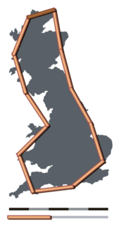
The coast, also known as the coastline or seashore, is the area where land meets the sea or ocean, or a line that forms the boundary between the land and the ocean or a lake. A precise line that can be called a coastline cannot be determined due to the Coastline paradox.

Great Lakes lakes in North America

The Great Lakes, also called the Laurentian Great Lakes and the Great Lakes of North America, are a series of interconnected freshwater lakes primarily in the upper mid-east region of North America, on the Canada–United States border, which connect to the Atlantic Ocean through the Saint Lawrence River. They consist of Lakes Superior, Michigan, Huron, Erie, and Ontario, although hydrologically, there are four lakes, Superior, Erie, Ontario, and Michigan-Huron. The connected lakes form the Great Lakes Waterway.

Contents

Two separate measurements are used: method 1 only includes states with ocean coastline and excludes tidal inlets; method 2 includes Great Lake coastline and the extra length from tidal inlets. For example, method 2 counts the Great Bay as part of New Hampshire's coastline, but method 1 does not. The resulting figures differ significantly due to the ambiguity inherent in all attempts at measuring coastlines, as expressed in the coastline paradox.

Great Bay (New Hampshire)

Great Bay is a tidal estuary located in Strafford and Rockingham counties in eastern New Hampshire, United States. The bay occupies over 6,000 acres (24 km2), not including its several tidal river tributaries. Its outlet is at Hilton Point in Dover, New Hampshire, where waters from the bay flow into the Piscataqua River, thence proceeding southeast to the Atlantic Ocean near Portsmouth. The northern end of the bay, near its outlet, is referred to as Little Bay.

New Hampshire State of the United States of America

New Hampshire is a state in the New England region of the northeastern United States. It is bordered by Massachusetts to the south, Vermont to the west, Maine and the Atlantic Ocean to the east, and the Canadian province of Quebec to the north. New Hampshire is the 5th smallest by area and the 10th least populous of the 50 states. Concord is the state capital, while Manchester is the largest city in the state. It has no general sales tax, nor is personal income taxed at either the state or local level. The New Hampshire primary is the first primary in the U.S. presidential election cycle. Its license plates carry the state motto, "Live Free or Die". The state's nickname, "The Granite State", refers to its extensive granite formations and quarries.

Coastline paradox

The coastline paradox is the counterintuitive observation that the coastline of a landmass does not have a well-defined length. This results from the fractal-like properties of coastlines, i.e., the fact that a coastline typically has a fractal dimension. The first recorded observation of this phenomenon was by Lewis Fry Richardson and it was expanded upon by Benoit Mandelbrot.

Congressional Research Service Public think tank

The Congressional Research Service (CRS), known as Congress's think tank, is a public policy research arm of the United States Congress. As a legislative branch agency within the Library of Congress, CRS works primarily and directly for Members of Congress, their Committees and staff on a confidential, nonpartisan basis.

United States Congress Legislature of the United States

The United States Congress is the bicameral legislature of the Federal Government of the United States. The legislature consists of two chambers: the House of Representatives and the Senate.

National Oceanic and Atmospheric Administration An American scientific agency within the US Department of Commerce that focuses on the oceans and the atmosphere

The National Oceanic and Atmospheric Administration is an American scientific agency within the United States Department of Commerce that focuses on the conditions of the oceans, major waterways, and the atmosphere.

Table

StateMethod 1 (CRS)Method 2 (NOAA)Ratio
(M2÷M1)
Area
[3] (mi2)
Coast/area ratio (ft/mi2)
CoastlineRankCoastlineRankMethod 1Method 2
Flag of Alaska.svg  Alaska 6,640 mi (10,690 km)133,904 mi (54,563 km)15.1166538453270
Flag of Florida.svg  Florida 1,350 mi (2,170 km)28,436 mi (13,576 km)26.2565758110680
Flag of California.svg  California 840 mi (1,350 km)33,427 mi (5,515 km)54.0816369527110
Flag of Hawaii.svg  Hawaii 750 mi (1,210 km)41,052 mi (1,693 km)181.4010932360510
Flag of Louisiana.svg  Louisiana 397 mi (639 km)57,721 mi (12,426 km)319.45237840780
Flag of Texas.svg  Texas 367 mi (591 km)63,359 mi (5,406 km)79.152685967.266
Flag of North Carolina.svg  North Carolina 301 mi (484 km)73,375 mi (5,432 km)611.25381930330
Flag of Oregon.svg  Oregon 296 mi (476 km)81,410 mi (2,270 km)174.76983791676
Flag of Maine.svg  Maine 228 mi (367 km)93,478 mi (5,597 km)415.33538034520
Flag of Massachusetts.svg  Massachusetts 192 mi (309 km)101,519 mi (2,445 km)167.911055496760
Flag of South Carolina.svg  South Carolina 187 mi (301 km)112,876 mi (4,628 km)1215.43202031470
Flag of Washington.svg  Washington 157 mi (253 km)123,026 mi (4,870 km)1119.37129812220
Flag of New Jersey.svg  New Jersey 130 mi (210 km)131,792 mi (2,884 km)1513.88723791,100
Flag of New York.svg  New York 127 mi (204 km)142,625 mi (4,225 km)1320.75455512250
Flag of Virginia.svg  Virginia 112 mi (180 km)153,315 mi (5,335 km)829.64277514410
Flag of Georgia (U.S. state).svg  Georgia 100 mi (160 km)162,344 mi (3,772 km)1423.4594258.9210
Flag of Connecticut.svg  Connecticut 96 mi (154 km)17618 mi (995 km)206.44554391590
Flag of Alabama.svg  Alabama 53 mi (85 km)18607 mi (977 km)2111.5524205.361
Flag of Mississippi.svg  Mississippi 44 mi (71 km)19359 mi (578 km)248.16484324.839
Flag of Rhode Island.svg  Rhode Island 40 mi (64 km)20384 mi (618 km)229.6015451401,300
Flag of Maryland.svg  Maryland 31 mi (50 km)213,190 mi (5,130 km)1010312406131,400
Flag of Delaware.svg  Delaware 28 mi (45 km)22381 mi (613 km)2313.6248959810
Flag of New Hampshire.svg  New Hampshire 13 mi (21 km)23131 mi (211 km)2810.193497.374
Flag of Michigan.svg  Michigan 3,224 mi (5,189 km)996714180
Flag of Wisconsin.svg  Wisconsin 820 mi (1,320 km)196549666
Flag of Ohio.svg  Ohio 312 mi (502 km)254482637
Flag of Minnesota.svg  Minnesota 189 mi (304 km)268693611
Flag of Pennsylvania.svg  Pennsylvania 140 mi (230 km)274605416
Flag of Illinois.svg  Illinois 63 mi (101 km)29579145.7
Flag of Indiana.svg  Indiana 45 mi (72 km)30364206.5
Total12,479 mi (20,083 km)94,122 mi (151,475 km)

See also

How Long Is the Coast of Britain? Statistical Self-Similarity and Fractional Dimension paper by Benoît Mandelbrot discussing the nature of fractals (without using the term)

"How Long Is the Coast of Britain? Statistical Self-Similarity and Fractional Dimension" is a paper by mathematician Benoît Mandelbrot, first published in Science in 5 May 1967. In this paper, Mandelbrot discusses self-similar curves that have Hausdorff dimension between 1 and 2. These curves are examples of fractals, although Mandelbrot does not use this term in the paper, as he did not coin it until 1975. The paper is one of Mandelbrot's first publications on the topic of fractals.

Related Research Articles

Lagoon A shallow body of water separated from a larger body of water by barrier islands or reefs

A lagoon is a shallow body of water separated from a larger body of water by barrier islands or reefs. Lagoons are commonly divided into coastal lagoons and atoll lagoons. They have also been identified as occurring on mixed-sand and gravel coastlines. There is an overlap between bodies of water classified as coastal lagoons and bodies of water classified as estuaries. Lagoons are common coastal features around many parts of the world.

East Coast of the United States Coastline in the United States

The East Coast of the United States, also known as the Eastern Seaboard, the Atlantic Coast, and the Atlantic Seaboard, is the coastline along which the Eastern United States meets the North Atlantic Ocean. The coastal states that have shoreline on the Atlantic Ocean are, from north to south, Maine, New Hampshire, Massachusetts, Rhode Island, Connecticut, New York, New Jersey, Delaware, Maryland, Virginia, North Carolina, South Carolina, Georgia, and Florida.

Barrier island A coastal dune landform that forms by wave and tidal action parallel to the mainland coast

Barrier islands are coastal landforms and a type of dune system that are exceptionally flat or lumpy areas of sand that form by wave and tidal action parallel to the mainland coast. They usually occur in chains, consisting of anything from a few islands to more than a dozen.They are subject to change during storms and other action, but absorb energy and protect the coastlines and create areas of protected waters where wetlands may flourish. A barrier chain may extend uninterrupted for over a hundred kilometers, excepting the tidal inlets that separate the islands, the longest and widest being Padre Island of Texas. The length and width of barriers and overall morphology of barrier coasts are related to parameters including tidal range, wave energy, sediment supply, sea-level trends, and basement controls. The amount of vegetation on the barrier has a large impact on the height and evolution of the island.

A riptide is a strong, offshore current that is caused by the tide pulling water through an inlet along a barrier beach, at a lagoon or inland marina where tide water flows steadily out to sea during ebb tide. It is a strong tidal flow of water within estuaries and other enclosed tidal areas. The riptides become the strongest where the flow is constricted. When there is a falling or ebbing tide, the outflow water is strongly flowing through an inlet toward the sea, especially once stabilized by jetties. During these falling and ebbing tides, a riptide can carry a person far offshore. For example, the ebbing tide at Shinnecock Inlet in Southampton, New York, extends more than 300 metres (980 ft) offshore. Because of this, riptides are typically more powerful than rip currents.

A storm surge, storm flood, tidal surge or storm tide is a coastal flood or tsunami-like phenomenon of rising water commonly associated with low pressure weather systems, the severity of which is affected by the shallowness and orientation of the water body relative to storm path, as well as the timing of tides. Most casualties during tropical cyclones occur as the result of storm surges. It is a measure of the rise of water beyond what would be expected by the normal movement related to tides.

National Estuarine Research Reserve

The National Estuarine Research Reserve System is a network of 29 protected areas established by partnerships between the National Oceanic and Atmospheric Administration (NOAA) and coastal states. The reserves represent different biogeographic regions of the United States. The National Estuarine Research Reserve System protects more than 1.3 million acres of coastal and estuarine habitats for long-term research, water-quality monitoring, education, and coastal stewardship.

Coastal Zone Management Act

The Coastal Zone Management Act of 1972 is an Act of Congress passed in 1972 to encourage coastal states to develop and implement coastal zone management plans (CZMPs). This act was established as a United States National policy to preserve, protect, develop, and where possible, restore or enhance, the resources of the Nation's coastal zone for this and succeeding generations.

Inlet An indentation of a shoreline that often leads to an enclosed body of salt water, such as a sound, bay, lagoon, or marsh

An inlet is an indentation of a shoreline, usually long and narrow, such as a small bay or arm, that often leads to an enclosed body of salt water, such as a sound, bay, lagoon, or marsh.

The National Ocean Service (NOS), an office within the U.S. Department of Commerce National Oceanic and Atmospheric Administration (NOAA), is responsible for preserving and enhancing the nation’s coastal resources and ecosystems along 95,000 miles (153,000 km) of shoreline bordering 3,500,000 square miles (9,100,000 km2) of coastal, Great Lakes, and ocean waters. Its mission is to "provide science-based solutions through collaborative partnerships to address evolving economic, environmental, and social pressures on our oceans and coasts." NOS works closely with many partner agencies to ensure that ocean and coastal areas are safe, healthy, and productive. National Ocean Service scientists, natural resource managers, and specialists ensure safe and efficient marine transportation, promote innovative solutions to protect coastal communities, and conserve marine and coastal places. NOS is a scientific and technical organization of 1,700 scientists, natural resource managers, and specialists in many different fields. NOS delivers a dynamic range of nationwide coastal and Great Lakes scientific, technical, and resource management services in support of safe, healthy, and productive oceans and coasts. NOS develops partnerships to integrate expertise and efforts across all levels of government and with other interests to protect, maintain, and sustain the viability of coastal communities, economies and ecosystems.

National Marine Fisheries Service

The National Marine Fisheries Service (NMFS) is the United States federal agency responsible for the stewardship of national marine resources. The agency conserves and manages fisheries to promote sustainability and prevent lost economic potential associated with overfishing, declining species, and degraded habitats.

Atlantic Oceanographic and Meteorological Laboratory

The Atlantic Oceanographic and Meteorological Laboratory (AOML), a federal research laboratory, is part of National Oceanic and Atmospheric Administration's (NOAA) Office of Oceanic and Atmospheric Research (OAR), located in Miami, Florida. AOML's research spans tropical cyclone and hurricanes, coastal ecosystems, oceans and human health, climate studies, global carbon systems, and ocean observations. It is one of seven NOAA Research Laboratories (RLs).

Coastal management

Coastal management is defence against flooding and erosion, and techniques that stop erosion to claim lands.

British Columbia Coast coastline alongside the Pacific Ocean in British Columbia, Canada

The British Columbia Coast or BC Coast is Canada's western continental coastline on the North Pacific Ocean. The usage is synonymous with the term West Coast of Canada.

Third Coast is an American colloquialism used to describe coastal regions distinct from the West Coast and the East Coast of the United States. Generally, the term "Third Coast" refers to either the Great Lakes region or the Gulf Coast of the United States.

Geography of Alaska

Alaska is one of two U.S. states not bordered by another state; Hawaii the other. Alaska has more ocean coastline than all of the other U.S. states combined. About 500 miles (800 km) of Canadian territory separate Alaska from Washington State. Alaska is thus an exclave of the United States that is part of the continental U.S. and the U.S. West Coast, but is not part of the contiguous U.S. Alaska is also the only state, other than Hawaii, whose capital city is accessible only via ship or air, because no roads connect Juneau to the rest of the continent.

ShoreZone

ShoreZone is an aerial imaging, habitat classification, and mapping system used to inventory alongshore and across-shore geomorphological and biological attributes of the coast. Habitat attributes are interpreted from oblique aerial imagery acquired during the lowest tides of the year. The mapping project was first developed as an oil spill response tool for British Columbia, and now ShoreZone extends from Oregon to Alaska and has many other uses including ecological studies, marine conservation planning, coastal flooding and vulnerability assessments, and community education.

The National Coastal Zone Management Program is a program of the US government that works with states and territories to protect, restore, and responsibly develop coastal communities, resources, and economies. The program is housed within the National Oceanic and Atmospheric Administration (NOAA) Office for Coastal Management. NOAA is an agency within the Department of Commerce. Participation is voluntary and 34 states and territories participate. States and territories agree to develop state programs that uphold the requirements specified in the founding legislation, the Coastal Zone Management Act of 1972.

References

  1. "U.S. International Borders: Brief Facts", Congressional Research Service, November 9, 2006
  2. "NOAA Office for Coastal Management | States and Territories Working on Ocean and Coastal Management". coast.noaa.gov. NOAA Office for Coastal Management. 14 October 2016. Retrieved 2016-10-27.
  3. "United States Summary: 2010, Population and Housing Unit Counts, 2010 Census of Population and Housing" (PDF) (PDF). United States Census Bureau. September 2012. pp. V&ndash, 2, 1 & 41 (Tables 1 & 18). Retrieved March 22, 2014.