List of the most populous counties by U.S. state

Last updated

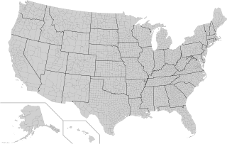
The following is a sortable table of the most populous county in each U.S. state, federal district, and territory . Counties and states/territories in bold have a population of at least 1 million.

Contents

Table

State
federal district
or territory
Largest county
parish
or municipality [note 1]
Population
(2013 estimate) [3]
County
parish seat
or shire town
State
federal district
or territory population
(2013 estimate) [4] [note 2]
Largest county/parish or municipality
Percentage of
state/federal district or territory population
Flag of Alabama.svg  Alabama Jefferson 659,479 Birmingham 4,833,72213.64%
Flag of Alaska.svg  Alaska Anchorage 300,950 Anchorage 735,13240.94%
Flag of American Samoa.svg  American Samoa Western District [1] [note 3] 31,329 [5] 55,51956.42%
Flag of Arizona.svg  Arizona Maricopa 4,009,412 Phoenix 6,626,62460.50%
Flag of Arkansas.svg  Arkansas Pulaski 391,284 Little Rock 2,959,37313.22%
Flag of California.svg  California Los Angeles 10,017,068 Los Angeles 38,332,52126.13%
Flag of Colorado.svg  Colorado El Paso 655,044 Colorado Springs 5,268,36712.43%
Flag of Connecticut.svg  Connecticut Fairfield 939,904 Bridgeport 3,596,08026.14%
Flag of Delaware.svg  Delaware New Castle 549,684 Wilmington 925,74959.38%
Flag of Washington, D.C.svg  District of Columbia District of Columbia 693,972 District of Columbia 693,972100%
Flag of Florida.svg  Florida Miami-Dade 2,617,176 Miami 19,552,86013.39%
Flag of Georgia (U.S. state).svg Georgia Fulton 1,010,562 Atlanta 10,214,8609.85%
Flag of Guam.svg  Guam Guam [note 4] 162,742 Hagåtña 162,742100%
Flag of Hawaii.svg  Hawaii Honolulu 983,429 Honolulu 1,404,05470.04%
Flag of Idaho.svg  Idaho Ada 416,464 Boise 1,612,13625.83%
Flag of Illinois.svg  Illinois Cook 5,240,700 Chicago 12,882,13540.68%
Flag of Indiana.svg  Indiana Marion 928,281 Indianapolis 6,570,90214.13%
Flag of Iowa.svg  Iowa Polk 451,677 Des Moines 3,090,41614.62%
Flag of Kansas.svg  Kansas Johnson 566,933 Olathe 2,893,95719.59%
Flag of Kentucky.svg  Kentucky Jefferson 756,832 Louisville 4,395,29517.22%
Flag of Louisiana.svg  Louisiana East Baton Rouge 445,227 Baton Rouge 4,625,4709.63%
Flag of Maine.svg  Maine Cumberland 285,456 Portland 1,328,30221.49%
Flag of Maryland.svg  Maryland Montgomery 1,016,677 Rockville 5,928,81417.15%
Flag of Massachusetts.svg  Massachusetts Middlesex 1,552,802 Cambridge and Lowell 6,692,82423.20%
Flag of Michigan.svg  Michigan Wayne 1,775,273 Detroit 9,895,62217.94%
Flag of Minnesota.svg  Minnesota Hennepin 1,198,778 Minneapolis 5,420,38022.12%
Flag of Mississippi.svg  Mississippi Hinds 244,899 Jackson 2,991,2078.19%
Flag of Missouri.svg  Missouri St. Louis 1,001,444 Clayton 6,044,17116.57%
Flag of Montana.svg  Montana Yellowstone 154,162 Billings 1,015,16515.19%
Flag of Nebraska.svg  Nebraska Douglas 531,265 Omaha 1,868,51628.43%
Flag of Nevada.svg  Nevada Clark 2,027,868 Las Vegas 2,790,13672.68%
Flag of New Hampshire.svg  New Hampshire Hillsborough 402,922 Manchester and Nashua 1,323,45930.44%
Flag of New Jersey.svg  New Jersey Bergen 925,328 Hackensack 8,899,33910.40%
Flag of New Mexico.svg  New Mexico Bernalillo 673,460 Albuquerque 2,085,28732.30%
Flag of New York.svg New York Kings 2,592,149 Brooklyn 19,651,12713.19%
Flag of North Carolina.svg  North Carolina Wake [6] 990,977 Charlotte 9,848,06010.06%
Flag of North Dakota.svg  North Dakota Cass 162,829 Fargo 723,39322.51%
Flag of the Northern Mariana Islands.svg  Northern Mariana Islands Saipan [1] 48,220 Capitol Hill, Saipan 52,26392.26%
Flag of Ohio.svg  Ohio Franklin [7] 1,268,154 Cleveland 11,570,80810.96%
Flag of Oklahoma.svg  Oklahoma Oklahoma 755,245 Oklahoma City 3,850,56819.61%
Flag of Oregon.svg  Oregon Multnomah 759,256 Portland 3,930,06519.32%
Flag of Pennsylvania.svg  Pennsylvania Philadelphia 1,553,165 Philadelphia 12,773,80112.16%
Flag of Puerto Rico.svg  Puerto Rico San Juan [1] 395,326 San Juan 3,337,17711.84%
Flag of Rhode Island.svg  Rhode Island Providence 628,323 Providence 1,051,51159.75%
Flag of South Carolina.svg  South Carolina Greenville 474,266 Greenville 4,774,8399.93%
Flag of South Dakota.svg  South Dakota Minnehaha 179,640 Sioux Falls 844,87721.26%
Flag of Tennessee.svg  Tennessee Shelby 940,764 Memphis 6,495,97814.48%
Flag of Texas.svg  Texas Harris 4,336,853 Houston 26,448,19316.40%
Flag of the United States.svg U.S. Minor Outlying Islands Wake Island (100) [note 5] (none)(160)62.5%
Flag of Utah.svg  Utah Salt Lake 1,063,842 Salt Lake City 2,900,87236.67%
Flag of Vermont.svg  Vermont Chittenden 158,504 Burlington 626,63025.29%
Flag of the United States Virgin Islands.svg Virgin Islands (U.S.) Saint Thomas island [1] 51,634 [note 6] 104,90149.22%
Flag of Virginia.svg  Virginia Fairfax 1,116,897 Fairfax 8,260,40513.52%
Flag of Washington.svg Washington King 2,044,449 Seattle 6,971,40629.33%
Flag of West Virginia.svg  West Virginia Kanawha 191,275 Charleston 1,854,30410.32%
Flag of Wisconsin.svg  Wisconsin Milwaukee 956,023 Milwaukee 5,742,71316.65%
Flag of Wyoming.svg  Wyoming Laramie 95,809 Cheyenne 582,65816.44%

Notes

  1. In the U.S. territories, the U.S. Census Bureau defines the following as county-equivalents: the districts and atolls of American Samoa, Guam as one entity, the municipalities of the Northern Mariana Islands, the municipalities of Puerto Rico, the islands of the U.S. Virgin Islands, and the islands of the U.S. Minor Outlying Islands. [1] [2] The District of Columbia is counted as one county-equivalent by the U.S. Census Bureau. [1]
  2. Territory estimates are from 2017 (except American Samoa — its estimate is from 2010).
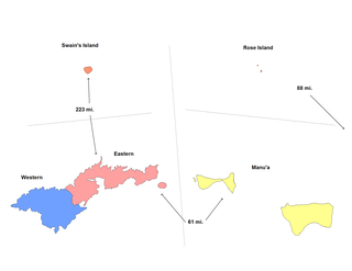
  3. American Samoa has 14 counties, but these counties are not counted by the U.S. Census Bureau (they are treated as minor civil divisions). [2]
  4. All of Guam is counted as one county-equivalent by the U.S. Census Bureau. [1]
  5. Wake Island's population is non-permanent. Wake Island, Midway Atoll and Palmyra Atoll all have small non-permanent human populations; of these, Wake Island is the most populous. The U.S. Census Bureau counts the islands in the U.S. Minor Outlying Islands as a county-equivalents.
  6. "Saint Thomas island" is a U.S. Census Bureau entity (county-equivalent) with no administrative significance. [1] Charlotte Amalie is the largest city on Saint Thomas and is the capital of the U.S. Virgin Islands.

Related Research Articles

<span class="mw-page-title-main">United States Minor Outlying Islands</span> Statistical designation of small islands of the United States

The United States Minor Outlying Islands is a statistical designation defined by the International Organization for Standardization's ISO 3166-1 code. The entry code is ISO 3166-2:UM. The minor outlying islands and groups of islands consist of eight United States insular areas in the Pacific Ocean and one in the Caribbean Sea.

<span class="mw-page-title-main">County (United States)</span> Subdivision used by most states in the United States

In the United States, a county or county equivalent is an administrative or political subdivision of a U.S. state or other territories of the United States which consists of a geographic area with specific boundaries and usually some level of governmental authority. The term "county" is used in 48 states, while Louisiana and Alaska have functionally equivalent subdivisions called parishes and boroughs, respectively. The specific governmental powers of counties vary widely between the states, with many providing some level of services to civil townships, municipalities, and unincorporated areas. Certain municipalities are in multiple counties; New York City is uniquely partitioned into five counties, referred to at the city government level as boroughs. Some municipalities have been consolidated with their county government to form consolidated city-counties, or have been legally separated from counties altogether to form independent cities. Conversely, those counties in Connecticut, Rhode Island, eight of Massachusetts's 14 counties, and Alaska's Unorganized Borough have no government power, existing only as geographic distinctions.

A minor civil division (MCD) is a term used by the United States Census Bureau for primary governmental and/or administrative divisions of a county or county-equivalent, typically a municipal government such as a city, town, or civil township. MCDs are used for statistical purposes by the Census Bureau, and do not necessarily represent the primary form of local government. They range from non-governing geographical survey areas to municipalities with weak or strong powers of self-government. Some states with large unincorporated areas give substantial powers to counties; others have smaller or larger incorporated entities with governmental powers that are smaller than the MCD level chosen by the Census.

<span class="mw-page-title-main">Lists of hospitals in the United States</span>

This article contains links to lists of hospitals in the United States, including U.S. States, the national capital of Washington, D.C., insular areas, and outlying islands. Links to more detailed state lists are shown.

In 45 of the 50 states of the United States, the county is used for the level of local government immediately below the state itself. Louisiana uses parishes, and Alaska uses boroughs. In Connecticut, Massachusetts, and Rhode Island, some or all counties within states have no governments of their own; the counties continue to exist as legal entities, however, and are used by states for some administrative functions and by the United States Census bureau for statistical analysis. There are 3,242 counties and county equivalent administrative units in total, including the District of Columbia and 100 county-equivalents in the U.S. territories.

<span class="mw-page-title-main">Insular area</span> U.S. territory that is neither a U.S. state nor the District of Columbia

In the law of the United States, an insular area is a U.S.-associated jurisdiction that is not part of a U.S. state or the District of Columbia. This includes fourteen U.S. territories administered under U.S. sovereignty, as well as three sovereign states each with a Compact of Free Association with the United States. The term also may be used to refer to the previous status of the Swan Islands, Hawaii, Puerto Rico, and the Philippines, as well as the Trust Territory of the Pacific Islands when it existed.

<span class="mw-page-title-main">Territories of the United States</span>

Territories of the United States are sub-national administrative divisions overseen by the federal government of the United States. The various American territories differ from the U.S. states and Indian reservations as they are not sovereign entities. In contrast, each state has a sovereignty separate from that of the federal government and each federally recognized Native American tribe possesses limited tribal sovereignty as a "dependent sovereign nation." Territories are classified by incorporation and whether they have an "organized" government through an organic act passed by the Congress. American territories are under American sovereignty and, consequently, may be treated as part of the United States proper in some ways and not others. Unincorporated territories in particular are not considered to be integral parts of the United States, and the Constitution of the United States applies only partially in those territories.

<span class="mw-page-title-main">Office of Insular Affairs</span> Subsidiary of the Department of the Interior

The Office of Insular Affairs (OIA) is a unit of the United States Department of the Interior that oversees federal administration of several United States insular areas. It is the successor to the Bureau of Insular Affairs of the War Department, which administered certain territories from 1902 to 1939, and the Office of Territorial Affairs in the Interior Department, which was responsible for certain territories from the 1930s to the 1990s. The word "insular" comes from the Latin word insula ("island").

<span class="mw-page-title-main">Administrative divisions of American Samoa</span>

American Samoa is administratively divided into three districts and two unorganized atolls. The districts are subdivided into 15 counties, which are composed of 76 villages.

<span class="mw-page-title-main">Forest cover by state and territory in the United States</span>

In the United States, the forest cover by state and territory is estimated from tree-attributes using the basic statistics reported by the Forest Inventory and Analysis (FIA) program of the Forest Service. Tree volumes and weights are not directly measured in the field, but computed from other variables that can be measured.

<span class="mw-page-title-main">Manuʻa District</span> District in American Samoa

The Manuʻa District is one of the three primary administrative divisions of American Samoa. The district comprises the Manuʻa Islands, which are located approximately 61 miles (98 km) east of the main island, Tutuila. The Manuʻa District is considered to be a county-equivalent by the U.S. Census Bureau.

References

  1. 1 2 3 4 5 6 7 8 "2010 FIPS Codes for Counties and County Equivalent Entities". Census Bureau. Archived from the original on 29 December 2018. Retrieved 23 September 2018.
  2. 1 2 "States, Counties, and Statistically Equivalent Entities (Chapter 4)" (PDF). Retrieved 27 May 2022.
  3. "State and County Estimates for 2013". Census Bureau. Retrieved 27 May 2022.
  4. "Population Estimates: Vintage 2013: State Tables - U.S Census Bureau". Archived from the original on 2015-01-06.
  5. "American Samoa (World Data)" (PDF). Britannica.com. Retrieved 23 September 2018.
  6. "Wake County now has larger population than Mecklenburg County, U.S. Census Bureau estimates" . Retrieved 27 May 2022.
  7. "Franklin County overtakes Cuyahoga as Ohio's largest county, though not quite officially yet" . Retrieved 27 May 2022.