This article features a list of islands sorted by their name beginning with the letter F.

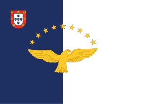
The Azores, officially the Autonomous Region of the Azores, is one of the two autonomous regions of Portugal. It is an archipelago composed of nine volcanic islands in the Macaronesia region of the North Atlantic Ocean, about 1,400 km (870 mi) west of Lisbon, about 1,500 km (930 mi) northwest of Morocco, and about 1,930 km (1,200 mi) southeast of Newfoundland, Canada.

Guam is an organized, unincorporated territory of the United States in the Micronesia subregion of the western Pacific Ocean. Guam's capital is Hagåtña, and the most populous village is Dededo. It is the westernmost point and territory of the United States, reckoned from the geographic center of the U.S. In Oceania, Guam is the largest and southernmost of the Mariana Islands and the largest island in Micronesia.

An island or isle is a piece of subcontinental land completely surrounded by water. Very small islands such as emergent land features on atolls can be called islets, skerries, cays or keys. An island in a river or a lake island may be called an eyot or ait, and a small island off the coast may be called a holm. Sedimentary islands in the Ganges Delta are called chars. A grouping of geographically or geologically related islands, such as the Philippines, is referred to as an archipelago.

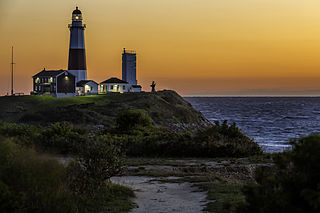
Long Island is an island in southeastern New York state, constituting a significant share of the New York metropolitan area in terms of both population and land area. The island extends from New York Harbor 118 miles (190 km) eastward into the North Atlantic Ocean with a maximum north–south width of 23 miles (37 km). With a land area of 1,401 square miles (3,630 km2), it is the largest island in the contiguous United States.

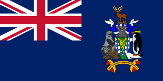
South Georgia and the South Sandwich Islands (SGSSI) is a British Overseas Territory in the southern Atlantic Ocean. It is a remote and inhospitable collection of islands, consisting of South Georgia and a chain of smaller islands known as the South Sandwich Islands. South Georgia is 165 kilometres (103 mi) long and 35 kilometres (22 mi) wide and is by far the largest island in the territory. The South Sandwich Islands lie about 700 kilometres (430 mi) southeast of South Georgia. The territory's total land area is 3,903 km2 (1,507 sq mi). The Falkland Islands are about 1,300 kilometres (810 mi) west from its nearest point.

In physical geography, tundra is a type of biome where tree growth is hindered by frigid temperatures and short growing seasons. The term is a Russian word adapted from Sámi languages. There are three regions and associated types of tundra: Arctic tundra, alpine tundra, and Antarctic tundra.

The Hawaiian Islands are an archipelago of eight major volcanic islands, several atolls, and numerous smaller islets in the North Pacific Ocean, extending some 1,500 miles from the island of Hawaiʻi in the south to northernmost Kure Atoll. Formerly called the Sandwich Islands, the present name for the archipelago is derived from the name of its largest island, Hawaiʻi.

Frigatebirds are a family of seabirds called Fregatidae which are found across all tropical and subtropical oceans. The five extant species are classified in a single genus, Fregata. All have predominantly black plumage, long, deeply forked tails and long hooked bills. Females have white underbellies and males have a distinctive red gular pouch, which they inflate during the breeding season to attract females. Their wings are long and pointed and can span up to 2.3 metres (7.5 ft), the largest wing area to body weight ratio of any bird.

Cape Hatteras is a cape located at a pronounced bend in Hatteras Island, one of the barrier islands of North Carolina.
This gallery of sovereign state flags shows the national or state flags of sovereign states that appear on the list of sovereign states. For flags of other entities, please see gallery of flags of dependent territories. Each flag is depicted as if the flagpole is positioned on the left of the flag, except for those of Iran, Iraq and Saudi Arabia which are depicted with the hoist to the right.

Ibiza, officially in Catalan: Eivissa, is a city and municipality located on the southeast coast of the island of Ibiza in the Balearic Islands autonomous community.

Severny Island is a Russian Arctic island. It is the northern island of the Novaya Zemlya archipelago. It was historically called Lütke Land after Friedrich Benjamin von Lütke, who explored it. It lies approximately 400 km north of the Russian mainland. It has an area of 48,904 square kilometres (18,882 sq mi), making it the 30th-largest island in the world and the 3rd-largest uninhabited island in the world. It is part of Russian Arctic National Park.

The Lucayan Archipelago, also known as the Bahamian Archipelago, is an island group comprising the Commonwealth of The Bahamas and the British Overseas Territory of the Turks and Caicos Islands. The archipelago is in the western North Atlantic Ocean, north of Cuba and the other Antillean Islands, and east and south-east of Florida.

Base Orcadas is an Argentine scientific station in Antarctica, and the oldest of the stations in Antarctica still in operation. It is located on Laurie Island, one of the South Orkney Islands, at 4 meters (13 ft) above sea level and 170 meters (558 ft) from the coastline. Established by the Scottish National Antarctic Expedition in 1903 and transferred to the Argentine government in 1904, the base has been permanently populated since, being one of six Argentine permanent bases in Argentina's claim to Antarctica, and the first permanently inhabited base in Antarctica.

The steel-blue flycatcher is a species of bird in the family Monarchidae. It is found in Papua New Guinea and Solomon Islands.

The Javanese shrew is a species of mammal in the family Soricidae. It is native to Indonesia and East Timor. It ranges throughout Java and the Lesser Sunda Islands. It has also been introduced to Ambon Island and the Aru Islands.

The Aleutian Islands, also called the Aleut Islands or Aleutic Islands and known before 1867 as the Catherine Archipelago, are a chain of 14 large volcanic islands and 55 smaller islands. Most of the Aleutian Islands belong to the U.S. state of Alaska, but some belong to the Russian federal subject of Kamchatka Krai. They form part of the Aleutian Arc in the Northern Pacific Ocean, occupying a land area of 6,821 sq mi (17,666 km2) and extending about 1,200 mi (1,900 km) westward from the Alaska Peninsula toward the Kamchatka Peninsula in Russia, and act as a border between the Bering Sea to the north and the Pacific Ocean to the south. Crossing longitude 180°, at which point east and west longitude end, the archipelago contains both the westernmost part of the United States by longitude and the easternmost by longitude. The westernmost U.S. island in real terms, however, is Attu Island, west of which runs the International Date Line. While nearly all the archipelago is part of Alaska and is usually considered as being in the "Alaskan Bush", at the extreme western end, the small, geologically related Commander Islands belong to Russia.