This article features a list of islands sorted by their name beginning with the letter C.

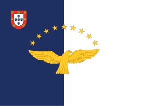
The Azores, officially the Autonomous Region of the Azores, is one of the two autonomous regions of Portugal. It is an archipelago composed of nine volcanic islands in the Macaronesia region of the North Atlantic Ocean, about 1,400 km (870 mi) west of Lisbon, about 1,500 km (930 mi) northwest of Morocco, about 1,930 km (1,200 mi) southeast of Newfoundland, Canada, and the same distance southwest of Cork, Ireland.

The Cyclades are an island group in the Aegean Sea, southeast of mainland Greece and a former administrative prefecture of Greece. They are one of the island groups which constitute the Aegean archipelago. The name refers to the archipelago forming a circle around the sacred island of Delos. The largest island of the Cyclades is Naxos, however the most populated is Syros.

Oceania is a geographical region including Australasia, Melanesia, Micronesia, and Polynesia. Outside of the English-speaking world, Oceania is generally considered a continent, while Mainland Australia is regarded as its continental landmass. Spanning the Eastern and Western hemispheres, at the centre of the water hemisphere, Oceania is estimated to have a land area of about 9,000,000 square kilometres (3,500,000 sq mi) and a population of around 46.3 million as of 2024. Oceania is the smallest continent in land area and the second-least populated after Antarctica.

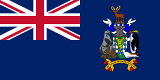
South Georgia and the South Sandwich Islands (SGSSI) is a British Overseas Territory in the southern Atlantic Ocean. It is a remote and inhospitable collection of islands, consisting of South Georgia and a chain of smaller islands known as the South Sandwich Islands. South Georgia is 165 kilometres (103 mi) long and 35 kilometres (22 mi) wide and is by far the largest island in the territory. The South Sandwich Islands lie about 700 kilometres (430 mi) southeast of South Georgia. The territory's total land area is 3,903 km2 (1,507 sq mi). The Falkland Islands are about 1,300 kilometres (810 mi) west from its nearest point.

Nantucket is an island in the state of Massachusetts in the United States, about 30 miles (48 km) south of the Cape Cod peninsula. Together with the small islands of Tuckernuck and Muskeget, it constitutes the Town and County of Nantucket, a combined county/town government. Nantucket is the southeasternmost town in both Massachusetts and the New England region. The name "Nantucket" is adapted from similar Algonquian names for the island.

The Hawaiian Islands are an archipelago of eight major volcanic islands, several atolls, and numerous smaller islets in the North Pacific Ocean, extending some 1,500 miles from the island of Hawaiʻi in the south to northernmost Kure Atoll. Formerly called the Sandwich Islands by Europeans, the present name for the archipelago is derived from the name of its largest island, Hawaiʻi.
Polynesians are an ethnolinguistic group comprising closely related ethnic groups native to Polynesia, which encompasses the islands within the Polynesian Triangle in the Pacific Ocean. They trace their early prehistoric origins to Island Southeast Asia and are part of the larger Austronesian ethnolinguistic group, with an Urheimat in Taiwan. They speak the Polynesian languages, a branch of the Oceanic subfamily within the Austronesian language family. The Indigenous Māori people form the largest Polynesian population, followed by Samoans, Native Hawaiians, Tahitians, Tongans, and Cook Islands Māori.
These are tables of congressional delegations from Rhode Island to the United States Senate and United States House of Representatives.

Base Orcadas is an Argentine scientific station in Antarctica, and the oldest of the stations in Antarctica still in operation. It is located on Laurie Island, one of the South Orkney Islands, at 4 meters (13 ft) above sea level and 170 meters (558 ft) from the coastline. Established by the Scottish National Antarctic Expedition in 1903 and transferred to the Argentine government in 1904, the base has been permanently populated since, being one of six Argentine permanent bases in Argentina's claim to Antarctica, and the first permanently inhabited base in Antarctica.

The green sea turtle, also known as the green turtle, black (sea) turtle or Pacific green turtle, is a species of large sea turtle of the family Cheloniidae. It is the only species in the genus Chelonia. Its range extends throughout tropical and subtropical seas around the world, with two distinct populations in the Atlantic and Pacific Oceans, but it is also found in the Indian Ocean. The common name refers to the usually green fat found beneath its carapace, due to its diet strictly being seagrass, not to the color of its carapace, which is olive to black.

Nelson Island is an island 22 kilometres (12 nmi) long and 13 kilometres (7 nmi) wide, lying southwest of King George Island in the South Shetland Islands, Antarctica. The name Nelson Island dates back to at least 1821 and is now established in international usage.
Ferry Island Provincial Park is a Class C provincial park in British Columbia that is located on the south side of the Fraser River northeast of Rosedale. This park is northwest of Bridal Falls, British Columbia and adjacent to the Agassiz-Rosedale Bridge. The Ferry Island Park was established in 1963, and it has an area of about 29 hectares.
Ghari is an Oceanic language spoken on Guadalcanal island of the Solomon Islands.

Rhode Island's 2nd congressional district is a congressional district located in the southern and western part of the U.S State of Rhode Island.The district is currently represented by Democrat Seth Magaziner, who has represented the district since January 2023.

Anglesey is an island off the north-west coast of Wales. It forms the bulk of the county known as the Isle of Anglesey, which also includes Holy Island and some islets and skerries. The county borders Gwynedd across the Menai Strait to the southeast, and is otherwise surrounded by the Irish Sea. Holyhead is the largest town, and the administrative centre is Llangefni. The county is part of the preserved county of Gwynedd. Anglesey is the northernmost county in Wales.

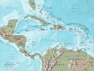
The Caribbean is a subregion in the middle of the Americas centered around the Caribbean Sea in the North Atlantic Ocean, mostly overlapping with the West Indies. Bordered by North America to the north, Central America to the west, and South America to the south, it comprises numerous islands, cays, islets, reefs, and banks. It includes the Lucayan Archipelago, Greater Antilles, and Lesser Antilles of the West Indies; the Quintana Roo islands and Belizean islands of the Yucatán Peninsula; and the Bay Islands, Miskito Cays, Archipelago of San Andrés, Providencia, and Santa Catalina, and Corn Islands of Central America. It also includes the coastal areas on the continental mainland of the Americas bordering the region from the Yucatán Peninsula in North America through Central America to the Guianas in South America.

The Aleutian Islands —also called the Aleut Islands, Aleutic Islands, or, before 1867, the Catherine Archipelago—are a chain of 14 main, larger volcanic islands and 55 smaller ones. Most of the Aleutian Islands belong to the U.S. state of Alaska, with the archipelago encompassing the Aleutians West Census Area and the Aleutians East Borough. The Commander Islands, located further to the west, belong to the Russian federal subject of Kamchatka Krai, of the Russian Far East. The islands form part of the Aleutian Arc of the Northern Pacific Ocean, and occupy a land area of 6,821 sq mi (17,666 km2) that extends westward roughly 1,200 mi (1,900 km) from the Alaskan Peninsula mainland, in the direction of the Kamchatka Peninsula; the archipelago acts as a border between the Bering Sea to the north and the Pacific Ocean to the south. Crossing longitude 180°, at which point east and west longitude end, the archipelago contains both the westernmost and easternmost parts of the United States, by longitude. The westernmost U.S. island, in real terms, however, is Attu Island, west of which runs the International Date Line.

Chelonoidis is a genus of turtles in the tortoise family erected by Leopold Fitzinger in 1835. They are found in South America and the Galápagos Islands, and formerly had a wide distribution in the West Indies.