List of places in Arizona (G)

Last updated

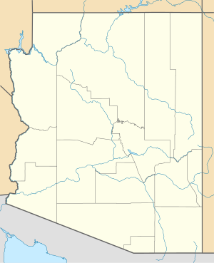
This is a list of cities, towns, unincorporated communities, counties, and other places in the U.S. state of Arizona, which start with the letter G. This list is derived from the Geographic Names Information System, which has numerous errors, so it also includes many ghost towns and historical places that are not necessarily communities or actual populated places. This list also includes information on the number and names of counties in which the place lies, its lower and upper ZIP code bounds, if applicable, its U.S. Geological Survey (USGS) reference number(s) (called the GNIS), class as designated by the USGS, and incorporated community located in (if applicable).
G

Name of placeNumber
of
counties
Principal
county
GNIS #(s)ClassLocated inZIP code
LowerUpper
Gadsden [1] 1 Yuma County 2408271 CDP 85336
Galeyville [2] 1 Cochise County 24426 Populated Place
Ganado [3] 1 Apache County 2408273 CDP 86505
Geronimo [4] 1 Graham County 24428 Populated Place 85536
Geronimo Estates [5] 1 Gila County 2582789 CDP
Gila Bend [6] 1 Maricopa County 2412681 Civil (Town) 85337
Gila Crossing [7] 1 Maricopa County 2612138 CDP 85339
Gila River Indian Reservation [8] 2 Pinal County 23998 Civil (Indian Reservation) 85247
Gilbert [9] 1 Maricopa County 2412682 Civil (Town) 85234
Gillespie [10] 1 Maricopa County 24430 Populated Place
Gillett [11] 1 Yavapai County 24431 Populated Place
Gisela [12] 1 Gila County 2408295 CDP 85541
Gleeson [13] 1 Cochise County 5054 Populated Place 85610
Glenbar [14] 1 Graham County 5058 Populated Place
Glendale [15] 1 Maricopa County 2410596 Civil (City) 8530185318
Glen Ilah [16] 1 Yavapai County 5057 Populated Place Yarnell 85362
Glen Oaks [17] 1 Yavapai County 29339 Populated Place
Globe [18] 1 Gila County 2410606 Civil (City) 85501
Gold Camp [19] 1 Pinal County 1853159 Populated Place Queen Valley
Gold Canyon [20] 1 Pinal County 2408303 CDP 85219
Golden Shores [21] 1 Mohave County 2582790 CDP 86436
Golden Valley [22] 1 Mohave County 2408307 CDP 86401
Goodwin [23] 1 Yavapai County 29416 Populated Place
Goodyear [24] 1 Maricopa County 2410622 Civil (City) 85338
Goodyear Village [25] 1 Pinal County 2612139 CDP 86340
Graham [26] 1 Graham County 25298 Populated Place 85552
Grand Canyon Village [27] 1 Coconino County 2408314 CDP
Grand Canyon West [28] 1 Mohave County 2582791 CDP
Grapevine [29] 1 Gila County 29504 Populated Place
Grasshopper [30] 1 Navajo County 24436 Populated Place
Grasshopper Junction [31] 1 Mohave County 24437 Populated Place
Gray Mountain [32] 1 Coconino County 5319 Populated Place 86001
Greasewood [33] 1 Navajo County 2408325 CDP
Greaterville [34] 1 Pima County 29567 Populated Place
Green Valley [35] 1 Pima County 2408329 CDP 85614
Greenwood [36] 1 Mohave County 24438 Populated Place
Greer [37] 1 Apache County 2582792 CDP 85927
Groom Creek [38] 1 Yavapai County 29613 Populated Place 86303
Growler [39] 1 Yuma County 24442 Populated Place
Guadalupe [40] 1 Maricopa County 2412713 Civil (Town) 85283
Gu Chuapo [41] 1 Pima County 24443 Populated Place
Gu Oidak [42] 1 Pima County 2582793 CDP 85634
Gurli Put Vo [43] 1 Pima County 24444 Populated Place
Guthrie [44] 1 Greenlee County 24445 Populated Place 85533
Gu Vo [45] 1 Pima County 5412 Populated Place 85634

Related Research Articles

<span class="mw-page-title-main">Geronimo, Arizona</span> Populated place in Graham County, Arizona

Geronimo is a populated place located on Highway 70 between Bylas and Fort Thomas, west of Safford in Graham County, Arizona, United States. Geronimo lies at an elevation of 2,723 feet (830 m).

Ali Oidak or Alioitak is a populated place located in the Gu Achi District of the Papago Indian Reservation in Pima County, Arizona, United States. It has an estimated elevation of 1,824 feet (556 m) above sea level. The place name means "little field" in the O'odham or Papago language. A 1969 study of Papago communities lists it as a village with a single field well, supporting six houses.

Geronimo Estates is both a census-designated place (CDP) and a populated place in Gila County, Arizona, United States. The population of the CDP was 60 at the 2010 census.

Gu Vo, also known as Cubo, Kerwo, or Kuvo, is a populated place situated in Pima County, Arizona, United States. Gu Vo became the official name as a result of a Board on Geographic Names decision in 1941. It has an estimated elevation of 2,146 feet (654 m) above sea level.

Oit Ihuk is a temporary village in the Gu Achi district of the Papago Indian Reservation in Pima County, Arizona, United States. It has an estimated elevation of 2,126 feet (648 m) above sea level. The name "Oit Ihuk" means "devil's claw field".

References

  1. "Feature Detail Report for: Gadsden Census Designated Place". Geographic Names Information System . United States Geological Survey, United States Department of the Interior.
  2. "Feature Detail Report for: Galeyville". Geographic Names Information System . United States Geological Survey, United States Department of the Interior.
  3. "Feature Detail Report for: Ganado Census Designated Place". Geographic Names Information System . United States Geological Survey, United States Department of the Interior.
  4. "Feature Detail Report for: Geronimo". Geographic Names Information System . United States Geological Survey, United States Department of the Interior.
  5. "Feature Detail Report for: Geronimo Estates Census Designated Place". Geographic Names Information System . United States Geological Survey, United States Department of the Interior.
  6. "Feature Detail Report for: Town of Gila Bend". Geographic Names Information System . United States Geological Survey, United States Department of the Interior.
  7. "Feature Detail Report for: Gila Crossing Census Designated Place". Geographic Names Information System . United States Geological Survey, United States Department of the Interior.
  8. "Feature Detail Report for: Gila River Indian Reservation". Geographic Names Information System . United States Geological Survey, United States Department of the Interior.
  9. "Feature Detail Report for: Town of Gilbert". Geographic Names Information System . United States Geological Survey, United States Department of the Interior.
  10. "Feature Detail Report for: Gillespie". Geographic Names Information System . United States Geological Survey, United States Department of the Interior.
  11. "Feature Detail Report for: Gillett". Geographic Names Information System . United States Geological Survey, United States Department of the Interior.
  12. "Feature Detail Report for: Gisela". Geographic Names Information System . United States Geological Survey, United States Department of the Interior.
  13. "Feature Detail Report for: Gleeson". Geographic Names Information System . United States Geological Survey, United States Department of the Interior.
  14. "Feature Detail Report for: Glenbar". Geographic Names Information System . United States Geological Survey, United States Department of the Interior.
  15. "Feature Detail Report for: City of Glendale". Geographic Names Information System . United States Geological Survey, United States Department of the Interior.
  16. "Feature Detail Report for: Glen Ilah". Geographic Names Information System . United States Geological Survey, United States Department of the Interior.
  17. "Feature Detail Report for: Glen Oaks". Geographic Names Information System . United States Geological Survey, United States Department of the Interior.
  18. "Feature Detail Report for: Globe". Geographic Names Information System . United States Geological Survey, United States Department of the Interior.
  19. "Feature Detail Report for: Gold Camp". Geographic Names Information System . United States Geological Survey, United States Department of the Interior.
  20. "Feature Detail Report for: Gold Canyon". Geographic Names Information System . United States Geological Survey, United States Department of the Interior.
  21. "Feature Detail Report for: Golden Shores Census Designated Place". Geographic Names Information System . United States Geological Survey, United States Department of the Interior.
  22. "Feature Detail Report for: Golden Valley Census Designated Place". Geographic Names Information System . United States Geological Survey, United States Department of the Interior.
  23. "Feature Detail Report for: Goodwin". Geographic Names Information System . United States Geological Survey, United States Department of the Interior.
  24. "Feature Detail Report for: City of Goodyear". Geographic Names Information System . United States Geological Survey, United States Department of the Interior.
  25. "Feature Detail Report for: Goodyear Village Census Designated Place". Geographic Names Information System . United States Geological Survey, United States Department of the Interior.
  26. "Feature Detail Report for: Government Hill". Geographic Names Information System . United States Geological Survey, United States Department of the Interior.
  27. "Feature Detail Report for: Grand Canyon Village Census Designated Place". Geographic Names Information System . United States Geological Survey, United States Department of the Interior.
  28. "Feature Detail Report for: Grand Canyon West Census Designated Place". Geographic Names Information System . United States Geological Survey, United States Department of the Interior.
  29. "Feature Detail Report for: Grapevine". Geographic Names Information System . United States Geological Survey, United States Department of the Interior.
  30. "Feature Detail Report for: Grasshopper". Geographic Names Information System . United States Geological Survey, United States Department of the Interior.
  31. "Feature Detail Report for: Grasshopper Junction". Geographic Names Information System . United States Geological Survey, United States Department of the Interior.
  32. "Feature Detail Report for: Grasshopper Junction". Geographic Names Information System . United States Geological Survey, United States Department of the Interior.
  33. "Feature Detail Report for: Greasewood Census Designated Place". Geographic Names Information System . United States Geological Survey, United States Department of the Interior.
  34. "Feature Detail Report for: Greaterville". Geographic Names Information System . United States Geological Survey, United States Department of the Interior.
  35. "Feature Detail Report for: Green Valley Census Designated Place". Geographic Names Information System . United States Geological Survey, United States Department of the Interior.
  36. "Feature Detail Report for: Greenwood". Geographic Names Information System . United States Geological Survey, United States Department of the Interior.
  37. "Feature Detail Report for: Greer". Geographic Names Information System . United States Geological Survey, United States Department of the Interior.
  38. "Feature Detail Report for: Groom Creek". Geographic Names Information System . United States Geological Survey, United States Department of the Interior.
  39. "Feature Detail Report for: Growler". Geographic Names Information System . United States Geological Survey, United States Department of the Interior.
  40. "Feature Detail Report for: Town of Guadalupe". Geographic Names Information System . United States Geological Survey, United States Department of the Interior.
  41. "Feature Detail Report for: Gu Chuapo". Geographic Names Information System . United States Geological Survey, United States Department of the Interior.
  42. "Feature Detail Report for: Gu Oidak Census Designated Place". Geographic Names Information System . United States Geological Survey, United States Department of the Interior.
  43. "Feature Detail Report for: Gurli Put Vo". Geographic Names Information System . United States Geological Survey, United States Department of the Interior.
  44. "Feature Detail Report for: Guthrie". Geographic Names Information System . United States Geological Survey, United States Department of the Interior.
  45. "Feature Detail Report for: Gu Vo". Geographic Names Information System . United States Geological Survey, United States Department of the Interior.