List of places in Middlesex

Last updated

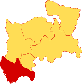
The historic county of Middlesex, England divided into the six hundreds. Hundreds of Middlesex.svg
The historic county of Middlesex, England divided into the six hundreds.

List of the parishes in Middlesex, grouped by hundred, as of 1831.

Contents

The historic county of Middlesex was recorded in the Domesday Book as being divided into the six hundreds of Edmonton, Elthorne, Gore, Hounslow (Isleworth in all later records), [1] Ossulstone and Spelthorne, as follows:

HundredParishesArea (1831)
acres [2]
Edmonton [3] Edmonton (All Saints)Enfield (St Andrew)Monken HadleySouth Mimms (St Giles)Tottenham (All Saints) 31,410
Elthorne [4] Cowley (St Lawrence)Cranford (St Dunstan)GreenfordHanwell (St Mary)Harefield (St Mary)HarlingtonHarmondsworth (St Mary)Hayes (St Mary the Virgin)HillingdonIckenham (St Giles)New BrentfordNortholtNorwoodPerivale (St Mary the Virgin)Ruislip (St Martin)Uxbridge HamletWest Drayton (St Martin) 35,690
Gore [5] Edgware (St Margaret)Great Stanmore (St John)Harrow on the Hill (St Mary)Hendon (St Mary)Kingsbury (St Andrew)Little Stanmore (St Lawrence)Pinner (St John) 28,660
Isleworth [6] Heston (St Leonard)Isleworth (All Saints)Twickenham (St Mary the Virgin) 9,280
Ossulstone [7] Acton (St Mary)Bethnal GreenBowBromleyCharter HouseChelsea (All Saints)Chiswick (St Nicholas)Clerkenwell • Duchy of Lancaster • Ealing (St Mary)Finchley (St Mary)Friern BarnetFulham (All Saints)Furnival's InnGlasshouse YardGray's InnHackneyHammersmith (St Paul)Hampstead (St John)Holy Trinity MinoriesHornseyIslington (St Mary)Kensington (St Mary Abbots) • Liberty of Saffron Hill, Hatton Garden, Ely Rents and Ely PlaceLiberty of the RollsLimehouseLincoln's InnMile End New TownMile End Old TownNorton FolgateOld Artillery GroundOld Tower WithoutPaddingtonPoplar • Precinct of the Savoy • RatcliffeShadwellShoreditchSpitalfields(St Andrew) HolbornStaple Inn • St Botolph Aldersgate • St Botolph without Aldgate • St Clement DanesStepney (St Dunstan)(St George) Bloomsbury • St George in the East • St George the Martyr • St Giles in the Fields • St Katharine's by the Tower • St Luke • St MaryleboneSt Mary le StrandStoke NewingtonSt PancrasSt Sepulchre WappingWest TwyfordWhitechapelWillesden (St Mary the Virgin) [Links incomplete]47,950
Spelthorne [8] Ashford (St Michael)East Bedfont (St Mary the Virgin)Feltham (St Dunstan)Hampton (St Mary the Virgin)Hampton WickHanworth (St George)Laleham (All Saints)LittletonShepperton (St Nicholas)Staines (St Mary)Stanwell (St Mary the Virgin)Sunbury (St Mary the Virgin)Teddington (St Mary) 23,500

The City of London (i.e., the original ″Square Mile″) was geographically located within Middlesex (and was bounded by the hundred of Ossulstone to the west, north and east) but was essentially independent of the county for most purposes.

Later development of civil parishes

See also List of Middlesex boundary changes. This list includes those areas (marked [L]) which became part of the County of London in 1889. See also List of civil parishes in the County of London in 1891. The list should be comprehensive.

ParishCreatedAbolishedNotes
Acton Ancient1965
Ashford C15th1974Medieval chapelry to Staines, later a civil parish, transferred to Surrey 1965.
Bethnal Green [L]17431965 Church built 1743. Previously it had been a "hamlet" of Stepney parish.
Bloomsbury [L]17311774
Bow or Stratford-at-Bow [L]17191907Had been a chapelry of Stepney since the 13th century.
Bromley-by-Bow [L]15371965Formerly an area in the parish of Stepney. Acquired a chapel 1537.
Charter House [L]18581915Formerly extra-parochial. Abolished to form Finsbury.
Chelsea [L]Ancient1965
Chiswick Ancient1965
Clerkenwell [L]Ancient1915Abolished to form Finsbury.
Close of the Collegiate

Church of St Peter [L]

18581922Formerly extra-parochial.
Cowley Ancient1938Merged into Uxbridge.
Cranford Ancient1934Split between Harlington, and Heston and Isleworth.
Ealing Ancient1965
East Bedfont Ancient1965
Edgware unknown1931Formerly a medieval chapelry to Kingsbury. Merged into Hendon.
Edmonton Ancient1965
Enfield Ancient1965
Feltham Ancient1965
Finchley Ancient1965
Finsbury [L]1915 [9] 1965
Friern Barnet Ancient1965
Fulham [L]Ancient1965
Furnival's Inn [L]18581930Formerly extra-parochial.
Glasshouse Yard [L]18661915Formerly part of St Botolph's Aldersgate lying in Middlesex. Abolished to form Finsbury.
Gray's Inn [L]18581932Formerly extra-parochial.
Great Stanmore Ancient1934Abolished to form Harrow.
Greenford Ancient1926Merged into Ealing.
Hackney [L]Ancient1965
Hadley 18941965Formerly part of Monken Hadley. Moved to Hertfordshire in 1894.
Hammersmith [L]18341965Formerly part of the parish of Fulham; a chapel of ease was erected in 1631
Hampstead [L]C15th1965Formerly a medieval chapelry to Hendon.
Hampton Ancient1937 [10]
Hampton Wick 18661937Formerly part of Hampton.
Hanwell Ancient1926Merged into Ealing.
Hanworth Ancient1965
Harefield Ancient1938Merged into Uxbridge.
Harlington Ancient1965
Harmondsworth Ancient1949Abolished to form Yiewsley and West Drayton.
Harrow 19341965
Harrow-on-the-Hill Ancient1934Abolished to form Harrow.
Harrow Weald 18941934Abolished to form Harrow.
Hayes Ancient1965
Hendon Ancient1965
Heston Ancient1927Abolished to form Heston and Isleworth.
Heston and Isleworth 19271965
Hillingdon Ancient1894Split into Hillingdon East and West.
Hillingdon East 18941938Merged into Uxbridge.
Hillingdon West18941938Merged into Uxbridge.
Holy Trinity Minories [L]1858?1895Extra-parochial from the Reformation onwards.
Hornsey Ancient1965
Ickenham Ancient1938Merged into Uxbridge.
Isleworth Ancient1927Abolished to form Heston and Isleworth.
Islington [L]Ancient1965
Kensington [L]Ancient1965
Kingsbury Ancient1934Abolished to form Harrow.
Laleham C15th1974Formerly a medieval chapelry to Staines. Moved to Surrey 1965.
Liberty of the Rolls [L]18661922Until C15th part of St Dunstan-in-the-West lying in Middlesex, then extra-parochial.
Limehouse [L]17251927 [11] Formerly a hamlet in Stepney parish. Merged back into Stepney.
Lincoln's Inn [L]18581932Formerly extra-parochial.
Little Stanmore Ancient1934Abolished to form Harrow.
Littleton Ancient1974Moved to Surrey 1965.
Mile End New Town [L]18661921Formed by the division of Stepney. Merged into Whitechapel.
Mile End Old Town [L]18661927Formed by the division of Stepney. Merged into Stepney.
Monken Hadley Ancient1965Transferred to Hertfordshire in 1889 along with parts of Enfield and South Mimms.
New Brentford unknown1965Formerly a medieval chapelry (of St Lawrence) in the parish of Hanwell. [12]
Northolt Ancient1928Mostly merged into Ealing, with a small area going to Harrow. [13]
Norton Folgate [L]18581921Formerly extra-parochial. Merged into Whitechapel.
Norwood (Green) unknown1965Formerly a medieval chapelry in Hayes parish, later a civil parish.
Old Artillery Ground [L]18581921Formerly extra-parochial. Merged into Whitechapel.
Old Brentford 18941965Formerly a hamlet in the parish of Ealing, gaining its first chapel in 1762.
Old Tower Without [L]18581895Formerly extra-parochial. Merged into St Botolph without Aldgate.
Paddington [L]Ancient1965
Perivale Ancient1926Merged into Ealing.
Pinner unknown1934Formerly a medieval chapelry to Harrow-on-the-Hill. Abolished to form Harrow.
Poplar [L]18171965Formerly part of Stepney. Became Poplar Borough parish in 1907.
Precinct of St Katharine

by the Tower [L]

18581895Formerly extra-parochial. Merged into St Botolph without Aldgate.
Precinct of the Savoy [L]18661922Formerly extra-parochial.
Ratcliff [L]18661921Formed by the division of Stepney. Merged into Limehouse.
Ruislip Ancient1965
Saffron Hill, Hatton Garden,

Ely Rents and Ely Place [L]

18661930Formerly extra-parochial.
St Andrew Holborn [L]Ancient1907A City of London parish with a portion in M'sex till 1767 (which was merged into the below).
St Andrew Holborn Above the

Bars w St George the Martyr [L]

17671930
St Anne Within the Liberty of

Westminster / St Anne Soho [L]

16871922
St Botolph's Aldersgate [L]Ancient1907A City of London parish with a portion in M'sex till 1866 (which became Glasshouse Yard).
St Botolph without Aldgate [L]Ancient1921A City of London parish with a portion in M'sex, which was merged into Whitechapel 1921.
St Clement Danes [L]Ancient1922Abolished to form Westminster.
St Dunstan-in-the-West [L]Ancient1907A City of London parish with a portion in M'sex till C15th (later Liberty of the Rolls).
St George Hanover Square [L]17241922 [14]
St George in the East [L]17291927Created out of Stepney and merged back into it.
St George the Martyr [L]17231767Abolished to form St Andrew Holborn Above the Bars with St George the Martyr.
St Giles [L]Ancient1774
St Giles Cripplegate [L]Ancient1907A City of London parish with a portion in M'sex till 1733 (which became St Luke's).
St Giles in the Fields and

St George Bloomsbury [L]

17741930
(St John of) Wapping [L]16941921Created out of Whitechapel. Merged into Limehouse.
St Luke's [L]17331915Formerly that part of St Giles Cripplegate which lay in Middlesex.
St Martin in the Fields [L]Ancient1922
St Mary le Strand [L]Ancient1922
St Marylebone [L]Ancient1965
St Pancras [L]Ancient1965
St Paul Covent Garden [L]16451922
St Sepulchre [L]Ancient1915A City of London parish with a portion in Middlesex.
Shadwell [L]16701921Created out of Stepney. Merged into Limehouse.
Shepperton Ancient1974Moved to Surrey 1965.
Shoreditch [L]Ancient1965
South Hornsey 18941900
South Mimms Ancient2023Now in Hertfordshire. Merged into South Mimms and Ridge 2023.
South Mimms Urban 18961965Created out of South Mimms in 1896 and simultaneously transferred to Hertfordshire.
Southgate 18941965Became a chapelry of Edmonton in 1615. [15]
Spitalfields [L]17291921Created out of Stepney. Merged into Whitechapel.
Staines Ancient1974Moved to Surrey 1965.
Stanwell Ancient1974Moved to Surrey 1965.
Staple Inn [L]18581930 [16] Formerly extra-parochial.
Stepney [L]Ancient1866Lost area before 1866; remainder divided into Ratcliff, Mile End Old, Mile End New 1866.
19271965Merger of Whitechapel, Limehouse, Mile End Old Town and St George in the East
Stoke Newington [L]Ancient1965
Sunbury Ancient1974Moved to Surrey 1965.
Teddington C13th1937 [17] Formerly medieval chapelry to Staines.
Tottenham Ancient1965
Tower of London [L]18581901Formerly extra-parochial, despite church. Merged into St Botolph without Aldgate.
Twickenham Ancient1965
Uxbridge 18661965Formerly medieval chapelry of Hillingdon.
Wealdstone 18941934Abolished to form Harrow.
Wembley 18941965Created out of Harrow-on-the-Hill.
West Drayton Ancient1949Abolished to form Yiewsley and West Drayton.
West Twyford 18581926Formerly an extra-parochial medieval chapelry to no church. [18] Merged into Ealing.
Westminster [L]19221965 [19]
Westminster St James [L]16851922
Westminster St John [L]17271922
Westminster (St Margaret) [L]Ancient1922
Whitechapel [L]c. 13381927Created out of Stepney (formerly a chapelry of that parish). Merged into Stepney.
Willesden Ancient1965
Wood Green 18941965Previously a hamlet in Tottenham parish. [20]
Yiewsley 18941949Previously a hamlet to Hillingdon. Abolished to form Yiewsley and West Drayton.
Yiewsley and West Drayton 19491965

Medieval parishes

The parishes of Middlesex did not alter very much between c. 1250 and 1831, but there were some small changes. Note that the below table also includes chapelries (in italics).

HundredParishes
Edmonton EdmontonEnfieldMonken HadleySouth Mimms 1Tottenham
Elthorne CowleyCranfordGreenfordHanwell ( New Brentford ) • HarefieldHarlingtonHarmondsworthHayes (Norwood) • Hillingdon ( Uxbridge ) • IckenhamNortholtPerivaleRuislipWest Drayton
Gore Great StanmoreHarrow on the Hill ( PinnerTokyngton ) • HendonKingsbury ( Edgware ) • Little Stanmore
Isleworth HestonIsleworthTwickenham
Ossulstone ActonChelseaChiswickClerkenwellEalingFinchleyFriern BarnetFulhamHackney Hampstead 2Hornsey ( Highgate Muswell Hill ) • IslingtonKensingtonPaddingtonSt Clement DanesSt GilesSt Martin in the FieldsSt MaryleboneSt Mary le StrandSt Pancras ( Kentish Town ) • ShoreditchStoke NewingtonStepney ( Isle of Dogs Stratford-at-Bow Whitechapel ) • West Twyford 3WestminsterWillesden
Spelthorne East BedfontFelthamHamptonHanworthLittleton 4Shepperton 4Staines 4 (Ashford 4 Laleham 4 Teddington ) • Stanwell 4Sunbury 4
(City of London)5 St Andrew HolbornSt Botolph AldersgateSt Botolph without AldgateSt Dunstan-in-the-WestSt Giles CripplegateSt Sepulchre

1now in Hertfordshire rather than Greater London 2a chapelry to Hendon, in Gore hundred 3a chapelry to no church 4now in Surrey rather than Greater London 5Parish churches in the City of London but with parishes extending into parts of Middlesex; see List of civil parishes in the City of London

Related Research Articles

<span class="mw-page-title-main">Middlesex</span> Historic county of England

Middlesex is an area of South East England which was formerly a county; it is now mainly within the ceremonial county of Greater London, with small sections in neighbouring ceremonial counties. The county's boundaries largely followed three rivers: the Thames in the south, the Lea to the east and the Colne to the west. A line of hills formed the northern boundary with Hertfordshire. The county was the second smallest of the historic counties of England, after Rutland.

<span class="mw-page-title-main">Metropolitan Borough of Southwark</span>

The Metropolitan Borough of Southwark was a metropolitan borough in the County of London from 1900 to 1965. It was created to cover the western section of the ancient borough of Southwark and the parish of Newington. In common with the rest of inner London, the borough experienced a steady decline in population throughout its existence. The borough council made an unsuccessful attempt to gain city status in 1955. Its former area is now the northwestern part of the current London Borough of Southwark.

<span class="mw-page-title-main">Metropolitan Borough of Westminster</span>

The Metropolitan Borough of Westminster was a metropolitan borough in the County of London, England, from 1900 to 1965.

<span class="mw-page-title-main">Metropolitan Borough of Holborn</span> Metropolitan borough in London

The Metropolitan Borough of Holborn was a metropolitan borough in the County of London between 1900 and 1965. The borough included most of Holborn as well as Bloomsbury and St Giles.

<span class="mw-page-title-main">Metropolitan Borough of Woolwich</span>

The Metropolitan Borough of Woolwich was a metropolitan borough in the County of London from 1900 to 1965. It was formed from the civil parishes of Eltham, Plumstead and Woolwich. Its former area is now part of the Royal Borough of Greenwich and the London Borough of Newham.

<span class="mw-page-title-main">Metropolitan Borough of Stepney</span> Metropolitan borough in the County of London

The Metropolitan Borough of Stepney was a Metropolitan borough in the County of London created in 1900. In 1965 it became part of the London Borough of Tower Hamlets.

<span class="mw-page-title-main">Knockholt</span> Human settlement in England

Knockholt is a village and civil parish in the Sevenoaks District of Kent, England. It is located 5 mi (8 km) north west of Sevenoaks & 5.7 mi (9.2 km) south of Orpington, adjacent to the Kent border with Greater London.

<span class="mw-page-title-main">Ashleyhay</span> Human settlement in England

Ashleyhay is a village and civil parish in the Amber Valley district of Derbyshire, England, about five miles north-west of Belper. It is also situated one and three-quarters of a mile south of Wirksworth and eleven miles north of Derby city centre. According to the 2001 census it had a population of 105, increasing to 118 at the 2011 Census.

<span class="mw-page-title-main">Ossulstone</span> Hundred of Middlesex

Ossulstone is an obsolete subdivision (hundred) covering 26.4% of – and the most metropolitan part – of the historic county of Middlesex, England. It surrounded but did not include the City of London and the area has been entirely absorbed by the growth of London. It now corresponds to the seven London Boroughs of Inner London north of the Thames and, from Outer London, in decreasing order, certain historic parishes of the London boroughs of Ealing, Brent, Barnet, and Haringey.

<span class="mw-page-title-main">Bracewell and Brogden</span> Civil parish in Lancashire, England

Bracewell and Brogden is a former civil parish, now in the parish of Barnoldswick, in the West Craven area of the Borough of Pendle in Lancashire, England. According to the 2001 census it had a population of 238, increasing slightly to 244 at the 2011 census. The parish included Bracewell and Brogden ; historically, both were in the West Riding of Yorkshire.

<span class="mw-page-title-main">Municipal Borough of Heston and Isleworth</span>

Heston and Isleworth was a local government district of Middlesex, England from 1875 to 1965.

<span class="mw-page-title-main">Laindon</span> Town and former civil parish in England

Laindon is a town and civil parish, which now forms part of the town of Basildon, in the Basildon district, in Essex, England. It is between Basildon and West Horndon. It was also an ancient parish. It was based on the manor of the same name. As of 2020, Laindon's population was 37,175.

<span class="mw-page-title-main">Spelthorne Hundred</span> Administrative division of England

Spelthorne was a hundred of the historic county of Middlesex, England. It contained these parishes and settlements:

<span class="mw-page-title-main">Rochford, Worcestershire</span> Human settlement in England

Rochford consists of two hamlets, Lower and Upper Rochford. A civil parish in the Malvern Hills District near Tenbury Wells, in the county of Worcestershire, England, Rochford is 18 miles (29 km) NW of Worcester. The River Teme, which rises in Wales, flows past Lower Rochford and joins the River Severn in Worcester. The chapelry of Rochford was an exclave of Herefordshire, part of the hundred of Wolphy. It was transferred by the Counties Act 1844 to Worcestershire.

<span class="mw-page-title-main">Huntingfield, Suffolk</span> Human settlement in England

Huntingfield is a village near the B1117 road, in the East Suffolk district, in the county of Suffolk, England. The village is close to the source of the River Blyth and the parish is 12 miles from the seaside town of Southwold. Nearby settlements include the town of Halesworth and the villages of Walpole, Heveningham, Cookley and Laxfield.

<span class="mw-page-title-main">Old Laund Booth</span> Human settlement in England

Old Laund Booth is a civil parish in the Pendle district of Lancashire, England. It has a population of 1,459, and contains the villages of Fence and Wheatley Lane.

<span class="mw-page-title-main">Wayland Rural District</span> Former Rural District in Norfolk, England

Wayland Rural District was a rural district in Norfolk, England from 1894 to 1974.

<span class="mw-page-title-main">Depwade Rural District</span>

Depwade Rural District was a rural district in Norfolk, England from 1894 to 1974.

<span class="mw-page-title-main">Erpingham Rural District</span>

Erpingham Rural District was a rural district in Norfolk, England from 1894 to 1974.

References

  1. "The hundred of Isleworth". A History of the County of Middlesex: Volume 3. 1962. Retrieved 20 February 2008.
  2. Great Britain Historical GIS / University of Portsmouth, Middlesex hundreds 1831 census  population . Retrieved 2008-02-20.
  3. Great Britain Historical GIS / University of Portsmouth, Edmonton hundred . Retrieved 2018-01-22.
  4. Great Britain Historical GIS / University of Portsmouth, Elthorne hundred . Retrieved 2018-01-22.
  5. Great Britain Historical GIS / University of Portsmouth, Gore hundred . Retrieved 2018-01-22.
  6. Great Britain Historical GIS / University of Portsmouth, Isleworth hundred . Retrieved 2018-01-22.
  7. Great Britain Historical GIS / University of Portsmouth, Ossulstone hundred . Retrieved 2018-01-22.
  8. Great Britain Historical GIS / University of Portsmouth, Spelthorne hundred . Retrieved 2018-01-22.
  9. "Finsbury CP through time | Census tables with data for the Parish-level Unit". www.visionofbritain.org.uk. Retrieved 4 August 2024.
  10. "Hampton CP/AP through time | Census tables with data for the Parish-level Unit". www.visionofbritain.org.uk. Retrieved 6 August 2024.
  11. "Limehouse CP/ExP through time | Census tables with data for the Parish-level Unit". www.visionofbritain.org.uk. Retrieved 5 August 2024.
  12. "New Brentford CP/Ch through time | Census tables with data for the Parish-level Unit". www.visionofbritain.org.uk. Retrieved 2 August 2024.
  13. "Northolt AP/CP through time | Census tables with data for the Parish-level Unit". www.visionofbritain.org.uk. Retrieved 2 August 2024.
  14. "St George Hanover Square CP/Vest through time | Census tables with data for the Parish-level Unit". www.visionofbritain.org.uk. Retrieved 5 August 2024.
  15. "Southgate Ch/CP through time | Census tables with data for the Parish-level Unit". www.visionofbritain.org.uk. Retrieved 2 August 2024.
  16. "Staple Inn CP/ExP through time | Census tables with data for the Parish-level Unit". www.visionofbritain.org.uk. Retrieved 5 August 2024.
  17. "Teddington CP/AP through time | Census tables with data for the Parish-level Unit". www.visionofbritain.org.uk. Retrieved 6 August 2024.
  18. "West Twyford: Church | British History Online". www.british-history.ac.uk. Retrieved 5 August 2024.
  19. "City of Westminster CP through time | Census tables with data for the Parish-level Unit". www.visionofbritain.org.uk. Retrieved 5 August 2024.
  20. "Wood Green CP/Ch through time | Census tables with data for the Parish-level Unit". www.visionofbritain.org.uk. Retrieved 2 August 2024.