Lyle, Minnesota | |
---|---|
Nickname: | |
Motto: | |
Coordinates: 43°30′15″N92°56′25″W / 43.50417°N 92.94028°W | |
Country | United States |
State | Minnesota |
County | Mower |
Established | 1854 |
Incorporated | June 18, 1870 |
Government | |
• Type | Mayor - Council |
Area | |
• Total | 0.76 sq mi (1.96 km2) |
• Land | 0.76 sq mi (1.96 km2) |
• Water | 0.00 sq mi (0.00 km2) |
Elevation | 1,194 ft (364 m) |
Population | |
• Total | 522 |
• Density | 690.48/sq mi (266.66/km2) |
Time zone | UTC-6 (CST) |
• Summer (DST) | UTC-5 (CDT) |
ZIP Code | 55953 |
Area code | 507 |
FIPS code | 27-38654 [4] |
GNIS feature ID | 2395790 [2] |
Website | www |
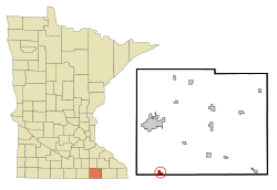
Lyle is a city in Mower County, Minnesota, United States. The city lies on the north side of the Iowa border. The population was 522 at the 2020 census. [3]
Lyle was platted in 1870. [5] The city was named after Robert Lyle, a farmer, territorial, and state legislator. [6] Lyle was incorporated in 1875. [5]
Lyle is in southwestern Mower County, with its southern border on the Iowa state line. The city is bordered to the north and west by Lyle Township and to the east by Nevada Township, while to the south it is bordered by Otranto Township in Mitchell County, Iowa.
U.S. Route 218 passes through the center of Lyle as 1st Street, leading north 12 miles (19 km) to Austin, the Mower county seat, and south 21 miles (34 km) to Osage, Iowa.
According to the U.S. Census Bureau, Lyle has an area of 0.76 square miles (1.97 km2), all of it recorded as land. [1] Otter Creek crosses the southeast corner of the city, flowing southwest to the Cedar River at Otranto, Iowa.
Census | Pop. | Note | %± |
---|---|---|---|
1880 | 182 | — | |
1890 | 306 | 68.1% | |
1900 | 488 | 59.5% | |
1910 | 552 | 13.1% | |
1920 | 505 | −8.5% | |
1930 | 453 | −10.3% | |
1940 | 513 | 13.2% | |
1950 | 609 | 18.7% | |
1960 | 607 | −0.3% | |
1970 | 522 | −14.0% | |
1980 | 576 | 10.3% | |
1990 | 504 | −12.5% | |
2000 | 566 | 12.3% | |
2010 | 551 | −2.7% | |
2020 | 522 | −5.3% | |
U.S. Decennial Census |
As of the census [7] of 2010, there were 551 people, 220 households, and 147 families residing in the city. The population density was 725.0 inhabitants per square mile (279.9/km2). There were 235 housing units at an average density of 309.2 per square mile (119.4/km2). The racial makeup of the city was 98.2% White, 0.2% Native American, 0.2% from other races, and 1.5% from two or more races. Hispanic or Latino of any race were 0.7% of the population.
There were 220 households, of which 33.6% had children under the age of 18 living with them, 51.8% were married couples living together, 11.8% had a female householder with no husband present, 3.2% had a male householder with no wife present, and 33.2% were non-families. 30.5% of all households were made up of individuals, and 16% had someone living alone who was 65 years of age or older. The average household size was 2.50 and the average family size was 3.06.
The median age in the city was 36.3 years. 27.2% of residents were under the age of 18; 8.4% were between the ages of 18 and 24; 23.6% were from 25 to 44; 26.1% were from 45 to 64; and 14.7% were 65 years of age or older. The gender makeup of the city was 48.3% male and 51.7% female.
As of the census [4] of 2000, there were 566 people, 211 households, and 148 families residing in the city. The population density was 733.2 inhabitants per square mile (283.1/km2). There were 225 housing units at an average density of 291.5 per square mile (112.5/km2). The racial makeup of the city was 99.82% White and 0.18% Native American. Hispanic or Latino of any race were 0.35% of the population.
There were 211 households, out of which 37.9% had children under the age of 18 living with them, 59.7% were married couples living together, 8.1% had a female householder with no husband present, and 29.4% were non-families. 25.6% of all households were made up of individuals, and 13.3% had someone living alone who was 65 years of age or older. The average household size was 2.68 and the average family size was 3.26.
In the city, the population was spread out, with 30.0% under the age of 18, 6.7% from 18 to 24, 30.6% from 25 to 44, 17.0% from 45 to 64, and 15.7% who were 65 years of age or older. The median age was 37 years. For every 100 females, there were 96.5 males. For every 100 females age 18 and over, there were 96.0 males.
The median income for a household in the city was $34,464, and the median income for a family was $42,500. Males had a median income of $30,938 versus $24,107 for females. The per capita income for the city was $14,624. About 4.2% of families and 9.4% of the population were below the poverty line, including 9.4% of those under age 18 and 11.0% of those age 65 or over.
Lyle Independent School District #497 serves both the city of Lyle and the surrounding farm community.
This district is merged for purposes of athletics with Austin Pacelli, a Catholic high school in Austin, Minnesota. Lyle sports teams, formerly the Lyle Lions, are now the Lyle-Pacelli Athletics. Since the district is so small, Lyle-Pacelli frequently plays against schools with much larger enrollments and plays nine-man football.
The Lyle area was engaged in a bitter fight over a school bond referendum from 2002 to 2005. Two groups emerged in the community: "Save our Schools and Community", a group supporting construction of a new school, and "Concerned Citizens for Lyle's Future", a group opposing the construction of a new school in favor of other less expensive solutions. In 2005, Concerned Citizens for Lyle's Future hired an anti-school-bond consultant from Ocheyedan, Iowa. [8] The bond passed on May 24, 2005, by a vote of 449 to 343. In this election, 98% of eligible voters participated. [9] The new school has been built on the site of the former facility.
Bond issue size | Votes for | Votes against | Margin | Result | |
---|---|---|---|---|---|
2002-11-05 | $11.1 million | 276 | 356 | 80 | Rejected |
2002-12-03 | $8.05 million | 325 | 365 | 29 | Rejected |
2004-09-14 | $6.3 million | 310 | 319 | 9 | Rejected |
2005-05-24 | $8.34 million | 449 | 343 | 106 | Passed |
Lyle-area news is covered by the following local media organizations:
Mower County is a county in the U.S. state of Minnesota. As of the 2020 census, the population was 40,029. The county seat is Austin. Mower County comprises the Austin Micropolitan Statistical Area and is included in the Rochester-Austin Combined Statistical Area. Lake Louise State Park is in southeastern Mower County, near Le Roy.
Adams is a city in Adams Township, Mower County, Minnesota, United States. The population was 683 at the 2020 census, down from 787 in 2010.
Adams Township is a township in Mower County, Minnesota, United States. The population was 475 at the 2000 census. The largest town in the township is Adams with a population of 800 people.
Austin Township is a township in Mower County, Minnesota, United States. The population was 1,396 at the 2000 census. The largest city partially in the township is Austin with a population of 24,718 people. The northern parts of the city of Austin are in Lansing Township. All other population centers are unincorporated areas.
Brownsdale is a city in Mower County, Minnesota, United States. The population was 633 at the 2020 census.
Dexter is a city Mower County, Minnesota, United States. The population was 324 at the 2020 census.
Grand Meadow is a city in Mower County, Minnesota, United States. The city is on the boundary between Grand Meadow Township and Frankford Township, and it is politically independent of both townships. The population was 1,127 at the 2020 census.
Lansing Township is a township in Mower County, Minnesota, United States. The population was 1,292 at the 2000 census. The largest city contained partially within the township is Austin with 23,314 people. The southern part of Austin is in Austin Township. Lansing Township also contains the town of Mapleview and the unincorporated areas of Ramsey, Corning, and Lansing.
Le Roy is a city in Mower County, Minnesota, United States, surrounded by Le Roy Township. The population was 957 at the 2020 census. Lake Louise State Park is just outside the town.
Lyle Township is a township in Mower County, Minnesota, United States. The population was 402 at the 2000 census. The largest city contained within the township is Lyle with 566 people. All other areas of the township are unincorporated. The township was named for Robert Lyle, an early settler from Ohio who later went on to become judge of probate and an elected representative of the region in the Minnesota House of Representatives.
Mapleview is a city in Lansing Township, Mower County, Minnesota, United States. It is a suburb of Austin, the county seat. The population was 144 at the 2020 census, down from 176 in 2010. It was named for a row of maple trees that once stood on the west side of town.
Nevada Township is a township in Mower County, Minnesota, United States. The population was 353 at the 2000 census. There are no recognized cities or towns and the township is entirely an unincorporated area.
Pleasant Valley Township is a township in Mower County, Minnesota, United States. The population was 308 at the 2000 census. There are no recognized cities or towns and the township is entirely an unincorporated area.
Racine is a city in Mower County, Minnesota, United States. The population was 458 at the 2020 census.
Rose Creek is a city in Mower County, Minnesota, United States. The population was 397 at the 2020 census.
Sargeant is a city in Mower County, Minnesota, United States. The population was 63 at the 2020 census.
Taopi is a city in Mower County, Minnesota, United States. The population was 61 at the 2020 census. It is located near the source of the Wapsipinicon River.
Waltham is a city in Mower County, Minnesota, United States. The population was 164 at the 2020 census.
Elkton is a city in Marshall Township, Mower County, Minnesota, United States. The population was 130 at the 2020 census.
Frankford Township is a township in Mower County, Minnesota, United States. The population was 358 at the 2000 census. The largest town located partially within the township is Grand Meadow, with a population of 945 people. The eastern half of Grand Meadow is in Frankford Township and the western half is in Grand Meadow Township. All other areas of the township are unincorporated. There was a village called Frankford on Deer Creek in the far eastern part of the township near Fillmore County. It almost became the county seat but lost this distinction to Austin.