Eldoret is a city in the Rift Valley region of Kenya. It serves as the capital of Uasin Gishu County. Located in western Kenya, and lying south of the Cherangani Hills, the local elevation varies from about 2,100 metres (6,900 ft) at the airport to more than 2,700 metres (8,900 ft) in nearby areas.

Nakuru is a city in the Rift Valley region of Kenya. It is the capital of Nakuru County, and is the third largest urban area in Kenya. As of 2019, Nakuru has an urban population of 570,674, making it the largest urban centre in the Rift Valley, succeeding Eldoret, Uasin Gishu County. The city lies along the Nairobi–Nakuru Highway, 160 kilometres (99 mi) from Nairobi.

Nakuru County is a county in Kenya. It is county number 32 out of the 47 Kenyan counties. Nakuru County is a host to Kenya's Fourth City – Nakuru City. On 1 December 2021, President Uhuru Kenyatta awarded a City Charter status to Nakuru, ranking it with Nairobi, Mombasa, and Kisumu as the cities in Kenya. With a population of 2,162,202, it is the third most populous county in Kenya after Nairobi County and Kiambu County, in that order. With an area of 7,496.5 km2, it is Kenya's 19th largest county in size. Until 21 August 2010, it formed part of Rift Valley Province.

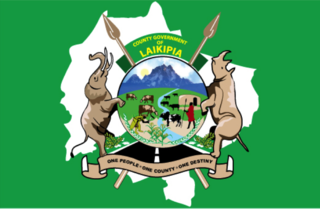
Laikipia County is one of the 47 Counties of Kenya, located on the Equator in the former Rift Valley Province of the Country. Laikipia is a cosmopolitan County and is Listed as County number 31. The county has two major urban centres: Nanyuki to the southeast, and Nyahururu to the southwest. Its County government headquarters town is Rumuruti. The County lies between latitudes 0° 18" South and 0° 51" North and between longitudes 36° 11" and 37° 24' East. It borders Samburu County to the North, Isiolo County to the North East, Meru County to the East, Nyeri County to the South East, Nyandarua County to the South, Nakuru County to the South West and Baringo County to the West.

Kericho County is one of the 47 counties in Kenya. The county seats between longitude 35°02' and 35°40' East and between the equator and latitude 0°23' South with an altitude of about 2002m above sea level. It borders Uasin Gishu County to the North West, Baringo County to the North-East, Nandi County to the North-West, Nakuru County to the East and Bomet County to the South, Kisumu County to the Northwest and Nyamira County to the West. It has a population of 901,777 and an area of 2,111 km². Its capital and largest town is Kericho.

Lamu County is a county in Kenya located along the North Coast of the country and is one of the six Coastal Counties in Kenya. Its capital is the town of Lamu. It borders Tana River County to the southwest, Garissa County to the north, Somalia to the northeast, and the Indian Ocean to the South.

Narok County is a county in southwestern Kenya with an estimated population of 1,157,873 according to 2019 Census. The dominant ethnic group is the Maasai. Its capital and largest town is Narok, with the only other major urban centre being Kilgoris. Narok County Government was formed by the County Governments Act of 2012 as prescribed in the 2010 Constitution of Kenya. Narok County governor is Patrick Ole Ntutu after winning in the 2022 elections and his Deputy is Tamalinye K. Koech.

Kiambu County is a county in the former Central Province of Kenya. Its capital is Kiambu and its largest town is Thika town. Kiambu County is the second most populous county in Kenya after Nairobi County. Kiambu County borders Nairobi and Kajiado Counties to the South, Machakos to the East, Murang'a to the North and North East, Nyandarua to the North West, and Nakuru to the West. It has a population of 2,417,735.

Kajiado County is a county in the former Rift Valley Province of Kenya. As of 2019, Kajiado county spanned an area of 21,292.7 km2, with a recorded population of 1,117,840. The county borders Nairobi and to its south it borders the Tanzanian regions of Arusha and Kilimanjaro. The county capital is Kajiado, but the largest town is Ongata Rongai. Its main tourist attraction is its wildlife.

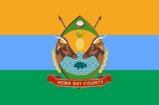
Homa Bay County is a county in the former Nyanza Province of Kenya. Its capital and largest town is Homa Bay. The county has a population of 1,131,950 and an area of 3,154.7 km2. Lake Victoria is a major source of livelihood for Homa Bay County. It has 40 wards, each represented by an MCA in the Homa Bay county assembly located in Homa Bay town, which is the county headquarters.
Molo is a town in Nakuru County. It is also one of the 11 constituencies in Nakuru County and is served by a branch of Kenya Railways, formerly the Uganda Railway, East African Railways Corporation until 1977. Molo hosts a town council. The town has a population of 156,732.
Ol Kalou is a town in Kenya which is the capital of Nyandarua County of the former Central Province. It is located west of the Aberdare range and 40 kilometres east of Nakuru. Ol Kalou is connected by road to Gilgil, Nyahururu and Nakuru. Ol Kalou forms a town council with a population of 47,795, of whom 15,186 are classified urban.
Molo Constituency is an electoral constituency in Kenya. It is one of eleven constituencies in Nakuru County. The constituency was established for the 1988 elections, renamed from the former Nakuru West Constituency.

Lari Constituency is an electoral constituency in Kenya, located in the northwestern part of Kiambu County. The constituency was established in 1966 from Limuru Constituency. Lari borders Kinangop to the North, Limuru to the South, Githunguri and Gatundu North constituencies to the east and Naivasha Constituency to the west. Lari is one of the 12 constituencies in Kiambu County, and is further divided to five wards each electing a representative to the Kiambu County Assembly.

The Counties of Kenya are geographical units created by the 2010 Constitution of Kenya as the new units of devolved government. They replaced the previous provincial system. The establishment and executive powers of the counties is provided in Chapter Eleven of the Constitution on devolved government, the Constitution's Fourth Schedule and any other legislation passed by the Senate of Kenya concerning counties. The counties are also single-member constituencies which elect members of the Senate, and special woman members to the National Assembly.
The Anglican dioceses of Nakuru are the Anglican presence in and around Nakuru, west-central, north-east and south-central Kenya; they are part of the Anglican Church of Kenya. The remaining dioceses of the Church area in the areas of Mombasa, of Maseno, and of Mount Kenya.
Nakuru Town West is a constituency in Kenya. It is one of eleven constituencies in Nakuru County that elect a member to the Kenya National Assembly.
Kuresoi South is a constituency in Kenya. Part of the former constituency of Kuresoi Community, it is one of eleven constituencies in Nakuru County. The Constituency is further divided into four wards namely; Amalo, Tinet, Kiptagich and Keringet.
William Kiprop Komen was a Kenyan KANU politician who served as a Member of Parliament for Rongai, Nakuru Town, and the former Nakuru West Constituency.
Samuel Arama is a Kenyan politician who has served as a member of the National Assembly for the Nakuru Town West constituency since 2013. He is a member of the Jubilee Party, having previously represented the Orange Democratic Movement.


