National Register of Historic Places listings in Carson City, Nevada

Last updated

Map all coordinates using: OpenStreetMap

Contents: National Register of Historic Places listings in Carson City, Nevada , USA:

Contents

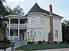
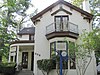
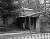
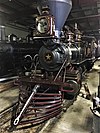
The locations of National Register properties and districts (at least for all showing latitude and longitude coordinates below), may be seen in an online map by clicking on "Map of all coordinates". [1]


    This National Park Service list is complete through NPS recent listings posted February 9, 2024. [2]

Contents: Counties in Nevada / See also: Nevada state-wide list
[3] Name on the RegisterImageDate listed [4] Location City or townDescription
1 Adams House
Adams House Adams House Carson City.jpg
Adams House
June 10, 1999
(#99000700)
990 N. Minnesota St.
39°10′09″N119°46′11″W / 39.169167°N 119.769722°W / 39.169167; -119.769722 (Adams House)
Carson City
2 Bank Saloon
Bank Saloon Bank Saloon.JPG
Bank Saloon
December 10, 1980
(#80004483)
418 S. Carson St.
39°09′40″N119°45′58″W / 39.161111°N 119.766111°W / 39.161111; -119.766111 (Bank Saloon)
Carson City
3 Belknap House
Belknap House Belknap House.jpg
Belknap House
October 30, 1997
(#97001302)
1206 N. Nevada St.
39°10′09″N119°46′04″W / 39.169167°N 119.767778°W / 39.169167; -119.767778 (Belknap House)
Carson City
4 Brougher Mansion
Brougher Mansion The Brougher Mansion.JPG
Brougher Mansion
August 11, 1980
(#80004274)
204 W. Spear St.
39°10′00″N119°46′22″W / 39.166667°N 119.772778°W / 39.166667; -119.772778 (Brougher Mansion)
Carson City
5 Carson Brewing Company
Carson Brewing Company Carson Brewing Company.JPG
Carson Brewing Company
August 18, 1978
(#78003210)
102 S. Division St.
39°09′49″N119°46′07″W / 39.163611°N 119.768611°W / 39.163611; -119.768611 (Carson Brewing Company)
Carson City
6 Carson City Civic Auditorium
Carson City Civic Auditorium Carson City Civic Auditorium.jpg
Carson City Civic Auditorium
June 19, 1990
(#90000912)
813 N. Carson St.
39°09′36″N119°45′19″W / 39.16°N 119.755278°W / 39.16; -119.755278 (Carson City Civic Auditorium)
Carson City
7 Carson City Post Office
Carson City Post Office Paul Laxalt State Building.jpg
Carson City Post Office
February 9, 1979
(#79003440)
401 N. Carson St.
39°10′00″N119°45′57″W / 39.166667°N 119.765833°W / 39.166667; -119.765833 (Carson City Post Office)
Carson City Formerly the U.S. Court House & Post Office, now home to the Nevada Commission on Tourism
8 Carson City Public Buildings
Carson City Public Buildings Ormsby County Courthouse.jpg
Carson City Public Buildings
October 2, 1987
(#87001625)
Carson St.
39°09′49″N119°46′41″W / 39.163611°N 119.778056°W / 39.163611; -119.778056 (Carson City Public Buildings)
Carson City
9 Dr. William Henry Cavell House
Dr. William Henry Cavell House Cavell House.jpg
Dr. William Henry Cavell House
June 22, 1987
(#86001655)
402 W. Robinson St.
39°10′02″N119°46′46″W / 39.167222°N 119.779444°W / 39.167222; -119.779444 (Dr. William Henry Cavell House)
Carson City
10 Orion Clemens House
Orion Clemens House Orion Clemens House 2.JPG
Orion Clemens House
March 12, 1979
(#79003439)
502 N. Division St.
39°10′00″N119°46′07″W / 39.166667°N 119.768611°W / 39.166667; -119.768611 (Orion Clemens House)
Carson City
11 Abraham Curry House
Abraham Curry House Abraham Curry House.jpg
Abraham Curry House
March 30, 1987
(#87000501)
406 N. Nevada St.
39°09′57″N119°46′08″W / 39.165833°N 119.768889°W / 39.165833; -119.768889 (Abraham Curry House)
Carson City
12 Dat So La Lee House
Dat So La Lee House Nevada - Dat So La Lee House - 20211027132208.jpg
Dat So La Lee House
June 6, 1994
(#94000553)
331 W. Proctor St.
39°09′55″N119°46′03″W / 39.165278°N 119.7675°W / 39.165278; -119.7675 (Dat So La Lee House)
Carson City
13 Foreman-Roberts House
Foreman-Roberts House Foreman-Roberts House.JPG
Foreman-Roberts House
January 3, 1978
(#78003213)
1217 N. Carson St.
39°10′19″N119°45′57″W / 39.171944°N 119.765833°W / 39.171944; -119.765833 (Foreman-Roberts House)
Carson City
14 The Glenbrook
The Glenbrook The Glenbrook2 NRHP 81000702 Carson City, NV.jpg
The Glenbrook
May 1, 1981
(#81000702)
600 N. Carson St.
39°10′07″N119°43′54″W / 39.168611°N 119.731667°W / 39.168611; -119.731667 (The Glenbrook)
Carson City
15 Governor's Mansion
Governor's Mansion Nevada Govenors Mansion.JPG
Governor's Mansion
October 22, 1976
(#76002242)
606 Mountain St.
39°10′04″N119°46′20″W / 39.167778°N 119.772222°W / 39.167778; -119.772222 (Governor's Mansion)
Carson City
16 Kitzmeyer Furniture Factory
Kitzmeyer Furniture Factory Kitzmeyer Furniture Factory.jpg
Kitzmeyer Furniture Factory
June 22, 1987
(#87000714)
319 N. Carson St.
39°09′58″N119°45′15″W / 39.166111°N 119.754167°W / 39.166111; -119.754167 (Kitzmeyer Furniture Factory)
Carson City
17 Lakeview House
Lakeview House The Lakeview House.JPG
Lakeview House
January 5, 1978
(#78003211)
U.S. Route 395 south of E. Lake Blvd.
39°12′29″N119°48′13″W / 39.208056°N 119.803611°W / 39.208056; -119.803611 (Lakeview House)
Carson City
18 Leport-Toupin House
Leport-Toupin House Leport-Toupin House.jpg
Leport-Toupin House
September 16, 1985
(#85002407)
503 E. Telegraph St.
39°09′57″N119°45′42″W / 39.165833°N 119.761667°W / 39.165833; -119.761667 (Leport-Toupin House)
Carson City
19 Marlette Lake Water System
Marlette Lake Water System Marlette Lake Water System.jpg
Marlette Lake Water System
September 16, 1992
(#92001162)
Roughly from Marlette Lake east to State Route 80
39°13′15″N119°49′17″W / 39.220833°N 119.821389°W / 39.220833; -119.821389 (Marlette Lake Water System)
Carson City
20 McKeen Motor Car #70
McKeen Motor Car #70 McKeen Motor Car -22 Restoration.jpg
McKeen Motor Car #70
September 6, 2005
(#05000968)
Nevada State Railroad Museum
39°08′55″N119°46′03″W / 39.148611°N 119.7675°W / 39.148611; -119.7675 (McKeen Motor Car #70)
Carson City National Historic Landmark designation October 16, 2012 [5]
21 Lew M. Meder House
Lew M. Meder House Meder House.jpg
Lew M. Meder House
August 2, 1978
(#78003075)
308 N. Nevada St.
39°09′56″N119°46′04″W / 39.165556°N 119.767778°W / 39.165556; -119.767778 (Lew M. Meder House)
Carson City
22 Nevada State Capitol
Nevada State Capitol Nevada State Capitol, 1875.jpg
Nevada State Capitol
June 10, 1975
(#75002126)
101 N. Carson St.
39°09′50″N119°45′54″W / 39.163889°N 119.765°W / 39.163889; -119.765 (Nevada State Capitol)
Carson City
23 Nevada State Printing Office
Nevada State Printing Office Nevada State Printing Office.jpg
Nevada State Printing Office
March 29, 1978
(#78003212)
101 S. Fall St.
39°09′49″N119°45′50″W / 39.163611°N 119.763889°W / 39.163611; -119.763889 (Nevada State Printing Office)
Carson City
24 Nevada State Prison
Nevada State Prison Nevada State Prison USGS.jpeg
Nevada State Prison
September 22, 2015
(#15000320)
3301 E. 5th St.
39°09′37″N119°44′15″W / 39.160278°N 119.7375°W / 39.160278; -119.7375 (Nevada State Prison)
Carson City
25 Gov. James W. Nye Mansion
Gov. James W. Nye Mansion Gov. James W. Nye Mansion.jpg
Gov. James W. Nye Mansion
April 16, 1975
(#75002128)
108 N. Minnesota St.
39°09′52″N119°46′11″W / 39.164444°N 119.769722°W / 39.164444; -119.769722 (Gov. James W. Nye Mansion)
Carson City
26 Olcovich-Meyers House
Olcovich-Meyers House Olcovich-Meyers House.jpg
Olcovich-Meyers House
July 29, 1993
(#93000682)
214 W. King St.
39°09′51″N119°46′03″W / 39.164167°N 119.7675°W / 39.164167; -119.7675 (Olcovich-Meyers House)
Carson City
27 Ormsby-Rosser House
Ormsby-Rosser House Ormsby-Rosser House.jpg
Ormsby-Rosser House
May 17, 1979
(#79003437)
304 S. Minnesota St.
39°09′44″N119°46′11″W / 39.162222°N 119.769722°W / 39.162222; -119.769722 (Ormsby-Rosser House)
Carson City
28 Raycraft Ranch
Raycraft Ranch Raycraft Ranch.jpg
Raycraft Ranch
May 4, 1976
(#76002243)
North of Carson City on U.S. Route 395
39°11′32″N119°46′44″W / 39.192222°N 119.778889°W / 39.192222; -119.778889 (Raycraft Ranch)
Carson City
29 Rinckel Mansion
Rinckel Mansion Rinckel Mansion.jpg
Rinckel Mansion
November 20, 1975
(#75002129)
102 N. Curry St.
39°09′51″N119°46′01″W / 39.164167°N 119.766944°W / 39.164167; -119.766944 (Rinckel Mansion)
Carson City
30 Gov. Reinhold Sadler House
Gov. Reinhold Sadler House Gov. Sadler House.jpg
Gov. Reinhold Sadler House
March 2, 1979
(#79003436)
310 Mountain St.
39°09′55″N119°46′20″W / 39.165278°N 119.772222°W / 39.165278; -119.772222 (Gov. Reinhold Sadler House)
Carson City
31 St. Charles-Muller's Hotel
St. Charles-Muller's Hotel StCharlesHotel Carson City.jpg
St. Charles-Muller's Hotel
May 27, 1982
(#82003209)
302-304-310 S. Carson St.
39°09′43″N119°45′58″W / 39.161944°N 119.766111°W / 39.161944; -119.766111 (St. Charles-Muller's Hotel)
Carson City
32 St. Peter's Episcopal Church
St. Peter's Episcopal Church St. Peter's Episcopal Church, Carson City.jpg
St. Peter's Episcopal Church
January 3, 1978
(#78003215)
312 N. Division St.
39°09′56″N119°46′09″W / 39.165556°N 119.769167°W / 39.165556; -119.769167 (St. Peter's Episcopal Church)
Carson City
33 George L. Sanford House
George L. Sanford House Sanford House.jpg
George L. Sanford House
December 19, 1994
(#94001472)
405 N. Roop St.
39°10′03″N119°42′47″W / 39.1675°N 119.713056°W / 39.1675; -119.713056 (George L. Sanford House)
Carson City
34 Sears–Ferris House
Sears-Ferris House Sears-Ferris House.jpg
Sears–Ferris House
February 9, 1979
(#79003438)
311 W. 3rd St.
39°09′44″N119°46′06″W / 39.162222°N 119.768333°W / 39.162222; -119.768333 (Sears–Ferris House)
Carson City
35 Second Railroad Car No. 21
Second Railroad Car No. 21 AKC 2014 pics7 019.jpg
Second Railroad Car No. 21
December 1, 1978
(#78003214)
Nevada State Railroad Museum, located at 2180 S. Carson St.
39°08′51″N119°46′06″W / 39.1475°N 119.768333°W / 39.1475; -119.768333 (Second Railroad Car No. 21)
Carson City
36 David Smaill House
David Smaill House David Smaill House.jpg
David Smaill House
September 16, 1985
(#85002408)
313 W. Ann St.
39°10′16″N119°46′06″W / 39.171111°N 119.768333°W / 39.171111; -119.768333 (David Smaill House)
Carson City
37 William Spence House
William Spence House William Spence House.JPG
William Spence House
July 18, 1985
(#85001602)
308 S. Thompson St.
39°09′45″N119°46′14″W / 39.1625°N 119.770556°W / 39.1625; -119.770556 (William Spence House)
Carson City
38 Stewart Indian School
Stewart Indian School Stewart Indian School Grounds.JPG
Stewart Indian School
September 18, 1985
(#85002432)
South of Carson City off U.S. Route 395
39°06′51″N119°45′21″W / 39.114167°N 119.755833°W / 39.114167; -119.755833 (Stewart Indian School)
Carson City
39 U.S. Mint
U.S. Mint Carson City Mint.jpg
U.S. Mint
September 5, 1975
(#75002127)
600 N. Carson St.
39°10′03″N119°45′59″W / 39.1675°N 119.766389°W / 39.1675; -119.766389 (U.S. Mint)
Carson City
40 Virginia and Truckee Railroad Depot-Carson City
Virginia and Truckee Railroad Depot-Carson City Train Museum 2.JPG
Virginia and Truckee Railroad Depot-Carson City
September 30, 1998
(#98001208)
729 N. Carson St.
39°10′04″N119°45′55″W / 39.167778°N 119.765278°W / 39.167778; -119.765278 (Virginia and Truckee Railroad Depot-Carson City)
Carson City
41 Virginia and Truckee Railway Locomotive No. 27
Virginia and Truckee Railway Locomotive No. 27 Locomotive 27.jpg
Virginia and Truckee Railway Locomotive No. 27
October 27, 2004
(#04001198)
Nevada State Railroad Museum, located at 2180 S. Carson St.
39°08′58″N119°46′00″W / 39.149444°N 119.766667°W / 39.149444; -119.766667 (Virginia and Truckee Railway Locomotive No. 27)
Carson City
42 Virginia and Truckee RR. Engines No. 18, The Dayton  and No. 22, The Inyo
Virginia and Truckee RR. Engines No. 18, The Dayton 4-4-0 Inyo.jpg
Virginia and Truckee RR. Engines No. 18, The Dayton
December 18, 1973
(#73002245)
Nevada State Railroad Museum, located at the northeastern corner of Colorado and Carson Sts.
39°08′50″N119°45′55″W / 39.147222°N 119.765278°W / 39.147222; -119.765278 (Virginia and Truckee RR. Engines No. 18, The Dayton)
Carson City
43 Wabuska Railroad Station
Wabuska Railroad Station Wabuska Railroad Station 3.JPG
Wabuska Railroad Station
August 30, 1984
(#84002070)
S. Carson St.
39°09′00″N119°46′00″W / 39.15°N 119.766667°W / 39.15; -119.766667 (Wabuska Railroad Station)
Carson City
44 West Side Historic District
West Side Historic District Stewart Nye Residence.JPG
West Side Historic District
November 2, 2011
(#11000785)
Roughly bounded by Curry, Mountain, 5th & John Sts.
39°09′59″N119°46′13″W / 39.166389°N 119.770278°W / 39.166389; -119.770278 (West Side Historic District)
Carson City

Former listings

[3] Name on the RegisterImageDate listedDate removedLocationCity or townDescription
1 Virginia and Truckee Railroad Shops December 2, 1977
(#77001508)
October 13, 2000Between Stewart and Plaza Streets
Carson City Demolished in 1991. [6] [7]

See also

Related Research Articles

<span class="mw-page-title-main">National Register of Historic Places listings in Brooklyn</span>

The following properties are listed on the National Register of Historic Places in Brooklyn.

<span class="mw-page-title-main">National Register of Historic Places listings in Niagara County, New York</span>

This is a list of the National Register of Historic Places listings in Erie County, New York.

<span class="mw-page-title-main">National Register of Historic Places listings in Staten Island</span>

List of the National Register of Historic Places listings in Richmond County, New York.

This is intended to be a complete list of properties and districts listed on the National Register of Historic Places on Manhattan Island below 14th Street, which is a significant portion of the New York City borough of Manhattan. In turn, the borough of Manhattan is coterminous with New York County, New York. For properties and districts in other parts of Manhattan Island, the mainland neighborhood of Marble Hill, and the other islands of New York County, see National Register of Historic Places listings in Manhattan. The locations of National Register properties and districts may be seen in an online map by clicking on "Map of all coordinates".

<span class="mw-page-title-main">National Register of Historic Places listings in Nevada County, California</span>

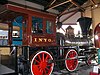
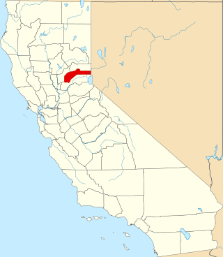
This is a list of the National Register of Historic Places listings in Nevada County, California.

<span class="mw-page-title-main">National Register of Historic Places listings in Nevada County, Arkansas</span>

This is a list of the National Register of Historic Places listings in Nevada County, Arkansas.

Contents:List of Registered Historic Places in Lander County, Nevada, USA:

List of Registered Historic Places in Churchill County, Nevada, USA:

<span class="mw-page-title-main">National Register of Historic Places listings in Douglas County, Nevada</span>

Contents:List of Registered Historic Places in Douglas County, Nevada, USA:

List of Registered Historic Places in Clark County, Nevada, USA:

Contents:List of Registered Historic Places in Humboldt County, Nevada, USA:

Contents:List of Registered Historic Places in Nye County, Nevada, USA:

<span class="mw-page-title-main">National Register of Historic Places listings in Elko County, Nevada</span>

List of Registered Historic Places in Elko County, Nevada, USA:

Contents:List of Registered Historic Places in Esmeralda County, Nevada, USA:

Contents:List of Registered Historic Places in Eureka County, Nevada, USA

Contents:List of Registered Historic Places in Lincoln County, Nevada, USA:

Contents:List of Registered Historic Places in Lyon County, Nevada, USA:

Contents:List of Registered Historic Places in Mineral County, Nevada, USA:

Contents:List of Registered Historic Places in Pershing County, Nevada, USA:

Contents:List of Registered Historic Places in Storey County, Nevada, USA:

References

  1. The latitude and longitude information provided in this table was derived originally from the National Register Information System, which has been found to be fairly accurate for about 99% of listings. Some locations in this table may have been corrected to current GPS standards.
  2. National Park Service, United States Department of the Interior, "National Register of Historic Places: Weekly List Actions", retrieved February 9, 2024.
  3. 1 2 Numbers represent an alphabetical ordering by significant words. Various colorings, defined here, differentiate National Historic Landmarks and historic districts from other NRHP buildings, structures, sites or objects.
  4. The eight-digit number below each date is the number assigned to each location in the National Register Information System database, which can be viewed by clicking the number.
  5. "Weekly list of actions taken on properties: 10/22/12 through 10/27/12". National Park Service. November 2, 2012. Retrieved November 6, 2012.
  6. "National Register #77001508: Virginia & Truckee Railroad Shops in Carson City, Nevada".
  7. "California next stop for shop". Reno Gazette-Journal . January 14, 1991. p. B1. Retrieved August 5, 2022 via Newspapers.com.