National Register of Historic Places listings in Churchill County, Nevada

Last updated

Map all coordinates using: OpenStreetMap  
Download coordinates as: KML

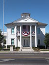
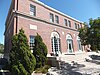
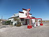
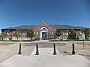
List of Registered Historic Places in Churchill County, Nevada , USA:

Contents

The locations of National Register properties and districts (at least for all showing latitude and longitude coordinates below), may be seen in an online map by clicking on "Map of all coordinates". [1]


    This National Park Service list is complete through NPS recent listings posted March 4, 2022. [2]

Contents: Counties in Nevada / See also: Nevada state-wide list

Current listings

[3] Name on the RegisterImageDate listed [4] Location City or townDescription
1 Carson River Diversion Dam
Carson River Diversion Dam CarsonDam1.JPG
Carson River Diversion Dam
March 25, 1981
(#81000380)
Carson River
39°29′50″N118°59′57″W / 39.497222°N 118.999167°W / 39.497222; -118.999167 (Carson River Diversion Dam)
Fallon
2 Churchill County Courthouse
Churchill County Courthouse ChurchillCourtHouse1.JPG
Churchill County Courthouse
September 23, 1992
(#92001258)
10 Williams St.
39°28′30″N118°46′51″W / 39.475°N 118.780833°W / 39.475; -118.780833 (Churchill County Courthouse)
Fallon
3 Churchill County Jail
Churchill County Jail ChurchillJail1.JPG
Churchill County Jail
April 9, 2002
(#01001546)
10 W. Williams Ave.
39°28′30″N118°46′36″W / 39.475°N 118.776667°W / 39.475; -118.776667 (Churchill County Jail)
Fallon
4 Cold Springs Pony Express Station Ruins
Cold Springs Pony Express Station Ruins 2015-04-02 14 50 46 Stagecoach station ruins at the Cold Springs Stagecoach Station, Nevada.JPG
Cold Springs Pony Express Station Ruins
May 16, 1978
(#78001718)
Address Restricted
Frenchman
5 Cold Springs Station Site
Cold Springs Station Site 2015-04-02 14 50 07 Stagecoach station ruins at the Cold Springs Stagecoach Station, Nevada.JPG
Cold Springs Station Site
February 23, 1972
(#72000762)
51 miles west of Austin on U.S. Route 50
39°23′31″N117°51′12″W / 39.391944°N 117.853333°W / 39.391944; -117.853333 (Cold Springs Station Site)
Austin
6 The Cottage Schools
The Cottage Schools CottageSchools2.JPG
The Cottage Schools
June 10, 2008
(#08000509)
255 E. Stillwater Ave.
39°28′19″N118°46′25″W / 39.471829°N 118.773475°W / 39.471829; -118.773475 (The Cottage Schools)
Fallon (School Buildings in Nevada MPS)
7 Douglass-Frey Ranch November 17, 2015
(#15000796)
1075 Dodge Ln.
39°22′34″N118°45′18″W / 39.3761°N 118.7549°W / 39.3761; -118.7549 (Douglass-Frey Ranch)
Fallon vicinity
8 Robert L. Douglass House
Robert L. Douglass House Douglass mansion (Fallon NV) from S 1.JPG
Robert L. Douglass House
August 13, 2001
(#01000822)
10 S. Carson St.
39°28′29″N118°46′42″W / 39.474667°N 118.778464°W / 39.474667; -118.778464 (Robert L. Douglass House)
Fallon
9 Fallon City Hall
Fallon City Hall FallonCityHall1.JPG
Fallon City Hall
October 27, 2004
(#04001197)
55 E. Williams Ave.
39°28′28″N118°46′36″W / 39.474444°N 118.776667°W / 39.474444; -118.776667 (Fallon City Hall)
Fallon
10 Federal Building and Post Office
Federal Building and Post Office Federal Building and Post Office (Fallon, Nevada).jpg
Federal Building and Post Office
March 8, 2006
(#06000109)
90 N. Maine St.
39°28′34″N118°46′32″W / 39.476111°N 118.775556°W / 39.476111; -118.775556 (Federal Building and Post Office)
Fallon
11 Fort Churchill and Sand Springs Toll Road
Fort Churchill and Sand Springs Toll Road Fort Churchill and Sand Springs Toll Road Pony Express Sign.JPG
Fort Churchill and Sand Springs Toll Road
November 24, 1997
(#97001383)
Address Restricted
Fallon
12 Grimes Point
Grimes Point GrimesPoint3.jpeg
Grimes Point
February 23, 1972
(#72000763)
Along U.S. Route 50 about 7 miles east of Fallon [5]
39°24′05″N118°38′50″W / 39.401389°N 118.647222°W / 39.401389; -118.647222 (Grimes Point)
Fallon
13 Harmon School
Harmon School HarmonSchool1.JPG
Harmon School
May 23, 1989
(#89000055)
Junction of Kirn Rd. and Harmon Rd.
39°29′26″N118°41′17″W / 39.490556°N 118.688056°W / 39.490556; -118.688056 (Harmon School)
Fallon
14 Hazen Store
Hazen Store HazenStore2.JPG
Hazen Store
January 28, 2002
(#01001547)
600 Reno Highway
39°33′50″N119°02′56″W / 39.563889°N 119.048889°W / 39.563889; -119.048889 (Hazen Store)
Hazen
15 Holy Trinity Episcopal Church
Holy Trinity Episcopal Church Holy Trinity Episcopal Church (Fallon NV) from NW 2.JPG
Holy Trinity Episcopal Church
May 16, 2003
(#03000413)
507 Churchill St.
39°28′13″N118°46′32″W / 39.470183°N 118.775672°W / 39.470183; -118.775672 (Holy Trinity Episcopal Church)
Fallon
16 Humboldt Cave March 15, 1976
(#76001140)
South of Lovelock off U.S. Route 40
39°52′53″N118°43′21″W / 39.881389°N 118.7225°W / 39.881389; -118.7225 (Humboldt Cave)
Lovelock
17 Lahontan Dam and Power Station
Lahontan Dam and Power Station Lahontan.jpg
Lahontan Dam and Power Station
March 25, 1981
(#81000381)
Southwest of Fallon
39°27′45″N119°03′53″W / 39.4625°N 119.064722°W / 39.4625; -119.064722 (Lahontan Dam and Power Station)
Fallon
18 Lovelock Cave
Lovelock Cave Lovelock-cave06.jpg
Lovelock Cave
May 24, 1984
(#84002073)
Address Restricted
Lovelock
19 Maine Street Historic District
Maine Street Historic District Fallon Downtown Founded 1908 Fallon NV - panoramio.jpg
Maine Street Historic District
June 27, 2019
(#100004098)
Downtown along Maine & Center Sts. & Williams Ave.
39°28′23″N118°46′38″W / 39.4731°N 118.7771°W / 39.4731; -118.7771 (Maine Street Historic District)
Fallon
20 Oats Park Grammar School
Oats Park Grammar School OatsPark1.JPG
Oats Park Grammar School
May 2, 1990
(#90000715)
167 E. Park St.
39°28′24″N118°46′02″W / 39.473333°N 118.767222°W / 39.473333; -118.767222 (Oats Park Grammar School)
Fallon
21 Sand Springs Station
Sand Springs Station 2015-04-02 16 41 36 Ruins of the Sand Springs Pony Express Station, Nevada with Sand Mountain visible in the background.JPG
Sand Springs Station
November 21, 1980
(#80002465)
Address Restricted
Fallon
22 Stillwater Marsh March 19, 1975
(#75001104)
Address Restricted
Fallon

See also

Related Research Articles

This is a list of properties and historic districts in Milton, Massachusetts, that are listed on the National Register of Historic Places.

National Register of Historic Places listings in Nevada County, California

This is a list of the National Register of Historic Places listings in Nevada County, California.

National Register of Historic Places listings in Warren County, North Carolina

This list includes properties and districts listed on the National Register of Historic Places in Warren County, North Carolina. Click the "Map of all coordinates" link to the right to view a Google map of all properties and districts with latitude and longitude coordinates in the table below.

National Register of Historic Places listings in Bertie County, North Carolina

This list includes properties and districts listed on the National Register of Historic Places in Bertie County, North Carolina. Click the "Map of all coordinates" link to the right to view an online map of all properties and districts with latitude and longitude coordinates in the table below.

National Register of Historic Places listings in Nevada County, Arkansas

This is a list of the National Register of Historic Places listings in Nevada County, Arkansas.

Contents:List of Registered Historic Places in Lander County, Nevada, USA:

National Register of Historic Places listings in Washoe County, Nevada

Contents:List of Registered Historic Places in Washoe County, Nevada, USA:

Contents:National Register of Historic Places listings in Carson City, Nevada, USA:

National Register of Historic Places listings in Douglas County, Nevada

Contents:List of Registered Historic Places in Douglas County, Nevada, USA:

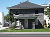
List of Registered Historic Places in Clark County, Nevada, USA:

Contents:List of Registered Historic Places in Humboldt County, Nevada, USA:

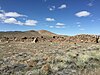
Contents:List of Registered Historic Places in Nye County, Nevada, USA:

National Register of Historic Places listings in Elko County, Nevada

List of Registered Historic Places in Elko County, Nevada, USA:

Contents:List of Registered Historic Places in Esmeralda County, Nevada, USA:

Contents:List of Registered Historic Places in Eureka County, Nevada, USA

Contents:List of Registered Historic Places in Lincoln County, Nevada, USA:

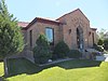
Contents:List of Registered Historic Places in Lyon County, Nevada, USA:

Contents:List of Registered Historic Places in Mineral County, Nevada, USA:

Contents:List of Registered Historic Places in Pershing County, Nevada, USA:

Contents:List of Registered Historic Places in Storey County, Nevada, USA:

References

  1. The latitude and longitude information provided in this table was derived originally from the National Register Information System, which has been found to be fairly accurate for about 99% of listings. Some locations in this table may have been corrected to current GPS standards.
  2. National Park Service, United States Department of the Interior, "National Register of Historic Places: Weekly List Actions", retrieved March 4, 2022.
  3. Numbers represent an alphabetical ordering by significant words. Various colorings, defined here, differentiate National Historic Landmarks and historic districts from other NRHP buildings, structures, sites or objects.
  4. The eight-digit number below each date is the number assigned to each location in the National Register Information System database, which can be viewed by clicking the number.
  5. Location is derived from this Bureau of Land Management website; the NRIS lists it as "Address Restricted"