Ngawi (town)

Last updated • 32 min readFrom Wikipedia, The Free Encyclopedia
Ngawi (town)
District of Ngawi
Kecamatan Ngawi
Other transcription(s)
   Javanese Ngawì(Gêdrig)
ڠاوي(Pégon)
ꦔꦮꦶ(Hånåcåråkå)
   Chinese 加維
Jiāwéi(Pinyin)
Ka-uî(Hokkien POJ)
Kartonyono Tugu Kota Ngawi.jpg
Kartonyono ivory monuments
Alun-alun ngawi.jpg
Ngawi square (alun-alun)
Ngawioboro Street Centre.jpg
Ngawioboro Street Center
Titik 0 Kilometer Ngawi (1).jpg
Point 0 kilometers of Ngawi city
Nickname(s): 
Kota Ramah (Friendly City), Kota Benteng (Fortress City)
Motto(s): 
Ngawi Berakhlak
"Ngawi has morals"
Java location map plain.svg
Red pog.svg
Ngawi (town)
Location in Java and Indonesia
Indonesia location map.svg
Red pog.svg
Ngawi (town)
Ngawi (town) (Indonesia)
Coordinates: 7°24′38″S111°27′28″E / 7.41056°S 111.45778°E / -7.41056; 111.45778
Country Flag of Indonesia.svg Indonesia
Region Java
Province Flag of East Java.svg East Java
Regency Ngawi Flag.png Ngawi
EstablishedJuly, 7th 1358
Government
  District HeadDodi Aprilasetia
  District SecretaryAgung Wahyu Wibowo
  Head of government sectionEko Syuhrul Fatoni
  General SubdivisionDelta Pranowo
Area
  Total
70.57 km2 (27.25 sq mi)
Elevation
50 m (167 ft)
Population
 (mid 2024 estimate)
  Total
85,862
  Density1,217/km2 (3,150/sq mi)
  [1]
Demonym Ngawians
Demographics
  Ethnic group [2] Javanese
Madura
Osing
Sundanese
Bantenese
Arabs
Chinese
etc.
  Religion [3]
Time zone UTC+07:00 (Indonesia Western Time)
Postcode
63211 – 63218
Area code (+62) 351
Vehicle registration AE J**/K*
HDI Increase2.svg 78,88 (2023)
high [4]
Bus station
(main bus station)
Kertonegoro bus station
Train station
(main train station)
Ngawi railway station
Largest villages or ward by area Kandangan – 9.01 square kilometres (3.48 sq mi)
Largest villages or ward by population Beran
(12,054 – 2022 est)
Website ngawi.ngawikab.go.id

Ngawi (Indonesian : Kecamatan Ngawi Kota, Indonesian pronunciation: [ŋaˈwi] ) is the capital city of the Indonesian regency of Ngawi. It is also the centre of government and economy of Ngawi Regency. Ngawi is also the name of a district (kecamatan) which is in Ngawi Regency. This district is located 183 km west of Surabaya  and 610 km east of  Jakarta. Geographically, Ngawi is in the middle of the northern part of Ngawi Regency. Infrastructure and settlements from Ngawi Regency are also concentrated in this town, which is the center of education for Ngawi Regency, with almost a quarter of the total school buildings in Ngawi Regency in this district. [5]

Contents

In mid 2024 the population in Ngawi town was estimated at 85,862 [1] people with a density of around 1,217 people per square kilometres, almost one-tenth of the total population Ngawi Regency  is domiciled in this urban district. Ngawi has an area of 70.57 km2 of which around 48 percent is paddy fields, rivers and plantations, the remainder is in the form of residential land, offices or agencies, shops, industry and other urban infrastructure. [6]

This District is directly adjacent to Pitu and Margomulyo Districts, Bojonegoro Regency to the north, Kasreman District and Pangkur District to the east, Geneng District, Kwadungan District and Paron District to the south and especially Paron District to the west. [6]

History

Etymology

Ngawi is taken from the word "Awi" which means bamboo tree Rumpun pohon bambu (11).JPG
Ngawi is taken from the word "Awi" which means bamboo tree

Ngawi comes from the word "AWI", which means bamboo which then gets the nasal letters "Ng" to become "NGAWI". [7] As is the case with names in other areas, there are lots of place (village) names associated with plant names. [7] As Ngawi pointed out, a place around the edge of Solo River and Madiun River is overgrown with bamboo. [7]

Kingdoms

In the past, Ngawi came from the word awi/bamboo and at the same time indicated Ngawi's location as a district on the banks of the Bengawan Solo and Madiun rivers. Based on research on ancient objects, it shows that in Ngawi there has been a religious activity since the Airlangga government which still lasted until the end of the reign of the Kingdom of Majapahit. [8]

This is reinforced by several inscriptions, one of which is the Cangu Inscription which is a legacy of King Hayamwuruk (Sri Rajasanegara) from Majapahit which has the Saka year 1280 (1358) which states that Ngawi is a private area. The enshrinement fragments show a spiritual nature which is closely related to the worship of Mount Lawu (Girindra), but over time there has been a shift due to the influence of the entry of Religion  Islam  as well as the culture brought by the Europeans especially the Dutch who long enough dominate the government in Indonesia. [8] [9]

Dutch colonial

The Dutch government at that time was headquartered in Fort van den Bosch Het fort te Ngawi, KITLV 34987.tiff
The Dutch government at that time was headquartered in Fort van den Bosch

Another relic is in the form of the Van den Bosch fortress. Now it is called Pendem fort because the location of the fort is underground so it is not visible from the outside. As for its location at the confluence corner between the 2 rivers Bengawan Solo and Madiun. [8] Fort van den Bosch was built between 1839 and 1845 by the Dutch East Indies government, at which time Ngawi had an important position in the field of transportation. With quite an important role in the past, so that Ngawi can survive and develop into a subdistrict and even the forerunner of the regencial itself. Besides that, Ngawi has played an important role in traffic since prehistoric times, having an important geostrategic position. [9]

Position of the Dutch government

Fort Van den Bosh is administratively located in the region Pelem, Ngawi (city), Ngawi. This fort is known to have been built in the mid-19th century. [10] The reason the Dutch colonial government built Fort van den Bosch began when Ngawi was successfully occupied by the Dutch in 1825. At that time, Ngawi was known as the center of trade and shipping in East Java via Solo river and Madiun river and is one of the gateways to districts and cities in East Java. [10]

The Dutch colonial government wanted Ngawi's strategic position and function and control of the trans-Java trade route at that time. For this reason, the Dutch finally decided to build a government building in the form of a fort, finally it was named Fort van den Bosch. The Dutch colonial government used this fort as protection when fighting Prince Diponegoro's struggle. In this fort there is the tomb of K.H Muhammad Nursalim, a prominent cleric who was also a fighter and companion of Prince Diponegoro. [10]

Then he was arrested by the Dutch, then imprisoned and buried alive. Kyai Muhammad Nursalim is also known as the figure who first spread Islam in Ngawi. [10]

Geography

Kartonyono Ivory Monuments Kartonyono Monuments.jpg
Kartonyono Ivory Monuments

Ngawi is located in the middle of Ngawi Regency which is also the Ngawi part of town. The total area of Ngawi district town is 70.57 km2. [11] [6] Administratively, this area is divided into 4 urban village and 12 villages, 86 hamlets. [12]

Geographically, Ngawi District town is located at 7°35'–7°48' South Latitude and 111°38'–111°50' East Longitude. Ngawi District is also located and flanked by two major rivers, namely the Solo River and Madiun River rivers which flow directly to the northern part of the Ngawi District. [6]

Borderline

Geology

The geological condition of Ngawi city consists of Alluvium, Litosol, Mergel and Limestone Lands. Based on geological conditions, Ngawi is categorized as an area that is relatively safe from earthquakes because it is located far from the Kendeng fault line which is located in the Randublatung and most of the area Bojonegoro Regency. This area has unstable soil contours or moves during the dry season in the form of hollow soil or cracked soil so that infrastructure development requires geotechnical engineering. [6]

Topography

Ngawi is located in the center of the northern part of Ngawi Regency. The area is directly adjacent to Kasreman and Pangkur Districts to the east, Kwadungan and Geneng Districts to the south, Paron District in the west and Pitu and Margomulyo Districts in the north. The majority of the Ngawi District area is lowland, namely 72.08% with an altitude between 43 – 57 meters above sea level, while the rest are hilly areas, namely 27.92% which are in the northern Ngawi region, namely Kerek Village, Ngawi Villy, Banyuurip Village and some areas Karangtengah Prandon Village north with an altitude between 57 – 133 meters above sea level. Soil structure in Ngawi consists of alluvial soil, the result of river deposits Solo river and Madiun river, in the north and northeast there are hills which are included in the Kendeng mountain area which contains high levels of lime because the majority of the land in Ngawi to the north and northeast is in the form of less fertile rocky soil. In Ngawi there are two large rivers namely Solo river and Madiun river. The Madiun River is one of the two main rivers that divide parts of the Ngawi region namely Ngawi District to the west and Ngawi District to the east or what is often called the ancient Ngawi region. Paddy fields and plantations are located in the western, southern and eastern regions of the city's Ngawi District while the forest area is in the north of Ngawi which is directly adjacent to Margomulyo. [6]

Climate

The climate in Ngawi District is a tropical climate, similar to the climate in Ngawi Regency. The temperature, weather, rainfall and humidity in the Ngawi District are not much different from the climate in Ngawi Regency. But the difference is only a few numbers. Based on Köppen climate classification, Ngawi District is included in the wet and dry tropical climate category (Aw) with two seasons in a year namely rainy season and dry season. Rainfall in Ngawi averages 163 mm per month and 1,951 mm per year. The highest rainfall above 200 mm occurs from January to March and November to December. The average air temperature in Ngawi ranges from 24.7 °C to 29.8 °C. [13]

Climate data for Ngawi (city), Ngawi, Indonesia
MonthJanFebMarAprMayJunJulAugSepOctNovDecYear
Record high °C (°F)30.1
(86.2)
30.8
(87.4)
31.6
(88.9)
32.3
(90.1)
31.4
(88.5)
32.6
(90.7)
32.2
(90.0)
33
(91)
34.4
(93.9)
35
(95)
32.6
(90.7)
33.2
(91.8)
35
(95)
Mean daily maximum °C (°F)28
(82)
28.6
(83.5)
29.3
(84.7)
29.9
(85.8)
29.1
(84.4)
29.7
(85.5)
29.2
(84.6)
29.8
(85.6)
31.3
(88.3)
32
(90)
30.5
(86.9)
30.8
(87.4)
29.9
(85.7)
Daily mean °C (°F)25.9
(78.6)
26.4
(79.5)
27
(81)
27.5
(81.5)
26.8
(80.2)
26.8
(80.2)
26.2
(79.2)
26.7
(80.1)
28.2
(82.8)
28.9
(84.0)
28.4
(83.1)
28.3
(82.9)
27.3
(81.1)
Mean daily minimum °C (°F)23.8
(74.8)
24.2
(75.6)
24.7
(76.5)
25.1
(77.2)
24.5
(76.1)
23.9
(75.0)
23.3
(73.9)
23.6
(74.5)
25
(77)
25.8
(78.4)
26.3
(79.3)
25.8
(78.4)
24.7
(76.4)
Record low °C (°F)21.7
(71.1)
22
(72)
22.5
(72.5)
22.7
(72.9)
22.2
(72.0)
21
(70)
20.3
(68.5)
20.5
(68.9)
21.9
(71.4)
22.8
(73.0)
24.3
(75.7)
23.4
(74.1)
20.3
(68.5)
Average precipitation mm (inches)304.2
(11.98)
267.9
(10.55)
218.5
(8.60)
156.3
(6.15)
131.7
(5.19)
110.9
(4.37)
88.1
(3.47)
31.2
(1.23)
43.2
(1.70)
94.7
(3.73)
205.7
(8.10)
298.6
(11.76)
1,951
(76.83)
Source: BMKG [13]

Government

Ngawi is led by a district head who is then assisted by a district secretary or secretariat in carrying out his duties. The current head of the Ngawi District is Dodi Aprilasetia, who has served since 2022 and is assisted by a district secretary named Agung Wahyu Wibowo. [6]

Administrative region

Administratively, the Ngawi District area has 12 villages (desa) and 4 urban village/ward (kelurahan) which are divided into 86 hamlets (dusun) or neighborhoods (lingkungan). The following is a list of names of the villages (desa and kelurahan) located in Ngawi District:

Name Ward or villageArea
in km2
Pop'n
estimate
2022 [3]
Number
of
hamlets [6]
Postal code [14] Ministry of Affairs code
Banyuurip Village6.031,79836321835,21,09,2005
Beran 7.4612,05496321635,21,09,2006
Grudo 5.057,01966321435,21,09,2008
Jururejo 3.596,32166321535,21,09,2007
Kandangan 9.016,46166321835,21,09,2002
Karang Asri 4.978,00136321835,21,09,2004
Karangtengah Prandon Village6.295,75086321835,21,09,2011
Kartoharjo Village5.863,92446321835,21,09,2003
Kerek Village2.641,13936321835,21,09,2012
Mangunharjo Village8.016,00266321835,21,09,2001
Ngawi Village 1.952,90296321835,21,09,2010
Watualang 7.915,96986321835,21,09,2009
Karangtengah town Ward 0.663,30866321835,21,09,1014
Ketanggi Ward 1.015,57966321135,21,09,1015
Margomulyo Ward2.167,03346321735,21,09,1013
Pelem Ward0.621,64336321235,21,09,1016

Demographics

Religion

Religion in Ngawi town [15]

   Islam (97.09%)
   Protestantism (1.97%)
   Catholicism (0.85%)
   Buddhism (0.05%)
   Hinduism (0.03%)
  Others (0.01%)

As of 30 June 2022, [16] the majority religion in Ngawi District is Islam, whose total adherents reach 97.09% or as many as 83,368 people of the entire population of Ngawi District, with its total population of 85,862. In Ngawi there is also the Baiturrahman Grand Mosque, which is the largest mosque in the district and even in Ngawi Regency. The mosques in this district are almost evenly distributed to the outskirts of the Ngawi District.

Other religions adhered to by the majority of the population include Christianity, with 2,420 people (2.82%) of whom Protestants total 1,689 people (1.97%) and Catholics total 731 people (0.85%). The majority of its adherents come from ethnic Chinese and ethnic East Indonesia and a minority of local Javanese. In Ngawi District there are also several churches including the St. Yosef Ngawi Catholic Church, the Jawi Wetan Ngawi Christian Church, Pentecostal Church in Indonesia Karang Asri, GBIKA Ngawi and so forth.

Other religions adhered to by residents of Ngawi District apart from Islam and Christianity are Buddhism with 45 people (0.05%), Hinduism with 29 people (0.03%) and the rest are Treat of YME of 4 souls (0.01%). [16]

Language

Javanese script Hanacaraka-jawa.svg
Javanese script

The language that is often spoken by the people of Ngawi town is language Indonesia as the official language. Javanese language is the language which is the dominant main language in Ngawi town. [17]

The Mataraman Javanese dialect is a dialect of the Javanese language that is spoken by many people in Ngawi Regency, especially in the Ngawi District area and the former residency areas of Madiun, Kediri and Bojonegoro. The term "Mataraman" refers to a cultural area which includes the west-south part of East Java because of that area was ruled by the Mataram Sultanate in Central Java. This dialect is also spoken by some people in Lamongan, parts of western Malang, parts of western Jombang, and southern parts of Banyuwangi. Based on the results of the 2020 Population Census, the percentage of speakers of the Javanese dialect of Mataramam reaches 34.62% of the total population of East Java as a whole. [17]

The most visible thing about this Javanese dialect is the use of language that still seems subtle compared to other Javanese dialects. [17] In addition, the Mataraman Javanese dialect has differences in intonation with standard Javanese because it often puts stress on the first syllable, for example "Byuh-byuh, uayuné cah iki" ("Wow, this child is beautiful").

The language in the Ngawi city area is not only Javanese, but consists of various languages in Indonesia including Sundanese language, Madura language, Osing language dan Tengger language. The Surabaya Javanese language and the Arekan dialect also have speakers in this district for those who migrate or immigrants who live in the Ngawi District. [17] [6]

Culture

Javanese Traditional House Rumah adat jawa berbentuk atap joglo.jpg
Javanese Traditional House

The original inhabitants or tribes who inhabit Ngawi Regency are Javanese, as well as in the Ngawi sub-district. However, residents from other tribes also live in this sub-district. [2] The Chinese in Ngawi District were immigrants who came from China who came to Ngawi in the pre-independence era of Indonesia. The average settlement of ethnic Chinese people in Ngawi is in the Chinatown village, more precisely in the neighborhood or hamlet of Sidomulyo, Ketangi Ward. The majority of people of Chinese descent in Ngawi work in services, services (including shops) and industry. This district is also the domicile center for all ethnic Chinese people in the Ngawi Regency area. considering the capacity of this district as the capital and economic center of Ngawi Regency. Other ethnic groups in Ngawi District besides the dominant Javanese who live in this district include the Madurese, Osing, Bawean, Tenggerese, Banjar, Samin, Balinese, Sundanese, Aceh, Malays, Dayak, Minahasa, Bugis, Ambon, Batak, Minangkabau, Betawi and some foreigners who are also people of Arab descent and Europeans. [18]

The Javanese are the majority ethnic group or those who dominate the population of the Ngawi District, apart from the Madurese, Tengger, Osing, Sundanese, or tribes outside Java. As with most other Indonesian ethnic groups, the Sundanese are one of them. The Javanese people are part of the Austronesian people whose ancestors are thought to have come from the plains of Taiwan or southern China and migrated via Philippines and Sulawesi first to reach the island of Java between the 15th century BC to the 10th century BC. [18]

Wayang Kulit, one of the arts in Ngawi Kesenian Wayang Kulit 2.jpg
Wayang Kulit, one of the arts in Ngawi

Javanese Culture is a culture that originates from Java and is embraced by the Javanese people, especially in North Banten, North West Java, Central Java, Yogyakarta, and including the East Java region. Javanese culture can be broadly divided into 3, namely the Javanese Kulonan culture (North Banten-North West Java-West Central Java), culture of Central Java (East)-(Yogyakarta), and East Java culture. Javanese culture prioritizes justice, balance, harmony and harmony in everyday life. Javanese culture upholds ethics and social simplicity. Javanese culture besides being found in North Banten, West Java North, Central Java, Yogyakarta, and East Java it is also found in the areas where the Javanese are overseas, namely in Jakarta, Sumatra, and up to the South American continent, namely Suriname. Even Javanese culture itself is one of the Indonesian cultures that are in great demand by foreign countries including Wayang kulit, Keris, Batik, Kebaya, and Gamelan. [17] [18]

Traditional dances

Orek-Orek is one of the traditional Indonesian dances originating from the Ngawi Regency, especially in the Ngawi District. This dance was popular in 1980, this type of dance is usually performed when an event or celebration is held and in almost every event the Orek-Orek Dance contains dynamic movements and is carried out by a pair of young people numbering four to ten people and you need to know that the art of Orek-Orek has existed since the Dutch colonial era before Indonesian independence. [19] [20] [21]

During the Dutch colonial era, the Dutch said that their celebrations looked messy maybe this is because the workers come from various regions, so that their dance has its own uniqueness - each and every word "morak-marik" or "urak-arik" then many people call it "orek-orek". [21]

This orek-orek dance depicts the excitement of the young people after doing the "Rodi" work ordered by the Dutch Government at that time the Ngawi Youth were forced to build a trans Java road from Ayer to Panarukan not only the Ngawi Youth were forced to do forced labor, but also many young people from other areas, after work they perform various performances, such as playing Ketoprak, Ludruk and they danced this dance together as entertainment to unwind after work. [20]

History of Orek-orek

The Orek-orek dance is a typical dance of the Ngawi District, especially the Ngawi Regency area. The Orek-Orek Dance was created as a substitute for the Orek-Orek cultural art which has become extinct because there are no devotees. Orek-Orek art is not dance art but drama art as well as theater. Mrs. Sri Widajati is an artist who comes from the District of Ngawi, Regency of Ngawi. She was the initiator of the Orek-orek dance, which at that time collaborated with the Government of Ngawi Regency to create a dance typical of the region. [21] In creating the Orek-Orek Dance, Mrs. Sri Widajati took two elements from the Orek-Orek art, namely the Orek-Orek Gending and the lyrics of the Orek-Orek song. The movement of the Orek-Orek Dance is taken from the history of the Orek-Orek art, which is about workers building dams and bridges during the Dutch colonial period. The Orek-Orek dance uses slendro tunings. The Orek-Orek dance consists of dynamic movements and songs accompanied by music. The dancers in the Orek-Orek Dance consist of men and women in pairs, which can be performed by a pair or several pairs of people. This art is called Orek-Orek for three reasons, namely this art form is messy or has various patterns, this art uses the accompaniment of Gending Orek-Orek with the faces of the performers crossed out using charcoal. [21]

The art of Orek-Orek was revived by a Ngawi resident, namely Mrs. Sri Widajati with different results. This was done with the aim of attracting the younger generation to improve their arts, especially in the field of dance. [20] [19] to revive the art of Orek-Orek in the form of dance. In 1981 Orek-Orek dance began to be developed by the local community in the form of a male and female pair dance which lasted about 8 minutes, and then the Orek-Orek dance movements were patented into 18 variations of motion. [20] [19]

The accompaniment used is the Orek-Orek music which existed before the Orek-Orek dance was created. Mrs. Sri, as the creator of the Orek-Orek dance, opened a dance studio called Sri Budaya as a forum for community art. [19] Since 1981 until now, the Orek-Orek dance has undergone developments, namely changes in the form of the choreography which are not only danced by pairs, but can be danced singly. In that year, the government began to make the Orek-Orek dance the icon of the Ngawi District, especially the area above it, namely the Ngawi Regency, because at that time the Ngawi District did not have dances except for the Orek-Orek dance. On the other hand, the Orek-Orek dance has movements that are easy to learn, so that the dance is appointed as a typical dance of the Ngawi District. Then the policy of the Ngawi Regency Government, especially the Ngawi District, is increasingly making efforts to preserve the orek-orek dance, such as training the orek-orek dance for teachers throughout Ngawi. [20] [19]

Every movement of the Orek-Orek dance has a symbolic meaning contained in it, such as the costumes and movements that depict a hard worker. Apart from having a symbolic meaning, the Orek-Orek dance also has values contained in it, such as religious values (praying and asking God), moral values (seriousness in work), these are the main reasons for Ibu Sri to preserve the Orek-Orek dance. ork. [21] [20]

Infrastructure

Ngawi town also has a number of infrastructures, starting from the outer ring road, toll roads and green open spaces built in urban areas. The Government of Ngawi Regency, especially the PUPR Service, built the southern ring road in 1997 to reduce the number of large vehicles passing in the city which can lead to traffic jams and damaged roads [22] There is a plan to build a northern ring road that passes outside the city, namely Pitu District and Kasreman District to build the economy of residents around the District of Ngawi in the north. [23] [24] Ngawi-Kertosono and Solo-Ngawi toll roads also have toll gates within the city. The purpose of building a toll gate in the Ngawi District is to be able to drive the economy of the people of Ngawi Regency, especially the Ngawi District. [25]

There are also green open parks created in urban areas to serve as tourist attractions for local residents and residents outside the city. Construction of multi-storey buildings began to spread in this area, one of which is the construction of hotels and shopping centers. To accommodate the needs of pedestrians and tourists, the Ngawi Regency government, especially the Ngawi District, built bicycle paths on a number of main roads in Ngawi, as well as pedestrian paths that are almost evenly distributed throughout the Ngawi region.

Transportation

Highway

Ngawi passed by Indonesian National Route 17 and Indonesian National Route 20. The highway intersection is located right in the city of Ngawi, namely at the Kartonyono intersection and the Karangasri intersection, so that in its development, the City of Ngawi is always crowded with various vehicles. [26] [22] Not only that, there are also roads between districts that are connected to each other. Inter-district roads in question are:

Passenger

Kertonegoro bus station

Even though the City of Ngawi is not crossed by a railway line for the southern route of Java, Ngawi also has a bus station which is also used as a boarding and alighting point for passengers who will be traveling to and from Ngawi town District. [27] The Kertonegoro bus station is also the only terminal in the Ngawi town area, so that with supporting facilities such as this terminal, passengers do not have to struggle to find the bus to board. [28] The modes of public transportation available at the Kertonegoro bus station include:

Other public transportation

In-city transportation in the Ngawi District is also served by online taxis (Grab Car  and  Go Car), conventional taxis, online taxis Grab and Go Ride, rickshaws, motorbike rickshaws as well as several car rental services available in the district as another option for traveling around the town of Ngawi.

Toll road

Ngawi-Solo Toll road Toltrans-jawa6.jpg
Ngawi–Solo Toll road

The city of Ngawi is also an area crossed by the Trans Java Toll Road, the toll road that connects Jakarta and Surabaya. And enter the Solo-Kertosono Toll Road. The details of the distribution are that on the west side there is the Solo–Ngawi Toll Road, while on the east side there is the Ngawi–Kertosono Toll Road, which is parallel to the southern Java railroad. The Ngawi Toll Gates is the only access for vehicles going to/from Ngawi City.[ citation needed ]

Sports

Sports that are developing in Ngawi City include football, basketball, badminton, tennis, volleyball, swimming, and so on. [29] Ngawi has a stadium, the Ketonggo Stadium. Ngawi also has a sports hall or abbreviated (GOR) even though it is located outside the Ngawi District of the city area, including the Klithic village area, Geneng District. however, almost all sports activities in the town are centered in the building.[ citation needed ]

Health

The town of Ngawi has hospitals managed by various parties, both the local government and the private sector. Hospitals in Ngawi Regency are also concentrated in the Ngawi District. There are two Community Health Centers (Puskesmas) in Ngawi, namely the Ngawi Health Center and the Ngawi Ancient Health Center. [30] [31] There are also three supporting health centers (Pustu) in the Ngawi District, the authority of which is under the two Puskesmas in Ngawi town. At several points in Ngawi there are also several herbal and traditional medicine clinics for treatment with natural ingredients.[ citation needed ]

Hospitals

The following are the names of hospitals in Ngawi:

Education

Elementary schools

In general, the education sector in Ngawi town is still dominated by public schools, especially at the elementary level. Public elementary school are spread across all districts and villages through the president instruction elementary school (SD Inpres) program, but among these public schools there are a few private elementary school. The total number of public and private primary schools in Ngawi City reaches thirty-six buildings. [32]
Meanwhile, there are eight school buildings in total for Islamic elementary school in Ngawi District. [33]
The following are the names of elementary schools in Ngawi town District:

  • Banyuurip Public Elementary School
  • Beran 4 Public Elementary School
  • Beran 5 Public Elementary School
  • Beran 6 Public Elementary School
  • Grudo 3 Public Elementary School
  • Grudo 4 Public Elementary School
  • Jururejo 2 Public Elementary School
  • Kandangan 1 Public Elementary School
  • Kandangan 3 Public Elementary School
  • Karang Asri 1 Public Elementary School
  • Karang Asri 3 Public Elementary School
  • Karangtengah Town 1 Public Elementary School
  • Karangtengah Town 4 Public Elementary School
  • Karangtengah Prandon 1 Public Elementary School
  • Karangtengah Prandon 2 Public Elementary School
  • Kartoharjo 3 Public Elementary School
  • Kerek Public Elementary School
  • Ketanggi 2 Public Elementary School
  • Mangunharjo 1 Public Elementary School
  • Mangunharjo 2 Public Elementary School
  • Mangunharjo 3 Public Elementary School
  • Mangunharjo 4 Public Elementary School
  • Margomulyo 1 Public Elementary School
  • Margomulyo 2 Public Elementary School
  • Ngawi 1 Public Elementary School
  • Ngawi 2 Public Elementary School
  • Pelem 1 Public Elementary School
  • Pelem 2 Public Elementary School
  • Watualang 1 Public Elementary School
  • Watualang 2 Public Elementary School
  • Watualang 3 Public Elementary School
  • Saint Joseph Chatolic Elementary School
  • Muhammadiyah 1 Elementary School
  • Islam Al Qolam Elementary School
  • Luqman Al-Hakim Elementary School
  • Harapan Ummat Elementary School (SDIT)

And here are some names of Islamic elementary school (Madrasa) in the Ngawi district of the city:

  • Tahfidz Madinatul Huffadz elementary school
  • Ngawi 6 Islamic elementary school
  • Al Falah Beran Islamic elementary school
  • Al Hijrah 1 Islamic elementary school
  • An Noor Karang Asri Islamic elementary school
  • Budi Mulia Islamic elementary school
  • PSM Watualang Islamic elementary school
  • Muhammadiyah Kartoharjo Islamic elementary school

Junior high schools

Meanwhile, public junior high schools in Ngawi town are dominated by private schools, with a total of eight school buildings. However, the number of public junior high schools in the town is almost even, with six public schools. [32] Apart from that there are also two Islamic junior high school in the town. [34]
The following are some names of junior high schools in the town area:

  • Ngawi 1 Public Junior High School
  • Ngawi 2 Public Junior High School
  • Ngawi 3 Public Junior High School
  • Ngawi 4 Public Junior High School
  • Ngawi 5 Public Junior High School
  • Ngawi 6 Public Junior High School
  • Luqman Al-Hakim Junior High School
  • Ma'arif Junior High School
  • Ngawi 5 Muhammadiyah Junior High School
  • Syafaatul Ulum Junior High School
  • TahFizh Al Qolam Junior High School
  • Wahidiyah Junior High School
  • Islam Al-Hijrah Junior High School
  • Harapan Ummat Junior High School

Islamic Junior High School (Madrasa) in the Ngawi district of the city:

  • Ngawi 3 Public Islamic Junior High School
  • PSA An-Noor Islamic Junior High School

Senior high schools/vocational high schools

Ngawi 1 Public Senior High School Gedung SMA Negeri 1 Ngawi.JPG
Ngawi 1 Public Senior High School

The only senior high school in the Ngawi City area is Ngawi 1 Public Senior High School (SMA Negeri 1 Ngawi), while Ngawi 2 Public Senior High School (SMA Negeri 2 Ngawi), although it uses the name Ngawi town District, is located in Geneng District. Senior High Schools in Ngawi City are dominated by private schools, with up to three buildings. The total number of public and private high schools in Ngawi City is four buildings. [32] There are twice as many Vocational Schools in Ngawi City as Senior High Schools. The number of Honesty Middle School buildings in Ngawi City reaches eight buildings, consisting of two state schools namely Ngawi 1 Vocational High School (SMKN 1 Ngawi), Ngawi 2 Vocational High School (SMKN 2 Ngawi) and six private schools. [32] Apart from that, there are also two Islamic senior high school in the Ngawi sub-district of the city. [35]
The following is a list of high school names and vocational in Ngawi City:

  • Ngawi 1 Public Senior High School
  • Karya Pembangunan Senior High School
  • Ma'arif Senior High School
  • Muhammadiyah 1 Ngawi Senior High School
  • Ngawi 1 Public Vocational High School
  • Ngawi 2 Public Vocational High School
  • PGRI 1 Vocational High School
  • Modern Vocational High School
  • 10 November Vocational High School
  • Muhammadiyah 1 Ngawi Vocational High School
  • Rahani Husada Health Vocational High School
  • Trisakti Vocational High School

Islamic Senior High School (Madrasa) in the Ngawi district of the city:

  • Ngawi 1 Public Islamic Senior High School
  • Al-Hijrah Islamic Senior High School

College

Most students in the Ngawi City area continue their tertiary education outside the city such as Surabaya, Yogyakarta, Surakarta, Semarang, Jakarta, Bandung, Malang and Bogor.[ citation needed ] This student from Ngawi Regency is a member of the FORSMAWI INDONESIA organization. Who has activities in the field of education and social. Even so, there are also universities in Ngawi. There are only a few tertiary schools in Ngawi, only five campus. Among them are the:[ citation needed ]

Economy

Modern markets

Ngawi also has shopping centers ranging from modern shopping centers (malls/supermarkets), wholesale centers, and traditional ones. Ngawi has two modern shopping centers.

Traditional and animal markets

In addition, Ngawi also has several traditional markets and animal markets, namely the Ngawi Big Market, [36] Beran Market, Grudo Market, Krempyeng (Watualang) Market, Brangetan Market or ancient Ngawi. There are two animal markets in the town, namely the Legi animal market and a flea market located in Kandangan Village and the Koplakan Chicken Market in the Karangtengah Town ward.[ citation needed ]

Industrial areas

Residents in Ngawi also work in the services, industry and trade sectors. Ngawi is the center of trade and business in Ngawi Regency which is experiencing rapid development. Large and medium industries include: Dwi Prima Sentosa, Wilmar group, Shou Lang Lastindo, Surya Bambu Timur industrial, etc. [37]

Tourism

Fort Van den Bosch

Fort van den Bosch Benteng van den bosch.jpg
Fort van den Bosch

Fort van den Bosch located in Pelem ward, northeastern part of the town, near the mouths of the Solo River and Madiun River, built by the Dutch government in 1839–1845 by Johannes van den Bosch. [38] This fort is often called "Fort Pendem" [39] [40] [41] [42] This fort is 165 by 80 metres (541 by 262 ft) with a land area of 15 hectares (37 acres). It is 1.5 kilometres (0.93 mi) northeast of Ngawi.

The location of the fort is strategic because it is near the mouth of the Madiun River which empties into the Solo River. This fort was deliberately made lower than the surrounding land surrounded by high ground so that it looks hidden from the outside.

The location of Fort Van Den Bosch was deliberately made low from the higher surrounding land so that it was hidden and fulfilled the ideal elements for a defensive fortress. However, with the greatness of the Dutch architect at that time in designing the drainage channels, even though the position was lower than the surrounding land, the location of the fort was able to avoid flooding. Therefore, the Van Den Bosch Fort is also known as the pendem fort by a number of people in Ngawi because of its hidden location.

Ngawioboro Street

Ngawioboro Street Ngawioboro Street Centre.jpg
Ngawioboro Street

Ngawioboro Street is part of a pedestrian walkway from the Ivory Monumen Kartonyono intersection in the south to Ngawi Regency Square in the north. Ngawioboro Street adopts the style of Malioboro Street which is located in the city of Yogyakarta, with wide pedestrian paths. The location of Ngawioboro Street is along Yos Sudarso Street on the west side. [43] [44]

The government changed the face of the sidewalks along Yos Sudarso street which used to be just an ordinary protocol road, but were changed in such a way as to form a town pedestrian area. Now many local residents call it "Ngawioboro Street" or "the Malioboro" of Ngawi town.[ citation needed ]

Candi Park

The temple park is a tourist and play park located near the dead river or the indentation of the Madiun River which has the form of a small lake. This park is located in Ketanggi Hamlets, Kartoharjo Village, Ngawi town District. [45] [46]

The view that can be seen from the entrance to the park is the Dead River or the Madiun River basin. The Candi garden is on the banks of the Madiun Bengawan which is no longer the main stream so the water looks calm. The river in the Temple Park area is the result of the normalization of the Madiun River watershed which was carried out in 1971.

Inside the dead river there are also fresh water fish which are the main entertainment for tourists provided for fishing spots. However, visitors are only allowed to catch fish by fishing. The regulation is based on Regional Regulation of Ngawi Regency No. 15 of 2016 concerning Green Open Spaces and Regional Regulation of Ngawi Regency No. 1 of 2017 on Convenience and Public order. Apart from that, there is also a boat, namely a duck boat that tourists can rent to get around in the Kali Mati area of the candi garden.

Even though this location is named Candi Park, it does not mean that there is a temple in the park. Candi is the name of the hamlet where the park is located, namely Candi Hamlet, Kartoharjo Village. In the garden there are various ornamental plants and trees. The park road has been repaired so that it can make it comfortable for tourists who are walking around in the park.

Dungus Park

Dungus Park is a green open park where there is a statue of a farmer with two buffaloes 7 meters high in the middle of the park and surrounded by a fountain. The statue has the meaning of Ngawi, as one of the rice granaries in East Java where the people are predominantly farmers. [47]

This tourist park has a high philosophy in the eastern part of Ngawi town. The location is quite close to the Kartonyono gold ivory monument, the crossroads of the Ngawi axis. From the Tugu Kartonyono location, head east for about 1 km. On the front there is the inscription Taman Dungus which corresponds to the name of the administrative location, namely in Dungus Hamlet, Karang Asri Village. Dungus Park is not far from the banks of the Madiun River, which is about 150 meters to the northeast.

The area was once a barren field, only grass adorned the garden. Not infrequently the residents' livestock were seen in this field before, such as cows, goats, buffalo and sheep. Now this park is a destination for tourists and travelers. This new tourist destination in Ngawi, which is one kilometre from the town center, was inaugurated on December 7, 2019, by the Regent of Ngawi. [48]

Kepatihan Ngawi Build

The old kepatihan itself is an old building located in the District of Ngawi town. Precisely on Patiunus street, Ketangi Village, Ngawi District. [49] This building has a great history for the district or even for Ngawi Regency. The reason is that this building used to be the governor's office that once existed in the Ngawi region. Even the hero HOS Cokroaminoto, a Javanese king without a crown, once worked here as a clerk. He left because he saw the Dutch's injustice to the natives. Until now this building has undergone renovations so that it becomes one of the Tourist Attractions in the Ngawi town District area. [50]

Kepatihan Ngawi is one of the cultural attractions in Ngawi which is located in the ex-Kepatihan on Jalan Patiunus, Ketangi Urban village, Ngawi District, Ngawi. This building includes the legacy of Patih Pringgokusumo, an important figure in the history of the Duchy of Ngawi. The Joglo house and 2 hectares of land belong to the Ngawi regional government which it is hoped will become one of the heritage areas in Indonesia. This kepatihan includes buildings from the past that have high historical value in defending Ngawi during the Dutch colonial period. [50]

Bukit Kerek Indah

Ngawi district also has other tourist rides. One of them is Kerek Bukit Indah which is located in the Napel hamlet area, Kerek Village. Although the location of this attraction is on the outskirts of the town near the border, but this tour can also be a reference or natural tourist destination in the Ngawi District. [51]

The tourist bridge on Bukit Kerek Indah Ngawi, precisely in Napel hamlet, Kerek village, Ngawi District, is a tourist destination built by local residents. This started when a group of villagers wanted to develop the tourism sector in their area.

The bridge with a height of 20 meters above the Kendeng Mountains was built independently by residents of Napel Hamlet, Kerek Village. The bridge building was built using bamboo and has a concrete foundation, This bridge has become a tourist destination for tourists from within the country to foreign tourists. On average, tourists come just to enjoy the view of the sky of the town of Ngawi from a high hill. [52]

Ngawi Square

Ngawi Square is an alun-alun (an area of common, lawn land) with an area of 68,310 square meters. It has several sporting facilities.

Design of Ngawi Square resembling a symmetrical axis is a Javanese order concept, among others, Catur Gatra is the regency seat of Ngawi Regency, Correctional Institution or abbreviated (Lapas), Grand Mosque, the Regional People's Representative Council building, Makodim and other district agencies and the Alun-alun are adjacent to each other and surround the quadrilateral of the Alun-alun. [53]

Cuisine

Gethuk lindri Getuk lindri.jpg
Gethuk lindri
Tempeh chips, Ngawi typical culinary Keripik tempe.jpg
Tempeh chips, Ngawi typical culinary

The city of Ngawi has a variety of culinary delights, from food to drinks.

Foods

Drinks

Snacks

See also

Related Research Articles

<span class="mw-page-title-main">West Java</span> Province of Indonesia

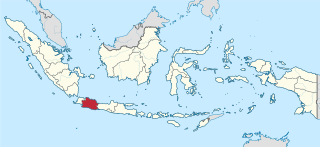
West Java is an Indonesian province on the western part of the island of Java, with its provincial capital in Bandung. West Java is bordered by the province of Banten and the country's capital region of Jakarta to the west, the Java Sea to the north, the province of Central Java to the east and the Indian Ocean to the south. With Banten, this province is the native homeland of the Sundanese people, the second-largest ethnic group in Indonesia.

<span class="mw-page-title-main">East Java</span> Province of Indonesia in eastern Java

East Java is a province of Indonesia located in the easternmost third of Java island. It has a land border only with the province of Central Java to the west; the Java Sea and the Indian Ocean border its northern and southern coasts, respectively, while the narrow Bali Strait to the east separates Java from Bali by around 2.29 kilometres (1.42 mi). Located in eastern Java, the province also includes the island of Madura, as well as the Kangean islands and other smaller island groups located further east and the Masalembu archipelago to the north. Its capital is Surabaya, the second largest city in Indonesia, a major industrial center and also a major business center. Banyuwangi is the largest regency in East Java and the largest on the island of Java.

<span class="mw-page-title-main">Central Java</span> Province of Indonesia

Central Java is a province of Indonesia, located in the middle of the island of Java. Its administrative capital is Semarang. It is bordered by West Java in the west, the Indian Ocean and the Special Region of Yogyakarta in the south, East Java in the east, and the Java Sea in the north. It has a total area of 33,750.37 km2, with a population of 36,516,035 at the 2020 Census making it the third-most populous province in both Java and Indonesia after West Java and East Java. The official population estimate in mid-2023 was 37,608,336 The province also includes a number of offshore islands, including the island of Nusakambangan in the south, and the Karimun Jawa Islands in the Java Sea.

<span class="mw-page-title-main">West Kalimantan</span> Province of Indonesia

West Kalimantan is a province of Indonesia. It is one of five Indonesian provinces comprising Kalimantan, the Indonesian part of the island of Borneo. Its capital and largest city is Pontianak. It is bordered by East Kalimantan and Central Kalimantan to the east, the Malaysian state of Sarawak to the north, and the Bangka Belitung Islands to the west and the Java Sea to the south. The province has an area of 147,037 km2, and had a population of 4,395,983 at the 2010 Census and 5,414,390 at the 2020 Census; the official estimate as at mid 2023 was 5,623,328, and was projected to rise to 5,695,500 at mid 2024. Ethnic groups include the Dayak, Malay, Chinese, Javanese, Bugis, and Madurese. The borders of West Kalimantan roughly trace the mountain ranges surrounding the vast watershed of the Kapuas River, which drains most of the province. The province shares land borders with Central Kalimantan to the southeast, East Kalimantan to the east, and the Malaysian territory of Sarawak to the north.

<span class="mw-page-title-main">Banyuwangi Regency</span> Regency of Indonesia

Banyuwangi Regency is a regency of East Java province in Indonesia. This regency also known as the sun rise of Java because it is located at the easternmost end of Java Island. The town of Banyuwangi serves as a port for ferry services between Java and Bali. The regency is surrounded by mountains and forests to the west; by sea to the east and south - is separated by the Strait of Bali from Bali. With an area of 5,782.5 km2, this regency is by far the largest on the island of Java. The regency is a tourist destination, and subject to ongoing development as an international tourist destination with relevant infrastructure. Banyuwangi regency has been declared a taman bumi, or national geological park (Geopark) in 2018.

<span class="mw-page-title-main">Cirebon</span> City in Java, Indonesia

Cirebon is a port city on the northern coast of the Indonesian island of Java. It is the only coastal city of West Java, located about 40 km west of the provincial border with Central Java, approximately 297 km (185 mi) east of Jakarta, at 6°43′S108°34′E. It had a population of 296,389 at the 2010 census and 333,303 at the 2020 census; the official estimate as at mid 2023 was 341,980.

<span class="mw-page-title-main">Semarang</span> Capital of Central Java, Indonesia

Semarang is the capital and largest city of Central Java province in Indonesia. It was a major port during the Dutch colonial era, and is still an important regional center and port today. The city has been named as the cleanest tourist destination in Southeast Asia by the ASEAN Clean Tourist City Standard (ACTCS) for 2020–2022.

<span class="mw-page-title-main">Bojonegoro Regency</span> Regency of Indonesia

Bojonegoro Regency is a regency in East Java Province of Indonesia, about 110 km west of Surabaya and 73 km northeast of Ngawi. It covers a land area of 2,307.06 km2 and is located in the inland part of the northern Java plain, mainly on the south bank of the Solo River, the longest river in Java. It had a population of 1,209,973 at the 2010 Census and 1,301,635 at the 2020 Census; the official estimate as at mid-2023 was 1,363,058. The administrative centre of the regency is the town of Bojonegoro.

<span class="mw-page-title-main">Solo River</span> Longest river in Java

The Solo River is the longest river in the Indonesian island of Java. It is approximately 600 km (370 mi) in length.

<span class="mw-page-title-main">Madiun</span> City in Java, Indonesia

Madiun is a city in the western part of East Java, Indonesia, known for its agricultural center. The city has been administratively separate from the surrounding Madiun Regency since the formation of the two bodies in 1950, but the city remained the seat of the regency administration until 2010. Madiun is commonly known as "Kota Gadis", which is an acronym for "Trading, Education and Industrial City" in Indonesian and sometimes known as Milaan van Java in Dutch language.

<span class="mw-page-title-main">Mojokerto</span> City in Java, Indonesia

Mojokerto is a city in East Java Province of Indonesia. It is located 40 km southwest of Surabaya, the provincial capital, and constitutes one of the component units of the Surabaya metropolitan area which comprises Gresik Regency, Bangkalan Regency, Mojokerto Regency, Mojokerto City, Surabaya City, Sidoarjo Regency, and Lamongan Regency. The city covers an area of 20.21 km2, and had a population of 120,196 at the 2010 census and 132,434 at the 2020 Census; the official estimate as of mid-2023 was 141,785.

<span class="mw-page-title-main">Yogyakarta</span> Capital of the Special Region of Yogyakarta, Indonesia

Yogyakarta is the capital city of the Special Region of Yogyakarta in Indonesia, in the south-central part of the island of Java. As the only Indonesian royal city still ruled by a monarchy, Yogyakarta is regarded as an important centre for classical Javanese fine arts and culture such as ballet, batik textiles, drama, literature, music, poetry, silversmithing, visual arts, and wayang puppetry. Renowned as a centre of Indonesian education, Yogyakarta is home to a large student population and dozens of schools and universities, including Gadjah Mada University, the country's largest institute of higher education and one of its most prestigious.

<span class="mw-page-title-main">Ponorogo Regency</span> Regency of Indonesia

Ponorogo Regency is an inland regency of East Java Province of Indonesia. It is considered the birthplace of Reog Ponorogo, a traditional Indonesian dance form. The regency covers an area of 1,371.78 km2 (529.65 sq mi), and it had a population of 855,281 at the 2010 census and 949,318 at the 2020 census; the official estimate as of mid-2023 was 959,500. The capital of the kabupaten is the local town of Ponorogo located around 30 km (19 mi) south of the main East Java city of Madiun and 65 km (40 mi) south of the town of Ngawi.

<span class="mw-page-title-main">Cirebon Regency</span> Regency in West Java, Indonesia

Cirebon Regency is a regency (kabupaten) of West Java Province of Indonesia. The town of Sumber is its regency seat. It covers 1,076.76 km2 and had a population of 2,068,116 at the 2010 census and 2,270,621 at the 2020 census; the official estimate as at mid 2023 was 2,360,441. These area and population figures exclude those of Cirebon City, which is an independent administration, although totally surrounded by the regency on its landward side.

<span class="mw-page-title-main">Ngawi Regency</span> Regency of Indonesia

Ngawi Regency is an inland regency (kabupaten) of Indonesia, on the island of Java. Ngawi is well known around the world for its Pithecanthropus erectus which was found by Eugene Dubois, a Dutchman. Ngawi is located in East Java Province but adjoins Central Java province. Its capital is Ngawi. Ngawi is also the main gate to enter East Java province since there are intersections that connect Surabaya–Bojonegoro–Ngawi–Solo–Jogja–Bandung–Jakarta. The Regency covers an area of 1,394.74 km2 (538.51 sq mi), and had a population of 817,765 at the 2010 census and 870,057 at the 2020 census; the official estimate as of mid-2023 was 904,094.

<span class="mw-page-title-main">Grobogan Regency</span> Regency of Indonesia

Grobogan Regency is a regency located in northeastern part of the Central Java province in Indonesia. Created on 4 March 1726, the Grobogan Regency has an area of 2,023.84 km2, and is the second largest regency in the Central Java Province. It had a population of 1,308,696 at the 2010 census and 1,453,526 at the 2020 census; the official estimate as at mid 2023 was 1,514,301. Its capital is the town of Purwodadi.

<span class="mw-page-title-main">Madiun Regency</span> Regency of Indonesia

Madiun Regency is a landlocked Regency in East Java province, Indonesia. It covers an area of 1,010.86 km2, and had a population of 662,278 at the 2010 Census and 744,350 at the 2020 Census; the official estimate as of mid-2023 was 747,589. It is bordered by Bojonegoro Regency in the north, Nganjuk Regency in the east, Ponorogo Regency in the south, and Magetan Regency and Ngawi Regency in the west, while the independent city of Madiun is an enclave within the regency.

<span class="mw-page-title-main">Solo–Kertosono Toll Road</span> Toll Road in Indonesia

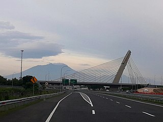
Solo–Kertosono Toll Road is part of Trans-Java toll road in the island of Java, Indonesia. The toll road connects to Semarang–Solo Toll Road in the west, and in the east it connects to Kertosono–Mojokerto Toll Road. This toll road has a total length of 177.12 km comprise two segments, segment Solo–Ngawi and segment Ngawi–Kertosono. The road passes through eight regions: Boyolali Regency, Karanganyar Regency, Solo City, Sragen Regency in Central Java Province, and Ngawi, Madiun, Nganjuk and Jombang Regency in East Java Province. When commencing operation, Solo–Kertosono Toll Road, known as Soker Toll Road. The toll road is the longest toll road in Indonesia.

<span class="mw-page-title-main">Fort van den Bosch</span> Fort in Ngawi, Indonesia

Fort van den Bosch, locally known as Benteng Pendem, is a fort located in Pelem administrative village, Ngawi (town), Ngawi, Indonesia.

The Madiun River is a river in East Java, Indonesia, about 500 km to the east of the capital Jakarta. It is the largest tributary of the Solo River. Its name indicates that it passes through the major city of Madiun, East Java, Indonesia. This river starts as several smaller tributaries converging near the city of Ponorogo, in particular the Kali Slahung, Kali Keyang, and Kali Sungkur. It eventually converges with the Solo River near the city of Ngawi.

References

Citations

  1. 1 2 Badan Pusat Statistik, Jakarta, 28 February 2024, Kabupaten Ngawi Dalam Angka 2024 (Katalog-BPS 1102001.3521)
  2. 1 2 Taufiq, Muhammad. "Mengenal 6 Suku yang Mendiami Provinsi Jawa Timur". Suara.com (in Indonesian). Retrieved 27 August 2021.
  3. 1 2 "Visualisasi Data Kependudukan - Kementerian Dalam Negeri 2021" (Visual). www.dukcapil.kemendagri.go.id. Retrieved 2021-08-27.
  4. Ngawi Development Planning Agency at Sub-National Level and BPS Ngawi Ngawi Sub-district year 2022
  5. A Brief Review of the City of Ngawi Sub-district - Ngawi Subdistrict Government Database
  6. 1 2 3 4 5 6 7 8 9 "Kecamatan Ngawi Dalam Angka Tahun 2023".
  7. 1 2 3 "Sejarah Ngawi" . Retrieved 2014-05-04.
  8. 1 2 3 "Profil Kabupaten Ngawi (Sejarah)". Archived from the original on 2014-05-04. Retrieved 4 May 2014.
  9. 1 2 "Sejarah Ngawi (Asal-Usul kota Ngawi)" . Retrieved 5 May 2014.
  10. 1 2 3 4 UI, KAMA FIB (2022-05-24). "Menelusuri Markas Belanda di Ngawi: Benteng Van Den Bosch". KAMA FIB UI. Retrieved 2023-12-05.
  11. "ArcGIS Web Application". gis.dukcapil.kemendagri.go.id. Retrieved 2022-10-25.
  12. "Data Dusun, RW dan RT di Kecamatan Ngawi".
  13. 1 2 BMKG. "Prakiraan Cuaca Kecamatan Ngawi (Kabupaten Ngawi) | BMKG". BMKG | Badan Meteorologi, Klimatologi, dan Geofisika. Retrieved 2022-11-29.
  14. "Kode pos wilayah Kecamatan Ngawi kota".
  15. "Visualisasi Data Kependudukan - Kementerian Dalam Negeri 2021" (Visual). www.dukcapil.kemendagri.go.id. Retrieved 2021-08-27.
  16. 1 2 Religion in Ngawi District - Ministry of Home Affairs Population Data for 2022
  17. 1 2 3 4 5 Budi, Arifina (27 December 2016). "Ini Keunikan yang Hanya Dimiliki Masyarakat Ngawi". Good News From Indonesia (in Indonesian). Retrieved 28 January 2020.
  18. 1 2 3 Badan Pusat Statistik Jakarta 2022
  19. 1 2 3 4 5 bidik (2019-12-11). "Asal Usul Tari Orek-Orek dan Sejarahnya" (in Indonesian). Retrieved 2023-01-13.
  20. 1 2 3 4 5 6 bidik (2020-09-10). "Mengenal Tari Orek-orek, Tarian dari Ngawi". Genpi (in Indonesian). Retrieved 2023-03-23.
  21. 1 2 3 4 5 bidik (2021-12-11). "Tarian Khas Ngawi" (in Indonesian). Retrieved 2023-03-23.
  22. 1 2 "Jalan Nasional di Ngawi" . Retrieved 2023-03-09.
  23. "Proyek Pembangunan Ring Road utara Ngawi Berpeluang datangkan Investor baru" . Retrieved 2023-03-09.
  24. "Perdagangan Jasa Pendidikan Kesehatan Peribadatan Perkantoran. rawat inap dokter jaga, bidan. Rawat Inap dokter jaga, bidan - PDF Free Download". adoc.pub. Retrieved 2023-03-09.
  25. "Jalan Tol Solo-Ngawi, Ngawi-Kertosono" . Retrieved 2023-03-09.
  26. "BPS Kabupaten Ngawi". ngawikab.bps.go.id. Retrieved 2022-12-07.
  27. Jalil, Abdul (2022-04-01). "Mengenal Terminal Kertonegoro Ngawi, Tempat yang Ada di Lagu Didi Kempot". Solopos.com (in Indonesian). Retrieved 2022-12-01.
  28. "Jelang Tahun Baru, Bus di Terminal Kertonegoro Ngawi Meningkat". Jatim Times (in Indonesian). Retrieved 2022-12-04.
  29. "koningawi.or.id – Website Resmi KONI Kabupaten Ngawi" . Retrieved 2023-01-10.
  30. "Puskesmas Ngawi – Dinas Kesehatan Kabupaten Ngawi" (in Indonesian). Retrieved 2022-11-30.
  31. "Profil Puskemas – Dinas Kesehatan Kabupaten Ngawi" (in Indonesian). Retrieved 2022-11-30.
  32. 1 2 3 4 "Data Sekolah - Pauddikdasmen". dapo.kemdikbud.go.id. Retrieved 2022-10-30.
  33. "MI di Kec. Ngawi - Data Sekolah". data.sekolah-kita.net. Retrieved 2022-11-29.
  34. "MTs di Kec. Ngawi - Data Sekolah". data.sekolah-kita.net. Retrieved 2022-11-29.
  35. "MA di Kec. Ngawi - Data Sekolah". data.sekolah-kita.net. Retrieved 2022-11-29.
  36. Media, Kompas Cyber (2021-12-17). "Diresmikan Jokowi, Begini Wajah Baru Pasar Besar Ngawi di Jawa Timur". KOMPAS.com (in Indonesian). Retrieved 2022-11-30.
  37. "BPS Kabupaten Ngawi". ngawikab.bps.go.id. Retrieved 2022-11-26.
  38. "Jokowi Telepon Menteri PUPR Minta Benteng Van Den Bosch Dipercantik". suara.com (in Indonesian). 2019-02-01. Retrieved 2022-12-04.
  39. "Wisata di Ngawi". Archived from the original on 2014-05-05. Retrieved 2014-05-05.
  40. "Search in this website - East Indies camp archives". www.indischekamparchieven.nl. Retrieved 2022-11-25.
  41. Media, Kompas Cyber (2022-07-30). "Sejarah Benteng Pendem Ngawi, Bukti Keinginan Belanda Kuasai Indonesia secara Utuh". KOMPAS.com (in Indonesian). Retrieved 2022-11-30.
  42. Media, Kompas Cyber (2021-08-30). "Benteng Van den Bosch: Sejarah, Fungsi, dan Kompleks Bangunan". KOMPAS.com (in Indonesian). Retrieved 2022-12-03.
  43. "Ngawioboro Menjadi Wahana Wisata Baru di Ngawi, Masyarakat Sebut Mirip Malioboro Jogja" (in Indonesian). Retrieved 2022-11-30.
  44. "Trotoar Kartonyono Ngawi, Jalur Pedestrian yang Asyik Buat Nongkrong dan Selfie". Indonesia Times (in Indonesian). Retrieved 2023-01-10.
  45. VIVA, PT VIVA MEDIA BARU- (2018-03-02). "Taman Candi Ngawi, Tempat Rekreasi Terbaru di Jawa Timur". www.viva.co.id (in Indonesian). Retrieved 2022-12-01.
  46. "Ratusan Orang Mancing Ngobok di Taman Candi Kalimati Ngawi". beritajatim.com. 2022-04-17. Retrieved 2022-12-01.
  47. "Kisah Dungus Ngawi Simbol Patung Petani dan Kerbau Melambangkan Daerah Sebagai Lumbung Pangan Nasional - Jurnal Ngawi". ngawi.pikiran-rakyat.com. Retrieved 2022-12-01.
  48. Sukri, Zayyim Multazam (2022-01-08). "Kisah Dungus Ngawi Simbol Patung Petani dan Kerbau Melambangkan Daerah Sebagai Lumbung Pangan Nasional - Jurnal Ngawi - Halaman 3". ngawi.pikiran-rakyat.com (in Indonesian). Retrieved 2023-01-14.
  49. admin (2019-01-05). "Dewan Minta Bangunan eks Kepatihan Dilengkapi Gedung Serbaguna". Radar Madiun (in Indonesian). Retrieved 2022-12-01.
  50. 1 2 Agency, ANTARA News. "Pemkab Ngawi Lakukan Restorasi Bangunan Eks-Kepatihan". ANTARA News Jawa Timur. Retrieved 2022-11-30.
  51. "Bukit Kerek Indah". Tribunnewswiki.com (in Indonesian). Retrieved 2022-12-12.
  52. Eko, Hatan (2017-03-27). "Jembatan Selfie Baru di Bukit Kerek Indah Ngawi". Dinas Komunikasi, Informatika, Statistik dan Persandian Kab. Ngawi. Retrieved 2023-01-14.
  53. "alun-alun-ngawi-dalam-goresan". KampoengNgawi. 2016-09-14. Retrieved 2022-12-01.
  54. Times, I. D. N.; Paramita, Dhea Gita Prajna. "5 Rekomendasi Tempat Makan Tepo Tahu di Ngawi". IDN Times (in Indonesian). Retrieved 2022-11-28.
  55. "Tahu Tepo, Wisata Kuliner Khas Ngawi, Salah Satunya Bisa Anda Dapatkan di Lokasi Ini - Koran Memo". www.koranmemo.com. Retrieved 2022-11-28.
  56. "Pecel Letok Pincuk Daun Jati, Kuliner Khas Ngawi Rekomended Dicicipi". Traveling Yuk (in Indonesian). 2018-06-19. Retrieved 2022-12-05.
  57. "Mengenal Nasi Lethok khas Ngawi, Sayur "Tempe Busuk" yang Lezat dan Menggugah Selera". Merdeka.com (in Indonesian). 12 March 2022. Retrieved 2023-03-24.
  58. Alena, Mom (2020-12-28). "Resep Wedang Cemue Minuman Hangat Khas Ngawi". OKEMOM (in Indonesian). Retrieved 2022-11-30.
  59. Media, Kompas Cyber (2020-09-27). "Resep Wedang Ronde, Minuman Jahe Hangat isi Bulatan Kenyal". Kompas.com (in Indonesian). Retrieved 2023-03-24.
  60. "Dawet Kemangi, Semangkuk Kesegaran dari Daerah yang Gersang". Kaskus.com (in Indonesian). Retrieved 2023-03-24.
  61. "Gethuk Lindri, salah satu jajanan khas Ngawi yang populer". Tribun Travel (in Indonesian). Retrieved 2022-12-05.
  62. Kompasiana.com (2021-01-14). "Kripik Tempe, Salah Satu Oleh-Oleh Khas Ngawi yang Jarang Diketahui Banyak Orang". KOMPASIANA (in Indonesian). Retrieved 2022-11-25.
  63. "JELAJAH LEBARAN JAWA-BALI 2019: Menyantap Intip Ketan di Tengah Damainya Malam di Ngawi". Bisnis.com (in Indonesian). 2019-06-01. Retrieved 2022-12-06.

Bibliography