North Point State Battlefield

Last updated
North Point State Battlefield
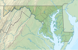
USA Maryland relief location map.svg
Red pog.svg
Location in Maryland
Location Dundalk, Maryland, United States
Coordinates 39°16′44″N76°29′15″W / 39.27889°N 76.48750°W / 39.27889; -76.48750 Coordinates: 39°16′44″N76°29′15″W / 39.27889°N 76.48750°W / 39.27889; -76.48750
Area9 acres (3.6 ha) [1]
Designation Maryland state battlefield
Established2015;7 years ago (2015)
Administrator Maryland Department of Natural Resources
Website North Point State Battlefield

North Point State Battlefield is a publicly owned historic preserve in Dundalk, Baltimore County, Maryland, that commemorates a portion of the site where the Battle of North Point was fought during the War of 1812. [2] On September 12, 1814, Brigadier General John Stricker commanded forces of the Maryland Militia from within the park's borders. Stricker's men fought the invading British forces from behind a fenceline along the monument's eastern edge. [3]

The 9-acre (3.6 ha) site opened to the public in 2015. Park features include wetlands, permeable parking and trail surfaces, boardwalks, and wildflower meadows. It is a satellite facility of North Point State Park, managed by the Maryland Department of Natural Resources. [2]
Related Research Articles

Battle of South Mountain Battle of the American Civil War

The Battle of South Mountain—known in several early Southern accounts as the Battle of Boonsboro Gap—was fought on September 14, 1862, as part of the Maryland campaign of the American Civil War. Three pitched battles were fought for possession of three South Mountain passes: Crampton's, Turner's, and Fox's Gaps. Maj. Gen. George B. McClellan, commanding the Union Army of the Potomac, needed to pass through these gaps in his pursuit of Confederate General Robert E. Lee's precariously divided Army of Northern Virginia. Although the delay bought at South Mountain would allow him to reunite his army and forestall defeat in detail, Lee considered termination of the Maryland Campaign at nightfall.

Calvert Cliffs State Park

Calvert Cliffs State Park is a public recreation area in Lusby, Calvert County, Maryland, that protects a portion of cliffs that extend for 24 miles along the eastern flank of the Calvert Peninsula on the west side of Chesapeake Bay from Chesapeake Beach southward to Drum Point. The state park is known for the abundance of mainly Middle Miocene sub-epoch fossils that can be found on the shoreline.

Point Lookout State Park State park in St. Marys County, Maryland, United States

Point Lookout State Park is a public recreation area and historic preserve occupying Point Lookout, the southernmost tip of a peninsula formed by the confluence of Chesapeake Bay and the Potomac River in St. Mary's County, Maryland. The state park preserves the site of an American Civil War prisoner of war camp and the Point Lookout Light, which was built in 1830. It is the southernmost spot on Maryland's western shore, the coastal region on the western side of the Chesapeake Bay.

Wilsons Creek National Battlefield National battlefield in Missouri, United States

Wilson's Creek National Battlefield, located near Republic, Missouri, preserves the site of the Battle of Wilson's Creek. Fought on August 10, 1861, the battle was the first major American Civil War engagement west of the Mississippi River. In the battle, a Confederate army commanded by Benjamin McCulloch and Sterling Price defeated a smaller Union army commanded by Nathaniel Lyon. However, the Confederates were unable to hold much of Missouri, and a Confederate defeat at the Battle of Pea Ridge effectively solidified Union control of the state. Major features include a five-mile automobile tour loop, the restored 1852 Ray House, and "Bloody Hill", the site of the final stage of the battle. The site is located near Republic in southwestern Missouri just southwest of the city of Springfield. It has been a unit of the National Park Service since 1960, and was listed on the National Register of Historic Places in 1966.

Seneca Creek State Park State park in Montgomery County, Maryland, United States

Seneca Creek State Park is a public recreation area encompassing more than 6,300 acres (2,500 ha) along 14 miles of Seneca Creek in its run to the Potomac River in Montgomery County, Maryland. The park features facilities for boating and fishing as well as trails for hiking, cycling, and horseback riding. It is managed by the Maryland Department of Natural Resources.

Meridian-Baseline State Park State Park in Michigan that is home to the two state Initial Point survey markers.

Meridian-Baseline State Park is a historic preservation area covering 108 acres (44 ha) in Ingham County and Jackson County, Michigan, containing the intersection of the Michigan meridian and the baseline used for the Michigan Survey. The state park has two monuments that show where the two mismatched baselines meet the principal meridian at the North Initial Point and South Initial Point.

Brandywine Battlefield Historic Site is a National Historical Landmark. The historic park is owned and operated by the Pennsylvania Historical and Museum Commission, on 52 acres (210,000 m2), near Chadds Ford, Delaware County, Pennsylvania in the United States. It is part of the site of the Battle of Brandywine fought on September 11, 1777, during the American Revolution. The Battle of Brandywine covered more than ten square miles, or 35,000 acres. However, the modern park only covers 50 acres which served primarily as the Continental encampment the two days prior to the battle. The battle was a decisive victory for the British and cleared a path directly to the rebel capital of Philadelphia. Brandywine Battlefield Park became a Pennsylvania State Park in 1949 and a National Historic Landmark in 1961.

John Stricker United States general (1759–1825)

Brigadier General John Stricker (1758–1825) was a Maryland state militia officer who fought in both the American Revolutionary War in the First Maryland Regiment of the famous "Maryland Line" of the Continental Army and in the War of 1812. He commanded the Third Brigade of the Maryland state militia in the Battle of North Point on Monday, September 12, 1814, which formed a part of the larger Battle of Baltimore, along with the subsequent British naval bombardment of Fort McHenry on September 13-14th, and was a turning point in the later months of the War of 1812 and to the peace negotiators across the Atlantic Ocean for the Treaty of Ghent, in the city of Ghent then in the Austrian Netherlands,, which finally arrived at a peace treaty on Christmas Eve of December 1814, of which news finally reached America in February 1815.

Elk Neck State Park Public recreation area in Maryland, US

Elk Neck State Park is a public recreation area located between Chesapeake Bay and the Elk River near the southern tip of the Elk Neck Peninsula in Cecil County, Maryland. The state park is home to the historic Turkey Point Light and offers land-based and water-based recreation. The park is located on MD 272, eight miles (13 km) south of the town of North East, and 13 miles (21 km) south of exit 100 on I-95. It is operated by the Maryland Department of Natural Resources.

Patapsco Valley State Park State park in Maryland, United States

Patapsco Valley State Park is a public recreation area extending along 32 miles (51 km) of the Patapsco River south and west of the city of Baltimore, Maryland. The state park encompasses multiple developed areas on over 14,000 acres (5,700 ha) of land. In 2006, it was officially celebrated as Maryland's first state park and is managed by the Maryland Department of Natural Resources.

Matapeake State Park State park on Kent Island in Queen Annes County, Maryland

Matapeake State Park is a public recreation area on Chesapeake Bay occupying the site of a former ferry landing in Matapeake, Kent Island, Maryland. The landing served the state-owned Chesapeake Bay Ferry System before the Chesapeake Bay Bridge opened. The park is leased and managed by Queen Anne's County.

Sandy Point State Park State park in Maryland, United States

Sandy Point State Park is a public recreation area on Chesapeake Bay, located at the western end of the Chesapeake Bay Bridge in Anne Arundel County, Maryland. The state park is known for the popularity of its swimming beach, with annual attendance exceeding one million visitors. The park grounds include the Sandy Point Farmhouse, which is listed on the National Register of Historic Places. The historic Sandy Point Shoal Lighthouse stands in about five feet of water some 1,000 yards (910 m) east of the park's beach.

Rocks State Park

Rocks State Park is a public recreation area located in and around Deer Creek Valley near Pylesville, Harford County, Maryland. The state park's 1,060 acres (430 ha) preserve the geologic formation known as the King and Queen's Seat and other features in three non-contiguous areas near the junction of Maryland Route 24 and Maryland Route 165. It is managed by the Maryland Department of Natural Resources.

Bentonville Battlefield United States historic place

Bentonville Battlefield is a North Carolina state historic site at 5466 Harper House Road in Johnston County, North Carolina. It belongs to the North Carolina Department of Natural and Cultural Resources and is the site of the 1865 Battle of Bentonville, fought in the waning days of the American Civil War. It was declared a National Historic Landmark in 1996.

North Point State Park

North Point State Park is a public recreation area located on Chesapeake Bay in Edgemere, Baltimore County, Maryland. The state park includes the site of the former Bay Shore Park, which was one of the state's premiere amusement parks during the first half of the 20th century. The park features restored remnants of the old amusement park as well as facilities for swimming, picnicking, bicycling, and hiking. Black Marsh, a 667-acre (270 ha) state wildlands area, makes up half the park's area. The park is administered by the Maryland Department of Natural Resources.

Hart-Miller Island State Park State park in Baltimore County, Maryland

Hart-Miller Island State Park is a state-owned, public recreation area located on Hart-Miller Island, a man-made landfill linking three natural Chesapeake Bay islands—Hart, Miller, and Pleasure—at the mouth of Back River in Maryland. The state park is accessible only by boat.

Palmer State Park is a public recreation area located along Deer Creek two miles southwest of Dublin in Harford County, Maryland. The state park saw its genesis in 1965, when Gerald and Ruth Palmer donated 463 acres for use as a public park. The park's historic industrial sites include remnants of the Husband Flint Mill and Deer Creek Iron Works. The heavily forested area is open to canoeing, fishing, and hiking.

South Mountain State Park State park in Maryland, United States

South Mountain State Park is a public recreation area that runs for nearly the entire length of South Mountain through Washington and Frederick counties in Maryland. The state park is contiguous with several other national, state and local parks on the mountain, including the Chesapeake and Ohio Canal National Historical Park, Gathland State Park, Washington Monument State Park, Greenbrier State Park and Pen Mar County Park.

References

  1. "DNR Lands Acreage" (PDF). Maryland Department of Natural Resources. Retrieved December 9, 2019.
  2. 1 2 "North Point State Battlefield". Maryland Department of Natural Resources. Retrieved November 1, 2016.
  3. "North Point State Battlefield Park opens to public". Maryland Department of Natural Resources. July 10, 2015. Retrieved November 10, 2016.