
The Shire of Dundas is a local government area in the Goldfields-Esperance region of Western Australia. The shire covers an area of 93,179 square kilometres (35,977 sq mi) and its seat of government is the town of Norseman. Its territory lies between Norseman and the border with South Australia, and is between 700 and 1,500 kilometres east of the state capital, Perth.

The Shire of Dalwallinu is a local government area in the Wheatbelt region of Western Australia, about 250 kilometres (155 mi) NNE of Perth, the state capital. The Shire covers an area of 7,236 square kilometres (2,794 sq mi) and its seat of government is the town of Dalwallinu.
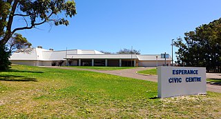
The Shire of Esperance is a local government area in the Goldfields–Esperance region of Western Australia, about 400 kilometres (250 mi) south of the town of Kalgoorlie and about 720 kilometres (450 mi) east-southeast of the state capital, Perth. The Shire covers an area of 42,547 square kilometres (16,427 sq mi), and its seat of government is the town of Esperance, where about three-quarters of the Shire's population resides.

The Shire of Laverton is a local government area in the Goldfields-Esperance region of Western Australia, about 370 kilometres (230 mi) northeast of the city of Kalgoorlie and about 950 kilometres (590 mi) east-northeast of the state capital, Perth. The Shire covers an area of 179,798 square kilometres (69,420 sq mi), and its seat of government is the town of Laverton.
Tarcoola Beach is a southern coastal suburb of Geraldton, Western Australia, which falls under the jurisdiction of the local government area of the City of Greater Geraldton.
Beachlands is an inner western suburb of Geraldton, Western Australia in the local government area of the City of Greater Geraldton.
Beresford is a northern coastal suburb of Geraldton, Western Australia. Its local government area is the City of Greater Geraldton.
Bluff Point is a northern coastal suburb of Geraldton, Western Australia. Its local government area is the City of Greater Geraldton.
Strathalbyn is a northeastern suburb of Geraldton, Western Australia. Its local government area is the City of Greater Geraldton.
Drummond Cove is a coastal town located 12 kilometres (7 mi) north of Geraldton, Western Australia in the local government area of the City of Greater Geraldton. The locality was gazetted in 1985.
Karloo is a locality southeast of Geraldton, Western Australia. Its local government area is the City of Greater Geraldton.
Wandina is an outer southern suburb of Geraldton, Western Australia. Its local government area is the City of Greater Geraldton.
Woorree is an eastern suburb of Geraldton, Western Australia. Its local government area is the City of Greater Geraldton.
Mahomets Flats is an inner southern coastal suburb of Geraldton, Western Australia in the local government area of the City of Greater Geraldton.
Mount Tarcoola is a southern suburb of Geraldton, Western Australia. Its local government area is the City of Greater Geraldton.
Rangeway is an inner eastern suburb of Geraldton, Western Australia. Its local government area is the City of Greater Geraldton.
Sunset Beach is an outer northern coastal suburb of Geraldton, Western Australia. Its local government area is the City of Greater Geraldton.

Castletown is a north-eastern suburb of Esperance, a town in south-eastern Western Australia. Its local government area is the Shire of Esperance.

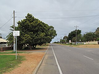
Chadwick is a northern suburb of Esperance, a town in south-eastern Western Australia. Its local government area is the Shire of Esperance. The eastern terminus of the South Coast Highway is located in Chadwick.

West Beach is a suburb of Esperance, a town in south-eastern Western Australia. It is located south of Esperance's central business district, extending southwesterly for several kilometres along the southern coast. Its local government area is the Shire of Esperance.

