Related Research Articles

Bloom Township is one of the thirteen townships of Fairfield County, Ohio, United States. As of the 2010 census the population was 8,466, up from 6,374 at the 2000 census. 7,028 people lived in the unincorporated portions of the township in 2010.

The Great Mound is a massive Native American mound in the southwestern part of the U.S. state of Ohio. Located in Section 19 of Madison Township in Butler County, it has a height of 43 feet (13 m) and a circumference of 511 feet (156 m). Its total volume is nearly 825,000 cubic feet (23,400 m3), making it the largest mound in Butler County and one of the largest in southwestern Ohio. Because of the mound's height and its placement on a ridgeline, an individual at the summit can see for a great distance. In the late nineteenth century, it was theorized that mounds such as the Great Mound were built as observation or watch points, and that the builders maintained the ability to light fires atop the mounds as a method of communicating across wide distances. The potential of these mounds for long-distance communication was demonstrated in 1990 by three groups of volunteers. After climbing the Great Mound, the first group established visual contact with the Hill-Kinder Mound in Franklin, from which point the observers of the second group contacted the third group atop the Miamisburg Mound near Dayton.

This is a list of the National Register of Historic Places listings in Ross County, Ohio.

The Carl Potter Mound is a historic Native American mound in southern Champaign County, Ohio, United States. Located near Mechanicsburg, it lies on a small ridge in a pasture field in southeastern Union Township. In 1974, the mound was listed on the National Register of Historic Places as a potential archaeological site, primarily because of its use as a burial mound.

The Horn Mound is a Native American mound in eastern Pickaway County, Ohio, United States. Located near the village of Tarlton, the mound sits along a stream at a significant distance from any other prehistoric sites. It is believed to have been built by people of the Adena culture, who constructed many burial mounds and other ceremonial earthworks in prehistoric Ohio. Although erosion by the nearby stream has the potential of damaging the mound, it appears to be virtually undisturbed by human exploration. Because of its pristine state, the Horn Mound is a likely archaeological site, and for this reason it was listed on the National Register of Historic Places in 1974.

The Highbank Park Works is a complex of earthworks and a potential archaeological site located within Highbanks Metro Park in Central Ohio in the United States. The park is in southernmost Delaware County on the east bank of the Olentangy River. The site is a semi-elliptical embankment, consisting of four sections, each 3 feet (0.91 m) high, and bordered by a shallow ditch. Two ravines and a 100-foot-high shale bluff surround the earthworks. It is thought to have been constructed sometime between 800 and 1300 CE by members of the Cole culture. The earthworks have seen little disturbance since the first white settlement of the region; agriculture has never been practiced on their vicinity, and no significant excavation has ever been conducted at the site. One small excavation and field survey, conducted in 1951, yielded a few pieces of pottery and flakes of flint from a small midden. Another excavation was conducted in 2011 that focused mainly on site usage and constructing a timeline for the mounds.
The Zaleski Mound Group is a collection of three burial mounds in the village of Zaleski, Ohio, United States. Built by people of the prehistoric Adena culture, these earthworks are valuable archaeological sites.

The Austin Brown Mound, also known as the "Dwight Fullerton Mound," is a subconical Native American mound located northwest of the city of Chillicothe in Ross County, Ohio, United States. In 1897, the Ohio Historical Society sponsored an excavation of the mound under the leadership of Clarence Loveberry, who oversaw the digging of a large tunnel into the mound's side. Loveberry's investigation yielded artifacts of the Adena culture and evidence of rotten logs on the floor of the mound, but in publishing the results of his excavation, he observed that neither a tomb nor any isolated burials were discovered within the mound. Since 1897, other Adena mounds have been excavated and shown to have wooden tombs in off-center locations, presumably to complicate the efforts of those who would loot the mounds; accordingly, it is possible that the Brown mound likewise has an off-center tomb.

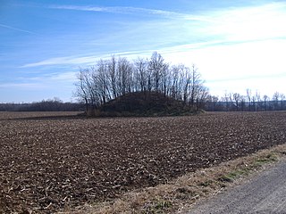
The W.C. Clemmons Mound is a Native American mound in the south central portion of the U.S. state of Ohio. Located near the unincorporated community of Fox, it lies in the middle of a farm field near a creek. A cone measuring approximately 22 feet (6.7 m) high and 144 feet (44 m) in diameter, its shape is almost exactly circular.
The Theodore B. Schaer Mound is a Native American mound in the central part of the U.S. state of Ohio. Located southeast of the city of Canal Winchester in Fairfield County, it is a large mound; its height is 13 feet (4.0 m), and it is 60 feet (18 m) in diameter. Today, the mound sits in woodland, being covered with brush and trees. Since white settlement of the region, the mound has seen few changes: individuals hunting for Indian relics have damaged it slightly, but the most significant effects have been minor natural phenomena such as the diggings of groundhogs.
The Fortner Mounds are a pair of Native American mounds in the central part of the U.S. state of Ohio. Located northeast of the city of Pickerington in Fairfield County, they are two of several mounds in the Pickerington vicinity, but the only pair of mounds in the area. As such, they are of special interest to archaeologists: some of the mound-building peoples of prehistoric North America lived in groups of two or three houses, which were often covered with piles of earth when the families would move to other places. Therefore, it is likely that these mounds cover groups of postholes, and buried bodies may also be located within them. From their shape, it is apparent that the mounds were constructed by people of the Adena culture, who lived in central Ohio between approximately 500 BC and AD 400.

The Coon Hunters Mound is a Native American mound in the central part of the U.S. state of Ohio. Located near the village of Carroll, it sits on the grounds of the Central Ohio Coonhunters Association.

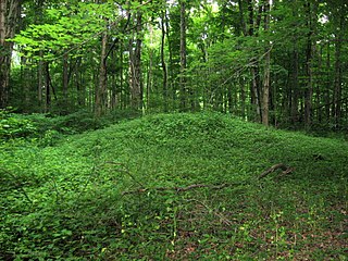
The Hillside Haven Mound is a Native American mound in the southwestern part of the U.S. state of Ohio. Located southwest of Oakland in Clinton County, it sits in dense woodland on the side of a hill. It is believed to have been conical in shape at the time of construction, but today it is rounded in shape, measuring 2.5 feet (0.76 m) high and 33 feet (10 m) in diameter.
The Ety Habitation Site is an archaeological site in the central part of the U.S. state of Ohio. Located northeast of the village of Carroll in Fairfield County, it encompasses an area of about 4 acres (1.6 ha), which is covered by a group of hillocks. Here have been found large numbers of artifacts of prehistoric man; the nature of the material found suggests that the Habitation Site was a substantial settlement for a long period, most likely from the Hopewellian period, two thousand years ago. Few Hopewellian sites have been discovered that both yielded such valuable information and were so little damaged by the passage of time; as a result, the Ety Habitation Site is a leading archaeological site.

The Hodgen's Cemetery Mound is a Native American mound in the far eastern part of the U.S. state of Ohio. Located in the village of Tiltonsville along the Ohio River shoreline of Jefferson County, the mound is a prehistoric earthwork and archaeological site, and it has been named a historic site.

The Orators Mound is a Native American mound in the western part of the U.S. state of Ohio. Although its cultural affiliation is disputed, it is an important archaeological site.
Indian Mound Reserve is a public country park near the village of Cedarville, Ohio, United States. Named for two different earthworks within its bounds — the Williamson Mound and the Pollock Works — the park straddles Massies Creek as it flows through a small canyon.

Cross Mound is an earthwork located near Tarlton, Ohio in the United States. The culture who built it and the time it was built remains unknown. It is listed on the National Register of Historic Places. Contemporary archaeologists have described it as "one of the many enigmatic effigy mounds in Southern Ohio."

The Hartley Mound is a Native American burial mound in Columbus, Ohio. The mound was created around 2,000 years ago by the Pre-Columbian Native American Adena culture. The site was added to the National Register of Historic Places in 1974. The mound measures 2 ft. high and 43 ft. in diameter. The site's location near a tributary to a major waterway, artifacts found nearby, and the small subconical form of the mound, suggests that it was built by the Adena culture. It is one of few mounds not seriously disturbed by agriculture, industry, or illegal excavation. Upon archaeological excavation, the site should provide information on Adena burial customs and domestic or mortuary structures.
References
- 1 2 3 "National Register Information System". National Register of Historic Places . National Park Service. March 13, 2009.
- ↑ Metro Parks Fact Sheets: The Adena Way of Life Archived 2010-09-28 at the Wayback Machine , Metro Parks, 2004. Accessed 2010-10-30.
- ↑ DeLorme. Ohio Atlas & Gazetteer. 7th ed. Yarmouth: DeLorme, 2004, 68. ISBN 0-89933-281-1.
- ↑ Owen, Lorrie K., ed. Dictionary of Ohio Historic Places. Vol. 1. St. Clair Shores: Somerset, 1999, 401.
