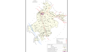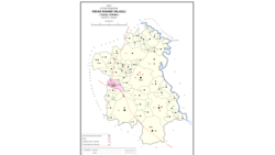
Terha is a village and gram panchayat in Unnao district, Uttar Pradesh, India. Terha holds a market twice per week, on Sundays and Thursdays, and the main items of trade are gur, vegetables, and cloths. As of 2011, the population of Terha is 3,909, in 759 households, and it has one primary school and no healthcare facilities.

Magrayar is a village in Bighapur block of Unnao district, Uttar Pradesh, India. Located 7km from Bighapur, Magrayar hosts a market on Mondays and Thursdays and was historically the seat of a pargana since at least the late 1500s. As of 2011, Magrayar's population is 4,248, in 964 households.

Mirri Kalan is a village in Asoha block of Unnao district, Uttar Pradesh, India. It has nine primary schools and four medical practitioners as well as one veterinary hospital. As of 2011, its population is 5,622, in 1,066 households.

Chaupai is a village in Asoha block of Unnao district, Uttar Pradesh, India. It has one primary school and no healthcare facilities. As of 2011, its population is 2,548, in 554 households.

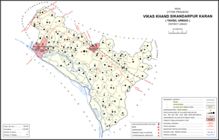
Magarwara is a village in Sikandarpur Karan block of Unnao district, Uttar Pradesh, India. It is located 6 km from the district headquarters, Unnao. It is located on state highways and has one primary school and no healthcare facilities. It has a train station on the Lucknow-Kanpur line, between Kanpur Bridge and Unnao train station; the same stretch of track is also connected with Rae Bareli and Balamau station past Unnao. Magarwara Bone Mill, established in 1927, is one of the major industrial establishments in Unnao district. As of 2011, its population is 6,584, in 1,263 households.

Nari Chak is a village in Hilauli block of Unnao district, Uttar Pradesh, India. As of 2011, its population is 2,129, in 363 households, and it has 3 primary schools and no healthcare facilities.

Maharani Khera is a village in Hilauli block of Unnao district, Uttar Pradesh, India. As of 2011, its population is 2,683, in 502 households, and it has one primary school and no healthcare facilities.

Lotna is a village in Hilauli block of Unnao district, Uttar Pradesh, India. As of 2011, its population is 2,443, in 477 households, and it has 2 primary schools and no healthcare facilities.

Sandana is a village in Hilauli block of Unnao district, Uttar Pradesh, India. As of 2011, its population is 6,082, in 1,184 households, and it has 3 primary schools and no healthcare facilities.

Bardaha is a village in Hilauli block of Unnao district, Uttar Pradesh, India. As of 2011, its population is 2,529, in 469 households, and it has one primary school and no healthcare facilities.

Asrenda is a village in Hilauli block of Unnao district, Uttar Pradesh, India. As of 2011, its population is 4,475, in 782 households, and it has 2 primary schools and no healthcare facilities.

Jera is a village in Hilauli block of Unnao district, Uttar Pradesh, India. As of 2011, its population is 2,826, in 521 households, and it has one primary school and no healthcare facilities.

Deomai is a village in Hilauli block of Unnao district, Uttar Pradesh, India. As of 2011, its population is 3,673, in 743 households, and it has 3 primary schools and 2 medical practitioners. It hosts a weekly haat and has a sub post office.

Sagauli is a village in Hilauli block of Unnao district, Uttar Pradesh, India. As of 2011, its population is 2,048, in 380 households, and it has 3 primary schools and no healthcare facilities.

Subas Khera is a village in Hilauli block of Unnao district, Uttar Pradesh, India. As of 2011, its population is 810, in 168 households, and it has one primary school and no healthcare facilities.

Gulariha is a village in Hilauli block of Unnao district, Uttar Pradesh, India. It is a dispersed settlement with several constituent hamlets, and it is right next to the border with Rae Bareli district. The Bhundi tank is located in the village, and it provides water for irrigation. As of 2011, its population is 12,482, in 2,300 households, and it has 10 primary schools and no healthcare facilities.

Mawai is a village in Hilauli block of Unnao district, Uttar Pradesh, India. As of 2011, its population is 14,690, in 2,734 households, and it has 8 primary schools and one medical clinic. It hosts a regular market and has a post office.

Basdeo Khera is a village in Hilauli block of Unnao district, Uttar Pradesh, India. As of 2011, its population is 103, in 22 households, and it has one primary school and no healthcare facilities.

Lawa Singhan Khera is a large village in Hilauli block of Unnao district, Uttar Pradesh, India. Located on the Sai river, it is a dispersed settlement consisting of several separate hamlets. As of 2011, its population is 9,984, in 1,797 households, and it has 8 primary schools and no medical clinics. It hosts a weekly haat and has a sub post office.

Shukla Khera is a village in Bighapur block of Unnao district, Uttar Pradesh, India. As of 2011, its population is 851, in 203 households, and it has one primary school and no healthcare facilities.


