Paulo Bento, Rio Grande do Sul

Last updated
Municipality of Paulo Bento
Praca das Tradicoes Gauchas em Paulo Bento.jpg
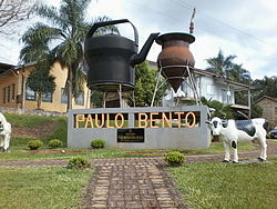
Praça das Tradições Gaúchas (Gauchas Traditions Square)
Paulo Bentorsbrasoes.jpg
RioGrandedoSul Municip PauloBento.svg
Location in Rio Grande do Sul and Brazil
Coordinates: 27°42′52″S52°25′15″W / 27.71444°S 52.42083°W / -27.71444; -52.42083
Country Brazil
Region South
State Rio Grande do Sul
Established14 April
Government
   Mayor Pedro Lorenzi (PV)
Area
[1]
  Total
148.184 km2 (57.214 sq mi)
Elevation
160 m (520 ft)
Population
 (2020 [2] )
  Total
2,299
  Density15.4/km2 (40/sq mi)
Time zone UTC−3 (BRT)
HDI (2010)0.710 – high [3]
Website www.paulobento.rs.gov.br

Paulo Bento is a municipality that is located in the state of Rio Grande do Sul, Brazil.

Contents

History

The name Paulo Bento owes its origin to the Bento and Souza brothers, a family that settled on a tract of land stretching from the Cravo River to the Erechim field around 1890. Later, João Barbosa acquired the land stretching from the Bento family's property to the border with Barão de Cotegipe, where the first German immigrants settled. In 1928, the village was planned by surveyor Oscar César with wide streets, 12 blocks, and 26 farms. [4]

See also

References

  1. IBGE (10 October 2002). "Área territorial oficial". Resolução da Presidência do IBGE de n° 5 (R.PR-5/02). Retrieved 5 December 2010.
  2. IBGE 2020
  3. "Ranking decrescente do IDH-M dos municípios do Brasil". Atlas do Desenvolvimento Humano. Programa das Nações Unidas para o Desenvolvimento (PNUD). 2010. Retrieved 4 September 2013.
  4. IBGE, GOV. "Rio Grande do Sul - RS" (PDF).