Pavonia Terminal

Last updated
Jersey City
PavoniaTerminalErieRRJerseyCity.tiff
General information
Location Harsimus Cove, Jersey City, New Jersey, U.S.
Owned by Erie Railroad
Line(s) Erie Railroad Main Line
New York, Susquehanna and Western Railroad
Bergen County Railroad
New York and Greenwood Lake Railroad
New Jersey and New York Railroad
Weehawken Branch
Newark Branch
Northern Branch
Connections Erie station (Hudson Tubes)
Other information
Station code4971 [1]
History
OpenedMay 1, 1861 [2]
ClosedDecember 12, 1958 [2]
Former services
Preceding station Erie Railroad Following station
Terminus Pavonia Ferry Chambers Street
Terminus
23rd Street
Terminus
Rutherford
toward Chicago
Main LineTerminus
Rutherford
toward Ridgewood
Bergen County Railroad
Arlington New York and Greenwood Lake Railway
Carlstadt
toward Haverstraw
New Jersey and New York Railroad
Susquehanna Transfer
toward Nyack
Northern Branch
Weehawken
Terminus
Weehawken Branch
Harrison
toward Paterson
Newark Branch
Preceding station New York, Susquehanna and Western Railroad Following station
Susquehanna Transfer
toward Stroudsburg
Main LineTerminus
New York City Railroads ca 1900.png
Map of the five train-to-ferry transfer points along the west shore of the Hudson River circa 1900

Pavonia Terminal was the Erie Railroad terminal on the Hudson River located in the Harsimus section of Jersey City, New Jersey. The station opened in 1861 and closed in 1958 when the Erie Railroad moved its passenger services to nearby Hoboken Terminal. The New York, Susquehanna and Western Railway also ran commuter trains from the terminal and various street cars, ferries and the underground Hudson and Manhattan Railroad serviced the station. The station was abandoned in 1958 and demolished in 1961. The site was eventually redeveloped into the Newport district in the late 20th century.

Contents

Pavonia was one of five passenger railroad terminals that lined the western shore of the Hudson Waterfront from the mid-19th to mid-20th centuries, along with those at Weehawken, Hoboken, Exchange Place, and Communipaw, with Hoboken being the only one still in service.

History

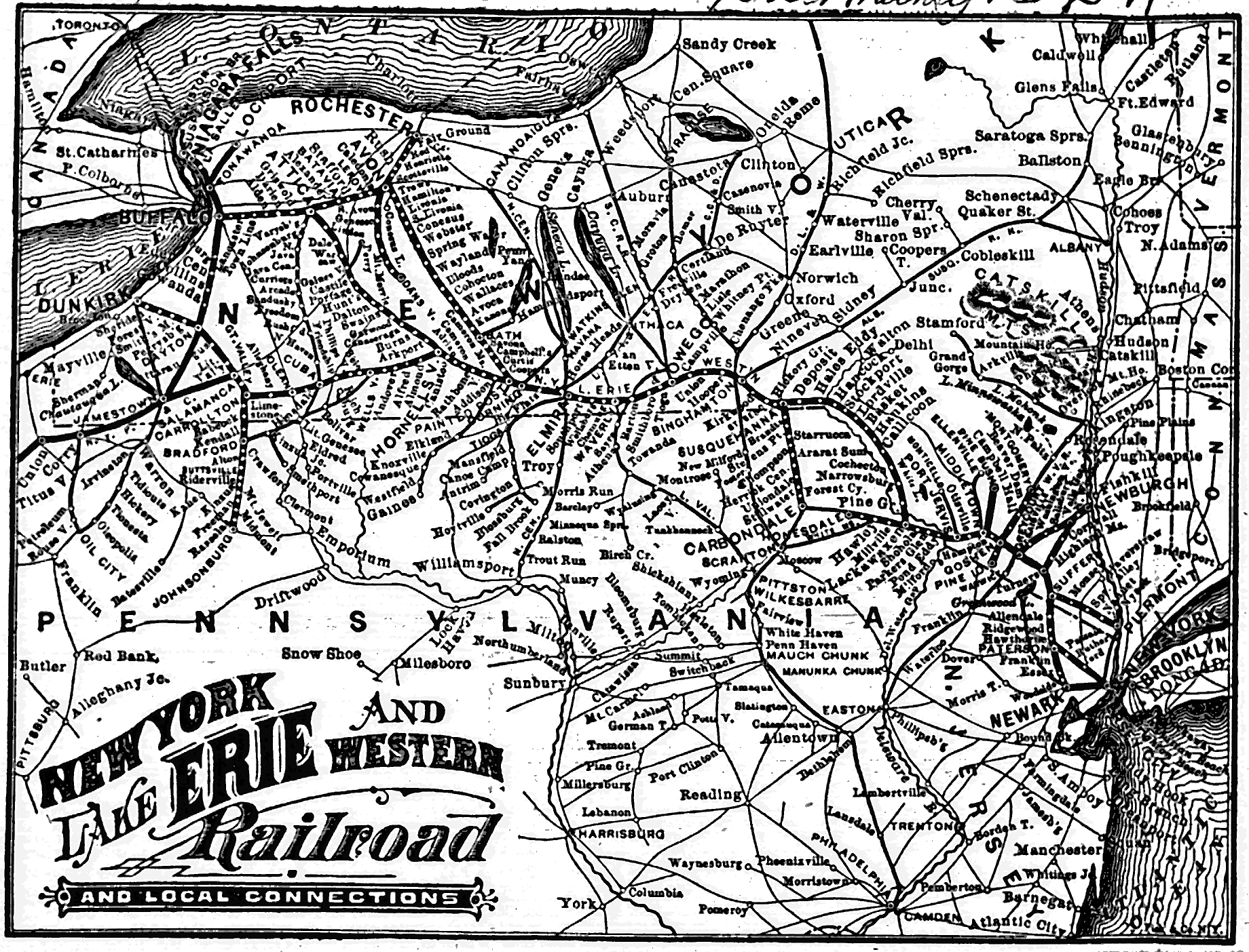
The Erie began developing the waterfront site in 1856. [3] The intermodal complex was open December 4, 1887. [4] Across the river-facing facade was New York, Lake Erie and Western Railroad , the name of the entity that built it, though it was also called Jersey City Terminal Station [5] or Erie Railroad Station The colloquial name is taken from the 17th century European settlement of Pavonia, New Netherland, [6] which began in the area and the ferry that served it. It has been described as "a brightly colored Victorian eclectic three story terminal located at the foot of Pavonia Avenue to serve a twelve track" station. It was designed by George E. Archer. [7] The end of track was at about 40.7266 N 74.0304 W. Besides the railroad, the complex was served by ferries, streetcars and the rapid transit Hudson and Manhattan Railroad (now PATH). The terminal was also used by New York, Susquehanna and Western Railway trains. [8] Long distance and suburban passenger trains reached the terminal by travelling through Bergen Hill via the Long Dock Tunnel and later under the Bergen Arches. [9]

In October 1956 the Erie Railroad began moving its trains out of Pavonia Terminal and into Delaware, Lackawanna and Western Railroad's Hoboken Terminal, and by 1960 had merged to become the Erie Lackawanna Railway. [10] Erie's Northern Branch trains moved to Hoboken in 1959; the New York, Susquehanna and Western operated to the terminal until it pulled back to Susquehanna Transfer in 1961. The terminal was razed by 1961. [11]

Service

Railroads

The few remnants of the Erie's extensive holdings include the embankment from the Palisades to the river, now demolished. 10th St embankment split jeh.jpg
The few remnants of the Erie's extensive holdings include the embankment from the Palisades to the river, now demolished.

The Erie Railroad's Main Line ran from Jersey City to Chicago via Binghamton, Youngstown and Akron; with a line to Buffalo, and a spur to Cleveland. [12] The name and a portion of the route exists in the form of the New Jersey Transit Main Line to Suffern, New York and, under contract for Metro North, all the way to Port Jervis. Parts of the contemporary Bergen County Line and Pascack Valley Line were also Erie operated, while sections of its Greenwood Lake Branch have been incorporated into the Montclair-Boonton Line. The Northern Branch of the Northern Railroad of New Jersey is another line from the Erie era along which freight is transported and that may be revived as light rail service. [13] [14] The last train to leave the station, the #1205 at 6:35 p.m. on Friday, December 12, 1958, was along the Northern Branch. The Newark Branch (with continuing service to Paterson) and the Orange Branch were also parts of its suburban network. The New York, Susquehanna and Western Railway main line ran to Wilkes-Barre, [8] although passenger service was operated that far for only a few years (and that Wilkes Barre and Eastern line was completely abandoned, even for freight service, in 1939), while regular commuter service ran only to Butler, NJ until 1966.

Named trains, many of them long distance, originated at the station. These included Atlantic Express, Erie Limited, Lake Cities, Midlander,Mountain Express, Pacific Express, and Southern Tier Express.

Ferry

An undated photograph of an Erie-owned ferryboat named the "Susquehanna" docked at the Pavonia Ferry Terminal General view of ferryboat - Erie Railway, Ferryboat Susquehanna, Jersey City, Hudson County, NJ HAER NJ,9-JERCI,7-1.tif
An undated photograph of an Erie-owned ferryboat named the "Susquehanna" docked at the Pavonia Ferry Terminal

The Pavonia Ferry began running in 1851, [15] along a route that had been established some decades earlier as Budd's Ferry. It was taken over by the Erie [16] and sold to the Pavonia Ferry Company of Jersey City [17] for what was considered a low price of $9,050, at New York City Hall, in February 1854. [6] [18] In February 1859 Nathaniel Marsh of the Erie Railroad Company purchased the lease on behalf of the Pavonia Ferry Company. He started a ferry which ran from Chambers Street (Manhattan) to the foot Pavonia Avenue on the other side of the Hudson River. Legal problems had prevented the Pavonia Ferry Company from establishing a ferry along this route. The New York and Erie Railroad paid an annual rent of $9,050 to transport passengers back and forth. [19] Eventually the railroad constructed its Pavonia Terminal on the land-filled Harsimus Cove. Suburban and long distance travelers would transfer from trains to boats for the passage across the river.

Its final two routes from the terminal across the Hudson to Lower Manhattan were to Chambers Street Ferry Terminal and 23rd Street.

New York Waterway re-introduced service to Pier 79 at West 39th Street on December 1, 2006. [20] Service officially ended January 2014. [21] Ferry service is being restored in the Summer of 2019. [22]

Streetcar

The letter E on the pillars at the Newport PATH station PavoniaColumn.jpg
The letter E on the pillars at the Newport PATH station

Numerous streetcar lines served the station. [23] Eventually they (and indeed all of Hudson County lines) were operated by the Public Service Railway. The Grove Street, which operated between Exchange Place and Hudson Place (Hoboken), passed nearby. The Pavonia and the Crosstown originated at the station. The Hudson Bergen Light Rail Pavonia/Newport Station opened in 2002, and is located one and half blocks west of the PATH system.

H & M tube station

Originally named "Erie", the PATH's Newport station, originally built by the Hudson and Manhattan Railroad (H&M), still bears the letter "E" engraved on its pillars. Opened on August 2, 1909, [24] the station was built with only the island platform. The side platform was added around 1914 to handle the heavier passenger volume. It was closed in 1954 in order for the bankrupt railroad to reduce costs. The side platform remained dormant for nearly 50 years. [25] The northernmost stairway exit from the two platforms led to a steep passageway, which originally went directly to the Erie Railroad terminal. In the 1920s, a second passageway and mezzanine area was built over the existing platforms and northbound trackway. This second passageway and mezzanine area were also closed in 1954 (as was also the entrance to/from Henderson Street), but was reopened in the late 1980s/early 1990s after the station was renovated. Also in 1954, the first moving sidewalk, or travellator, in the United States was installed. Named the "Speedwalk" and built by Goodyear, it was 277 feet (84 m) long and moved up a 10-percent grade at a speed of 1.5 miles per hour (2.4 km/h). [26] The walkway was removed a few years later when traffic patterns at the station changed.

Site

Site of former terminal across the Long Slip. The ventilation tower is part of Holland Tunnel, which contributed to the demise of terminals along the west bank of the North River. PavinoaNerport0016.jpg
Site of former terminal across the Long Slip. The ventilation tower is part of Holland Tunnel, which contributed to the demise of terminals along the west bank of the North River.

The complex was built on the northern portion of landfilled Harsimus Cove. The southern part was the Pennsylvania Railroad abattoir and freight yard. A narrow slip kept that name, while another called the Long Slip was created and separated it from Hoboken Terminal. The only visible trace of the Erie's waterfront complex that remains today is part of the right of way/viaduct which carried trains from the foot of the Palisades escarpment to the waterfront. Part of it runs parallel to Boyle Plaza (the toll plaza for the Holland Tunnel) and is used for motor vehicular traffic to the Newport district of Jersey City. [27]

See also

Related Research Articles

<span class="mw-page-title-main">North River (Hudson River)</span> Section of the Hudson River between New York City and New Jersey

North River is an alternative name for the southernmost portion of the Hudson River in the vicinity of New York City and northeastern New Jersey in the United States.

<span class="mw-page-title-main">Hoboken Terminal</span> Commuter station in Hoboken, New Jersey

Hoboken Terminal is a commuter-oriented intermodal passenger station in Hoboken, Hudson County, New Jersey. One of the New York metropolitan area's major transportation hubs, it is served by eight NJ Transit (NJT) commuter rail lines, an NJ Transit event shuttle to Meadowlands Sports Complex, one Metro-North Railroad line, various NJT buses and private bus lines, the Hudson–Bergen Light Rail, the Port Authority Trans Hudson (PATH) rapid transit system, and NY Waterway-operated ferries.

<span class="mw-page-title-main">Marion Junction (New Jersey)</span>

Marion Junction is a railroad junction in western Jersey City, New Jersey. Currently, it connects CSX's River Line to Conrail's Passaic and Harsimus Line. The two lines merge towards the west, allowing through trains from upstate New York to continue towards the rest of the country. The track actually making the connection is known as the Marion Running Track.

<span class="mw-page-title-main">Susquehanna Transfer</span>

Susquehanna Transfer was a passenger station on the New York, Susquehanna and Western Railway, located in North Bergen, New Jersey located at what today is the Route 495 overpass. It was an interchange station where transfer was possible from the railroad to a bus through the Lincoln Tunnel to the Port Authority Bus Terminal in Midtown Manhattan.

<span class="mw-page-title-main">Timeline of Jersey City, New Jersey-area railroads</span>

For the purposes of this article, the Jersey City area extends North to Edgewater, South to Bayonne and includes Kearny Junction and Harrison but not Newark. Many routes east of Newark are listed here.

<span class="mw-page-title-main">Northern Branch</span>

The Northern Branch is a railroad line that runs from Jersey City to Northvale in northeastern New Jersey, and formerly extended further into New York State. The line was constructed in 1859 by the Northern Railroad of New Jersey to connect the New York and Erie Railroad's Piermont Branch terminus in Piermont, New York, directly to Erie's primary terminal in Jersey City, initially Exchange Place, later Pavonia Terminal. In 1870 the line was extended to Nyack, New York, and continued to provide passenger service until 1966. After the Erie's unsuccessful merger with the Lackawanna Railroad to form the Erie-Lackawanna, ownership of the line passed into the hands of Conrail upon its formation in 1976 from a number of bankrupt railroads.

<span class="mw-page-title-main">New Jersey Midland Railway</span> 19th-century American railroad

The New Jersey Midland Railway was a 19th-century predecessor to the New York, Susquehanna and Western Railway (NYS&W) that operated in Northern New Jersey and Orange County, New York.

<span class="mw-page-title-main">Newport station (PATH)</span> Port Authority Trans-Hudson rail station

The Newport station is a station on the PATH system. Located on Town Square Place at the corner of Washington Boulevard in the Newport neighborhood of Jersey City, New Jersey, it is served by the Hoboken–World Trade Center and Journal Square–33rd Street lines on weekdays, and by the Journal Square–33rd Street line on weekends. As of 2017, its estimated weekday use was nearly 20,000 passengers, up from 17,000 to 18,000 average weekday passengers in 2010.

<span class="mw-page-title-main">Exchange Place station (Pennsylvania Railroad)</span> Former intermodal terminal in Jersey City (closed 1961)

The Pennsylvania Railroad Station was the intermodal passenger terminal for the Pennsylvania Railroad's (PRR) vast holdings on the Hudson River and Upper New York Bay in Jersey City, New Jersey. By the 1920s the station was called Exchange Place. The rail terminal and its ferry slips were the main New York City station for the railroad until the opening in 1910 of New York Pennsylvania Station, made possible by the construction of the North River Tunnels. It was one of the busiest stations in the world for much of the 19th century.

<span class="mw-page-title-main">Newport station (Hudson–Bergen Light Rail)</span> Light rail station in Jersey City, New Jersey

Newport station is a station of the Hudson–Bergen Light Rail in Jersey City, New Jersey. Located on Mall Drive East near the Newport Centre shopping mall, the station services trains operating between Hoboken Terminal and Tonnelle Avenue station in North Bergen to West Side Avenue in Jersey City and 8th Street station in Bayonne. The station is also a stop on the Bayonne Flyer, an express service on the light rail. Newport station also serves as a transfer to the PATH line between Newark Penn Station, Hoboken Terminal and the 33rd Street and World Trade Center stations in New York City at its Newport station. The station consists of a single island platform to service two tracks. As of 2014, it is the busiest station on the HBLR system.

<span class="mw-page-title-main">Central Railroad of New Jersey Terminal</span> Former intermodal terminal in Jersey City, New Jersey

The Central Railroad of New Jersey Terminal, also known as Communipaw Terminal and Jersey City Terminal, was the Central Railroad of New Jersey's waterfront passenger terminal in Jersey City, New Jersey. The terminal was built in 1889, replacing an earlier one that had been in use since 1864. It operated until April 30, 1967.

<span class="mw-page-title-main">Bergen Hill</span> Lower part of the Hudson Palisades, New Jersey, United States

Bergen Hill refers to the lower Hudson Palisades in New Jersey, where they emerge on Bergen Neck, which in turn is the peninsula between the Hackensack and Hudson Rivers, and their bays. In Hudson County, it reaches a height of 260 feet.

<span class="mw-page-title-main">Hudson River Waterfront Walkway</span> Park in the United States of America

The Hudson River Waterfront Walkway, also known as the Hudson River Walkway, is a promenade along the Hudson Waterfront in New Jersey. The ongoing and incomplete project located on Kill van Kull and the western shore of Upper New York Bay and the Hudson River was implemented as part of a New Jersey state-mandated master plan to connect the municipalities from the Bayonne Bridge to the George Washington Bridge with an urban linear park and provide contiguous unhindered access to the water's edge.

<span class="mw-page-title-main">Weehawken Terminal</span> Former intermodal terminal in Weehawken, New Jersey

Weehawken Terminal was the waterfront intermodal terminal on the North River in Weehawken, New Jersey for the New York Central Railroad's West Shore Railroad division, whose route traveled along the west shore of the Hudson River. It opened in 1884 and closed in 1959. The complex contained five ferry slips, sixteen passenger train tracks, car float facilities, and extensive yards. The facility was also used by the New York, Ontario and Western Railway. The terminal was one of five passenger railroad terminals that lined the Hudson Waterfront during the 19th and 20th centuries; the others were located at Hoboken, Pavonia, Exchange Place and Communipaw, with Hoboken being the only one still in use.

<span class="mw-page-title-main">Pavonia Ferry</span>

The Pavonia Ferry was a ferry service on the Hudson River, operating between New York City and Jersey City, New Jersey, United States. It was launched in 1854. It was sold to the Pavonia Ferry Company of Jersey City for $9,050 at New York City Hall in February 1854.

<span class="mw-page-title-main">Harsimus</span> Populated place in Hudson County, New Jersey, US

Harsimus is a neighborhood within Downtown Jersey City, Hudson County, in the U.S. state of New Jersey. The neighborhood stretches from the Harsimus Stem Embankment on the north to Christopher Columbus Drive on the south between Coles Street and Grove Street or more broadly, to Marin Boulevard. It borders the neighborhoods of Hamilton Park to the north, Van Vorst Park to the south, the Village to the west, and the Powerhouse Arts District to the east. Newark Avenue has traditionally been its main street. The name is from the Lenape, used by the Hackensack Indians who inhabited the region and could be translated as Crow's Marsh. From many years, the neighborhood was part of the "Horseshoe", a political delineation created by its position between the converging rail lines and political gerrymandering.

<span class="mw-page-title-main">Ridgefield Park station</span> Railroad station in New Jersey, U.S.

Ridgefield Park station, also known as West Shore Station, was a railroad station in Ridgefield Park, New Jersey, at the foot of Mount Vernon Street served by the New York, Susquehanna and Western Railroad (NYSW) and the West Shore Railroad, a division of New York Central (NYCRR). The New York, Ontario and Western Railway (NYO&W) had running rights along the West Shore and sometimes stopped at Ridgefield Park. First opened in 1872 it was one of three passenger stations in the village, the others being the Little Ferry station to the south and Westview station to the north. Service on the West Shore Railroad began in 1883. The station house, built at a cost $100,000 opened in 1927. Southbound service crossed Overpeck Creek and continued to terminals on the Hudson River waterfront where there was connecting ferry service across the Hudson River to Manhattan. Northbound near Bogota the parallel NYSW and West Shore lines diverge and continue into northern New Jersey, Pennsylvania, and upstate New York. Passenger service ended in 1966.

<span class="mw-page-title-main">Hackensack station (New York, Susquehanna and Western Railroad)</span>

Hackensack was a railroad station in Hackensack, New Jersey on the New York, Susquehanna and Western Railway Main Line, which provided passenger service between the 1870s and 1960s. The station at Main and Mercer Streets opened in 1872; it was replaced with one at River Street in 1950. Public Service trolley lines served both stations.

<span class="mw-page-title-main">Bogota station</span>

Bogota was a railroad station in Bogota, New Jersey, at Court Street/Fort Lee Road west of River Road and east of the Court Street Bridge over the Hackensack River. It was located on the New York, Susquehanna and Western Railway Main Line, which provided passenger service between the 1870s and 1960s.

<span class="mw-page-title-main">North Bergen station</span>

North Bergen was a railroad station in North Bergen, New Jersey, United States known Homestead for most of its existence. It as built in the mid 19th century and served by the New York, Susquehanna and Western Railway (#1059) and the Erie Railroad's Northern Branch (#1903).

References

  1. "List of Station Names and Numbers". Jersey City, New Jersey: Erie Railroad. May 1, 1916. Archived from the original on March 8, 2012. Retrieved November 23, 2010.
  2. 1 2 "Final Trip Slated for Erie Ferryboat". The Bergen Evening Record . Hackensack, New Jersey. December 12, 1958. p. 1. Archived from the original on October 26, 2020. Retrieved October 23, 2020 via Newspapers.com. Open Access logo PLoS transparent.svg
  3. "NEW-JERSEY.; Erie Railroad Improvements. Another Victim. Pickpockets on the Ferry-boats. Military. The Kentucky Legislature on Federal Relations--Resolutions on the Missouri Compromise, Fugitive Slave Law, &c" (PDF). The New York Times. 1856. Archived (PDF) from the original on July 20, 2021. Retrieved January 31, 2011.
  4. "A HANDSOME BUILDING.; THE ERIE RAILWAY'S NEW STATION AT JERSEY CITY" (PDF). The New York Times. December 4, 1887. Archived (PDF) from the original on July 20, 2021. Retrieved February 15, 2018.
  5. "Jersey City Terminal Station". Archived from the original on 2010-06-26. Retrieved 2009-11-14.
  6. 1 2 "Erie Railroad Terminal". New Jersey City University. Archived from the original on February 4, 2012. Retrieved May 30, 2010.
  7. "Jersey Central Railroad Jersey City Ferry Terminal Johnson Ave. at Hudson River Jersey City Hudson County New Jersey (HAER No. NJ-27)" (PDF). Historical American Engineering Record. p. 16. Archived from the original (PDF) on January 6, 2014. Retrieved May 5, 2013.
  8. 1 2 NYSW Stations [ permanent dead link ]
  9. "The Bergen Arches of the Erie Railroad". Jersey City Landmarks Conservancy. Archived from the original on January 30, 2011. Retrieved May 30, 2010.
  10. "The Erie and the DL&W Were Merged in 1960". Archived from the original on March 30, 2010. Retrieved May 30, 2010.
  11. "Erie Lackwanna Railroad and Predecessors". Archived from the original on June 10, 2008. Retrieved May 30, 2010.
  12. http://upload.wikimedia.org/wikipedia/commons/e/e9/1884_Erie.gif Archived 2009-11-11 at the Wayback Machine [ bare URL image file ]
  13. Bogaty, Lewis (2009). "Northern Branch Photos & Information". Archived from the original on January 13, 2010. Retrieved May 30, 2010.
  14. "Northern Branch Corridor Project". New Jersey Transit. Archived from the original on April 18, 2010. Retrieved May 30, 2010.
  15. Baxter, Raymond J.; Adams, Arthur G. (1999). Railroad Ferries of the Hudson. New York: Fordham University Press. p. 65. ISBN   0-8232-1954-2.
  16. "Sale Postponed". The New York Times. February 2, 1854. p. 6. Archived from the original on July 26, 2018. Retrieved May 30, 2010.
  17. "The Pavonia Ferry Lease Sold at Auction". The New York Times. February 16, 1854. p. 8. Archived from the original on July 26, 2018. Retrieved May 30, 2010.
  18. "Corporation Doings". The New York Times. February 24, 1854. p. 4. Archived from the original on July 26, 2018. Retrieved May 30, 2010.
  19. "Aldermen's Committee On Ferries". The New York Times. February 1, 1859. p. 5. Archived from the original on July 26, 2018. Retrieved May 30, 2010.
  20. "Newport Ferry to Pier 79, West 39th Street, Manhattan". New York City Department of Transportation. Archived from the original on May 29, 2010. Retrieved May 30, 2010.
  21. McDonald, Terrence (January 18, 2014). "NY Waterway officially ends service from Newport terminal". The Jersey Journal. Archived from the original on September 17, 2014. Retrieved September 18, 2014.
  22. "Ferry Service Will Return to Newport Jersey City This Summer". jerseydigs.com. January 30, 2019. Archived from the original on July 12, 2019. Retrieved June 25, 2019.
  23. "New Erie Road Terminal". The New York Times. March 31, 1903. p. 7. Archived from the original on July 26, 2018. Retrieved May 30, 2010.
  24. "Tube Stations". hudsoncity.net. Archived from the original on August 16, 2006. Retrieved April 14, 2006.
  25. "PATH to Reopen Commuter Platform at Pavonia/Newport Station" (Press release). Port Authority of New York and New Jersey. August 11, 2003. Archived from the original on July 28, 2011. Retrieved May 30, 2010.
  26. "Passenger Conveyor Belt to Be Installed in Erie Station". The New York Times. October 6, 1953. p. 31. Archived from the original on October 22, 2012. Retrieved May 30, 2010.
  27. "Erie ROW". Archived from the original on 2012-11-09. Retrieved 2009-11-01.

40°43′36″N74°02′05″W / 40.726676°N 74.034757°W / 40.726676; -74.034757