Penstrowed

Last updated

Penstrowed
St Gwrhai, Penstrowed - geograph.org.uk - 1384974.jpg
Powys UK location map.svg
Red pog.svg
Penstrowed
Location within Powys
Community
Principal area
Preserved county
Country Wales
Sovereign state United Kingdom
Post town Newtown
Police Dyfed-Powys
Fire Mid and West Wales
Ambulance Welsh
UK Parliament
Senedd Cymru – Welsh Parliament
List of places
UK
Wales
Powys
52°30′29″N3°22′16″W / 52.508°N 3.371°W / 52.508; -3.371

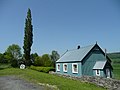
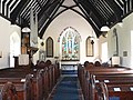
Penstrowed is a historic Montgomeryshire parish to the west of Newtown, now in the community of Mochdre with Penstrowed, Powys, Wales .

Contents

Description

Penstrowed is situated in the river Severn valley. The founder of the church, Saint Gwrhai was a 5th-century saint who is supposed to have been buried in the churchyard. The Penstrowed Quarry was an important source for local stone and was used for building the Caersws workhouse. It was later acquired by Montgomeryshire County Council and a railway siding connecting the quarry to Cambrian main line laid in 1902 and closed in May 1937. [1]

Penstrowed now claims to be 'The smallest hamlet in Wales'. [2] It is governed by the Mochdre with Penstrowed Community Council.

Eiluned Lewis (1900–1979), a Welsh novelist, poet, and journalist came from the town.

Church

Penstrowed Church in 1795 Penstrowed Church 1795.png
Penstrowed Church in 1795

The church of Saint Gwrhai is a very small single-chamber church with bellcote and S porch. Neatly rebuilt in 1864 by Edward Jones. Decorated period east and west windows, with stained glass by James Powell and Sons by Powell's, 1864: Christ appearing to the three Marys. There is a monument to the Rev. John Herbert who died in 1876. Next to the church is a corrugated iron church hall.

Houses and chapel

Glanhafren Hall is a brick three-bay, three-storey front range of c. 1810. The block, one room deep, contains a two-flight stair with honeysuckle ironwork balusters in a segmental recess, and two rooms with classical plaster cornices. [3]

Glandulais is a small Late Georgian house of two storeys and four bays—the windows mostly tripartite with cambered heads. Staircase with fluted balusters. In the drawing room a ceiling with trophy motifs in an oval of leaves, and a frieze of garlands. [4]

Penstrowed Methodist Chapel was built during the mid-nineteenth century. It is stone built in the Vernacular style with a gable entry plan and small-pane flat-headed windows. By 2002 this chapel had been converted for use as a store. [5]

Literature

Related Research Articles

<span class="mw-page-title-main">Llanidloes</span> Town in Powys, Wales

Llanidloes is a town and community on the A470 and B4518 roads in Powys, within the historic county boundaries of Montgomeryshire, Wales. The population in 2011 was 2,929, of whom 15% could speak Welsh. It is the third largest settlement in Montgomeryshire, after Newtown and Welshpool.

<span class="mw-page-title-main">Montgomery, Powys</span> Town in Powys, Wales

Montgomery is a town and community in Powys, Wales. It is the traditional county town of the historic county of Montgomeryshire to which it gives its name and is within the Welsh Marches border area. The town centre lies about 1 mile (1.6 km) west of the England–Wales border. Montgomery Castle was started in 1223 and its parish church in 1227. Other locations in the town include The Old Bell Museum, the Offa's Dyke Path, the Robber's Grave and the town wall. The large Iron Age hill fort of Ffridd Faldwyn is sited northwest of the town and west of the Castle.

<span class="mw-page-title-main">Llandinam</span> Human settlement in Wales

Llandinam is a village and community in Montgomeryshire, Powys, central Wales, between Newtown and Llanidloes, located on the A470. As a community, Llandinam is made up of the village itself, small hamlets including Plas Dinam and Little London and several farms. The village itself has a population of around 576 with 56% born in Wales.

<span class="mw-page-title-main">Mochdre, Conwy</span> Human settlement in Wales

Mochdre[ˈmoːχdrɛ](listen) is a village and an electoral ward to the west of Colwyn Bay in Conwy County Borough, Wales. Originally part of the municipal borough of Colwyn Bay prior to local government reorganisation in April 1974, it is now a separate community whose population at the 2001 census was 1,862 increasing to 1,923 at the 2011 census. The village can be seen in its entirety from Bryn Euryn.

Berriew is a village and community in Montgomeryshire, Powys, Wales. It is on the Montgomeryshire Canal and the Afon Rhiw, near the confluence with the River Severn at grid reference SJ185005, 79 miles (128 km) from Cardiff and 151 miles (243 km) from London. The village itself had a population of 283. and the community also includes Garthmyl Hall and Refail.

<span class="mw-page-title-main">Church Stoke</span> Human settlement in Wales

Churchstoke or Church Stoke is a village, community and electoral ward in Montgomeryshire, Powys, Wales. Located in the southeast of the Vale of Montgomery, it is overlooked by Todleth Hill, Roundton Hill and Corndon Hill. The rivers Caebitra and Camlad have their confluence just outside the village. The nearest town is Montgomery. In the 2011 census the village had a population of 708.

<span class="mw-page-title-main">Pontrobert</span> Parish in the county of Powys, Wales

Pontrobert is an ecclesiastical parish that was formed in September 1854. It comprises the townships of Teirtref and part of Nantymeichiaid in the parish Meifod, a portion of Cynhinfa which was in the parish of Llangynyw and portions of the townships of Fachwel, Llaethbwlch and Cadwnfa which were in the parish of Llanfihangel. The total area of this parish is 5,000 acres. As a result of this arrangement, Pont Robert is now divided between the present day Community Councils of Meifod, Llangyniew and Mawddwy. Pontrobert was within the historic county of Montgomeryshire, now forming part of Powys. The name Pontrobert is derived from Robert ap Oliver of Cyhinfa, who built the original bridge over the River Vyrnwy around 1700. An alternative Welsh name for Pontrobert is Pont y ddolfeiniog.

<span class="mw-page-title-main">Llanfyllin</span> Human settlement in Wales

Llanfyllin is a market town and community in Powys, Wales. The town population in 2021 was 1,586 and the town's name means church or parish (llan) of St Myllin. The community includes the settlements of Bodfach, Ty Crwyn, Abernaint and several farms.

<span class="mw-page-title-main">Dolanog</span> Human settlement in Wales

Dolanog or Pont Dolanog is an ecclesiastical parish or chapelry that was formed in October 1856. It comprises the townships of Dolwar in Llanfihangel portions of Coedtalog in Llanerfyl, Cynhinfa in Llangyniew and Gwaunynog in Llanfair Caereinion. The total area of this parish is 3,100 acres. Dolanog was within the historic county of Montgomeryshire, which now forms part of Powys, Wales. Dolwar Fechan in Dolanog was the home Ann Griffiths, the Methodist hymn writer.

<span class="mw-page-title-main">Llanfechain</span> Village in northern Powys, Wales

Llanfechain is a village and community in Powys, Wales, on the B4393 road between Llanfyllin and Llansantffraid-ym-Mechain. Historically it belonged to Montgomeryshire. The River Cain runs through. The population of 465 at the 2011 Census was estimated at 476 in 2019.

<span class="mw-page-title-main">Llandyssil</span> Human settlement in Wales

Llandyssil is a village in the community of Abermule with Llandyssil, in Powys, Wales, in the traditional county of Montgomeryshire. It is about two miles from the town of Montgomery.

<span class="mw-page-title-main">St James Street, Monmouth</span>

St James Street is a historic street in the town centre of Monmouth, Monmouthshire, Wales. It appears as a segment of Whitecross Street on the 1610 map of the town by cartographer John Speed and is within the medieval town walls. On more recent maps, it extends from St James Square southwest to Almshouse Street. In 2010, the street was the site of discovery of Mesolithic era artefacts. St James Street is lined with numerous listed buildings.

<span class="mw-page-title-main">St Beuno's Church, Berriew</span> Church in Powys, Wales

St Beuno’s Church is the parish church of Berriew, in the historic county of Montgomeryshire, now Powys. The church stands in an almost oval churchyard in the centre of the village. The original church was a single-chamber, with a wooden west bellcote and a northchancel chapel. This church was replaced in 1803-4 with a larger brick church by the architect John Hiram Haycock of Shrewsbury. It was of brick with stone dressings, and had the entry under a pinnacled west tower to a galleried nave with four round-headed windows a side. The church was largely rebuilt by his grandson, Edward Haycock, Junior in 1876. It consists of a nave, aisles, chancel, north porch, and west tower The west tower has the doorway blocked, stone facing for brick, and Gothic windows, except for the circular ones on its second stage.

<span class="mw-page-title-main">Hyssington</span> Village in the county of Powys, Wales

Hyssington is a parish in the South-Eastern corner of the historic county of Montgomeryshire in Wales and borders the county of Shropshire in England. It is now within the area of the Church Stoke community council in Powys. It is dominated by Corndon Hill. The church which is in the Diocese of Hereford lies just the north of a small village and is sited just to the west of a medieval Motte-and-bailey castle. This area was also the source of late Neolithic and Early Bronze Age battle-axes and axe-hammers, made from picrite that were widely traded around 2000 BC.

<span class="mw-page-title-main">Plasau Duon</span> Historic site in Montgomeryshire, Wales

Plasau Duon or Plasauduon is a timber-framed house, formerly in the parish of Carno, but now within the area of the community council of Caersws in the historic county of Montgomeryshire, and now in Powys, Wales. It is located on a site above the left bank of the Afon Carno, on a farm road leading off the lane from the A.470 to Bwlch-y-garreg. It is a fine example of a ‘’Severn Valley’’ house and has a Grade II* listing. It is likely to have been built in the second half of the 16th. century.

<span class="mw-page-title-main">Architecture of Wales</span>

Architecture of Wales is an overview of architecture in Wales from the medieval period to the present day, excluding castles and fortifications, ecclesiastical architecture and industrial architecture. It covers the history of domestic, commercial, and administrative architecture.

<span class="mw-page-title-main">Gurdwara Sahib Woolwich</span>

The Gurdwara Sahib Woolwich is a Sikh gurdwara in central Woolwich in the Royal Borough of Greenwich, South East London. It was built in 1814–16 as a Methodist church and converted into a Sikh place of worship in the late 1970s. The main hall is Grade II-listed; the former Soldier's Institute and Sunday School next door, now in use as a langar hall, is not.

<span class="mw-page-title-main">Mochdre, Powys</span> Human settlement in Wales

Mochdre is a small village in the community of Mochdre with Penstrowed, in Montgomeryshire, Powys, Wales.

<span class="mw-page-title-main">Mochdre with Penstrowed</span> Community in Powys, Wales

Mochdre with Penstrowed, or just Mochdre, is a community in Montgomeryshire, Powys, Wales. The community includes Mochdre, Penstrowed and the much larger settlement of Stepaside. The community had a population of 494 as of the 2011 UK Census.

<span class="mw-page-title-main">Buildings associated with Owain Glyndŵr</span>

There are multiple buildings and sites associated with Owain Glyndwr in Wales.

References

  1. Poole B. (2015), Penstrowed Quarry, Montgomeryshire, Montgomeryshire Collections, Vol 103, 91–102.
  2. "History of Mochdre with Penstrowed". Mochdre with Penstrowed Community Council. Retrieved 16 September 2018.
  3. www.britishlistedbuildings.co.uk Glanhafran Hall
  4. www.britishlistedbuildings.co.uk Glandulais farmhouse
  5. "Penstrowed Methodist Chapel (11478)". Coflein. RCAHMW.