
The Cumberland Mountains are a mountain range in the southeastern section of the Appalachian Mountains. They are located in western Virginia, southwestern West Virginia, eastern edges of Kentucky, and eastern middle Tennessee, including the Crab Orchard Mountains. Their highest peak, with an elevation of 4,223 feet (1,287 m) above mean sea level, is High Knob, which is located near Norton, Virginia.

The Monongahela National Forest is a national forest located in the Allegheny Mountains of eastern West Virginia, USA. It protects over 921,000 acres of federally owned land within a 1,700,000 acres proclamation boundary that includes much of the Potomac Highlands Region and portions of 10 counties.

Purgitsville is an unincorporated community in Hampshire County in the U.S. state of West Virginia. According to the 2000 census, the ZCTA for Purgitsville had a population of 813. Purgitsville is located on U.S. Highway 220/West Virginia Route 28 at its intersection with Huffman Road south of Junction. An elementary school, Mill Creek Elementary, was open here until 1993 when it was consolidated with Romney Elementary.
Back Creek is a 59.5-mile-long (95.8 km) tributary of the Potomac River that flows north from Frederick County, Virginia, to Berkeley County in West Virginia's Eastern Panhandle. Back Creek originates along Frederick County's border with Hampshire County, West Virginia, at Farmer's Gap in the Great North Mountain. Its name reflects its location to the west of North Mountain. The perspective of colonists from the east in the 18th century led them to call it "Back Creek", because it lay to the back of North Mountain.
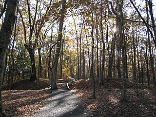
The Fort Mill Ridge Wildlife Management Area is located on 217 acres (0.88 km2) two miles (3 km) southwest of Romney in Hampshire County, West Virginia. Fort Mill Ridge WMA is owned by the West Virginia Division of Natural Resources. The Fort Mill Ridge Civil War Trenches are located at the top of the Fort Mill Ridge access road.

Meadow Branch is a 16.7-mile-long (26.9 km) tributary stream of Sleepy Creek in West Virginia's Eastern Panhandle region. It passes through the Sleepy Creek Wildlife Management Area, where it is dammed to form the 205-acre (0.83 km2) Sleepy Creek Lake.

Sleepy Creek Mountain is a mountain ridge in the Ridge-and-Valley Appalachians on the border between Morgan and Berkeley counties in the Eastern Panhandle of West Virginia. The long-distance Tuscarora Trail traverses the southern ridge and northern bench of the mountain.
Pine Grove is an unincorporated community in Marion County, West Virginia, United States. Pine Groves lies to the west of Barrackville along Buffalo Creek.
Pine Creek is a tributary of the West Branch Susquehanna River in Potter, Tioga, Lycoming, and Clinton counties in Pennsylvania in the United States. The creek is 87.2 miles (140.3 km) long. Within Tioga County, 23.25 miles (37.42 km) of Pine Creek are designated as a Pennsylvania Scenic River.

Cedar Creek State Park is sited on 2,588 acres (1,047 ha) along Cedar Creek in Gilmer County, West Virginia, located about 4 miles (6.4 km) south of Glenville. Two of the buildings at the park are historical restorations of West Virginia's pioneer days, including a log cabin now used as the campground check-in station, and the Pine Run One Room School, an old one-room schoolhouse complete with restored school desks and potbellied stove. The schoolhouse is open for tours on Saturdays in the summer.

Difficult Creek Natural Area Preserve is an 819-acre (3.31 km2) Natural Area Preserve located in Halifax County, Virginia. The preserve aims to restore a portion of Virginia's southern Piedmont to pre-settlement conditions, when the region was dominated by savannas maintained through a natural fire regime. These savannas featured open, prairie-like areas with scattered pines and hardwoods. Management of the preserve includes utilizing prescribed burns and removing loblolly pine plantations to restore the former landscape. Several rare plants, remnants of the original prairie vegetation, survived by colonizing roadsides and power lines; these plants are now protected and encouraged within the preserve.

Burches Run Wildlife Management Area, formerly Burches Run Lake WMA, is located on 55 acres (22 ha) near Wheeling in Marshall County, West Virginia. Until 2005 the wildlife management area contained a lake impounded by a dam at risk of failure. The name change occurred after the dam was removed. The terrain climbs gently above Burches Run and is covered by a mature oak-hickory second-growth forest.

Sleepy Creek Wildlife Management Area is located in Morgan and Berkeley Counties in West Virginia's Eastern Panhandle. It encompasses 22,928 acres (92.79 km2), mostly covered with mixed oak and pine forest, although about 3,500 acres (14 km2) are covered with mixed hardwoods. The 205-acre (83 ha) Sleepy Creek Lake is located entirely within the WMA.

Stumptown Wildlife Management Area is located in both Calhoun and Gilmer Counties near the community of Stumptown, West Virginia. Stumptown WMA is located on 1,675 acres (678 ha) of hilly terrain, mostly covered with mixed oak and pine forest, with stands of mixed hardwoods.

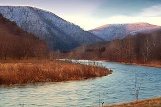
The North River is a tributary of the Cacapon River, belonging to the Potomac River and Chesapeake Bay watersheds. The river is located in Hampshire and Hardy counties in the U.S. state of West Virginia's Eastern Panhandle. The mouth of the North River into the Cacapon is located at Forks of Cacapon. From its headwaters to its mouth, the North River spans 52.4 miles (84.3 km) in length.

Old Pine Church, also historically known as Mill Church, Nicholas Church, and Pine Church, is a mid-19th century church located near to Purgitsville, West Virginia, United States. It is among the earliest extant log churches in Hampshire County, along with Capon Chapel and Mount Bethel Church.

Barbours Creek Wilderness is a U.S. wilderness area in the Eastern Divide Ranger District of George Washington and Jefferson National Forests of western Virginia, United States. The wilderness area was established in 1988 and consists of 5,382 acres (2,178 ha) of forests in the Appalachian Mountains ranging in elevation from 1,700 to 3,800 feet.


