
The Appalachian Mountains, often called the Appalachians, are a system of mountains in eastern North America. The Appalachians first formed roughly 480 million years ago during the Ordovician Period. They once reached elevations similar to those of the Alps and the Rocky Mountains before experiencing natural erosion. The Appalachian chain is a barrier to east–west travel, as it forms a series of alternating ridgelines and valleys oriented in opposition to most highways and railroads running east–west.
The Monongahela National Forest is a national forest located in the Allegheny Mountains of eastern West Virginia, USA. It protects over 921,000 acres of federally owned land within a 1,700,000 acres proclamation boundary that includes much of the Potomac Highlands Region and portions of 10 counties.

Picea rubens, commonly known as red spruce, is a species of spruce native to eastern North America, ranging from eastern Quebec and Nova Scotia, west to the Adirondack Mountains and south through New England along the Appalachians to western North Carolina. This species is also known as yellow spruce, West Virginia spruce, eastern spruce, and he-balsam.

Cass Scenic Railroad State Park is a state park and heritage railroad located in Cass, Pocahontas County, West Virginia.
The Potomac Highlands of West Virginia centers on five West Virginian counties in the upper Potomac River watershed in the western portion of the state's Eastern Panhandle, bordering Maryland and Virginia. Because of geographical proximity, similar topography and landscapes, and shared culture and history, the Potomac Highlands region also includes Pocahontas, Randolph, and Tucker counties, even though they are in the Monongahela River or New River watersheds and not that of the Potomac River.

Meadow Branch is a 16.7-mile-long (26.9 km) tributary stream of Sleepy Creek in West Virginia's Eastern Panhandle region. It passes through the Sleepy Creek Wildlife Management Area, where it is dammed to form the 205-acre (0.83 km2) Sleepy Creek Lake.

Blair is an unincorporated community in Logan County, West Virginia, United States, on the Spruce Fork. Blair lies along West Virginia Route 17. According to the Geographic Names Information System, Blair has also been known as Ginseg, Ginseng, and Seng.

Cheat Mountain is an exceptionally high and rugged ridge situated in the Allegheny Mountains of eastern West Virginia, USA. It is about 50 miles (80 km) long and more than five miles (8 km) wide at its widest. Its highest point is at its southernmost end at Thorny Flat, which has an elevation of 4,848 feet (1,478 m). Several other knobs rise above 4,000 feet (1,200 m) along its length.
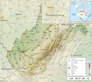
The Environment of West Virginia encompasses terrain and ecosystems ranging from plateaus to mountains. Most of West Virginia lies within the Appalachian mixed mesophytic forests ecoregion, while the higher elevations along the eastern border and in the panhandle lie within the Appalachian-Blue Ridge forests.

Spruce Knob-Seneca Rocks National Recreation Area is a national recreation area in the Monongahela National Forest of eastern West Virginia, USA.

North Fork Mountain is a quartzite-capped mountain ridge in the Ridge and Valley physiographic province of the Allegheny Mountains of eastern West Virginia, USA. Kile Knob, at 4,588 feet, is the mountain's highest point, and Panther Knob and Pike Knob are nearly as high.

Canaan Valley is an oval, bowl-like upland valley in northeastern Tucker County, West Virginia, USA. Within it are extensive wetlands and the headwaters of the Blackwater River which spills out of the valley at Blackwater Falls. It is a well-known and partially undeveloped scenic attraction and tourist draw, associated with the Canaan Valley Resort State Park and the Blackwater Falls State Park.

The Silurian Tuscarora Formation — also known as Tuscarora Sandstone or Tuscarora Quartzite — is a mapped bedrock unit in Pennsylvania, Maryland, West Virginia, and Virginia, USA.

The Durbin and Greenbrier Valley Railroad is a heritage and freight railroad in the U.S. states of Virginia and West Virginia. It operates the West Virginia State Rail Authority-owned Durbin Railroad and West Virginia Central Railroad, as well as the Shenandoah Valley Railroad in Virginia.

Shavers Mountain, is a high and rugged ridge situated in the Allegheny Mountains of eastern West Virginia. It is about 35 miles (56 km) long, north to south, and several of its peaks exceed 4,000 feet (1,200 m) in elevation. Shavers Mountain is notable for being "bookended", at its northern and southern ends, by two exceptional natural areas: the Otter Creek Wilderness and the Gaudineer Scenic Area, respectively, both of which preserve small stands of old growth forest on the mountain.

The Otter Creek Wilderness is a U.S. Wilderness area located in the Cheat-Potomac Ranger District of Monongahela National Forest in West Virginia, USA. The Wilderness sits in a bowl-shaped valley formed by Otter Creek, between McGowan Mountain and Shavers Mountain in Tucker and Randolph Counties. It is crossed by 42 miles (68 km) of hiking trails. Otter Creek Trail is the longest, at 11 miles (18 km).

U.S. Route 33 (US 33) in the U.S. state of West Virginia extends 248 miles (399 km) from the Ohio River at Ravenswood to the Virginia state line atop Shenandoah Mountain west of Harrisonburg, Virginia.
The Greenbrier, Cheat and Elk Railroad (GC&E) was a logging railroad in West Virginia operating in the early 20th century. Its main line ran from Bergoo to Cheat Junction, where it connected with the Western Maryland Railway (WM).

Spruce Mountain, in eastern West Virginia, USA, is the highest ridge of the Allegheny Mountains. The "whale-backed" ridge extends for only about 16 miles (26 km), from northeast to southwest, but several of its peaks exceed 4,500 feet (1,400 m) in elevation. The summit, Spruce Knob, is celebrated as the highest point in the state as well as the range, which covers parts of four states.


