Kistler, West Virginia | |
|---|---|
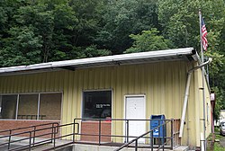 Kistler post office | |
 Kistler  Kistler | |
| Coordinates: 37°45′22″N81°51′36″W / 37.75611°N 81.86000°W | |
| Country | United States |
| State | West Virginia |
| County | Logan |
| Area | |
• Total | 1.494 sq mi (3.87 km2) |
| • Land | 1.486 sq mi (3.85 km2) |
| • Water | 0.008 sq mi (0.02 km2) |
| Elevation | 774 ft (236 m) |
| Population (2020) | |
• Total | 420 |
| • Density | 355.3/sq mi (137.2/km2) |
| Time zone | UTC-5 (Eastern (EST)) |
| • Summer (DST) | UTC-4 (EDT) |
| ZIP Code | 25628 |
| Area codes | 304 & 681 |
| GNIS feature ID | 1541251 [2] |
| FIPS code | 54-44188 |
Kistler is an unincorporated community and census-designated place (CDP) in Logan County, West Virginia, United States. As of the 2020 census, its population was 420 (down from 528 at the 2010 census). [3] [4]
