The Temple of Portunus is a Roman temple located in Rome, Italy. It was built beside the Forum Boarium, the Roman cattle market associated with Hercules, which was adjacent to Rome's oldest river port and the oldest stone bridge across the Tiber River, the Pons Aemilius. It was probably dedicated to the gateway god Portunus although the precise dedication remains unclear as there were several other temples in the area besides his. It was misidentified as the Temple of Fortuna Virilis from the Renaissance and remains better known by this name. The temple is one of the best preserved of all Roman temples.
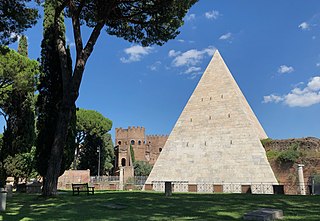
The pyramid of Cestius is a Roman Era pyramid in Rome, Italy, near the Porta San Paolo and the Protestant Cemetery. It was built as a tomb for Gaius Cestius, a member of the Epulones religious corporation. It stands at a fork between two ancient roads, the Via Ostiensis and another road that ran west to the Tiber along the approximate line of the modern Via Marmorata. Due to its incorporation into the city's fortifications, it is today one of the best-preserved ancient buildings in Rome.

The Forum Boarium was the cattle market or forum venalium of ancient Rome. It was located on a level piece of land near the Tiber between the Capitoline, the Palatine and Aventine hills. As the site of the original docks of Rome and adjacent to the Pons Aemilius, the earliest stone bridge across the Tiber, the Forum Boarium experienced intense commercial activity.
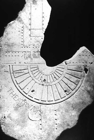
The Forma Urbis Romae or Severan Marble Plan is a massive marble map of ancient Rome, created under the emperor Septimius Severus between 203 and 211 CE. Matteo Cadario gives specific years of 205–208, noting that the map was based on property records.

The Basilica Aemilia was a civil basilica in the Roman Forum, in Rome, Italy. Today only the plan and some rebuilt elements can be seen. The Basilica was 100 meters (328 ft) long and about 30 meters (98 ft) wide. Along the sides were two orders of 16 arches, and it was accessed through one of three entrances.

Andrea Carandini is an Italian professor of archaeology specialising in ancient Rome. Among his many excavations is the villa of Settefinestre.

Lucus Feroniae was an ancient sanctuary or, literally sacred grove ("lucus"), dedicated to the Sabine goddess Feronia, protector of freedmen, ex-slaves. It was located near to the ancient town of Feronia in Etruria on the ancient Via Tiberina, in what is now the territory of the modern commune of Capena, Lazio.

Ranuccio Bianchi Bandinelli was an Italian archaeologist and art historian.
Filippo Coarelli is an Italian archaeologist, Professor of Greek and Roman Antiquities at the University of Perugia.
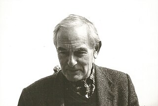
Lucos Cozza was an italian Roman archaeologist.

The Meta Sudans was a large monumental conical fountain in ancient Rome.
The Via Sublacensis was a Roman road constructed to connect Nero's palace in present-day Subiaco to Rome, splitting off from the Via Valeria near Varia, about 10 km northeast of Tivoli.

Alessandra Melucco Vaccaro was an Italian historian and archaeologist. Her main activity was in the three fields in which she made significant innovations - the High Middle Ages, archaeological restoration, and environment and landscape. President Carlo Azeglio Ciampi conferred the Medaglia d'Oro for culture and art in Vaccaro's memory in February 2001.
Ficana was an ancient city of Latium, which figures in Roman history only on the occasion of its conquest by Ancus Marcius, who is said to have moved the inhabitants to Rome, and destroyed the city itself. It is certain that it was never repeopled: its name is found in Pliny's list of the extinct cities of Latium, and is noticed also by Festus as a place no longer in existence. The latter passage, however, affords us a clue to its position; according to Marcus Antistius Labeo there cited, it was situated on the Via Ostiensis, eleven miles from Rome, and apparently immediately adjoining the Tiber, on which it had a port, at a place called by Fabius Pictor the Puilia Saxa. The city's site is in the commune of Rome near Acilia, on the via Ostiense between Rome and Ostia.
The Lexicon Topographicum Urbis Romae (1993–2000) is a six-volume, multilingual reference work considered to be the major, modern work covering the topography of ancient Rome. The editor is Eva Margareta Steinby, and the publisher is Edizioni Quasar of Rome. It is considered the successor to Platner and Ashby's A Topographical Dictionary of Ancient Rome.

The Emporium was the river port of the ancient Rome, that rose approximately between the Aventine Hill and the Rione Testaccio.

The Sant'Omobono Area is an archaeological site in Rome next to the church of Sant'Omobono, at the junction of via L. Petroselli and the Vico Jugario at the foot of the Campidoglio. It was discovered in 1937 and contains much important evidence for archaic and republican Rome. It contains altars and the sites of the temple of Fortuna and the temple of Mater Matuta. An earlier archaic-period temple underlies these two, dating itself to the early 6th century BCE, making it the oldest known temple remains in Rome.
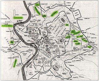
The Horti Agrippinae was a luxurious villa-estate belonging to Agrippina the Elder in ancient Rome. It was located on the west bank of the river Tiber where St. Peter's Basilica is now, and extended to the river where a terrace with a portico was built.

Alda Levi Spinazzola was an Italian archaeologist and art historian.

Maria Floriani Squarciapino (1917-2003) was an Italian classical archaeologist and professor at La Sapienza University in Rome, known for her work on the Roman port city of Ostia.


