Airlie Beach is a coastal locality and resort town in the Whitsunday Region of Queensland, Australia. In the 2021 census, Airlie Beach had a population of 1,312 people.

Shute Harbour is a coastal locality and harbour in the Whitsunday Region of Queensland, Australia. It has port facilities and transport options for people seeking to access the Whitsunday Islands and holiday destinations.

Cannonvale is a coastal locality in the Whitsunday Region, Queensland, Australia. In the 2021 census, Cannonvale had a population of 6,596 people.
Laguna Quays is a coastal locality in the Mackay Region, Queensland, Australia. In the 2021 census, Laguna Quays had a population of 89 people.
Kelsey Creek is a rural locality in the Whitsunday Region, Queensland, Australia. In the 2021 census, Kelsey Creek had a population of 157 people.
Mount Marlow is a rural locality in the Whitsunday Region, Queensland, Australia. In the 2021 census, Mount Marlow had a population of 161 people.
Strathdickie is a rural locality in the Whitsunday Region, Queensland, Australia. In the 2021 census, Strathdickie had a population of 1,003 people.
Conway is a locality in the Whitsunday Region, Queensland, Australia. In the 2021 census, Conway had a population of 202 people.
Gunyarra is a rural locality in the Whitsunday Region, Queensland, Australia. In the 2021 census, Gunyarra had a population of 30 people.

Flametree is a coastal locality in the Whitsunday Region, Queensland, Australia. In the 2021 census, Flametree had a population of 143 people.
Mandalay is a coastal locality in the Whitsunday Region, Queensland, Australia. In the 2021 census, Mandalay had a population of 338 people.

Jubilee Pocket is a residential locality in the Whitsunday Region, Queensland, Australia. In the 2021 census, Jubilee Pocket had a population of 2,047 people.

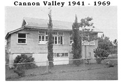
Cannon Valley is a semi-rural locality in the Whitsunday Region, Queensland, Australia. In the 2021 census, Cannon Valley had a population of 1,131 people.
Woodwark is a coastal locality in the Whitsunday Region, Queensland, Australia. In the 2021 census, Woodwark had a population of 559 people.
Brandy Creek is a rural locality in the Whitsunday Region, Queensland, Australia. In the 2021 census, Brandy Creek had a population of 114 people.
Mount Julian is a rural locality in the Whitsunday Region, Queensland, Australia. In the 2021 census, Mount Julian had a population of 477 people.
Gregory River is a coastal rural locality in the Whitsunday Region, Queensland, Australia. In the 2021 census, Gregory River had a population of 427 people.
Sugarloaf is a rural locality in the Whitsunday Region, Queensland, Australia. In the 2021 census, Sugarloaf had a population of 310 people.
Preston is a rural locality in the Whitsunday Region, Queensland, Australia. In the 2021 census, Preston had a population of 346 people.
Proserpine–Shute Harbour Road is a continuous 34.3 kilometres (21.3 mi) road route in the Whitsunday local government area of Queensland, Australia. The route is designated as State Route 59. It is a state-controlled regional road.


