Rowes Run, Pennsylvania

Last updated

Rowes Run, Pennsylvania
USA Pennsylvania location map.svg
Red pog.svg
Rowes Run
Usa edcp location map.svg
Red pog.svg
Rowes Run
Coordinates: 40°0′35″N79°48′51″W / 40.00972°N 79.81417°W / 40.00972; -79.81417
Country United States
State Pennsylvania
County Fayette
Township Redstone
Area
  Total1.2 sq mi (3.2 km2)
  Land1.2 sq mi (3.2 km2)
  Water0.0 sq mi (0.0 km2)
Elevation
980 ft (300 m)
Population
 (2010)
  Total564
  Density458/sq mi (176.8/km2)
Time zone UTC-5 (Eastern (EST))
  Summer (DST) UTC-4 (EDT)
FIPS code 42-66472
GNIS feature ID1193232

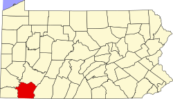
Rowes Run is an unincorporated community and census-designated place in Redstone Township, Fayette County, Pennsylvania, United States. As of the 2010 census, its population was 564. [1] The community was part of the Grindstone-Rowes Run CDP before it was split into two separate CDPs for the 2010 census.

Contents

History

Rowes Run was founded in 1907 by the Pittsburgh Coal Company. Also known as "New Hill", it was named for a stream that ran through property owned by James Rowe, a prominent figure in the area. The mine located in the town was known as Colonial #3. In 1911, the town was acquired by the H. C. Frick Coke Company. [2]

Geography

Rowes Run is located in northwestern Fayette County, at the northern end of Redstone Township. It is bordered to the north, across Grindstone Road, by the community of Grindstone. Redstone Creek forms the northern border of the Rowes Run CDP east of Grindstone Road. Brownsville is 5 miles (8 km) to the west, and Uniontown, the county seat, is 11 miles (18 km) to the southeast.

According to the U.S. Census Bureau, the Rowes Run CDP has an area of 1.2 square miles (3.2 km2), all land. [1]

Notable person

Related Research Articles

<span class="mw-page-title-main">Fayette County, Pennsylvania</span> County in Pennsylvania, United States

Fayette County is a county in the Commonwealth of Pennsylvania. It is located in southwestern Pennsylvania, adjacent to Maryland and West Virginia. As of the 2020 census, the population was 128,804. Its county seat is Uniontown. The county was created on September 26, 1783, from part of Westmoreland County and named after the Marquis de Lafayette.

<span class="mw-page-title-main">South Fayette Township, Pennsylvania</span> Township in Pennsylvania, United States

South Fayette Township is a township in Allegheny County, Pennsylvania, United States. The population was 14,416 at the 2010 census.

<span class="mw-page-title-main">Grindstone-Rowes Run, Pennsylvania</span> Former CDP in Pennsylvania, United States

Grindstone-Rowes Run was a census-designated place (CDP) in Fayette County, Pennsylvania, United States.

<span class="mw-page-title-main">Jefferson Township, Fayette County, Pennsylvania</span> Township in Pennsylvania, United States

Jefferson Township is a township in Fayette County, Pennsylvania, United States. The population was 2,007 at the 2020 census, a decline from the figure of 2,008 tabulated in 2010. It is named for former president Thomas Jefferson, and many of the township's streets are named after other U.S. presidents. Frazier School District serves the area.

<span class="mw-page-title-main">Redstone Township, Pennsylvania</span> Township in Pennsylvania, United States

Redstone Township is a township in Fayette County, Pennsylvania, United States. The population was 5,077 at the 2020 census, a decline from the figure of 5,566 tabulated in 2010. The Brownsville Area School District serves the region.

<span class="mw-page-title-main">Republic, Pennsylvania</span> Census-designated place in Pennsylvania, United States

Republic is an unincorporated community and census-designated place (CDP) in Fayette County, Pennsylvania, United States. The population was 1,096 at the 2010 census, down from 1,396 at the 2000 census. The community is in Redstone Township.

Lynnwood-Pricedale is a census-designated place (CDP) in Fayette and Westmoreland counties in the Pennsylvania. The population was 2,031 at the 2010 census, down from 2,168 at the 2000 census. The community of Lynwood is located in Fayette County's Washington Township, while Pricedale is part of Westmoreland County's Rostraver Township.

<span class="mw-page-title-main">Imperial, Pennsylvania</span> Census-designated place in Pennsylvania, United States

Imperial is a census-designated place (CDP) in Allegheny County, Pennsylvania, United States and part of the Pittsburgh metropolitan area. The population was 2,722 at the 2020 census. The CDP is located in North Fayette and Findlay Townships, and geographically close to Pittsburgh International Airport.

<span class="mw-page-title-main">Trexlertown, Pennsylvania</span> Census-designated place in Pennsylvania, United States

Trexlertown is an unincorporated community and census-designated place (CDP) in Upper Macungie Township in Lehigh County, Pennsylvania. As of the 2020 census, the population was 2,382. It is part of the Lehigh Valley, which had a population of 861,899 and was the 68th-most populous metropolitan area in the U.S. as of the 2020 census, and lies between Breinigsville and Wescosville.

<span class="mw-page-title-main">Farmington, Pennsylvania</span> Census-designated place in Pennsylvania, United States

Farmington is an unincorporated community and census-designated place in Wharton Township, Fayette County, Pennsylvania.

Star Junction is an unincorporated community and census-designated place in Perry Township, Fayette County, Pennsylvania, United States. The community is located on Pennsylvania Route 51. At the 2010 census, the population was 616.

<span class="mw-page-title-main">Arnold City, Pennsylvania</span> Census-designated place in Pennsylvania, United States

Arnold City is an unincorporated community and census-designated place in Washington Township, Fayette County, Pennsylvania, United States. It is located approximately 3 miles (5 km) east of the borough of Belle Vernon, in far northwestern Fayette County. As of the 2010 census, the population of Arnold City was 498.

<span class="mw-page-title-main">Georgetown, Lancaster County, Pennsylvania</span> Census-designated place in Pennsylvania, United States

Georgetown is an unincorporated community and census-designated place (CDP) in Bart Township, Lancaster County, Pennsylvania, United States. As of the 2010 census, the population was 1,022. Georgetown has a post office for P.O. boxes that is called Bart and has the ZIP code of 17503. Otherwise, the CDP is divided into three ZIP code areas for more distant communities.

Lemont Furnace is an unincorporated community and census-designated place in North Union Township, Fayette County, Pennsylvania, United States. It is located 3 miles (5 km) northeast of the city of Uniontown and approximately 60 miles (97 km) southeast of Pittsburgh. The community is part of the Pittsburgh metropolitan area. At the 2010 census, the population of Lemont Furnace was 827.

Fivepointville is an unincorporated community and census-designated place (CDP) in Brecknock Township, Lancaster County, Pennsylvania, United States. As of the 2010 census, the population was 1,156. The town is named for its position at an intersection of five separate roads.

Grindstone is an unincorporated community and census-designated place that is located in Jefferson and Redstone townships, in Fayette County, Pennsylvania, United States. The community was part of the Grindstone-Rowes Run CDP before it was split into two separate CDPs for the 2010 census. In 2010, the population was 498.

Kersey is an unincorporated community and census-designated place in Fox Township, Elk County, Pennsylvania, United States. As of the 2020 census the population was 797.

New Salem is an unincorporated community and census-designated place located in Menallen Township, Fayette County, Pennsylvania, United States. It was formerly part of the New Salem-Buffington CDP, before it was split into two separate CDPs for the 2010 census. The population of New Salem was 579 as of the 2010 census.
Allison is an unincorporated community and census-designated place (CDP), which is located in Luzerne and Redstone townships in Fayette County, Pennsylvania, United States. It is situated 3 miles (5 km) south of the borough of Brownsville.

Smock is an unincorporated community and census-designated place that is located in Franklin and Menallen townships in Fayette County, Pennsylvania, United States. Situated roughly halfway between the borough of Perryopolis and the city of Uniontown, it is part of the Pittsburgh metropolitan area.

References

  1. 1 2 "Geographic Identifiers: 2010 Census Summary File 1 (G001), Rowes Run CDP, Pennsylvania". American FactFinder. U.S. Census Bureau. Archived from the original on February 13, 2020. Retrieved July 27, 2016.
  2. History