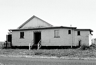
Rosedale is a rural town and locality split between the Gladstone Region and the Bundaberg Region in central Queensland, Australia. In the 2021 census, the locality of Rosedale had a population of 452 people.
Lowmead is a rural town and locality in the Gladstone Region, Queensland, Australia. In the 2021 census, the locality of Lowmead had a population of 179 people.
Baffle Creek is a rural locality in the Gladstone Region, Queensland, Australia. In the 2021 census, Baffle Creek had a population of 155 people.
Winfield is a rural locality in the Bundaberg Region, Queensland, Australia. In the 2021 census, Winfield had a population of 154 people.
Berajondo is a rural locality in the Gladstone Region, Queensland, Australia. In the 2021 census, Berajondo had a population of 112 people.
Bukali is a rural locality in the North Burnett Region, Queensland, Australia. In the 2021 census, Bukali had a population of 57 people.
Mullett Creek is a rural coastal locality in the Bundaberg Region, Queensland, Australia. In the 2021 census, Mullett Creek had a population of 67 people.
Waterloo is a rural locality in the Bundaberg Region, Queensland, Australia. In the 2021 census, Waterloo had a population of 171 people.
Colosseum is a rural locality in the Gladstone Region, Queensland, Australia. In the 2021 census, Colosseum had a population of 184 people.
West Stowe is a rural locality in the Gladstone Region, Queensland, Australia. It is immediately west of the Gladstone urban area and immediately south of the small town of Yarwun. In the 2021 census, West Stowe had a population of 391 people.
Deepwater is a coastal locality in the Gladstone Region, Queensland, Australia. In the 2021 census, Deepwater had a population of 287 people.

Victoria Hill is a rural locality spit between the Southern Downs Region and the Toowoomba Region, both in Queensland, Australia. In the 2021 census, Victoria Hill had a population of 48 people.
The 2018 Central Queensland bushfires were a series of 1,250 bushfires which ignited and moved across areas of the Central Queensland region of Australia in November and December 2018, during the 2018-19 Australian bushfire season.

Captain Creek is a rural locality in the Gladstone Region, Queensland, Australia. In the 2021 census, Captain Creek had a population of 452 people.
Round Hill is a rural locality in the Gladstone Region, Queensland, Australia. In the 2021 census, Round Hill had a population of 189 people.
Taunton is a rural locality in the Gladstone Region, Queensland, Australia. In the 2021 census, Taunton had a population of 57 people.
Mount Maria is a rural locality in the Gladstone Region, Queensland, Australia. In the 2021 census, Mount Maria had a population of 225 people.
Euleilah is a rural locality in the Gladstone Region, Queensland, Australia. In the 2021 census, Euleilah had a population of 202 people.
Cobraball is a rural locality in the Livingstone Shire, Queensland, Australia. In the 2021 census, Cobraball had a population of 81 people.
Maria Creeks is a rural locality in the Cassowary Coast Region, Queensland, Australia. In the 2021 census, Maria Creeks had a population of 143 people.


