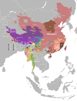
Sampang language

Last updated
Sampang
Region Nepal
Ethnicity Khambu Sampang Rai
Native speakers
18,300 (2011 census) [1]
Language codes
ISO 639-3 rav
Glottolog samp1249
ELP Sampang

Sampang language is a subgroup of Central Kiranti languages.

Contents

Geographical distribution

Sampang is spoken in the following locations of Nepal ( Ethnologue ).

Sampang language more

chafood, rice
khaecurry
Minapeople
fupagrandfather
mumagrandmother
AppaFather
Aammamother
Nanaelder sister
Nichamalittle sister
niniAunt elder to dad
dipaUncle Elder to Dad
babbawUncle younger to Dad
bubuElder Brother
NuchaYounger Brother
 ?solti
 ?soltini
 ?Brothers children Son/ Daughter
kwopaMother's Brother
Rwamoney
teycloths
kawawater
mifire
 ?Cup
khwabuloflour
LungchhaMillet
Khamawalocally brew wine
saameat

The different branch of Sampang people

  1. Chetapi Namrewa Sampang
  2. Tomiha sampang
  3. Rana Sampang
  4. Samaru Sampang
  5. Bhalu Sampang
  6. Wakchalee Sampang
  7. Repsona Sampang
  8. Rangkham Sampang
  9. Rodu sampang
  10. Herang Sampang
  11. Maremlung Sampang
  12. Damrewa Sampang
  13. Bali Sampang
  14. samring sampang

Related Research Articles

<span class="mw-page-title-main">Bhojpur Municipality</span> Municipality in Province No. 1, Nepal

Bhojpur is one of the two urban municipalities of Bhojpur District of Province No. 1 of Nepal.

<span class="mw-page-title-main">Bhojpur District, Nepal</span> District in Koshi Province, Nepal

Bhojpur District is one of 14 districts of Koshi Province of eastern Nepal. The district's area is 1,507 km2 with a population of 182,459 (2011). The administrative center is Bhojpur. It is surrounded by Dhankuta and Sankhuwasabha in the east, Khotang in the west, again Sankhuwasabha in north-east, Solukhumbu in the north-west and Udayapur in the South.

<span class="mw-page-title-main">Khotang District</span> District in Koshi Province, Nepal

Khotang District is one of 14 districts of Koshi Province of eastern Nepal. The district, with Diktel as its district headquarters, covers an area of 1,591 km2 (614 sq mi) and has a population (2021) of 206,312. The district is bordered by Bhojpur District in the east, Udayapur District in the south, Okhaldhunga District in the west and Solukhumbu District in the North. In this district there are 2 municipalities and 8 rural/urban municipalities.

<span class="mw-page-title-main">Sankhuwasabha District</span> District in Koshi Province, Nepal

Sankhuwasabha District is one of 14 districts of Koshi Province of eastern Nepal. The district's area is 3,480 km2 with a population of 159,203 in 2001 and 158,742 in 2011. The administrative center is Khandbari.

<span class="mw-page-title-main">Udayapur District</span> District in Koshi Province, Nepal

Udayapur District (Nepali: उदयपुर जिल्ला, is one of the 14 districts of Koshi Province in eastern Nepal. The district, with Triyuga as its district headquarters, covers an area of 2,063 km2 and in 2001 had a population of 287,689, in 2011 of 317,532, in 2021 of 342,773

Puma is a Kiranti language spoken by about 4,310 people in Sagarmatha Zone, Nepal. The actual population may be somewhat higher. The same term ‘Puma’ refers both to the people and the language they speak [Sharma 2014].

Magar Dhut is a Sino-Tibetan language spoken mainly in Nepal, southern Bhutan, and in Darjeeling and Sikkim, India, by the Magar people. It is divided into two groups and further dialect divisions give distinct tribal identity. In Nepal 788,530 people speak the language.

<span class="mw-page-title-main">Tamang language</span> Sino-Tibetan dialect cluster

Tamang is a term used to collectively refer to a dialect cluster spoken mainly in Nepal, Sikkim, West Bengal (Darjeeling) and North-Eastern India. It comprises Eastern Tamang, Northwestern Tamang, Southwestern Tamang, Eastern Gorkha Tamang, and Western Tamang. Lexical similarity between Eastern Tamang and other Tamang languages varies between 81% and 63%. For comparison, lexical similarity between Spanish and Portuguese, is estimated at 89%.

Wambule is a Kiranti language language spoken by the Wambule Rai, one of the Rai groups belonging to the Kiranti (किरान्ती) ethnolinguistic family of eastern Nepal. Wambule is spoken by more than 5000 people living around the confluence of the Sunkosi (सुनकोसी) and Dudhkosi (दूधकोसी) rivers near Kui-Bhir Hill. The Wambule-speaking area comprises the southernmost part of Okhaldhunga district, the westernmost part of Khotang district, the northernmost part of Udayapur district, and the northeasternmost part of Sindhuli district.

The Bantawa Language, is a Kiranti language spoken in the eastern Himalayan hills of eastern Nepal by Kirati Bantawa ethnic groups. They use a syllabic alphabet system known as Kirat Rai. Among the Khambu or Rai people of Eastern Nepal, Sikkim, Darjeeling and Kalimpong in India, Bantawa is the largest language spoken. According to the 2001 National Census, at least 1.63% of the Nepal's total population speaks Bantawa. About 370,000 speak Bantawa Language mostly in eastern hilly regions of Nepal (2001). Although Bantawa is among the more widely used variety of the Bantawa language, it falls in the below-100,000 category of endangered languages. It is experiencing language shift to Nepali, especially in the northern region.

<span class="mw-page-title-main">Kulung people</span>

The Kulung Rai also call Kulunge Rai/Rodu are one of the major subgroup of Rai people and indigenous communities of Nepal, as well as parts of northeastern Sikkim and Darjeeling district of India, having their own Kulung language, culture, history and tradition.

Bhujel or Gharti are a Tibeto-Burman ethnic group in Nepal.They are scattered in several districts, mostly in Tanahu and Syangja. The inhabitants living near the Bhuji Khola river called Bhujel. Bhujel are divided into four subcaste – Bhujyal, Gharti, Nisel and Khawas.

Jerung or Jero is a moribund Kiranti language spoken in Nepal. The native language consultants whom Opgenort (2005) consulted, preferred the term ‘Jero’ to designate the language. The term ‘Jerung’, by contrast, is a toponym used in the names of several villages within the language area as well as the name of a village in the Wambule-speaking area. The Jerung language is mutually intelligible with Wambule. Jerung is spoken by more than 2,000 people living in Okhalḍhuṅgā and Sindhulī districts of eastern Nepal. Gerd Hanßon (1991) claims that there are three to four dialects of Jerung: Madhavpur, Balkhu-Sisneri, and Ratnawati (Sindhuli). However, according to Opgenort's (2005) consultants, there are only two major dialects: a northern dialect, which is spoken in Okhaldhunga District (ओखलढुङ्गा), and a southern dialect, which is spoken in Sindhuli District (सिनधुली).

Dungmali, or Dungmali-Bantawa, is a Kiranti language spoken in Nepal. It is largely cognate with Bantawa language, but differs grammatically and phonologically.

Mewahang (Meohang), or Newahang, is a Kiranti language spoken in Nepal. The eastern and western dialects are structurally distinct.

Ghale is a Tibeto-Burman language of Nepal. It belongs to the group of Ghale languages. The dialects of Ghale have limited intelligibility: (south) Barpak, Kyaura, Laprak, (north) Khorla, Uiya, Jagat, Philim, Nyak

Nachhiring is a Kirati language spoken mostly in the eastern hills of Nepal. It not merges into Kulung in the north and Sampang in the south. A follower of the Nachiring sub-caste

<span class="mw-page-title-main">Koshi Province</span> Province of Nepal

Koshi Province is the autonomous easternmost province adopted on 20 September 2015 by Constitution of Nepal. The province is rich in natural resources, tourist attractions, recreational activities, and natural beauty. The province covers an area of 25,905 km2 (10,002 sq mi), about 17.5% of the country's total area. With the industrial city of Biratnagar as its capital, the province includes major eastern towns of Birtamod, Sundar Haraincha, Damak, Dharan, Itahari, Triyuga Municipality and Mechinagar, and the Mount Everest, Kangchenjunga and Ama Dablam. Koshi River, the largest river of the nation, forms the province's western boundary. Under the First-past-the-post voting system issued by the Constituency Delimitation Commission, Nepal, the province hosts 28 parliamentary seats and 56 provincial assembly seats.

<span class="mw-page-title-main">Geography of Koshi Province</span>

Koshi Province covers an area of 25,905 square kilometres (10,002 sq mi). It is located at easternmost part of Nepal bordering by Tibet Autonomous Region of China in north Bagmati Province in west, Province No. 2 in south-west, Bihar of India in south, North Bengal of India in south-east and Sikkim of India in north-east. Sikkim and part of North Bengal of India forms ethno-linguistic relation with Nepal. Geography of Koshi Province in eastern Nepal is very diverse, of highest peaks of Himalayas in northern extremes to terai region to south. It lies between 86 degree 1 minute and 88 degree 3 minutes east longitude and 28 degree 2 minutes and 26 degree 3 minutes north longitude. Biratnagar, the industrial capital of Nepal, is the temporary capital of this province.

References

  1. Sampang at Ethnologue (18th ed., 2015) (subscription required)