Gong | |
---|---|
Ugong | |
Region | Western Thailand |
Ethnicity | 500 (2007) [1] |
Native speakers | 150 (2007 Bradley) [1] |
Sino-Tibetan
| |
Thai script | |
Language codes | |
ISO 639-3 | ugo |
Glottolog | ugon1239 |
ELP | Ugong |
The Gong language (also 'Ugong, Ugong, Lawa or Ugawng, with U- meaning 'person') [2] is an endangered Tibeto-Burman language of Western Thailand, spoken in isolated pockets in Uthai Thani and Suphanburi provinces.
The ethnic group was first known to Westerners in the 1920s, when the language was already considered in severe decline (Kerr 1927). In the 1970s, David Bradley began working on the language in the several areas where it was still used, by which time it was already extinct in two of the locations given by Kerr (1927) about 50 years earlier. The people were then forced from two of these villages when the Electricity Generating Authority of Thailand built dams over the Kwae Yai and Khwae Noi River (Bradley 1989). Because of the displacement of the people of an already declining language, the language is considered especially vulnerable to extinction. The last children speakers were in the 1970s and the children now speak Thai as their first language.
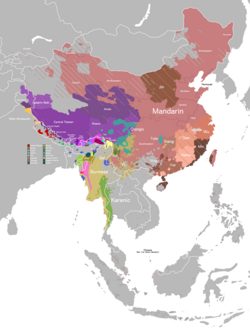
The classification of Gong within Tibeto-Burman is uncertain, although Bradley (1989) suggests that it is a divergent Lolo-Burmese language that does not fit into either the Burmish or Loloish branches. Hsiu (2018) considers Gong to be a separate branch of Tibeto-Burman, rather than part of Lolo-Burmese. [3]
The Gong language consists of two dialects (Ethnologue).
Gong was once also spoken in western Kanchanaburi province, but is now extinct in that province (Ethnologue). Word lists of two Gong varieties (namely Lawa of Kwê Yai and Lawa of Kwê Noi) from Kanchanaburi have been collected by Kerr (1927).
Gong families now live in the following 3 villages. [2]
There are around 500 ethnic Gong people and 50 speakers of the Gong language. There are also many Lao Krang people living in the Gong areas.
Gong used to be much more widespread, and was found in the Khwae Noi River, Khwae Yai River, and Bo Phloi River watersheds (Bradley 1989). [5] It was reportedly spoken in locations including: [5]
In Kanchanaburi province, many Gong have intermarried with Karen and Mon people. [5] Sisawat and Sangkhlaburi have since been flooded by the construction of a dam, and the speakers have been dispersed to other places. As of 1991 in Kanchanaburi province, Gong has not been spoken for 20–30 years, with most Gong people speaking Thai or Karen instead. [4]
Gong has SOV (verb-final) word order.
Kanchanaburi is the largest of the western provinces (changwat) of Thailand. The neighboring provinces are Tak, Uthai Thani, Suphan Buri, Nakhon Pathom, and Ratchaburi. In the west it borders Kayin State, Mon State, and the Tanintharyi Region of Myanmar.
Uthai Thani, one of Thailand's seventy-six provinces (changwat) lies in lower northern Thailand. Neighbouring provinces are Nakhon Sawan, Chai Nat, Suphan Buri, Kanchanaburi and Tak. It lies somewhat off the route between Bangkok, 200 km distant and Chiang Mai.
The Thung Yai Naresuan Wildlife Sanctuary is a protected area in Thailand in the northern part of Kanchanaburi Province and the southern part of Tak Province. It was declared a wildlife sanctuary in 1972, and a World Heritage Site by UNESCO in 1991 together with the adjoining Huai Kha Khaeng Wildlife Sanctuary.
Bang Pa-in is one of the 16 districts (amphoe) of Phra Nakhon Si Ayutthaya province, central Thailand.
Sai Yok is a district (amphoe) in Kanchanaburi province in western Thailand.
Sangkhla Buri is a district (amphoe) in Kanchanaburi province in western Thailand.
Kuy, also known as Kui, Suay or Kuay, is a Katuic language, part of the larger Austroasiatic family spoken by the Kuy people of Southeast Asia.
Si Sawat is a district (amphoe) in Kanchanaburi province, western Thailand.
Ban Rai is a district (amphoe) in Uthai Thani province in western Thailand.
Mueang Kanchanaburi is the capital district of Kanchanaburi province, central Thailand.
Phanom Thuan is a district (amphoe) in the eastern part of Kanchanaburi province, western central Thailand.
Bo Phloi is a district (amphoe) of Kanchanaburi province, central Thailand.
Lao Khwan is a district (amphoe) in the northeastern part of Kanchanaburi province, central Thailand.
Huai Krachao is a district (amphoe) in the eastern part of Kanchanaburi province, central Thailand.
The Khwae Yai River, also known as the Si Sawat, is a river in western Thailand. It has its source in the Tenasserim Hills and flows for about 380 kilometres (240 mi) through Sangkhla Buri, Si Sawat, and Mueang Districts of Kanchanaburi Province, where it merges with the Khwae Noi to form the Mae Klong River at Pak Phraek.
The Thai highway network follows the left-hand traffic rule of the road. The network is the twin responsibility of the Department of Highways, and the Department of Rural Roads, under the oversight of the Transportation ministry of Thailand. Public highways are also called public roads, especially when part of urban streets. The network spans over 70,000 kilometers across all regions of Thailand. Most are single carriageways. Dual carriageways have frequent u-turn lanes and intersections slowing down traffic. Coupled with the increase in the number of vehicles and the demand for a limited-access motorway, the Thai Government issued a Cabinet resolution in 1997 detailing the motorway construction master plan. Some upgraded sections of highway are being turned into a "motorway", while other motorways are not being built from highway sections.
Sai Yok National Park is a national park in Sai Yok district, Kanchanaburi Province, Thailand. The park, home to mountains, waterfalls and caves, is part of the Western Forest Complex protected area.
Southern Line is a metre-gauge railway line in Thailand, operated by State Railway of Thailand (SRT), which runs through most of the provinces in the Central, Western, and Southern regions of Thailand. At 1,144.29 kilometres in length, it is Thailand's longest railway line.
Uttamanusorn Bridge or commonly known as Mon Bridge and Wooden Mon Bridge (สะพานไม้มอญ) is a wooden footbridge in Tambon Nong Lu, Sangkhla Buri District, northwest of Kanchanaburi Province, Thailand. It spans the Songaria River.
Songkalia River is a river in Kanchanaburi Province, Thailand. It combines with two other rivers, the Bikhli River and the Rantee River, at the confluence called Sam Sop or Sam Phrasop in Sangkhlaburi District to form the Khwae Noi River. "Song Ka Lia" in the Mon language means "over there".