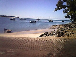
Hervey Bay is a city on the coast of the Fraser Coast Region of Queensland, Australia. The city is situated approximately 290 kilometres (180 mi) or 3½ hours' highway drive north of the state capital, Brisbane. It is located on the bay of the same name open to the Coral Sea between the Queensland mainland and nearby K'gari. The local economy relies on tourism which is based primarily around whale watching in Platypus Bay to the north, ferry access to K'gari, accessible recreational fishing and boating and the natural north facing, calm beaches with wide undeveloped foreshore zones. In October 2019, Hervey Bay was named the First Whale Heritage Site in the world by the World Cetacean Alliance, for its commitment to and practices of sustainable whale and dolphin watching.

Yandina is a rural town and locality in the Sunshine Coast Region, Queensland, Australia. In the 2021 census, the locality of Yandina had a population of 3,073 people.

The Great Sandy Strait is a strait in the Australian state of Queensland of 70 kilometres (43 mi) length which separates mainland Queensland from K'gari. It is also a locality in the Fraser Coast Region local government area. To the north of the strait is Hervey Bay. In the 2021 census, Great Sandy Strait had "no people or a very low population".

River Heads is a coastal town and locality in the Fraser Coast Region, Queensland, Australia. In the 2021 census, the locality of River Heads had a population of 2,044 people.

Brassall is a suburb in the City of Ipswich, Queensland, Australia. In the 2021 census, Brassall had a population of 12,115 people.

Torquay is a coastal suburb in Hervey Bay in the Fraser Coast Region, Queensland, Australia. In the 2021 census, Torquay had a population of 6,533 people.

Urangan Pier is a historic pier in Urangan, Hervey Bay, Queensland, Australia.
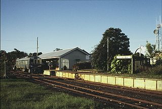
Colton railway station is a closed railway station on the North Coast railway line in Queensland. It was the junction for the Urangan railway line that extended from Colton to Takura, Stockyard Creek, Walligan, Nikenbah, Urraween, Kawungan, Pialba, Scarness, Torquay and finally Urangan and the Urangan Pier in Hervey Bay. Much of the Urangan line has now been removed, as has Colton station itself.

Hervey Bay railway line, sometimes known as Urangan railway line, is a closed railway line in Queensland, Australia. It was opened in 1896 to Pialba and it was extended to Urangan in 1913. It was extended to the end of the Urangan Pier in 1917, along with the opening of the pier. It was closed in 1993.

Pialba is a coastal town and suburb of Hervey Bay in the Fraser Coast Region, Queensland, Australia. It is the central business district of Hervey Bay. In the 2021 census, the suburb of Pialba had a population of 4,151 people.

Urangan is a coastal suburb of the city of Hervey Bay in the Fraser Coast Region, Queensland, Australia. In the 2021 census, Urangan had a population of 10,988 people.
Kawungan is a suburb of Hervey Bay in the Fraser Coast Region, Queensland, Australia. In the 2021 census, Kawungan had a population of 5,460 people.

Torbanlea is a rural town and locality in the Fraser Coast Region, Queensland, Australia. In the 2021 census, the locality of Torbanlea had a population of 841 people.

Burrum Heads is a coastal town and locality in the Fraser Coast Region, Queensland, Australia. In the 2021 census, the locality of Burrum Heads had a population of 2,538 people.
Urraween is a suburb of Hervey Bay in the Fraser Coast Region, Queensland, Australia. In the 2021 census, Urraween had a population of 7,951 people.
Nikenbah is a rural town and locality in the Fraser Coast Region, Queensland, Australia. In the 2021 census, the locality of Nikenbah had a population of 1,234 people.

Bunya Creek is a rural locality in the Fraser Coast Region, Queensland, Australia. In the 2021 census, Bunya Creek had a population of 75 people.

Toogoom is a coastal town and rural locality in the Fraser Coast Region, Queensland, Australia. At the 2021 census, Toogoom had a population of 2,596.
Point Vernon is a coastal suburb in the Fraser Coast Region, Queensland, Australia. In the 2021 census, Point Vernon had a population of 5,718 people.
Maryborough–Hervey Bay Road is a continuous 44.9 kilometres (27.9 mi) road route in the Fraser Coast region of Queensland, Australia. The entire route is signed as State Route 57. It is a state-controlled regional road.


