Sherrill | |
---|---|
Nickname: "The Silver City" | |
Coordinates: 43°4′15″N75°35′57″W / 43.07083°N 75.59917°W | |
Country | United States |
State | New York |
County | Oneida |
Government | |
• Type | City Manager/ City Commission |
• Mayor | William Vineall |
• City Manager | Brandon Lovett |
• City Commissioners | Members' List |
Area | |
• Total | 2.31 sq mi (5.99 km2) |
• Land | 2.31 sq mi (5.99 km2) |
• Water | 0.00 sq mi (0.00 km2) |
Elevation | 499 ft (152 m) |
Population (2020) | |
• Total | 3,077 |
• Density | 1,331.46/sq mi (513.97/km2) |
Time zone | UTC-5 (Eastern (EST)) |
• Summer (DST) | UTC-4 (EDT) |
ZIP code | 13461 |
Area code | 315 |
FIPS code | 36-66993 |
GNIS feature ID | 0965089 |
Website | City of Sherrill, New York |
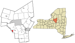
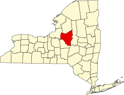
Sherrill is a city in Oneida County, New York, United States. With a population of 3,077 (2020 census), it is the state's least populous city. Sherrill is at the western end of the Town of Vernon on Route 5. Sherrill is referred to as The Silver City. [2]
Sherrill was founded in 1916 through a special act of the state legislature and is named in honor of Congressman James S. Sherman's infant son Sherrill Babcock Sherman. It is unique among cities in New York, because its city charter provides that, for many purposes, it is to be treated as if it were still a village located within the town of Vernon. While other cities in New York are not subject to a town's jurisdiction, the Vernon town government continues to have jurisdiction over the territory of the city. [3] On September 10, 1969 Police Chief Thomas P. Reilly and Patrolman Robert A. Mumford were shot on Route 5 and Sherrill Road when questioning a man about a $500 holdup of a gas station in Canastota, NY. Martin J. Fitzpatrick killed Patrolman Mumford that day and Chief Reilly died 3 days later. In 1997, the Oneida tribe purchased land within the city, eventually initiating a dispute about whether they had to pay taxes. [4]
Sherrill is located at 43°04′15″N75°35′57″W / 43.070808°N 75.599124°W , [5] adjacent to the border of Madison County. According to the United States Census Bureau, the city has a total area of 2.0 square miles (5.2 km2), all land.
New York State Route 5 passes through the north side of the city.
Census | Pop. | Note | %± |
---|---|---|---|
1920 | 1,761 | — | |
1930 | 2,150 | 22.1% | |
1940 | 2,184 | 1.6% | |
1950 | 2,236 | 2.4% | |
1960 | 2,922 | 30.7% | |
1970 | 2,986 | 2.2% | |
1980 | 2,830 | −5.2% | |
1990 | 2,864 | 1.2% | |
2000 | 3,147 | 9.9% | |
2010 | 3,071 | −2.4% | |
2020 | 3,077 | 0.2% | |
U.S. Decennial Census [6] |
As of the census [7] of 2000, there were 3,147 people, 1,262 households, and 879 families residing in the city. The population density was 1,554.6 inhabitants per square mile (600.2/km2). There were 1,309 housing units at an average density of 646.6 per square mile (249.7/km2). The racial makeup of the city was 98.00% (3,084) White, 0.22% (6) African American, 0.60% (18) Native American, 0.60% (18) Asian, 0.03% from other races, and 0.54% from two or more races. Hispanic or Latino of any race were 0.83% (26) of the population.
There were 1,262 households, out of which 33.6% had children under the age of 18 living with them, 59.3% were married couples living together, 8.1% had a female householder with no husband present, and 30.3% were non-families. 27.4% of all households were made up of individuals, and 15.9% had someone living alone who was 65 years of age or older. The average household size was 2.48 and the average family size was 3.03.
In the city, the population was spread out, with 26.2% under the age of 18, 5.8% from 18 to 24, 25.0% from 25 to 44, 25.9% from 45 to 64, and 17.1% who were 65 years of age or older. The median age was 41 years. For every 100 females, there were 86.8 males. For every 100 females age 18 and over, there were 81.8 males.
The median income for a household in the city was $48,919, and the median income for a family was $60,573. Males had a median income of $41,179 versus $26,500 for females. The per capita income for the city was $22,311. About 0.8% of families and 2.2% of the population were below the poverty line, including 2.6% of those under age 18 and 3.9% of those age 65 or over.
With less than 3,000 estimated in 2019, Sherrill is the smallest city in New York.
Vernon-Verona-Sherrill Central School District operates area schools. E.A. McAllister Elementary School is in Sherrill. [8] The area secondary schools are Vernon-Verona-Sherrill Middle School and Vernon-Verona-Sherrill High School.
Oneida County is a county in the state of New York, United States. As of February 26, 2024, the population was 226,654. The county seat is Utica. The name is in honor of the Oneida, one of the Five Nations of the Iroquois League or Haudenosaunee, which had long occupied this territory at the time of European encounter and colonization. The federally recognized Oneida Indian Nation has had a reservation in the region since the late 18th century, after the American Revolutionary War.
Lawrence County is located in the southwest portion of the U.S. state of Missouri, in the area of the Ozarks. As of the 2020 census, the population was 38,001. Its county seat is Mount Vernon. The county was organized in 1845 and named for James Lawrence, a naval officer from the War of 1812 known for his battle cry, "Don't give up the ship!"
Oneida County is a county located in the U.S. state of Idaho. As of the 2020 Census the county had a population of 4,564. The county seat and largest city is Malad City. Most of the county's population lives in Malad City and the surrounding Malad Valley.
Sherrill is a city in Dubuque County, Iowa, United States. The population was 189 at the time of the 2020 census, up from 186 in 2000.
Oneida is a city in Nemaha County, Kansas, United States. As of the 2020 census, the population of the city was 61.
Vernon Center is a city in Blue Earth County, Minnesota, United States, along the Blue Earth River. The population was 328 at the 2020 census. It is part of the Mankato-North Mankato Metropolitan Statistical Area.
Colden is a town in Erie County, New York, United States. The population was 3,265 at the 2010 census. The town derives its name from Cadwallader D. Colden, a state senator. Colden is an interior town in the southeastern part of the county. It is one of the "Southtowns" of Erie County.
Lenox is a town in Madison County, New York, United States. The population was 8,768 as of the 2020 census.
Oneida is a city in Madison County in the U.S. state of New York. It is located west of Oneida Castle and east of Wampsville. The population was 11,390 at the 2010 census. The city, like both Oneida County and the nearby silver and china maker, was named for the Oneida tribe, which had a large territory here around Oneida Lake during the colonial period.
Oneida Castle is a village in Oneida County, New York, United States. The population was 625 at the 2010 census.
Verona is a town in southwestern Oneida County, New York, United States. The population was 6,293 at the 2010 census. The town was named after Verona, Italy.
Westmoreland is a town in Oneida County, New York, United States. The population was 6,138 at the 2010 census.
Whitestown is a town in Oneida County, New York, United States. The population was 18,667 at the 2010 census. The name is derived from Judge Hugh White, an early settler. The town is immediately west of Utica and the New York State Thruway passes across the town. The offices of the town of Whitestown are in the Village of Whitesboro.
Oneida is a town in Outagamie County, Wisconsin, United States. The population was 4,001 at the 2000 census. The unincorporated communities of Chicago Corners and Oneida are located in the town. The town occupies the Outagamie County portion of Wisconsin's Oneida Nation of Wisconsin.
Brewerton is a census-designated place (CDP) in the town of Cicero in Onondaga County and the town of Hastings in Oswego County in the U.S. state of New York. It lies at the west end of Oneida Lake at its outlet into the Oneida River. The population was 4,549 at the 2020 census. Maps of the 19th century indicate that this area was once known as Fort Brewerton, while Brewerton meant the Cicero portion.
Oneida is an unincorporated community and former census-designated place (CDP) in the Town of Oneida, Outagamie County, Wisconsin, United States. The population was 1,070 at the 2000 census. At the census, part of the CDP lay within the Town of Hobart, which has since incorporated as a village, in adjacent Brown County. Oneida is located on Wisconsin Highway 54.
Vernon is a village in Oneida County, New York, United States. The population was 1,172 at the 2010 census.
Vernon is a town in Oneida County, New York, United States. The population was 5,408 at the 2010 census.
Verona is a city in Dane County, Wisconsin, in the United States and is a suburb of Madison. The population was 14,030 at the 2020 census. The city is located ten miles southwest of downtown Madison within the Town of Verona. It is part of the Madison Metropolitan Statistical Area.
Vernon-Verona-Sherrill Central School District is a school district in Verona, New York.