Related Research Articles

Busia is a county in the former Western Province of Kenya. It borders Kakamega County to the east, Bungoma County to the north, Lake Victoria and Siaya County to the south and Uganda's Busia District to the west. The county population was 893,861, as of 2019. It spans about 1,700 square kilometers, making it one of the smallest counties in Kenya. Busia is inhabited by the Luhya tribe and the Teso of Kenya, and small groups of the Luo. The Luhya communities include the Abakhayo, Marachi, Samia and Abanyala communities.

Kericho is the biggest town in Kericho County located in the highlands west of the Kenyan Rift Valley. Standing on the edge of the Mau Forest, Kericho has a warm and temperate climate making it an ideal location for agriculture and in particular, the large scale cultivation of tea.

Kericho County is one of the 47 counties in Kenya. The county seats between longitude 35°02' and 35°40' East and between the equator and latitude 0°23' South with an altitude of about 2002m above sea level. It borders Uasin Gishu County to the North West, Baringo County to the North-East, Nandi County to the North-West, Nakuru County to the East and Bomet County to the South, Kisumu County to the Northwest and Nyamira County to the West. It has a population of 901,777 and an area of 2,111 km². Its capital and largest town is Kericho.

Kakamega County is a county in the former Western Province of Kenya. It borders Vihiga County to the South, Siaya County to the West, Bungoma and Trans Nzoia counties to the North and Nandi and Uasin Gishu counties to the East. Its capital and largest town is Kakamega. The county has a population of 1,867,579 and an area of 3,033.8 km2.

Kiambu County is a county in the former Central Province of Kenya. Its capital is Kiambu and its largest town is Thika town. Kiambu County is the second most populous county in Kenya after Nairobi County. Kiambu County borders Nairobi and Kajiado Counties to the South, Machakos to the East, Murang'a to the North and North East, Nyandarua to the North West, and Nakuru to the West. It has a population of 2,417,735.

Nyamira County is a county in the former Nyanza Province of Kenya. Formally a district, Nyamira was hived off Kisii District in 1989, and it shares common boundaries with what was known as Nyamira District. The main cash crops grown are bananas and tea. The county has a population of 605,576. Its capital and largest town is Nyamira, with an urban population of around 41,668 The county is also referred to as North Kisii.

Kajiado County is a county in the former Rift Valley Province of Kenya. As of 2019, Kajiado county spanned an area of 21,292.7 km2, with a recorded population of 1,117,840. The county borders Nairobi and to its south it borders the Tanzanian regions of Arusha and Kilimanjaro. The county capital is Kajiado, but the largest town is Ongata Rongai. Its main tourist attraction is its wildlife.
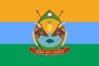
Homa Bay County is a county in the former Nyanza Province of Kenya. Its capital and largest town is Homa Bay. The county has a population of 1,131,950 and an area of 3,154.7 km2. Lake Victoria is a major source of livelihood for Homa Bay County. It has 40 wards, each represented by an MCA in the Homa Bay county assembly located in Homa Bay town, which is the county headquarters.

Garissa County is an administrative county in Kenya. It is located in Eastern Kenya bordering Somalia to the East, Wajir County and Isiolo County to the North, Tana River County to the West and Lamu County to the South. Its capital and largest urban area is Garissa.
Mandera County is one of the counties in Kenya. Its capital and largest town is Mandera. The county is bordered by Ethiopia to the north, Somalia to the east and Wajir County to the southwest. According to the 2019 census, the county has a population of 1,200,890 and an area of 25,939.8 square kilometres (10,015.4 sq mi). The main economic activity in the county is pastoralism, while others include cross-border trade with Ethiopia, artisanal mining, beekeeping, and agriculture along the Dawa River.

Bomet County is a county in the former Rift Valley Province of Kenya. Initially a district, Bomet District was created from the former Kericho District in 1992. The capital of Bomet County is Bomet. It has a population of 875,689 in 2019 and an area of 1,630.0 km2 (629.3 sq mi).
Cherangany Constituency, comprises the larger Trans Nzoia East District; otherwise known as Cherangani Sub-County, with an approximate area of 556.9 square km. It is an electoral constituency in Kenya, which was established/created for the 1988 general election.
Makueni Constituency is an electoral constituency in Kenya. It is one of six constituencies in Makueni County. The constituency was established for the 1966 elections.Its current MP is Daniel Kitonga Maanzo of Wiper party who is also vying for Makueni Senate.
Belgut is an electoral constituency in Kenya. It is one of six constituencies of Kericho County. The constituency was established for the 1963 elections. A new Constituency Sigowet-Soin was curved out of this Constituency in 2013 after the promulgation of the new constitution (2010).

Kisii County is a county in the former Nyanza Province in southwestern Kenya. Its capital and largest town is Kisii. The county has a population of 1,266,860 people. It borders Nyamira County to the North East, Narok County to the South, and Homa bay and Migori Counties to the West. The county covers an area of 1,318 km².
Mandera West Constituency is an electoral constituency in Kenya that was established for the 1966 elections. It is one of six constituencies in Mandera County. It has five wards, all electing councillors to the Mandera County Assembly.
Mathioya Constituency is an electoral constituency in Kenya. It is one of seven constituencies of Muranga County. The constituency has three wards comprising Kiru, Kamacharia and Gitugi wards all electing Members of the County Assembly to the Muranga County Assembly.

Sub-counties, also known as Districts, are the decentralised units through which government of Kenya provides functions and services. At national level, sub-counties take a more administrative function like security, statistical purposes, provision of government services, etc. Even though the sub-counties are divisions of counties, powers to create new national sub-counties lies with the national government. As of 2023, there are 314 sub-counties, compared to 290 constituencies. A deputy county commissioner is appointed by the state to lead each sub-county. The sub-counties are further divided into divisions, locations and sub-locations.
Kipkelion East is an electoral constituency in Kericho County, Kenya. It is one of six constituencies in the county. It was established for the 2013 general elections as constituency number 188 when Kipkelion Constituency was split into Kipkelion East and Kipkelion West constituency.
Kipsengeret Koros is a Kenyan Politician and a Member of Parliament for Sigowet-Soin Constituency in Kericho County, Kenya. He was elected in 2017 on an Independent ticket where he garnered 20,284 votes against the outgoing's 13,068 votes. Koros is the second Member of Parliament since the inception of Sigowet-Soin Constituency in the year 2013. He won the seat after defeating Justice Kemei.
References
- ↑ "Sigowet - Soin Constituency". Softkenya.com. 2012-11-21. Retrieved 2017-09-06.
- ↑ "Justice Kipsang Kemei". Mzalendo. Retrieved 2017-09-06.