South Beach-Franklin Delano Roosevelt Boardwalk

Last updated
The boardwalk, with Hoffman Island in the background New York Bay Islands.jpg
The boardwalk, with Hoffman Island in the background

The South Beach-Franklin Delano Roosevelt Boardwalk, alternately referred to as the F.D.R. Boardwalk or the South Beach Boardwalk is a boardwalk on the East Shore of Staten Island, one of the five boroughs of New York City.
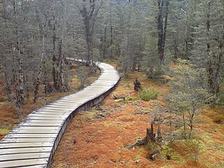
Boardwalk pedestrian walkway along beaches or in nature areas, often built using wooden planks

A boardwalk is an elevated footpath, walkway, or causeway built with wooden planks that enables pedestrians to cross wet, fragile, or marshy land. They are also in effect a low type of bridge. Such timber trackways have existed since at least Neolithic times.


The term East Shore is frequently applied to a series of neighborhoods along the Lower New York Bay and the Raritan Bay and within New York City's borough of Staten Island.

Staten Island Borough in New York City and county in New York, United States

Staten Island is one of the five boroughs of New York City, in the U.S. state of New York. Located in the southwest portion of the city, the borough is separated from New Jersey by the Arthur Kill and the Kill Van Kull, and from the rest of New York by New York Bay. With an estimated population of 479,458 in 2017, Staten Island is the least populated of the boroughs but is the third-largest in land area at 58.5 sq mi (152 km2).

The boardwalk was built in 1935 to replace an existing commercial boardwalk and tourist area. The boardwalk is part of a New York City public Park that stretches from the Fort Wadsworth and the Verrazano-Narrows Bridge to Miller Field. Both Fort Wadsworth and Miller Field are federal parks.

New York City Largest city in the United States

The City of New York, often called New York City (NYC) or simply New York (NY), is the most populous city in the United States. With an estimated 2017 population of 8,622,698 distributed over a land area of about 302.6 square miles (784 km2), New York City is also the most densely populated major city in the United States. Located at the southern tip of the state of New York, the city is the center of the New York metropolitan area, the largest metropolitan area in the world by urban landmass and one of the world's most populous megacities, with an estimated 20,320,876 people in its 2017 Metropolitan Statistical Area and 23,876,155 residents in its Combined Statistical Area. A global power city, New York City has been described as the cultural, financial, and media capital of the world, and exerts a significant impact upon commerce, entertainment, research, technology, education, politics, tourism, art, fashion, and sports. The city's fast pace has inspired the term New York minute. Home to the headquarters of the United Nations, New York is an important center for international diplomacy.

Fort Wadsworth United States military base

Fort Wadsworth is a former United States military installation on Staten Island in New York City, situated on The Narrows which divide New York Bay into Upper and Lower halves, a natural point for defense of the Upper Bay and Manhattan beyond. Prior to closing in 1994 it claimed to be the longest continually garrisoned military installation in the United States. Divided into several smaller units, including Fort Tompkins and Fort Richmond, its present name was adopted in 1865 to honor Brigadier General James Wadsworth, who had been killed in the Battle of the Wilderness during the Civil War. Fort Wadsworth is now part of the Staten Island Unit of Gateway National Recreation Area, maintained by the National Park Service.

Coordinates: 40°34′47″N74°04′33″W / 40.57972°N 74.07583°W / 40.57972; -74.07583

Geographic coordinate system Coordinate system

A geographic coordinate system is a coordinate system that enables every location on Earth to be specified by a set of numbers, letters or symbols. The coordinates are often chosen such that one of the numbers represents a vertical position and two or three of the numbers represent a horizontal position; alternatively, a geographic position may be expressed in a combined three-dimensional Cartesian vector. A common choice of coordinates is latitude, longitude and elevation. To specify a location on a plane requires a map projection.


Related Research Articles

New York City Department of Parks and Recreation

The New York City Department of Parks and Recreation, also called the Parks Department or NYC Parks, is the department of the government of New York City responsible for maintaining the city's parks system, preserving and maintaining the ecological diversity of the city's natural areas, and furnishing recreational opportunities for city's residents and visitors.

Carl Schurz Park

Carl Schurz Park German: [ʃʊɐ̯ts]; is a 14.9 acres (6.0 ha) public park in the Yorkville neighborhood of Manhattan, New York City, named for German-born Secretary of the Interior Carl Schurz in 1910, at the edge of what was then a solidly German-American community of Yorkville. The park contains Gracie Mansion, the official residence of the Mayor of New York.

Sara Delano Roosevelt Park

Sara Delano Roosevelt Park is a 7.8-acre (32,000 m2) park in the Lower East Side of the New York City borough of Manhattan. The park, named after Sara Roosevelt (1854–1941), the mother of President Franklin Delano Roosevelt, stretches north-south along seven blocks between East Houston Street on the Lower East Side and Canal Street in Chinatown, bordered by Chrystie Street on the west and Forsyth Street on the east. The park is operated and maintained by the New York City Department of Parks and Recreation.

Hanover Square (Manhattan) square in New York City, United States of America

Hanover Square is a square with a public park in the Financial District, Lower Manhattan, New York City. It is triangular in shape, bordered by Pearl Street, Stone Street and a street named Hanover Square. Most surrounding buildings are primarily commercial.

Travers Park is a 2-acre (8,100 m2) community park and playground in Jackson Heights, Queens, New York City. It is located between 77th and 78th Streets, on the north side of 34th Avenue. More than half of the park is occupied by an asphalt play area, with basketball and tennis courts. A children's playground with leaf-and-vine shaped spray shower occupies about one third of the park. There are also restroom facilities, handball courts, a small picnic area and a bicycle rack. In 2012, a segment of adjacent 78th Street was transformed in a permanent Street Plaza and the sports area of a nearby school was bought by New York City and added to the park. Although Travers Park is surrounded by trees, it does not have a lawn or any significant green space.

Mapleton, Brooklyn neighborhood in Brooklyn, New York City

Mapleton is a neighborhood in southern Brooklyn, New York City, bounded by 16th Avenue on the west, Dahill Road on the east, 57th Street on the north, and 65th Street on the south. It borders Bensonhurst and Borough Park to the west, and Midwood to the east.

Clove Lakes Park

Clove Lakes Park is a public park located in the New York City borough of Staten Island, in the neighborhood of Sunnyside.

John J. Carty Park, also known as Rubber Park, is located in Bay Ridge, Brooklyn. This park honors John J. Carty (1909–1970), a native of Bay Ridge, Brooklyn who lived his life only five blocks away and dedicated himself to New York City government for 32 years.

Father Capodanno Boulevard, formerly called Seaside Boulevard, is primary north-south artery that runs through the Arrochar, South Beach, Ocean Breeze, Midland Beach, and New Dorp Beach neighborhoods of New York City, in the borough of Staten Island, New York. The boulevard runs parallel to the South Beach-Franklin Delano Roosevelt Boardwalk and public park.

Buono Beach

Buono Beach is a small shorefront public park in the New York City borough of Staten Island, in the neighborhood of Rosebank, at the foot of Hylan Boulevard. Buono Beach borders New York Harbor and is adjacent to the park containing the Alice Austen House. The park contains a local veterans' memorial fountain.

Fort Cockhill

Fort Cockhill was an 18th-century military fortification located on Cox's Hill or Tubby Hook Hill, now known as the present-day Inwood Hill Park. A small, circular earthwork structure, in height some ten or twelve feet and equipped with two cannon, it was situated at the northwestern extremity of Tubby Hook Hill, at a point overlooking both the Hudson River and the Harlem River valley.

O'Donohue Park is a public green space located in the Far Rockaway neighborhood on the Rockaway Peninsula of New York City. The park is located at the eastern tip of the Rockaway Beach Boardwalk.

Spring Street Park

Spring Street Park, is a small triangular park in the lower Manhattan neighborhood of Hudson Square in New York City. The park is bounded by Spring Street on the north, Broome Street on the south, Avenue of the Americas on the east, and on the west by a narrow two-block street considered to be a spur of Sixth Avenue. As a pedestrian plaza, the triangle was previously known as SoHo Square.

John Paul Jones Park

John Paul Jones Park is a public park located in Fort Hamilton, Bay Ridge, Brooklyn. The park borders Shore Road, Fourth Avenue, 101st Street, and Fort Hamilton Parkway. The park is currently managed by the New York City Department of Parks and Recreation, which was acquired from the city of Brooklyn in the year of 1897.

Concourse, Bronx Neighborhood of the Bronx in New York City

Concourse is a neighborhood in the southwestern section of the New York City borough of the Bronx which includes the Bronx County Courthouse, the Bronx Museum of the Arts, and Yankee Stadium. The neighborhood is divided into three subsections: West Concourse, East Concourse, and Concourse Village.

Bensonhurst Park is a park in NYC Borough of Brooklyn. The Park stretches from the north border with Cropsey Avenue and ends up in the Lower New York Bay. The park has a playground on the north-east side, a field in the middle of the playground and several basketball courts on the west side. There is also a bathroom in the northwest side of the park.

A list of skateparks in New York City.